BGS receives funding for new system to analyse oxygen isotopes
A major upgrade of BGS's research equipment following investment from NERC will help scientists understand historic changes in climate.
26/09/2022 By BGS Press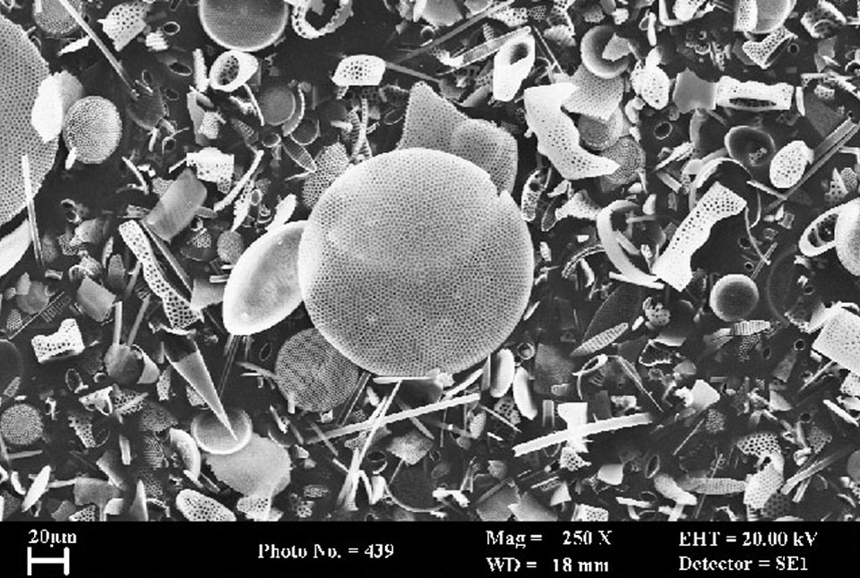

Scientists researching ways to tackle air pollution, climate change and other environmental sciences challenges facing the UK will benefit from a major upgrade of research equipment.
The Natural Environment Research Council (NERC) has invested £6.6 million in improving the UK’s national research infrastructure by funding the purchase of ten state-of-the-art pieces of equipment.
BGS has received over £350 000 for a new microfluorination for oxygen isotopes in biogenic silica (MOBiS) system. The new system will analyse sediment samples from a range of settings including the ocean, land and waterways. It will help scientists understand historic changes in climate by analysing the oxygen isotope compositions of biogenic silica, which is one of the most widespread biogenic minerals found in the world.
The equipment can analyse oxygen isotopes in any minerals that contain oxygen. This will enable the equipment to be used by a wider community and in other disciplines, for example the analysis of nuclear materials for isotope forensics applications.

I am extremely excited that we will be able to utilise this innovative system, which will be housed in the laboratories at the BGS headquarters in Keyworth, Nottingham. It will allow us and the UK’s wider research community to take a deep dive into oxygen isotopes in biogenic silica and how changes in these from thousands of years ago can help us understand climate change and shed light on ways to mitigate environmental impact.
Prof Melanie Leng, BGS Chief Scientist for Environmental Change, Adaptation and Resilience.
For more information and enquiries about the MOBiS system, please contact Dr Jack Lacey.
Relative topics
Latest news

New NERC-funded project empowers young people to engage with environmental science
23/07/2026
BGS is part of a new, collaborative project, funded through NERC’s ‘Opening up the environment’ programme, helping the environmental research community become more accessible.

Delving deep into mountains for future water security
16/07/2026
A BGS-led project is using new water-tracing investigation methods, geophysics and modelling to understand how water moves from mountains to the lowlands, helping to improve water security for billions of people.

Updated national 3D model will determine the depth to the solid bedrock beneath our feet
13/07/2026
The BGS Superficial Deposit Thickness Model now includes an elevation model of geological rockhead for the first time, providing important data for civil engineers, geoscientists and environmental scientists.

UK’s world-class research organisations launch new collective
10/07/2026
The launch of the National Research Organisations Group brings together more than 100 science leaders to provide an authorativive voice on science, research policy and long-term investment.

Cheshire Geoenergy Observatory releases key geological datasets for UK thermal energy storage scheme design
09/07/2026
A new report and data packs from BGS will provide a unique resource for scientists working on the geology and hydrogeology of the Sherwood Sandstone Formation, an important aquifer and reservoir rock.

New geological mapping underway to help manage flooding along the River Tweed
08/07/2026
Scientists are surveying the Tweed catchment for the first time in over 100 years to enhance understanding of localised groundwater and improve flood forecasting.

Geological research in North Sea helping to safeguard subsea cables
06/07/2026
Subsea power and telecommunications cables are critical to the UK’s energy infrastructure and global connectivity, yet they remain vulnerable to damage from ship anchors, fishing activity and natural hazards.

UK Critical Minerals Intelligence Centre makes recommendations for the next UK criticality assessment
01/07/2026
CMIC has outlined the enhancements made to the next assessment update to ensure it is better tailored to the structure of the UK economy.

From archive to discovery: historical mineral reports support gold exploration in Scotland
25/06/2026
Digitised geological records show potential to unlock untapped mineral resources in Ardlochan, Argyllshire.

UK and Philippines scientists investigate natural hydrogen generation processes at atomic scale
22/06/2026
BGS researchers were granted access to use the Diamond Light Source facility in order to study hydrogen in light brighter than the sun.

Shortage of end-of-life materials presents challenge to UK critical minerals security
17/06/2026
A new report by the UK Critical Minerals Intelligence Centre reveals insufficient end-of-life material stocks present a supply risk over the coming decade, but offer significant long-term potential to meet critical mineral demand through recycling.

UK geothermal catalogue receives update
16/06/2026
BGS releases the second digital version of the UK geothermal catalogue of subsurface temperature and rock thermal conductivity measurements and heat flow calculations.