BGS receives award at the World Landslide Forum 2023
BGS's landslide team has been designated a World Centre of Excellence on landslide risk reduction by the International Consortium on Landslides.
30/11/2023 By BGS Press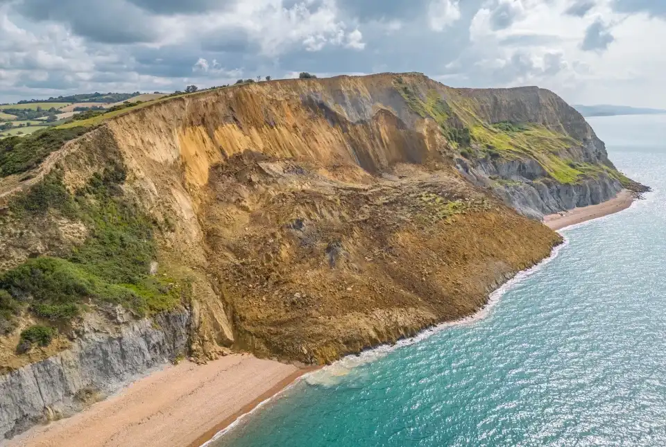

The World Landslide Forum takes place every three years, with the first meeting held in Tokyo, Japan, in 2008, and sees the participation of over a thousand researchers from all over the world. The aim of the forum is to create a common platform to promote cooperation between scientists, technicians and experts to develop collaborative strategies to reduce the risk of landslides worldwide.
The sixth World Landslide Forum, which was titled ‘Landslide science for sustainable development’, took place this year in Florence, Italy, from Tuesday 14 to Friday 17 November 2023.
It was announced at the forum that BGS has been designated as a World Centre of Excellence on landslide risk reduction, along with 15 other institutes.

It was a great honour for BGS to receive this recognition, which is testament to the hard work and excellent science undertaken by our landslides team.
Prof Jonathan Chambers, BGS Head of Shallow Geohazards and Earth Observation.
During the forum, the most important aspects relating to landslide research were addressed, following six thematic areas:
- monitoring and early warning
- modelling
- hazard and risk assessment
- mitigation techniques
- triggering mechanisms
- climate change
Relative topics
Related news

Delving deep into mountains for future water security
16/07/2026
A BGS-led project is using new water-tracing investigation methods, geophysics and modelling to understand how water moves from mountains to the lowlands, helping to improve water security for billions of people.

Updated national 3D model will determine the depth to the solid bedrock beneath our feet
13/07/2026
The BGS Superficial Deposit Thickness Model now includes an elevation model of geological rockhead for the first time, providing important data for civil engineers, geoscientists and environmental scientists.

UK’s world-class research organisations launch new collective
10/07/2026
The launch of the National Research Organisations Group brings together more than 100 science leaders to provide an authorativive voice on science, research policy and long-term investment.

Cheshire Geoenergy Observatory releases key geological datasets for UK thermal energy storage scheme design
09/07/2026
A new report and data packs from BGS will provide a unique resource for scientists working on the geology and hydrogeology of the Sherwood Sandstone Formation, an important aquifer and reservoir rock.

New geological mapping underway to help manage flooding along the River Tweed
08/07/2026
Scientists are surveying the Tweed catchment for the first time in over 100 years to enhance understanding of localised groundwater and improve flood forecasting.

Geological research in North Sea helping to safeguard subsea cables
06/07/2026
Subsea power and telecommunications cables are critical to the UK’s energy infrastructure and global connectivity, yet they remain vulnerable to damage from ship anchors, fishing activity and natural hazards.

UK Critical Minerals Intelligence Centre makes recommendations for the next UK criticality assessment
01/07/2026
CMIC has outlined the enhancements made to the next assessment update to ensure it is better tailored to the structure of the UK economy.

From archive to discovery: historical mineral reports support gold exploration in Scotland
25/06/2026
Digitised geological records show potential to unlock untapped mineral resources in Ardlochan, Argyllshire.

UK and Philippines scientists investigate natural hydrogen generation processes at atomic scale
22/06/2026
BGS researchers were granted access to use the Diamond Light Source facility in order to study hydrogen in light brighter than the sun.

Shortage of end-of-life materials presents challenge to UK critical minerals security
17/06/2026
A new report by the UK Critical Minerals Intelligence Centre reveals insufficient end-of-life material stocks present a supply risk over the coming decade, but offer significant long-term potential to meet critical mineral demand through recycling.

UK geothermal catalogue receives update
16/06/2026
BGS releases the second digital version of the UK geothermal catalogue of subsurface temperature and rock thermal conductivity measurements and heat flow calculations.

Scientists make new discovery in the history of the Giant’s Causeway
15/06/2026
New research is changing our scientific understanding of the formation of one of the UK’s most iconic landmarks and has revealed that Northern Ireland’s volcanic past occurred over a much shorter period than previously thought.