BGS GeoScour: bridging the river erosion data gap
The geological properties of bedrock and superficial deposits that make up riverbeds and banks are fundamental controls on the susceptibility of any given river reach to scouring.
31/08/2022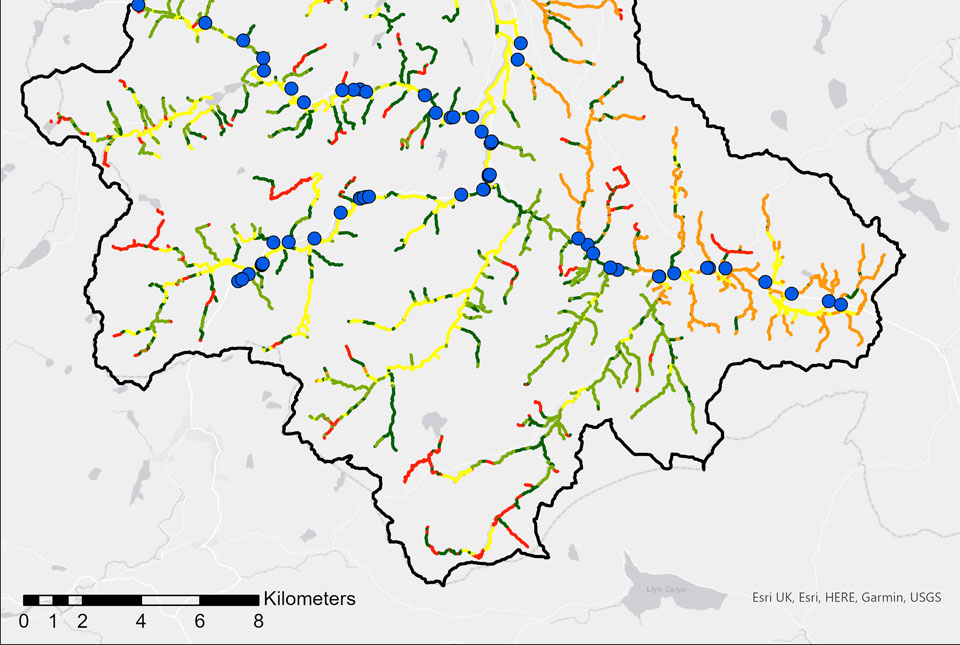

The geological properties of bedrock and superficial deposits that make up riverbeds and banks are fundamental controls on the susceptibility of any given river reach to scouring. Geological data is therefore a key input into any predictive models attempting to understand and resolve this issue, as well as being an invaluable resource for infrastructure risk and catchment health assessments.
BGS GeoScour
In a previous blog post we discussed the economic and societal impacts of river erosion geohazards in the UK and identified significant gaps in available datasets for managing and modelling this hazard. In light of this, BGS has developed the GeoScour data product. This is a national- to local-scale geological scour assessment based on the spatial variation in geological properties, allowing users to identify:
- river catchments with higher erosion activity due to landscape evolution and river sinuosity
- subcatchments that have a higher risk of scour due to river morphology, underlying geological factors and catchment size
- susceptibility to scour of specific sections of a given river’s current profile
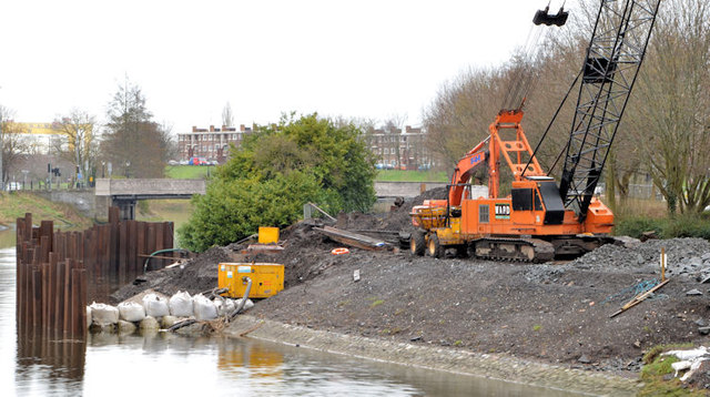
When considering natural hazards in a riverine or catchment setting, it is often high-magnitude flood events that grab the headlines. In comparison, associated catchment hazards such as river scour are often overlooked, but these events can be no less costly in their societal and economic impacts. Pictured are revetment works, River Lagan in Belfast. Photo © Albert Bridge (cc-by-sa/2.0)
GeoScour is based on the outputs of numerous research programmes, data analytics and stakeholder advice. It provides data sufficient for users to analyse and assess a range of riverine risks at various scales.
This suite of data is split into three tiers. These provide a consistent, nationwide scour assessment for Great Britain. Tier 1 and 2 datasets are freely accessible via the BGS GeoIndex and are aligned to the Water Framework Directive management catchments. Tier 3 contains licenced datasets created at a riverine scale using the latest OS Open Rivers watercourse data, which also subsequently feeds into the Tier 2 catchment-scale data.
Tier 1
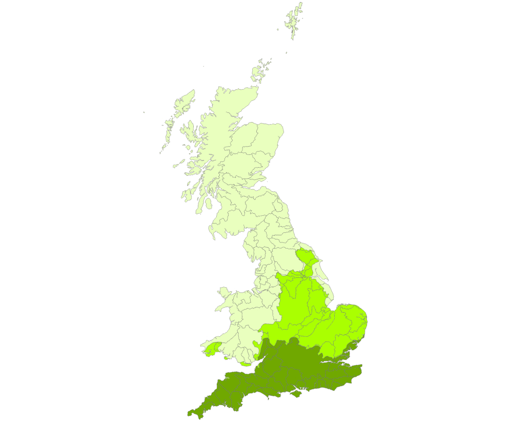
BGS GeoScour Tier 1 data is available at 1:625 000 scale. Contains OS data (C) Crown Copyright and database right 2022
Data provides a summary overview of the catchment characteristics, typical response type and evolution. It can be used to provide a high-level overview (1:625 000 scale) for incorporation into catchment management plans, national reviews and catchment comparisons.
Tier 2
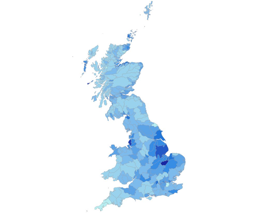
BGS GeoScour Tier 2 data is available as smaller catchment areas at 1:250 000 scale. Contains OS data (C) Crown Copyright and database right 2022
Data is available as smaller catchment areas (1:250 000 scale) and focuses on providing more detailed catchment management, natural flood management and other broad-scale assessments. It analyses geological properties such as flood accommodation space and geomorphology type, as well as additional summary statistics for worst-, average- and best-case scenarios for underlying surface-scour susceptibility.
Tier 3
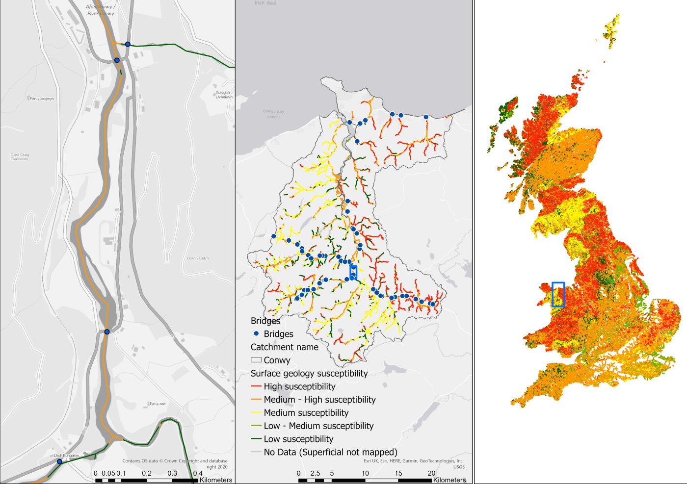
BGS GeoScour Tier 3 data showing reach, catchment and national information for Conwy. Contains OS data © Crown Copyright and database right 2022
Licenced data provides detailed riverine information (1:50 000 scale) that is designed to be incorporated into more complex river scour models. It provides the baseline geological context for river scour development and identifies important factors that should be considered in any scour model: characteristics such as material mineralogy, strength and density are key properties that can influence a river’s ability to scour. An assessment of river fall, sinuosity and flood accommodation space is also provided. This data is of use to those assessing the propensity for river scour for any given reach of a river across Great Britain and can be used as an input into hydraulic or hydrodynamic models.
Geological susceptibility to river scour
It is worth noting that the term ‘scour’ is commonly associated with bridge scour and has come to be an all-encompassing term covering various elements of scour action at hydraulic structures, as defined by the Construction Industry Research and Information Association (CIRIA) manual on scour at bridges (Kirkby et al., 2015).
BGS GeoScour is solely concerned with providing a susceptibility to natural scour assessment based on the geological properties of the riverbed and bank material. It does not consider hydraulic factors such as flow contraction or velocities, nor turbulence generated by structures or the engineering properties of said structures. By providing an assessment of the geological susceptibility to river scour, GeoScour is a valuable addition to any infrastructure scour risk assessment and, in combination with hydraulic and engineering properties, it can contribute to a complete understanding of scour conditions from catchment scale down to individual site assessments.
Who is GeoScour for?
GeoScour is targeted at stakeholders concerned with catchment management, such as local authorities, river trusts and national park authorities. It can be applied to erosion hazard models as a key input and used in assessments by asset owners and managers, such as transport authorities, insurers, lenders and other infrastructure owners, to highlight threats to their infrastructure networks or asset portfolios.
For more details on the potential applications of GeoScour data as well as an opportunity to interact with sample data for all three tiers, please read our interactive case study ESRI StoryMap.
Join our live webinar – 8 Sept 2022
Join our data products team for a live webinar on September 8th and discover more about our new data product to underpin river erosion hazard decision making.
Get in touch
To find out more about our GeoScour data product, including arranging sample datasets or learning more about licensing, please contact our digital data team (digitaldata@bgs.ac.uk)
Previous entries in this blog series
Kirby, A, Roca, M, Kitchen, A, Escarameia, M, and Chesterton, O. 2015. Manual on Scour at Bridges and Other Hydraulic Structures. (London, UK: CIRIA.) ISBN: 0860177475.24
About the author

Rob Shaw
Geospatial data analyst
Relative topics
Latest blogs

Building Europe’s geological future
20/07/2026
BGS scientists are contributing to a continent-wide initiative that is strengthening collaboration across borders to tackle shared subsurface challenges and unlock new opportunities.

Collecting beach pebbles: fun hobby but is it legal?
14/07/2026
The UK coastline will be inundated with keen holidaymakers this summer, many of whom will take a memento of their trip home in the shape of a pebble or two — but is it legal?

Strengthening capacity through partnership: a critical minerals perspective
28/04/2026
BGS has been working in partnership with the Geological Survey Department of Zambia (GSD) to build national capacity, improve data accessibility and support long-term, sustainable development.

PhD adventures in Copenhagen, Denmark: revealing past recovery processes of tropical forest systems through ancient environmental DNA
12/03/2026
PhD student Chris Bengt visited the University of Copenhagen to carry out very delicate extraction of aeDNA from lake-sediment cores, in the hopes of unlocking the secrets of past volcanic eruptions.

MARC Conference 2025: highlighting the importance of conferences to PhD students
16/02/2026
BGS and University of Nottingham PhD student Paulina Baranowska shares her experience presenting her research on nuclear forensics at her first international conference.

Hole-y c*@p! How bat excrement is sculpting Borneo’s hidden caves
23/12/2025
BGS researchers have delved into Borneo’s underworld to learn more about how guano deposited by bats and cave-dwelling birds is shaping the subsurface.

How the geology on our doorstep can help inform offshore infrastructure design
19/11/2025
BGS is part of a new collaboration using onshore field work to contextualise offshore data and update baseline geological models which can inform the sustainable use of marine resources.

Fieldwork on Volcán de Fuego
13/10/2025
Understanding how one of the world’s most active volcanoes builds up material, and how they collapse to feed hot flows
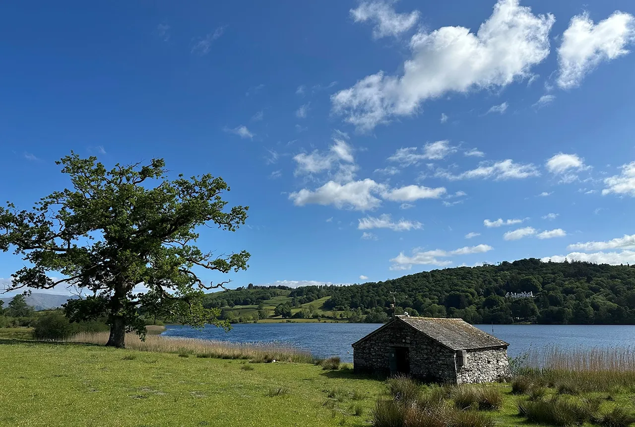
Esthwaite Water: applying novel approaches to understand lake-water nutrient pollution
19/09/2025
Andi Smith (BGS) and Savannah Worne (Loughborough University) embarked on fieldwork in the Lake District, applying a novel stable isotope method for tracing phosphorus sources.

Opening up the geosciences: making work experience more accessible
19/09/2025
BGS has been working with partners to make the geosciences more accessible to young people, including those from under-represented backgrounds.
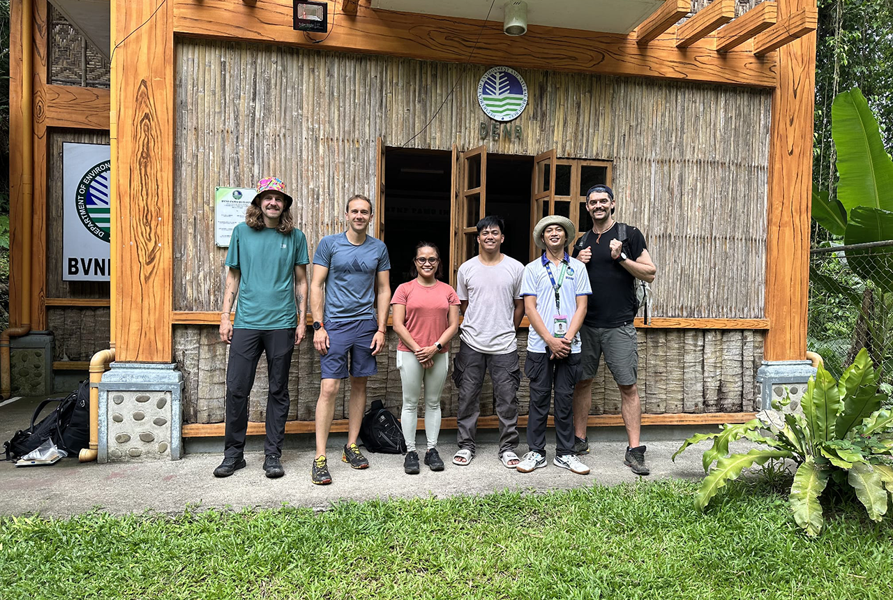
PhD adventures in the Philippines: coring around Lake Bulusan
05/09/2025
Chris Bengt recounts his two-week field trip to Bulusan Volcano Natural Park in the Philippines to collect lake sediment cores, fresh soil and water samples.
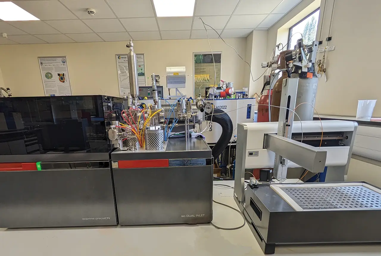
Gemini: a new stable isotope tool
21/08/2025
BGS’s Stable Isotope Facility has new mass spectrometer equipment for analysing carbon and oxygen isotopes from carbonates and water.