BGS Civils: corrosivity (ferrous)
- 1:50 000
- Great Britain
- Premium
The BGS Civils corrosivity dataset is a GIS layer supporting the management of underground iron assets, which has been created in response to the growing awareness of the cost of maintenance of structures such as pipelines and building foundations.
Key information
- Scale:
- 1:50 000
- Coverage:
- Great Britain
- Availability:
- Premium
- Price:
BGS Civils bundle (all eight layers) £0.58 per km2
BGS Civils individual layers £0.35 per km2
Subject to number of users, licence fee and data preparation fee.
- Format:
- GIS line and polygon data (ESRI, MapInfo, others available by request)
- Uses:
- Local-level use
- Themes:
- Engineering geology, Geochemistry
BGS Civils is a suite of national maps of engineering properties based on geological data and the digital 1:50 000-scale geological map — BGS Geology 50K.
It comprises eight layers:
- bulking volume
- corrosivity (ferrous)
- discontinuities
- engineered fill
- excavatability
- foundation conditions
- strength
- sulfate/sulfide
The primary goal of the product is to provide the key engineering characteristics of the geology of Great Britain to professional users who need simple and rapid access to such information. You might be planning pipeline routes avoiding difficult ground conditions, calculating tender costs for trench excavation or you might need knowledge of ground properties in order to plan your daily activities.
The data is provided as GIS shapefiles that are available to licence individually or as a bundle to meet your own requirements.
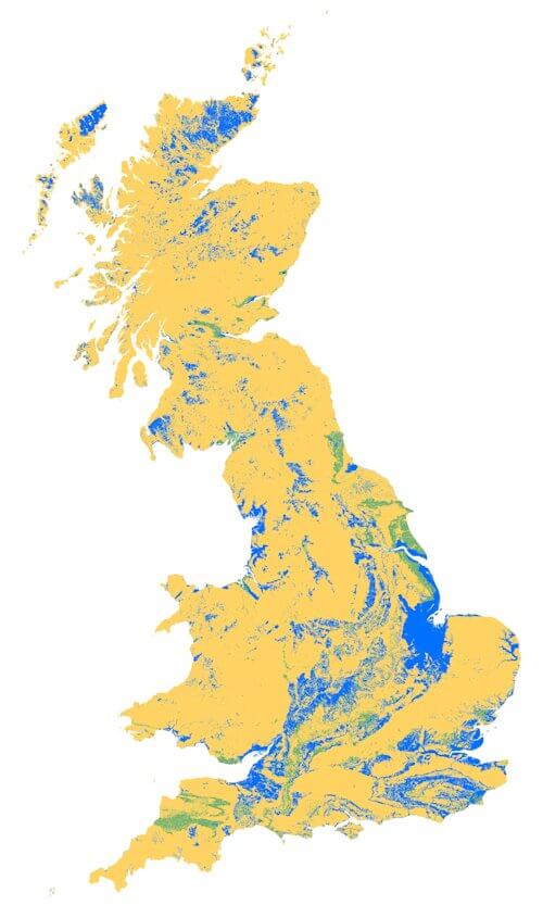

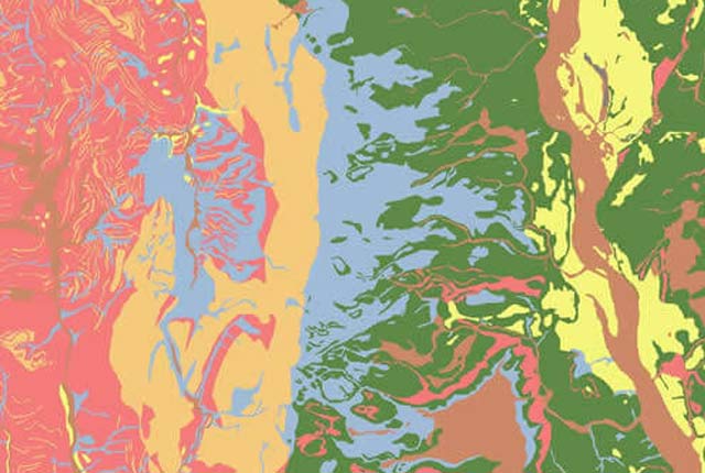
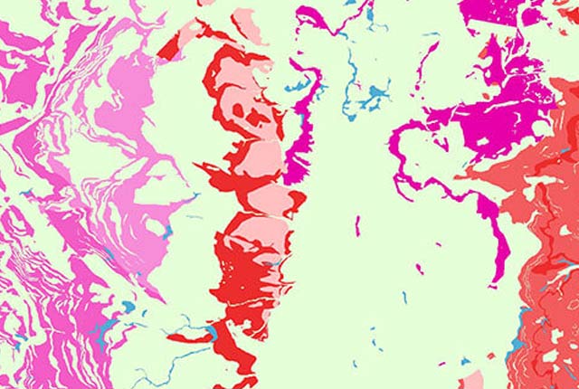
BGS Civils: corrosivity (ferrous) coverage. BGS © UKRI – Contains OS data © Crown copyright 2020.
This dataset
The BGS corrosivity (ferrous) dataset is a GIS layer supporting the management of underground iron assets, which has been created in response to the growing awareness of the cost of maintenance of structures such as pipelines and building foundations.
As underground structures and pipes get older, their potential to fail as a result of surface pitting and corrosion increases. The cost in the UK of corrosion of these structures has been estimated at four per cent of gross national product (GNP) per year (Institute of Corrosion).
Some of this cost comes in the form of corrosion of underground iron structures (e.g. pipes), particularly in what are termed ‘aggressive soils’.
This dataset identifies where the ground beneath the topsoil has potentially ‘corrosive’ or ‘aggressive’ characteristics and places them within the recognised scoring framework developed by the Ductile Iron Pipe Research Association (DIPRA).
What is at risk and who might require this data?
Underground assets that are at risk from different types of corrosion include:
- building foundations, such as steel piles
- cabling
- earthing rods
- oil and gas pipelines
- sewers
- water pipelines
This dataset can be utilised by a wide range of users such as:
- energy providers
- engineering and industrial insurers, including associations such as the International Association of Engineering Insurers (IMIA)
- local authorities and councils
- petrochemical companies
- regulatory and coordinating bodies
- transport infrastructure providers
- water companies
- water regulators and coordinating bodies such as Water UK
Inspection/testing prioritisation and project planning
All companies that have underground pipes are required to engage inline inspection testing to assess the state of the pipeline. The corrosivity dataset can be used as part of a risk-based approach to these inspections that takes into account ground conditions. This would result in prioritised inspection plans and, therefore, potentially reduce unnecessary inspections.
The dataset can also be used by pipeline coordinating bodies that have a role to play in agreeing policy and actions and preventing incidents that could cause injury and damage the environment. Companies engaged in the distribution of electrical power (power, water or transport infrastructure) use earthing rods to ensure safety of the power supply. These earthing rods can be subject to corrosion under some types of ground conditions compromising safety.
In addition, the dataset can be used in project planning and desk-study stages for new infrastructure, to identify the appropriate construction materials and level of preventative action that may be required. Examples of this include new infrastructure for renewable energy resources including solar, wind and wave.
Corrosion alone does not cause pipes to fail. However, corrosion coupled with ground movement due to shrink–swell, landslides and a variety of other physical geohazards will cause failure. We also licence a comprehensive set of geohazard data that can be used alongside the corrosivity data within asset management systems.
You may also be interested in
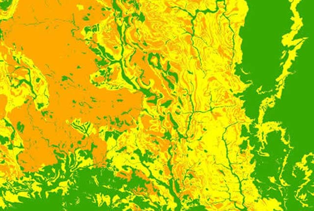
BGS Civils: bulking volume
BGS Civils is a suite of national maps of engineering properties based on geological data and the digital 1:50 000 scale geological map – BGS Geology 50k.
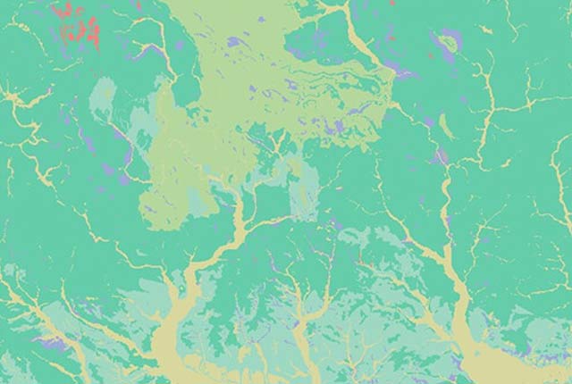
BGS Civils: discontinuities
This theme provides information on the discontinuities in bedrock and superficial deposits as part of a suite of GIS layers for different engineering parameters.
BGS Civils: engineered fill
This theme provides information on the suitability of a geological material to be used as engineered fill.
BGS Civils: excavatability
This theme provides information on the excavatability of geological deposits at surface.
BGS Civils: foundation conditions
This theme provides information on the suitability of a geological material for foundations as part of a suite of GIS layers for different engineering parameters.
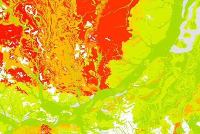
BGS Civils: strength
This theme provides information on zones of rock strength and the local factors controlling it, as part of a suite of GIS layers for different engineering parameters.
BGS Civils: sulfate/sulfide potential
The BGS Civils: sulfates and sulfides dataset is a GIS layer that supports the management of underground assets
Infiltration SuDS map
The BGS Infiltration SuDS map dataset is suitable for those involved in the design of sustainable drainage systems and approving SuDS planning applications.

Permeability
Permeability data is often used in studies of groundwater. Our permeability information is based on BGS Geology 50K data.
Superficial deposit thickness model
The superficial deposit thickness model shows the depth of the bedrock surface below unconsolidated deposits