BGS Civils: foundation conditions
- 1:50 000
- Great Britain
- Premium
The BGS Civils foundation conditions theme provides information on the suitability of a geological material for foundations as part of a suite of GIS layers for different engineering parameters. The foundation conditions of rocks and soils are an important consideration for determining how surface construction loads are transmitted into the ground safely and for the lifespan of the project.
Key information
- Scale:
- 1:50 000
- Coverage:
- Great Britain
- Availability:
- Premium
- Price:
BGS Civils bundle (all eight layers) £0.58 per km2
BGS Civils individual layers £0.35 per km2
Subject to number of users, licence fee and data preparation fee.
- Format:
- GIS line and polygon data (ESRI, MapInfo, others available by request)
- Uses:
- Local-level use
- Themes:
- Built environment, Engineering geology
BGS Civils is a suite of national maps of engineering properties based on geological data and the digital 1:50 000-scale geological map — BGS Geology 50K.
It comprises eight layers:
- bulking volume
- corrosivity (ferrous)
- discontinuities
- engineered fill
- excavatability
- foundation conditions
- strength
- sulfate/sulfide
The primary goal of the product is to provide the key engineering characteristics of the geology of Great Britain to professional users who need simple and rapid access to such information. You might be planning pipeline routes avoiding difficult ground conditions, calculating tender costs for trench excavation or you might need knowledge of ground properties in order to plan your daily activities.
The data is provided as GIS shapefiles, which are available to licence individually, or as a bundle, to meet your own requirements.
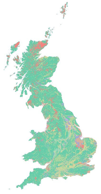

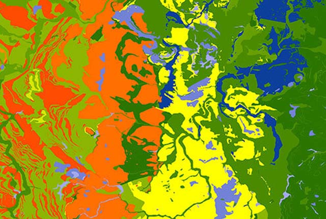
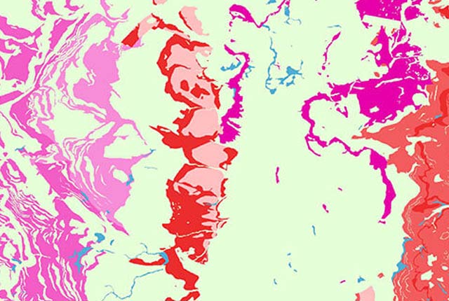
BGS Civils: foundation conditions coverage. BGS © UKRI – Contains OS data © Crown copyright 2020.
This dataset
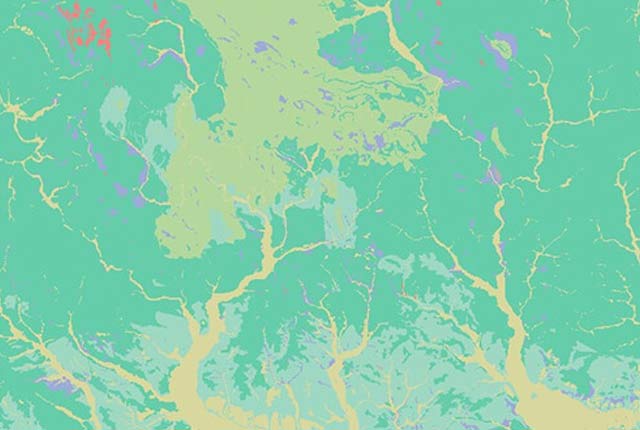
This theme provides information on the suitability of a geological material for foundations as part of a suite of GIS layers for different engineering parameters.
The spatial model covers England, Scotland and Wales at 1:50 000 scale and is based upon the Soil Parent Material Model, the National Geotechnical Property Database and BGS Geology 50k dataset. It characterises bedrock and superficial deposits in terms of their engineering properties related to the suitability for foundations.
What are foundation conditions?
The foundation is the interface of some form of construction and the ground. Design of the foundations takes into consideration a number of factors, including the response of the ground to the stresses produced by the construction. The behaviour, or ‘condition’, of the ground may be assessed by in situ and/or laboratory tests during a typical site investigation.
This dataset highlights common factors to consider when planning for a site investigation or land-suitability assessment.
The foundation conditions of rocks and soils are an important consideration for determining how surface construction loads are transmitted into the ground safely and for the lifespan of the project.
The main considerations are:
- strength or bearing capacity
- settlement (compressibility) and differential settlement
- volume change of the ground due to climatic conditions
- subsidence due to natural voids beneath the foundation, leading to ground failure
Other considerations include:
- weathering and alteration
- aggressive ground conditions of soluble sulfate, sulfide, low pH or high chloride content
- foundation excavations protection
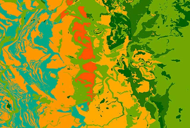
Classification
The primary classifiers give a qualitative assessment of the likely ground conditions for foundations. This is based on characteristics including bearing capacity (strength), compressibility, rate of consolidation and the variability of the ground conditions for each unit. A special case for construction above mapped coal seams is also given, which is also relevant for units that contain coal seams. In these cases this is one of the subsets.
| Condition | Additional hazard considerations |
|---|---|
| Generally good foundation conditions |
|
| Generally good foundation conditions but might be locally moderate or poor |
|
| Generally good foundation conditions but may be locally variable or poor |
|
| Generally good foundation conditions but may be locally poor |
|
| Good to poor foundation conditions |
|
| Good to very poor foundation conditions |
|
| Generally unsuitable for most foundation types |
|
| Generally very poor foundation conditions or poor to moderate conditions (where ground is no longer tidal) |
|
| Variable foundation conditions from poor (in dynamic environment) to good (in stable environment) |
|
| Generally unsuitable foundation conditions (unless assessed as stable or stabilised by engineering works) |
|
| Difficult foundation conditions (due to the presence of boulders) |
|
| Foundation conditions unknown because lithologies are unknown |
|
You may also be interested in
BGS Civils: bulking volume
BGS Civils is a suite of national maps of engineering properties based on geological data and the digital 1:50 000 scale geological map – BGS Geology 50k.
BGS Civils: corrosivity (ferrous)
The BGS corrosivity dataset is a GIS layer supporting the management of underground iron assets that has been created in response to the growing awareness of the cost of maintenance of structures such as pipelines and building foundations.
BGS Civils: discontinuities
This theme provides information on the discontinuities in bedrock and superficial deposits as part of a suite of GIS layers for different engineering parameters.
BGS Civils: engineered fill
This theme provides information on the suitability of a geological material to be used as engineered fill.
BGS Civils: excavatability
This theme provides information on the excavatability of geological deposits at surface.
BGS Civils: strength
This theme provides information on zones of rock strength and the local factors controlling it, as part of a suite of GIS layers for different engineering parameters.
BGS Civils: sulfate/sulfide potential
The BGS Civils: sulfates and sulfides dataset is a GIS layer that supports the management of underground assets
Infiltration SuDS map
The BGS Infiltration SuDS map dataset is suitable for those involved in the design of sustainable drainage systems and approving SuDS planning applications.

Permeability
Permeability data is often used in studies of groundwater. Our permeability information is based on BGS Geology 50K data.
Superficial deposit thickness model
The superficial deposit thickness model shows the depth of the bedrock surface below unconsolidated deposits