Map of BGS BritPits showing the distribution of worked mineral commodities across the country
BGS’s data scientists have generated a summary map of the most commonly extracted mineral commodities by local authority area, demonstrating the diverse nature of British mineral resources.
18/02/2026 By BGS Press

The BGS BritPits dataset contains more than 264 000 records of onshore mineral workings located in Great Britain, Northern Ireland, the Isle of Man and the Channel Islands. The data includes active, inactive, dormant and ceased sites, as well as a range of mineral operations including mines, quarries and onshore oil and gas fields, together with wharfs and rail depots handling mineral products and industrial processes. Each record describes an onshore mineral working in terms of its name, operational status, geographical location, Mineral Planning Authority (MPA), operator, geology, worked mineral commodity and a range of relevant metadata.
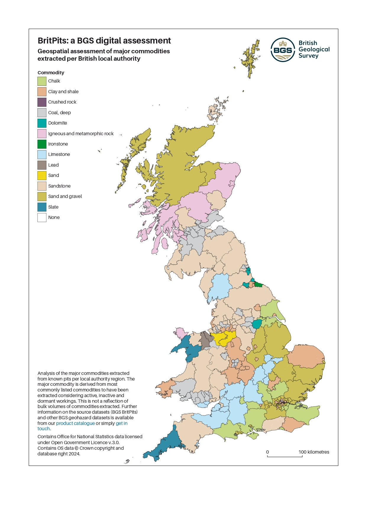
An analysis of commodities extracted from known pits per local authority region. Contains Office for National Statistics data licensed under Open Government Licence v 3.0. Contains OS data © Crown copyright and database right 2024.
Three levels of BGS BritPits data are available. The open-source index is based on the full BritPits dataset but contains index level information only, including the name, status and location of the working. This can be accessed as a Web Map Service (WMS) layer or via the BGS Onshore GeoIndex. The other two levels are available as licensed datasets.
- The open-source index package is available under an Open Government Licence
- The full dataset includes all the entries of the BGS BritPits database, including historic sites; this data is also available for specific Mineral Planning Areas
- A subset of the full dataset that contains only the active, inactive and dormant mines and quarries (over 5200 entries)
These datasets are updated every year. The latest version, released in February 2026, contains 264 549 records, an increase from 262 814 records in the previous version.
This data will be of use to organisations in the public and private sector who have an interest in the location of mineral extraction sites and their possible after-use. For example, the data has been supplied to:
- national and local governments for use in planning and statistical studies
- non-governmental organisations for environmental and conservation planning
- commercial organisations for analysis of resource potential and legacy operations
Relative topics
Related news

Updated national 3D model will determine the depth to the solid bedrock beneath our feet
13/07/2026
The BGS Superficial Deposit Thickness Model now includes an elevation model of geological rockhead for the first time, providing important data for civil engineers, geoscientists and environmental scientists.

New geological mapping underway to help manage flooding along the River Tweed
08/07/2026
Scientists are surveying the Tweed catchment for the first time in over 100 years to enhance understanding of localised groundwater and improve flood forecasting.

UK Critical Minerals Intelligence Centre makes recommendations for the next UK criticality assessment
01/07/2026
CMIC has outlined the enhancements made to the next assessment update to ensure it is better tailored to the structure of the UK economy.

From archive to discovery: historical mineral reports support gold exploration in Scotland
25/06/2026
Digitised geological records show potential to unlock untapped mineral resources in Ardlochan, Argyllshire.

Ukraine and the UK strengthen their commitment to geological cooperation
10/06/2026
A new Memorandum of Understanding reaffirms the UK’s support of Ukraine’s ambitions to develop its critical mineral resources, paving the way for collaboration through capacity-building programmes.
Newly released core could hold clues on potential mineral prospectivity in Perthshire
05/06/2026
A comprehensive collection of geological samples from the vicinity of a former mine in Scotland is now available to scientists for further research.

Extractive Industry Geology (EIG) Conference 2026
Event from 08/09/2026 to 11/09/2026
University of Liverpool
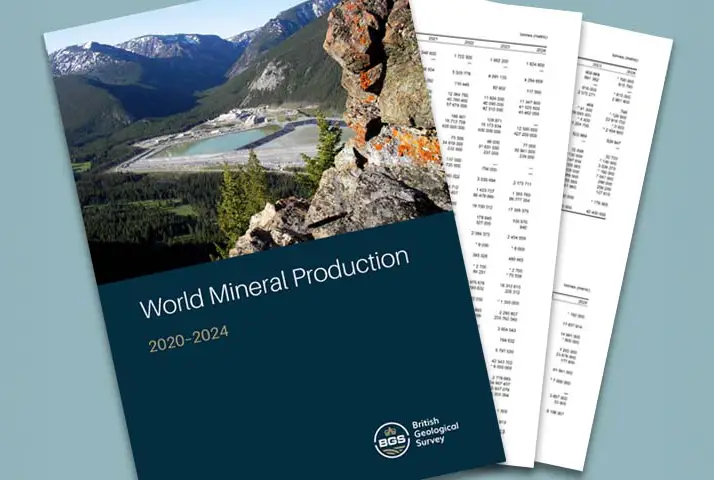
Latest data on world mineral production now available
25/05/2026
BGS has released the updated statistics on the global production of over 70 commodities between 2020 and 2024.

New geological maps of Berwick-upon-Tweed to help future-proof natural water supply
20/05/2026
Scientists have mapped the geology under the town to better understand the groundwater system to inform decisions around abstraction.

BGS contributes to UN sand and sustainability report
19/05/2026
The new report highlights the impact of poor governance and unsustainable sand mining practices, calling on policymakers to take action.
BGS GeoClimate – dataset launch webinar
Event on 02/06/2026
The virtual launch of our new BGS GeoClimate dataset – helping mitigate the economic risk from shrink-swell subsidence. Event recording now available

Strengthening capacity through partnership: a critical minerals perspective
28/04/2026
BGS has been working in partnership with the Geological Survey Department of Zambia (GSD) to build national capacity, improve data accessibility and support long-term, sustainable development.