Celebrating 20 years of virtual reality innovation at BGS
Twenty years after its installation, BGS Visualisation Systems lead Bruce Napier reflects on our cutting-edge virtual reality suite and looks forward to new possibilities.
08/04/2025 By BGS Press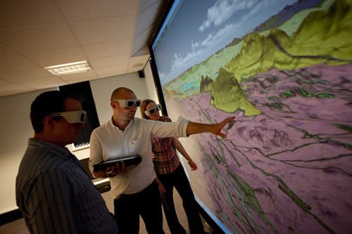

Twenty years ago, BGS took a bold step into the world of virtual reality (VR), pioneering 3D visualisation in geological surveying. From its first immersive 3D room in 2005 to its global influence today, the journey of VR at BGS has been one of constant innovation, exploration and impact.
The early days: a new perspective on geology
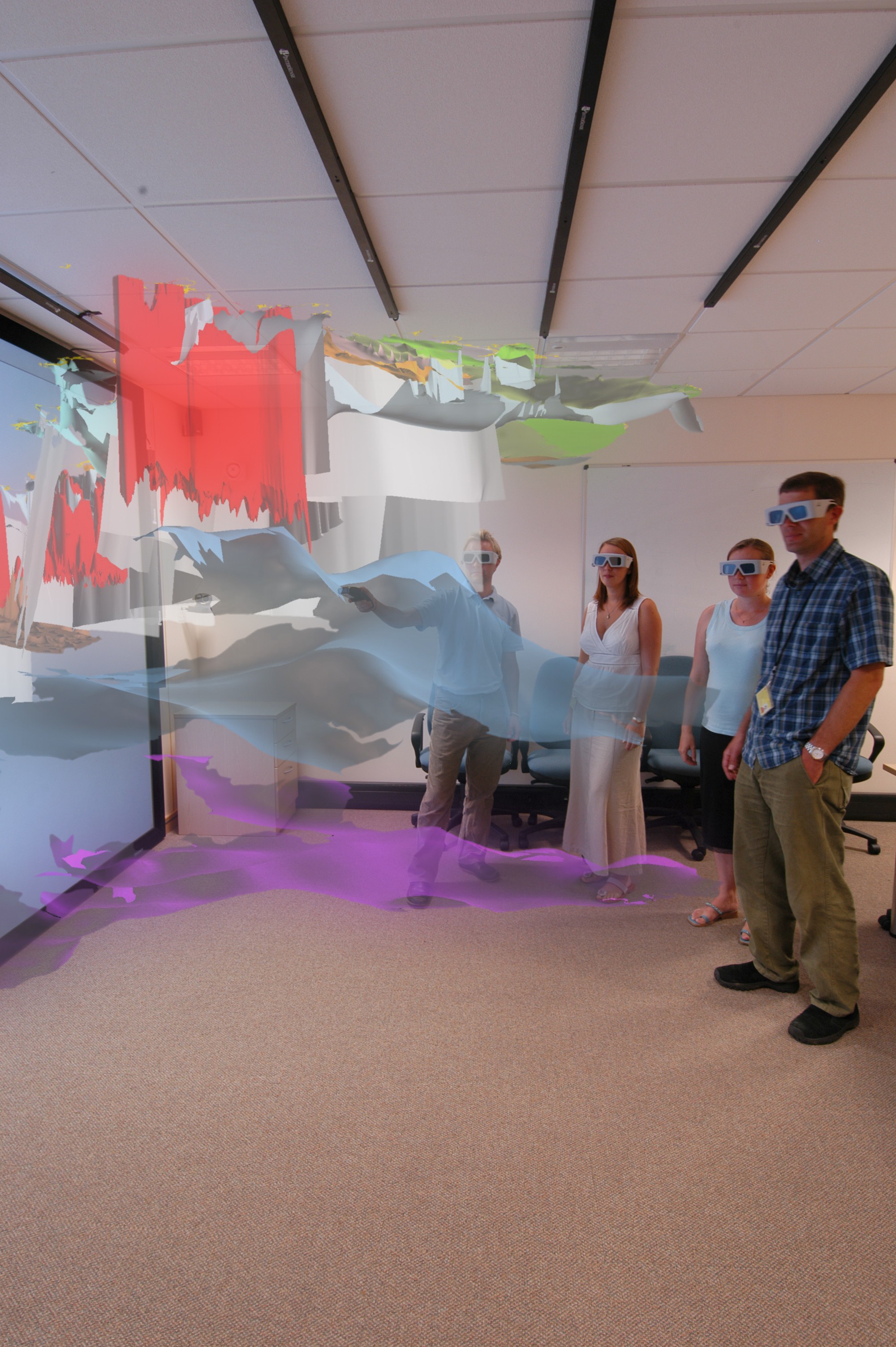
BGS has been working to improve understanding of the potential for CO2 storage as part of its International Geoscience Research and Development programme. During early 2005, Virtalis Ltd. installed BGS’s first 3D visualisation facility at our headquarters in Keyworth, Nottinghamshire, featuring a state-of-the-art Christie S-4K projector and nVidia Quadro graphics. A cutting-edge Intersense motion tracking system brought geological models to life, offering an immersive way to explore complex 3D data.
Initially, these rooms served as a platform to showcase geological model outputs from the BGS GeoScience Spatial Model (DGSM) programme. However, their potential quickly expanded beyond presentations, opening the door to practical applications in 3D modelling and landscape visualisation. BGS commissioned Virtalis to develop immersive VR experiences for GOCAD models and digital terrain models, overlaying geological maps, aerial photographs and satellite images to enrich understanding of geological formations.
The first BGS i3DVF in 2005. BGS © NERC
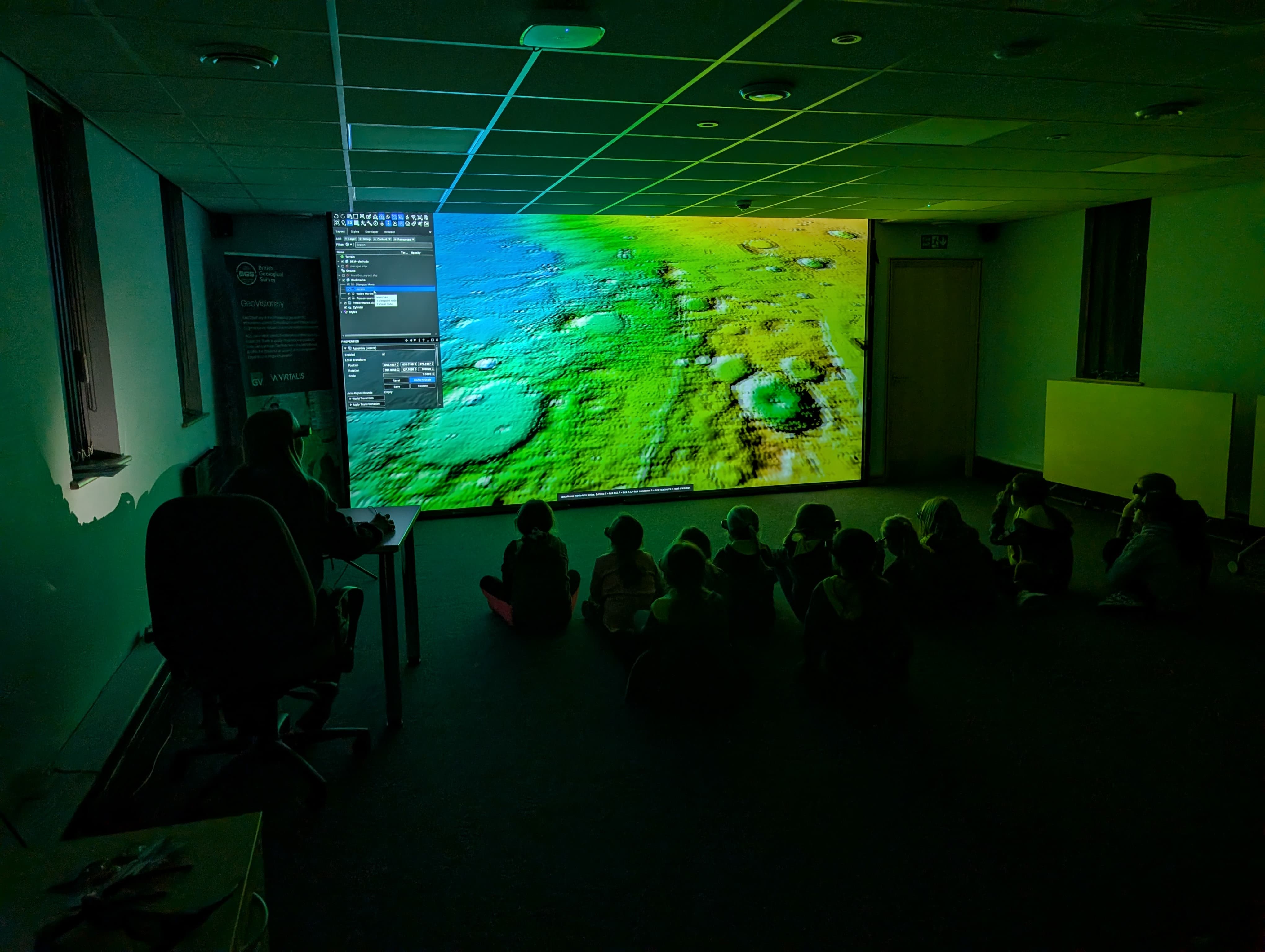
The Keyworth Brownies learning about the geology of Mars in the 3D Visualisation suite, 2025. Emily Gammon BGS © NERC
A showcase for science
The technology quickly became a key feature of BGS, attracting a diverse range of visitors. These included school groups, MPs, top government scientific advisors, VIPs and even royalty — including the Princess Royal — who were all invited to witness BGS’s cutting-edge capabilities firsthand. These demonstrations proved to be a powerful tool for communicating the importance of geological research.
Expanding the horizon: virtual field reconnaissance
By 2006, the vision for BGS VR had grown. The next challenge was making VR an interactive, integral part of geological surveying. A cross-disciplinary project was launched, bringing together the land survey, remote sensing and data and digital systems teams to develop virtual field reconnaissance (VFR). The aim was ambitious: integrate field data collection with VR landscapes, enabling geologists to conduct initial assessments remotely before heading into the field. This initiative aligned perfectly with BGS’s acquisition of high-resolution aerial orthophotos and a 5m digital terrain model (DTM) and digital surface model (DSM) from Intermap Technologies.
To handle the vast datasets seamlessly, Virtalis was commissioned once again, this time to build a prototype virtual landscape visualisation system. The result was a game-changing enhancement to geological fieldwork, increasing efficiency and accuracy and giving us the ability to plan research in a way never before possible.
Evolution and global expansion
In 2010, the original immersive 3D visualisation facility (i3DVF) needed a new home due to building works. BGS created a cutting-edge VR hub, complete with an upgraded projector, screen and computing power. Six years later, in 2016, the facility saw another major upgrade: the world’s first 4K projection system in a geological survey organisation. The enhanced resolution, combined with new, highly detailed 2 m DTM and DSM data from the Pan-Governmental Data Agreement, took geological visualisation to an unprecedented level.
What began as a pioneering project within BGS has since spread across the world. The integration of GeoVisionary and i3DVF technology has inspired geological surveys, mining companies, universities, and environmental organisations globally. From Alaska to South Africa, Malaysia to Brazil, BGS’s VR expertise continues to revolutionise how geologists explore and understand our planet.
Looking ahead
As we celebrate 20 years of VR at BGS, we also look to the future. With advancements in artificial intelligence, real-time data processing and even more immersive visualisation technologies, the possibilities for geological VR are boundless. One thing is certain: BGS will remain at the forefront, pushing the boundaries of innovation and transforming how we see the Earth.
Here’s to the next 20 years of discovery!
Further reading
- BGS 3D Visualisation Systems
- Why 3D? The need for solution-based modelling in a national geoscience organisation
- Digital geoscience spatial model project final report
Relative topics
Related news

Updated national 3D model will determine the depth to the solid bedrock beneath our feet
13/07/2026
The BGS Superficial Deposit Thickness Model now includes an elevation model of geological rockhead for the first time, providing important data for civil engineers, geoscientists and environmental scientists.

New geological mapping underway to help manage flooding along the River Tweed
08/07/2026
Scientists are surveying the Tweed catchment for the first time in over 100 years to enhance understanding of localised groundwater and improve flood forecasting.

New geological maps of Berwick-upon-Tweed to help future-proof natural water supply
20/05/2026
Scientists have mapped the geology under the town to better understand the groundwater system to inform decisions around abstraction.

Updated geological assessment of the Southern North Sea set to underpin future offshore infrastructure development
25/03/2026
The first regional assessment for 30 years will support offshore marine and subsurface planning for the UK’s low-carbon energy infrastructure, including the 2030 target of 45 to 50 GW generated through offshore wind.

Map of BGS BritPits showing the distribution of worked mineral commodities across the country
18/02/2026
BGS’s data scientists have generated a summary map of the most commonly extracted mineral commodities by local authority area, demonstrating the diverse nature of British mineral resources.

Can sandstones under the North Sea unlock the UK’s carbon storage potential?
02/02/2026
For the UK to reach its ambitious target of storing 170 million tonnes of carbon dioxide per year by 2050, it will need to look beyond the current well-studied geographical areas.

Quaternary UK offshore data digitised for the first time
21/01/2026
The offshore wind industry will be boosted by the digitisation of a dataset showing the Quaternary geology at the seabed and the UK’s shallow subsurface.

New geological maps of the Yorkshire Wolds to better inform groundwater management and policy decisions
17/12/2025
The new mapping provides crucial data on localised geological issues that may assist in protecting water supplies.

New 3D model to help mitigate groundwater flooding
08/12/2025
BGS has released a 3D geological model of Gateshead to enhance understanding of groundwater and improve the response to flooding.
New research shows artificial intelligence earthquake tools forecast aftershock risk in seconds
25/11/2025
Researchers from BGS and the universities of Edinburgh and Padua created the forecasting tools, which were trained on real earthquakes around the world.

Latest BGS Geology 50K mapping data launched
06/11/2025
Some of our most widely used maps have received a major update, including the 1:50 000-scale map series that now includes enhanced coverage of Great Britain.

Extended seabed geology map of the Bristol Channel published
07/10/2025
BGS has released significantly extended high-resolution maps that will support offshore green-energy initiatives in the area.