Relative topics
64 results for "maps and models"
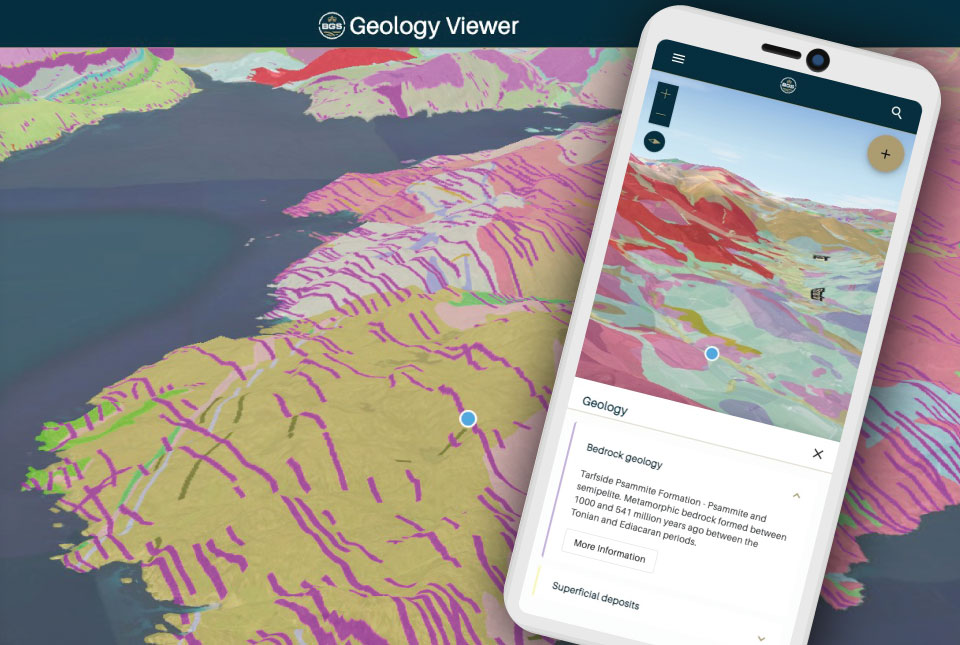
BGS launches new Geology Viewer
A new app providing easy access to the subsurface of Britain has been released by BGS.
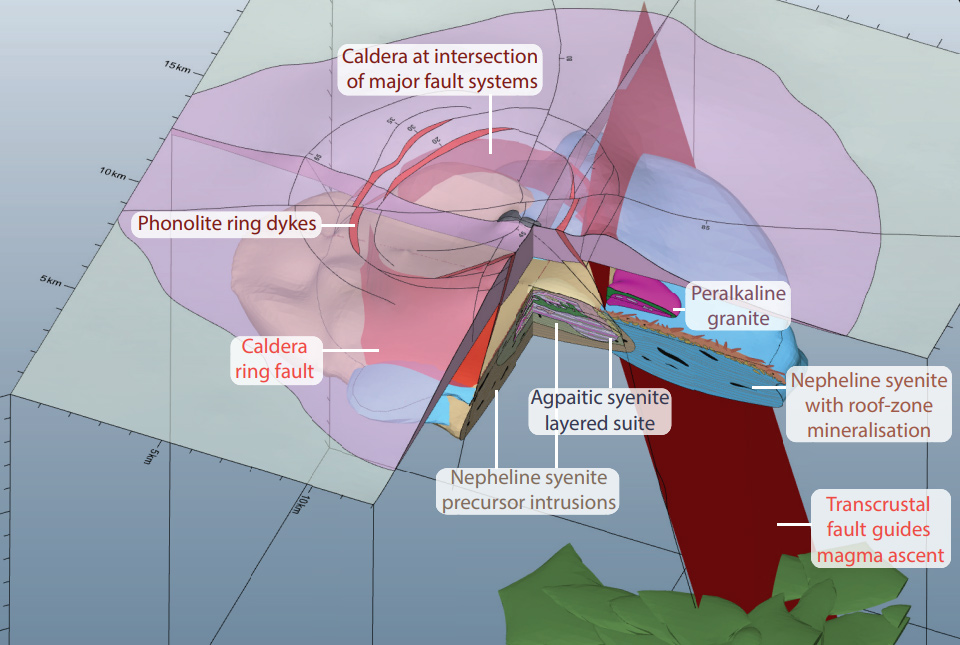
New 3D model will help guide exploration for rare earth element deposits in alkaline igneous systems
A team of scientists and institutions across Europe have developed a new 3D geological model designed to guide exploration for rare earth elements.
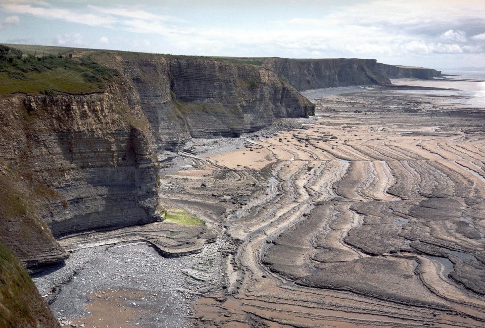
BGS releases first in a series of new offshore maps of the UK seabed
BGS has released the first high-resolution, offshore map in a new series featuring the seabed around the UK.
Soil maps could hold the key for urban planning
Research by BGS has developed a predictive model to evaluate levels of bioaccessible contaminants in urban soils and their relationship with the underlying geology and former industrial land use.
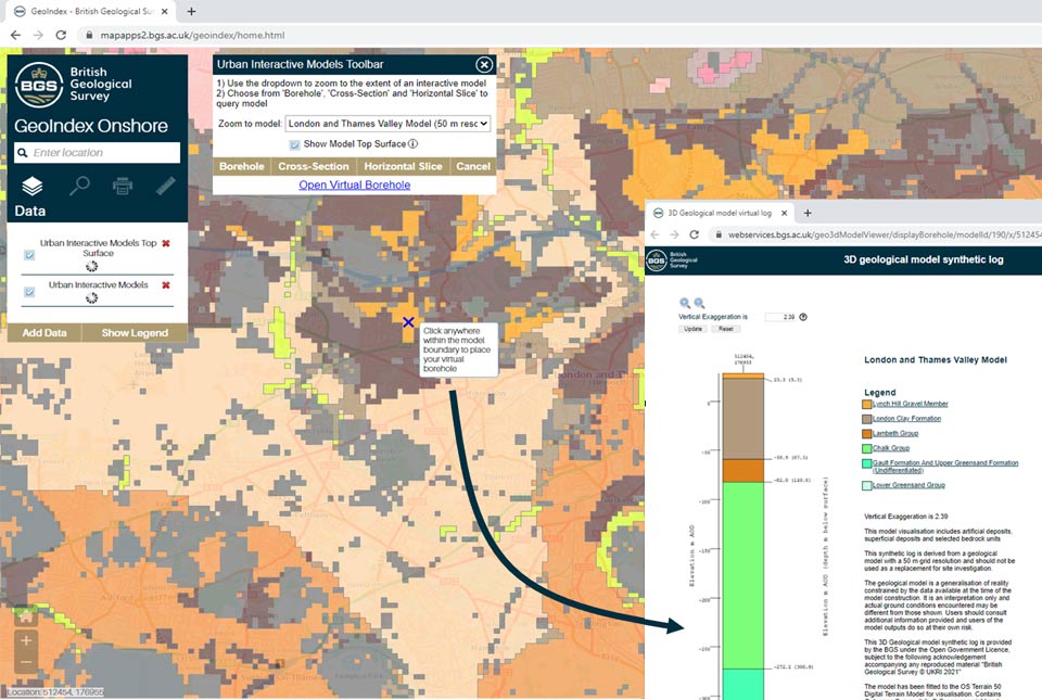
New tool provides users with free access to geological models for three major UK cities
A new tool providing free user access to 3D geological models has been added to the GeoIndex.
Five minutes with … the BGS Hazard and Resilience Modelling team
Meet the team behind our geohazard products and datasets.

iGeology: enhancing the visibility of BGS map data and reports
Downloaded over 400 000 times worldwide by building surveyors, walkers, teachers and geologists
New maps reveal heat stored in Britain’s abandoned coal mines
BGS and the Coal Authority have released maps which for the first time, reveal the extent to which heat is stored in Britain’s abandoned coal mines.