iGeology: enhancing the visibility of BGS map data and reports
Downloaded over 400 000 times worldwide by building surveyors, walkers, teachers and geologists
24/03/2021

Please note that, as part of our ongoing programme of application upgrades and redevelopment, the iGeology app was retired on 1 August 2022.
iGeology offers a digital geology map of Britain, which allows users to explore their local geology at street-level scale virtually anywhere in the UK. Since launching in 2010, iGeology has been downloaded more than 400 000 times and over one thousand users access the app every week.
iGeology has provided over four thousand bespoke geological reports to industry professionals. The on-demand generation and delivery of radon reports and natural subsidence reports have enabled small and medium-sized enterprises to incorporate BGS’s trusted data in order to provide authoritative answers to geological hazards. iGeology business users who have utilised these data products include building surveyors, land surveyors and arboricultural consultants.
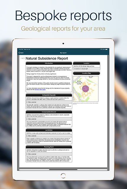
iGeology users can buy bespoke geological reports that include landslide, subsidence and radon reports. BGS © UKRI.
iGeology and citizen science
Since 2018, iGeology has enabled users to register for a free BGSiD account in order to submit geological observations, provide feedback on the BGS Digital Geological Map of Great Britain (BGS Geology 50K) or tell other users about geological points of interest. Since then, over four thousand users have registered and there have been hundreds of detailed submissions, including photographs and technical commentary on BGS Geology 50K, demonstrating the level of engagement and interest shown by our app user base.
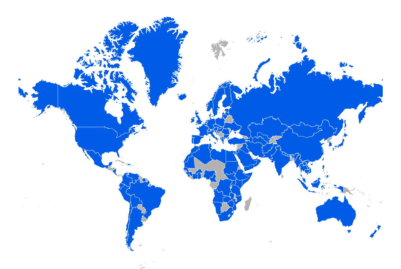
The iGeology app has been downloaded in 134 countries worldwide. Dark blue colours correspond to countries with the highest number of downloads; grey countries relate to zero downloads. Basemap © National Geographic Society.
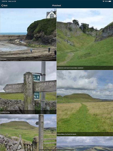
Four thousand users have registered for BGSiD and have uploaded several hundred photographs. Images: ©BGSiD contributors.
iGeology has reached new audiences and helped to raise awareness of BGS products and research. The app has been downloaded in 134 countries worldwide, making the BGS, as an organisation and brand, more visible to a wider international audience.
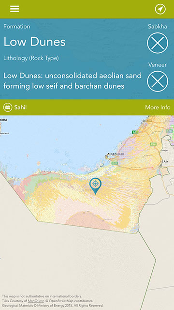
We have also replicated our mobile apps for national governments, such as mGeology created for the UAE Ministry of Energy. Smart services enable ready access to national data assets. mGeology makes an important and leading contribution to this strategy.
Image: Map tile courtesy of MapQuest. ©OpenStreetMap contributors. Geological Materials ©Ministry of Energy 2015.
iGeology for teaching and public engagement
Through iGeology, BGS geological data is available to anyone, including non-specialists who can view and use geological maps without downloading any specific software. iGeology includes bedrock and superficial geology, borehole locations and geological features including faults, folds and mineral veins. iGeology is a useful tool for teaching geology in the field or as an aid to explain local landscape evolution to the public.
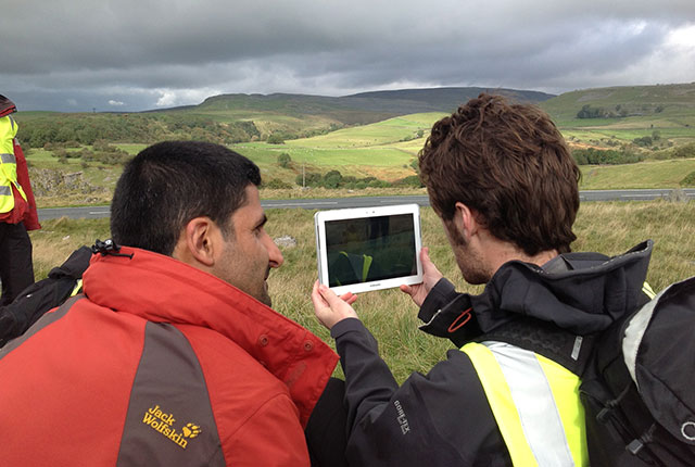
iGeology is widely used in fieldwork as a teaching tool for geology and geography students. iGeology includes bedrock and superficial geology, borehole locations and geological features including faults, folds and mineral veins. BGS © UKRI.
The Geology of Britain viewer is available via a web browser.
iGeology: timeline 2010 to present
2010
iGeology launch
2011
Best Mobile App, Storytelling with Maps contest 2011
2011
AGI Innovation & Best Practice (Highly commended)
2012
iGeology 3D launch
2012
In-App purchases: natural subsidence reports and radon risk
2012
100 000 iOS downloads
2013
New map layers: boreholes and linear features. Links from boreholes to scanned borehole log images. Bedrock geology and superficial deposits separated into layers
2013
Amazon app store launch
2017
200 000 iOS downloads
2018
iGeology has enabled users to register for a free BGSiD account in order to submit geological observations, provide feedback on DigMap or tell other users about geological points of interest
2019
300 000 iOS downloads
2021
400 000 downloads (all platforms)
2022
iGeology retired
About the author

Steven Richardson
Geospatial applications developer
More information
Please contact BGS Enquiries (enquiries@bgs.ac.uk).