Relative topics
53 results for "maps and models"
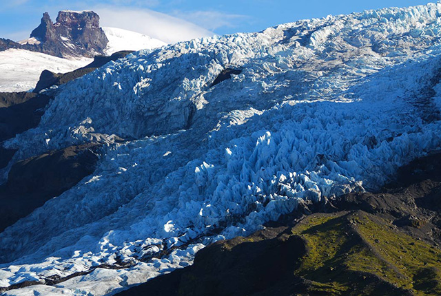
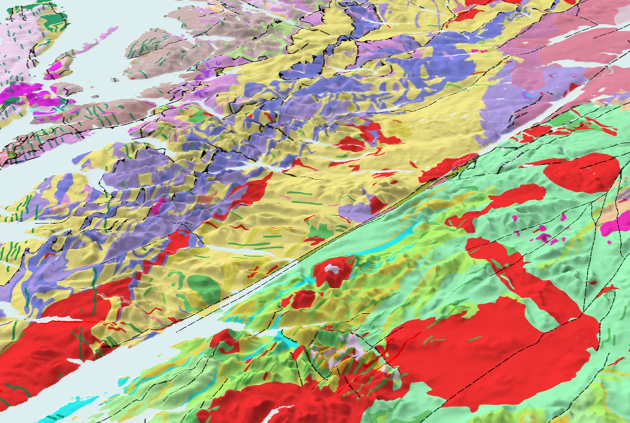
Glacial, periglacial and permafrost modelling
Glacier ice and permafrost have important implications for global water security and energy infrastructure
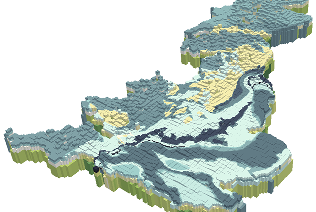
British Groundwater Model
A unique tool for simulating groundwater resources at the national scale.
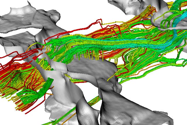
Environmental modelling
Advancing the understanding of environmental systems through innovative modelling techniques and interdisciplinary research.
BGS announces collaboration with Ordnance Survey
Ordnance Survey and BGS have teamed up to add a range of geological data products to the OS Data Hub, making it easier for users to access and use geospatial data.
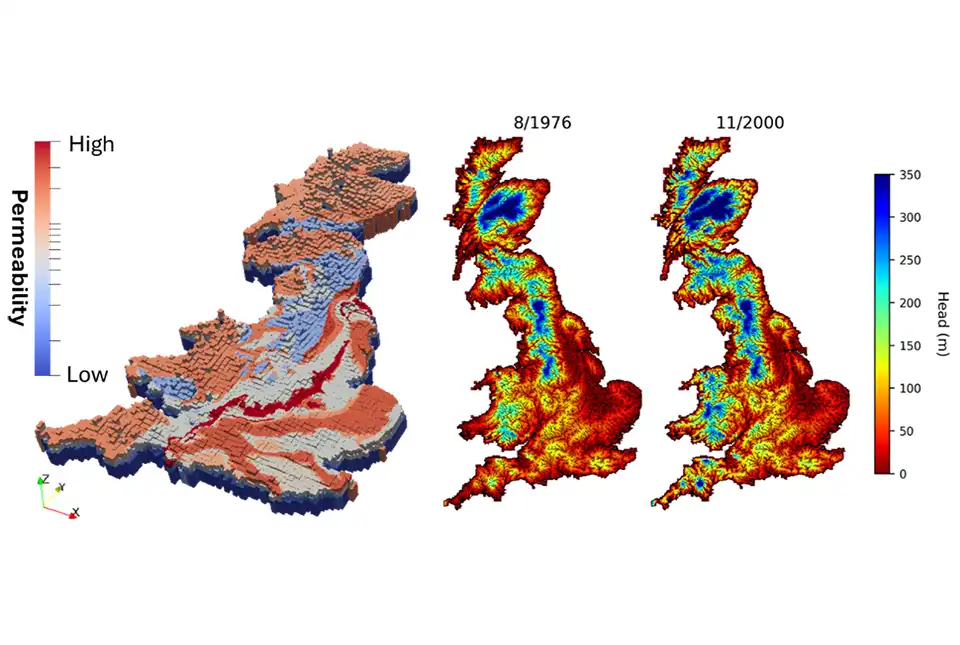
First national-scale groundwater model in Great Britain developed
BGS has developed a new model that provides a unique tool for simulating groundwater resources at a national scale.
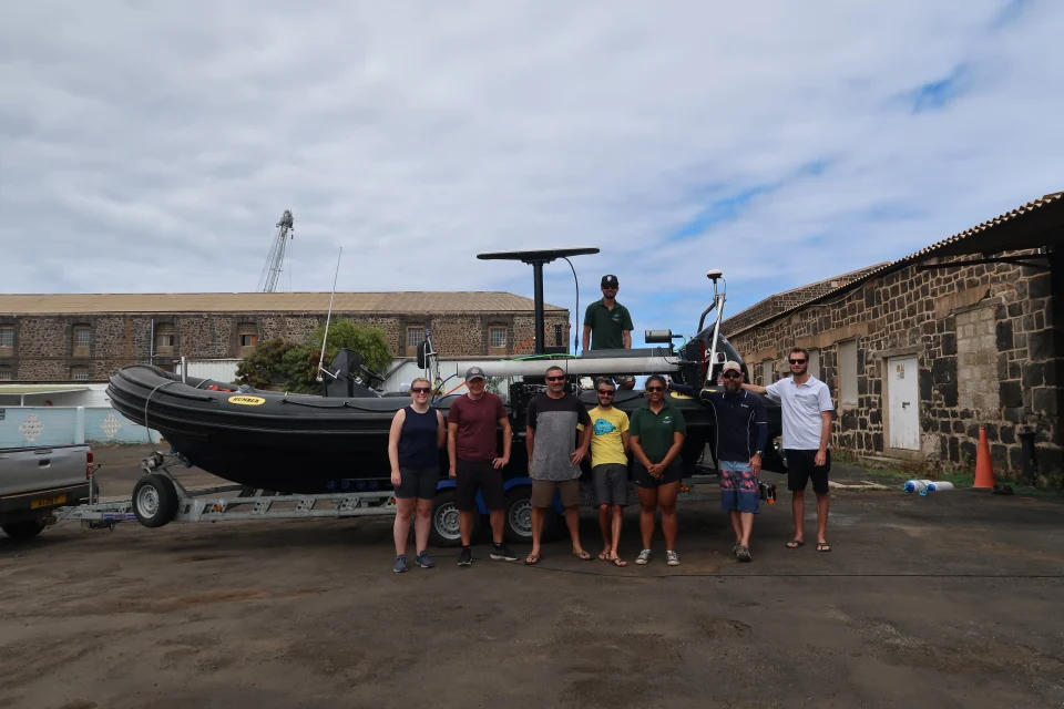
In photos: marine surveying a remote volcanic island
A photo blog by members of the BGS Marine Survey team, who recently completed marine surveys around Ascension Island in the South Atlantic Ocean.
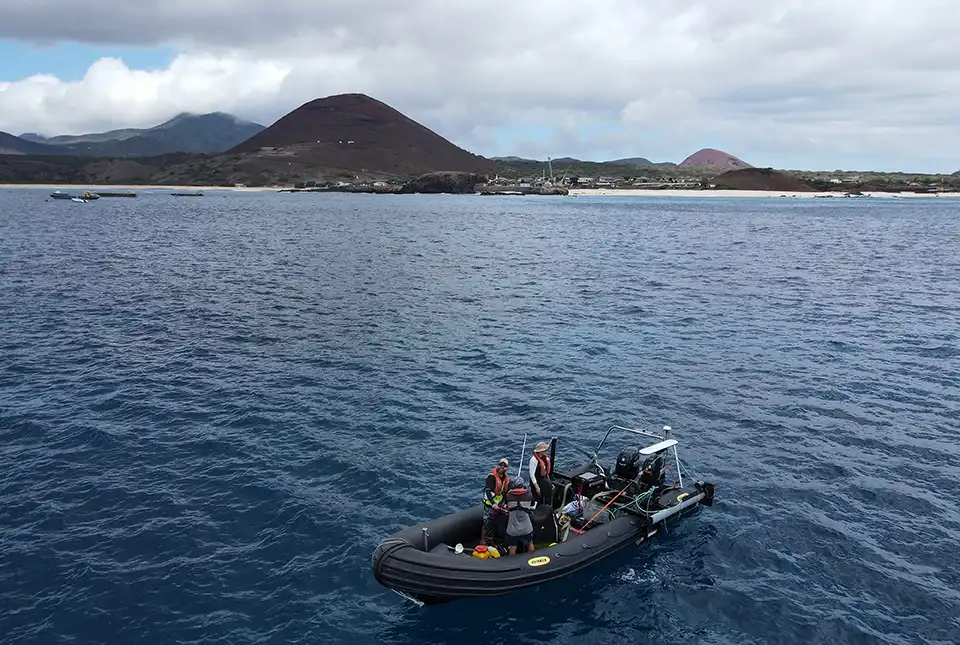
BGS completes first mapping expedition to Ascension Island
BGS marine geoscientists travelled to Ascension Island to support its government with an ongoing, conservation-driven mapping programme.
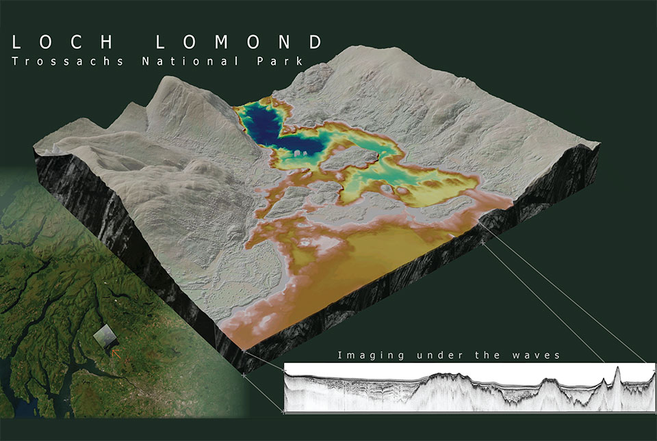
What lies beneath Loch Lomond?
BGS geoscientists have visualised what lies beneath the waves of Loch Lomond, revealing an image of the loch bed and various sedimentary features of the subsurface.