Key information
Scale:
5 km hex grid (approx. 1:5 000 000)Coverage:
Great BritainAvailability:
FreeFormat:
GIS polygon data (ESRI).Price:
Free for commercial, research and public use under the Open Government Licence. Please acknowledge the material
Uses:
National-level useGet Data
Free access
Our free data is available under the Open Government Licence. Please acknowledge reproduced BGS materials.
Download (pdf)Download GIS (shapefile format)Download OGC GeoPackageSupporting documents
The BGS GeoSure 5 km hex grid datasets provide a generalised overview of the susceptibility to six naturally occurring geohazards in Great Britain. The hexagon grid provides a national-scale summary of the GeoSure data product. The detailed GeoSure dataset is also available to licence and provides further detail at a scale of 1:50 000.
The 5 km hex grid data has been generalised into a vector map of interlocking hexagon cells (a side length of 5 km), with an area approximately 65 km2. There are three classes included within the data: low, moderate and significant.
The six layers of data provided are as follows:
- BGS GeoSure: collapsible deposits
- BGS GeoSure: compressible ground
- BGS GeoSure: landslides
- BGS GeoSure: running sand
- BGS GeoSure: shrink–swell
- BGS GeoSure: soluble rocks
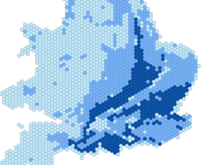

BGS GeoSure (5 km hex grid) coverage. BGS © UKRI – Contains OS data © Crown copyright 2020.
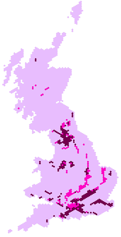
BGS GeoSure 5 km hex grid coverage (soluble rocks layer). BGS © UKRI – Contains OS data © Crown copyright 2020.
Download GeoSure hex grid – GIS (shapefile format)
You may also be interested in

BGS GeoSure
The BGS GeoSure datasets identify areas of potential hazard and, therefore, potential natural ground movement, in Great Britain.