Scientists identify hidden landslides beneath Scottish lochs
Survey data shows five locations around the Scottish coast are subject to underwater landslides.
26/06/2020 By BGS Press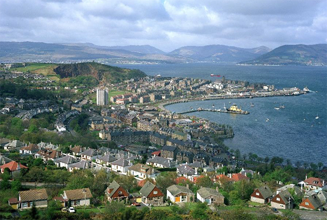

The sea bed can fail when physical conditions change, just as on land, creating an underwater landslide.
These mass movements, usually involving vast amounts of sediment, are known as submarine landslides and have the potential to threaten waterfront areas and sea-floor infrastructure.
Researchers at BGS in Edinburgh and the Scottish Association for Marine Science (SAMS) in Oban are helping to understand landslide characteristics that have never been compiled into a single study for UK waters before.
By analysing survey data, using sonar technology to map the sea floor, they have discovered evidence of at least fourteen submarine landslides occurring at five loch locations off the Scottish coast.
The data shows that Loch Eriboll, Little Loch Broom, Sound of Mull, Firth of Lorn, and Holy Loch, opposite the mouth of the Clyde estuary, have all been subject to underwater landslides.
Scientists don’t yet understand when these landslides occurred at these locations or how they were triggered.
According to the study, initial assessments of the scars and deposits on surrounding areas of the seafloor, show little evidence of any modification.
It could suggest that most, if not all of the landslides, date back to the Holocene, which is the name given to the last 11 700 years, since the end of the last major ‘ice age’. In geological terms, it is an era that is still young.
Until experts can be certain, they cannot draw conclusions about what kind of hazards these underwater landslides pose for the UK.
However, the results suggest that submarine landslides could be more common to these loch environments than previously accounted for.

Author of the research and BGS marine geoscientist, Gareth Carter, who is based at the Lyell Centre in Edinburgh, says:
“Without further data that would allow us to place exact dates on each of the landslides and understand what triggered them, it is impossible to understand what kind of hazard aspects these events might pose for the UK.
“What we do know is that quite a few of the potential trigger mechanisms that are often linked with landslides in sea lochs in other global locations are still present across the sea lochs of Scotland, so we cannot absolutely rule out another landslide event occurring.”
In locations like Canada, Alaska and Norway, which share similar geological histories and fjord environments to those found near Scotland, nearshore submarine landslides have potential to cause thousands to millions of pounds worth of damage to seafloor infrastructure, like cables and pipelines.
In some cases they have resulted in significant damage to coastal and waterfront developments, and in the most extreme cases, resulted in loss of life.
“As subsea and coastal engineering has advanced, these locations have been favoured as landfall sites for subsea cables and pipelines, sites for aquaculture industry installations, and continued waterfront development,” explains Gareth.
“It’s not untrue to say that the submerged slopes of a fjordic domain can pose a hazard to infrastructure, and even life, but the diverse styles of slope failure identified in this study are based on a relatively small dataset and further work is required.
“What is important is that the study highlights additional evidence of the issues surrounding subaqueous slope instability within coastal and fjordic environments, and particularly those around the UK that have never been studied before.
“This strengthens the need for a thorough site investigation and characterisation prior to any nearshore infrastructure project commencing in the future.”
Co-author and marine geoscientist, John Howe of the Scottish Association for Marine Science, adds: “This study illustrates some of the amazing processes that shape our seabed.
“The seas around the UK are mostly hidden to us but with sonar technologies we are able to visualise the seafloor and examine features such as these underwater landslides. The more we explore our local water, the more surprises we can uncover.”
The research is available to view free until 31 July 2020 in the journal Geomorphology.
Relative topics
For further details or to arrange media interviews please contact:
Hannah Pole, British Geological Survey Press Office, Keyworth, Nottingham, NG12 5GG
Mobile: +44 (0)7565 297 132
Notes for Editors
A link to the research is available to view free until the 31st July: https://authors.elsevier.com/a/1bDUn,3sl3mxtF
Available for interview:
Gareth Carter, BGS (Edinburgh)
Images free for media use with this acknowledgement: British Geological Survey © UKRI
British Geological Survey
The British Geological Survey (BGS) is a world leading applied geoscience research centre that is part of UK Research and Innovation (UKRI) and affiliated to the Natural Environment Research Council (NERC). BGS core science provides objective and authoritative geoscientific data, information and knowledge to inform UK Government on the opportunities and challenges of the subsurface. It undertakes national and public good research to understand earth and environmental processes in the UK and globally. The BGS annual budget of approximately £60 million pa is funded directly by UKRI, as well as research grants, government commissions and private sector contracts. Its 650 staff work across the UK with two main sites, the head office in Nottingham and Lyell Centre, a joint collaboration with Heriot Watt University in Edinburgh. BGS works with more than 150 private sector organisations, has close links to 40 universities and sponsors about 100 PhD students each year. Please see www.bgs.ac.uk.
Lyell Centre
The Lyell Centre is a strategic partnership between Heriot-Watt University and the British Geological Survey, funded by the Natural Environment Research Council (NERC), the Scottish Funding Council and Heriot-Watt University. The partnership enables them to work together combining their expertise in land and marine geoscience. Exploring themes ranging from geology and geophysics to marine ecosystems, the centre’s combination of pure and applied expertise employs innovative methods and technologies to society’s most important environmental science and energy challenges. Visit: www.lyellcentre.ac.uk
The Scottish Association for Marine Science (SAMS UHI)
The Scottish Association for Marine Science (SAMS UHI), based at Dunstaffnage, near Oban, is Scotland’s largest and oldest independent marine science organisation, dedicated to delivering marine science for a healthy and sustainable marine environment through research, education and engagement with society. It is a charitable organisation (009206) and an academic partner within the University of the Highlands and Islands.