Moving stones: faults, slopes and sediments
Fractured rock along faults affects sediment movement on slopes with implications for the design of infrastructure.
12/01/2024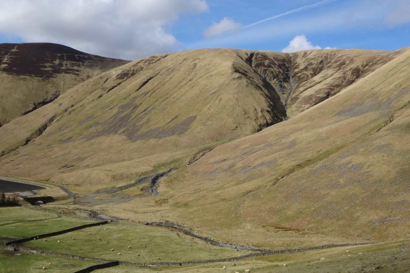

Deposits on upland hillslopes are formed by a range of processes like debris flows, rock falls, slope wash and soil creep. The movement of sediment by these processes occurs over days, years or decades and can have far-reaching implications. Over geological timescales it can influence the relief of mountain ranges, but on human timescales it is also a potential geohazard affecting roads, bridges, and reservoirs, and a key factor in managing river habitats and water quality.
Faults are important geological features, even when they are no longer active tectonic structures. They are often associated with highly fractured ‘damage zones’ that are relatively weak, providing abundant source material for slope processes and acting as conduits for groundwater flow. We investigated how faults control the types of deposits that are produced on upland slopes by weathering and erosion, and how the direction of a fault’s intersection with a hillside influences the way sediment is mobilised and transported to rivers and reservoirs.
Study area: Tweedsmuir Hills, Scotland
In the Tweedsmuir Hills, in Scotland’s Southern Uplands, the rolling upland landscape is bisected by a series of brittle faults comprising highly fractured damage zones in the otherwise hard, metasedimentary rocks. The study area, at the head of the Talla Reservoir, provides a prime opportunity to compare the geomorphological imprint of slope-oblique faults that traverse across a slope at a low angle (roughly perpendicular to the slope direction) with that of slope-parallel faults (roughly parallel to the slope direction).
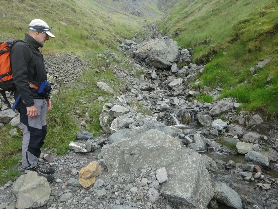
Examining debris flow deposits in the Codleteth Burn, Talla, Southern Uplands. BGS © UKRI.
Faults that traverse slopes at low angles are associated with enhanced regolith (weathered bedrock) production, which forms a more-or less continuous spread of colluvial deposits (loose sediments that move downslope under gravity) across the slope. Sediment transfer to the valley floor is limited because topographical breaks associated with the slope-crossing structures disrupt gully systems and inhibit sediment ‘flow’ downslope.
By contrast, slope-parallel faults are associated with more focused erosion along fault zones, giving rise to a deep and well-connected gully system. The alignment of slope and fault directions creates positive feedback, which enhances downslope erosion and transport to the valley floor. This feedback has resulted in approximately 20 times more rock being eroded per metre of fault length than in the slope-oblique fault system.
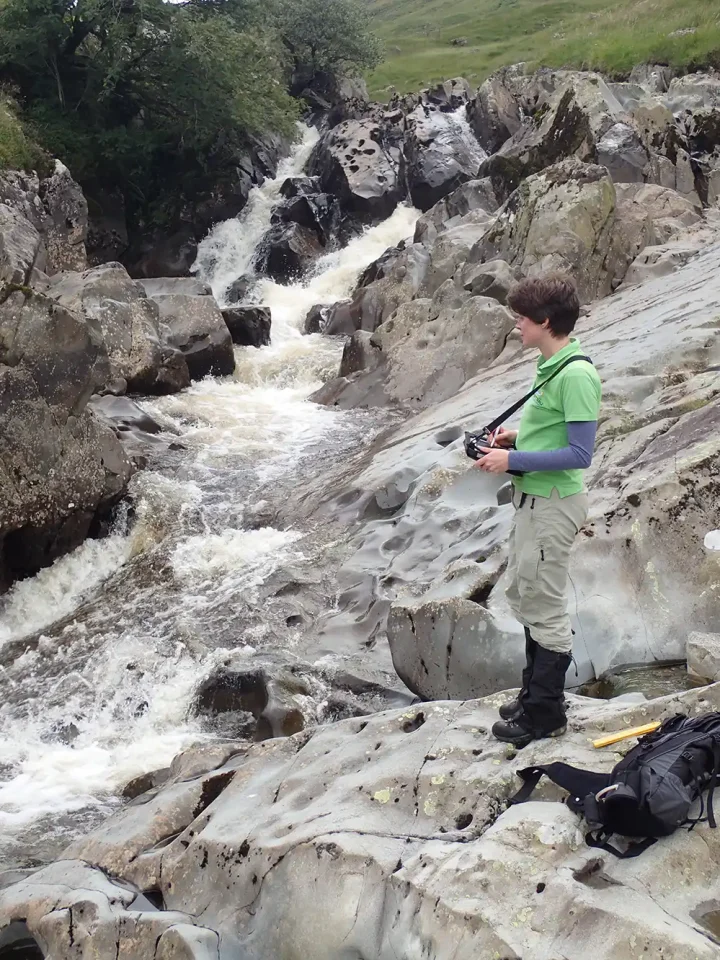
Observing the sparsely fractured (unfaulted) wacke sandstone in the bed of the Gameshope Burn. BGS © UKRI.
Influence on infrastructure design
The movement of sediment is associated with geohazards such as debris flows and rock falls as well as slope instability that can damage upland transport, energy and water infrastructure. However, sediment movement on slopes is a natural part of how our landscape behaves and interrupting or altering the flow of sediment from hillslopes into streams can affect river environments and habitats, and influence water quality in reservoirs.
Understanding the mechanisms of active slope processes and their distributions within the landscape is necessary to ensure we can design effective approaches for managing both the impact of moving sediment on our built infrastructure, and the effect this infrastructure has on our rivers and reservoirs.
Another way of looking at it is that every slope has its own story. Our work in Talla demonstrates how geomorphological mapping and quantitative field analysis can be used to help understand the dynamics of slope systems, adding to our knowledge of the ‘language’ of slopes. By understanding how their past geological history influences their present processes, we can learn to better ‘read’ slopes and ensure we develop more positive relationships with them.
About the authors

Dr Katie Whitbread
Survey geologist
Relative topics
Reference
Whitbread, K, Thomas, C, and Finlayson, A. 2023. The influence of bedrock faulting and fracturing on sediment availability and Quaternary slope systems, Talla, Southern Uplands, Scotland, UK. Proceedings of Geologists’ Association, in press. DOI: https://doi.org/10.1016/j.pgeola.2023.11.003
Latest news

Call for new members and Chair to join the NERC facilities steering committees
25/02/2026
New members are needed to join the committees over the next four years.

Your views wanted – developing a ‘Geothermal energy subsurface data portfolio’
24/02/2026
BGS is aiming to support the growth of the sector by providing the best-available, location-specific geothermal and ground source heat information as an accessible product or service.

Map of BGS BritPits showing the distribution of worked mineral commodities across the country
18/02/2026
BGS’s data scientists have generated a summary map of the most commonly extracted mineral commodities by local authority area, demonstrating the diverse nature of British mineral resources.

Funding awarded to map the stocks and flows of technology metals in everyday electronic devices
12/02/2026
A new BGS project has been awarded Circular Electricals funding from Material Focus to investigate the use of technology metals in everyday electrical items.

New UK/Chile partnership prioritises sustainable practices around critical raw materials
09/02/2026
BGS and Chile’s Servicio Nacional de Geología y Minería have signed a bilateral scientific partnership to support research into critical raw materials and sustainable practices.

Extensive freshened water confirmed beneath the ocean floor off the coast of New England for the first time
09/02/2026
BGS is part of the international team that has discovered the first detailed evidence of long-suspected, hidden, freshwater aquifers.

Funding secured to help mitigate ground risk in UK construction sector
05/02/2026
The BGS Common Ground project has been awarded new funding to help unlock the value of ground investigation data.

Can sandstones under the North Sea unlock the UK’s carbon storage potential?
02/02/2026
For the UK to reach its ambitious target of storing 170 million tonnes of carbon dioxide per year by 2050, it will need to look beyond the current well-studied geographical areas.

Quaternary UK offshore data digitised for the first time
21/01/2026
The offshore wind industry will be boosted by the digitisation of a dataset showing the Quaternary geology at the seabed and the UK’s shallow subsurface.

Suite of ten new soil reference materials released
02/01/2026
BGS has a longstanding track record of producing high-quality reference materials and has released ten new soil reference materials.
Perth and Kinross tops the UK’s earthquake activity charts for 2025
29/12/2025
Seismologists at BGS have published data on the number of seismic events over the past 12 months with over 300 earthquakes recorded.

BGS awarded funding to support Malaysia’s climate resilience plan
17/12/2025
The project, funded by the Foreign, Commonwealth & Development Office, will focus on minimising economic and social impacts from rainfall-induced landslides.