Isle of Arran announced as UNESCO Global Geopark
The Isle of Arran has officially been named as the tenth UNESCO Global Geopark in the UK.
17/04/2025 By BGS Press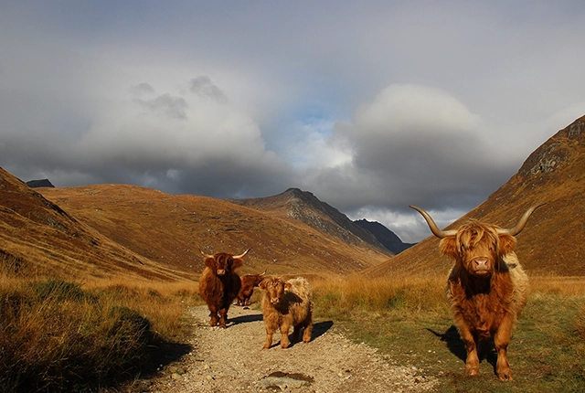

The Isle of Arran was officially announced as a UNESCO Global Geopark on Thursday 17 April 2025. Arran contains a variety of rock types and structures, vast archaeological and geological heritage, and an array of habitats that all make it a truly unique location. The island has a diverse range of plants and animals that benefit from the landscape and underlying geology, which means that Scotland’s ‘big five’ — golden eagles, red deer, red squirrels, otters and harbour seals — are well established.
UNESCO’s Global Geoparks are areas with internationally important landscapes and rocks, all of which are managed responsibly for conservation, education and sustainable development. Although geology is their foundation, Global Geoparks also bring together other aspects of heritage such as archaeology, history, culture and biodiversity. Collaboration with local people makes the Global Geoparks better places to work, live and visit.
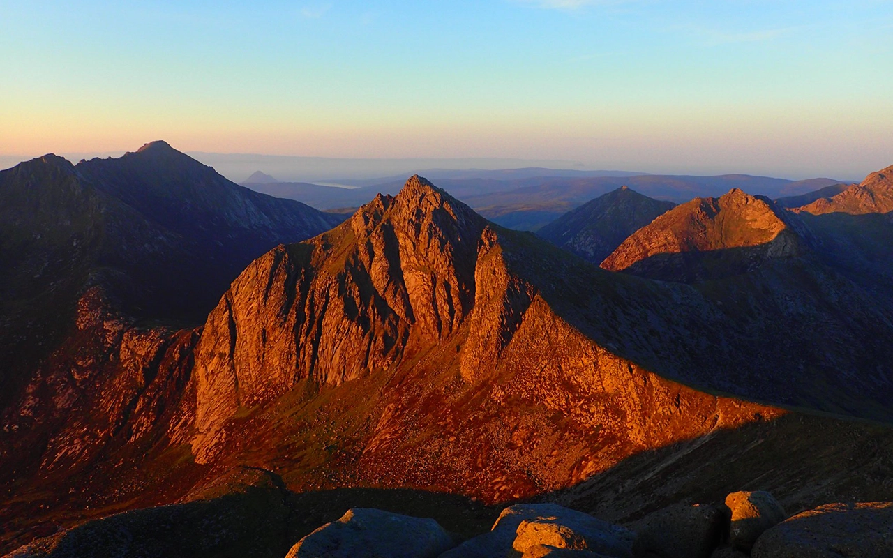
Cir Mhor mountain sunrise Arran. ArranUGGp © Corinna Goeckeritz.
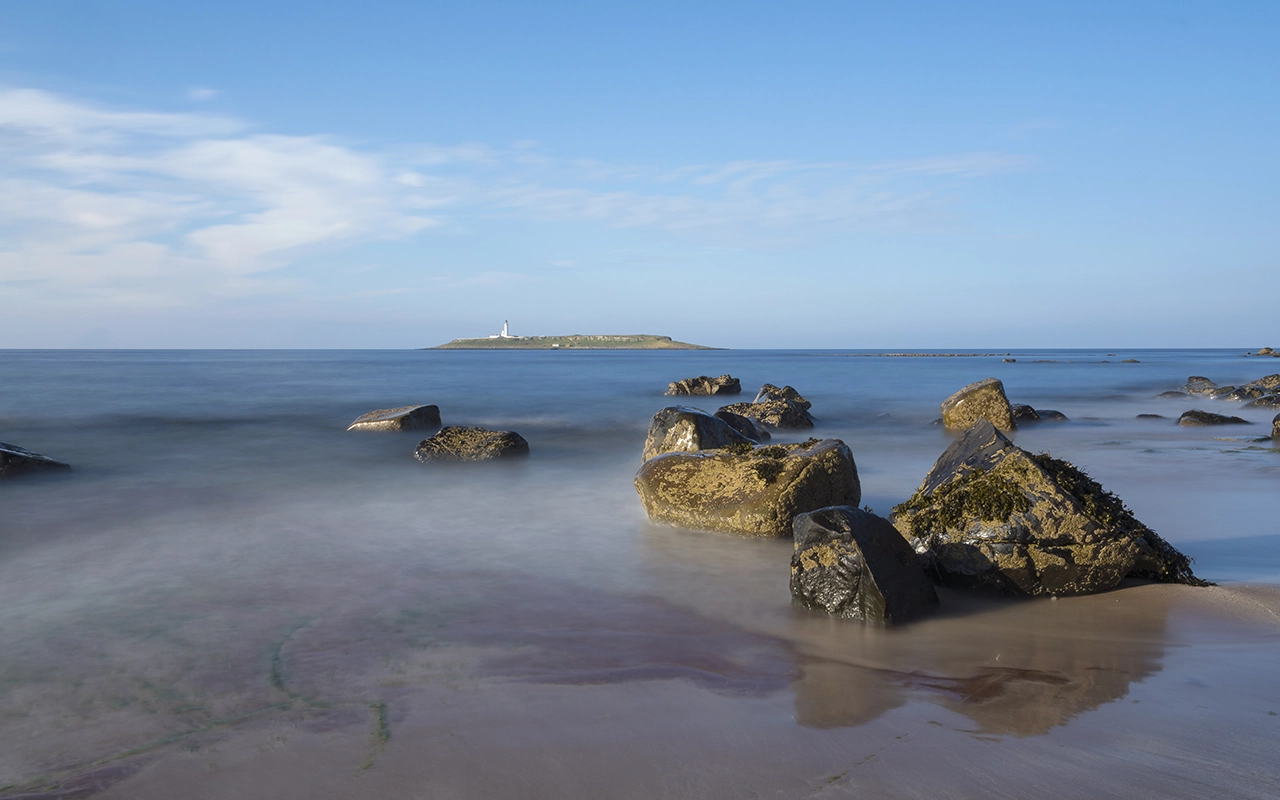
Pladda island from Kildonan at the south of the island. ArranUGGp © VisitArran.
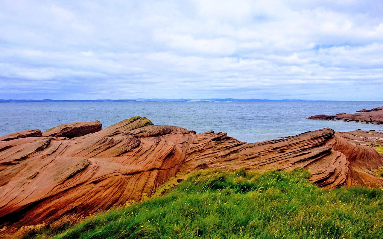
Permian desert sandstone on the north Arran coast. © ArranUGGp.
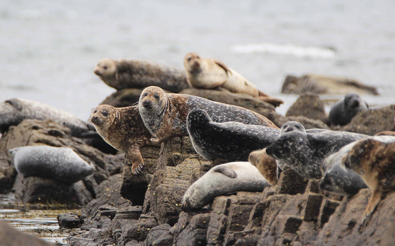
Common seals basking on a Palaeogene dyke at Kildonan. ArranUGGp © Kate Sampson.
BGS contributes to the development of UNESCO Global Geoparks through the UK Committee for UNESCO Global Geoparks, which is responsible for coordinating Global Geoparks at a national level, and the submission of UK candidates for UNESCO Global Geopark designation. BGS is also able to provide geological information, such as historical geological maps and photos.
There are now 229 UNESCO Global Geoparks in 50 countries, 10 of which are located in the UK, including the Isle of Arran. Two other Global Geoparks in Scotland are the North-west Highlands and Shetland. Other UK Global Geoparks include the Black Country in the West Midlands of England, Fforest Fawr in south Wales, Cuilcagh Lakelands Geopark in Northern Ireland.

Through my role as Chair of the UK Committee for UNESCO Global Geoparks, I mentor aspiring UNESCO Global Geoparks in the UK and have worked with the Isle of Arran over the past four years to develop its application.
Arran is truly special in terms of its geology, archaeology and habitats, and we are delighted that this has been recognised and that the island has been named as a UNESCO Global Geopark. Congratulations to all those involved.
Dr Kirstin Lemon, science programme manager at the Geological Survey of Northern Ireland and Chair of the UK Committee for UNESCO Global Geoparks.
The geology of Arran is truly special. Features of the island include folded rocks from ancient Caledonian mountains, red desert sandstone, footprints of extinct reptiles, and a great variety of dykes, sills and intrusions, formed when the Atlantic Ocean opened. It was at Arran that James Hutton, the ‘father of modern geology’, found the first example of an unconformity, now one of three Hutton’s unconformities. The granites of Goat Fell, Cir Mhòr and Beinn Tarsuinn are sculpted into intriguing shapes by ice, wind and water, and bear some of the finest rock-climbing routes in Scotland. I congratulate the local community for their hard work making Arran a UNESCO Global Geopark.
Dr Maarten Krabbendam, BGS Chief Geologist, Scotland.
Relative topics
Related news

PhD adventures in Copenhagen, Denmark: revealing past recovery processes of tropical forest systems through ancient environmental DNA
12/03/2026
PhD student Chris Bengt visited the University of Copenhagen to carry out very delicate extraction of aeDNA from lake-sediment cores, in the hopes of unlocking the secrets of past volcanic eruptions.
Modern pesticides found in UK rivers could pose risk to aquatic life
17/06/2025
New research shows that modern pesticides used in agriculture and veterinary medicines have been found for the first time in English rivers.
What is the impact of drought on temperate soils?
22/05/2025
A new BGS review pulls together key information on the impact of drought on temperate soils and the further research needed to fully understand it.
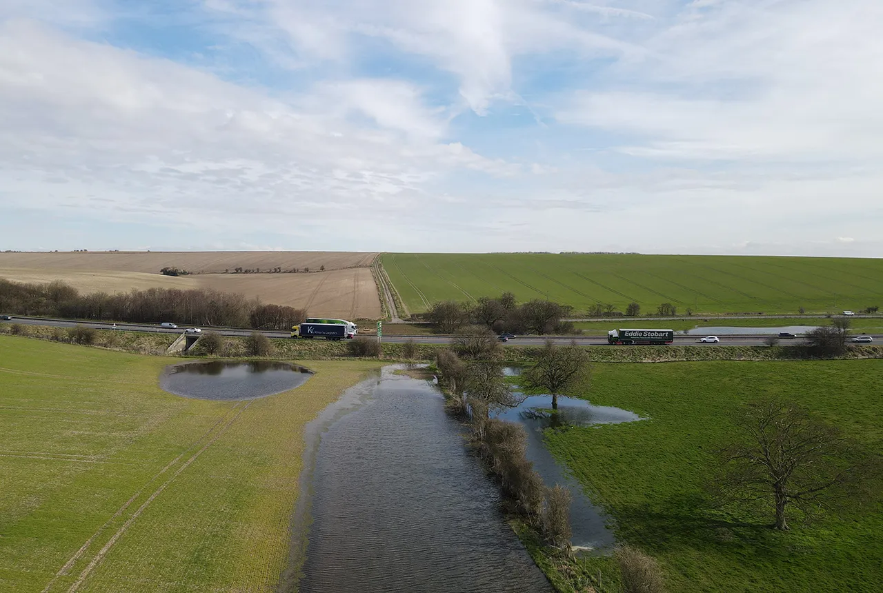
What does the next generation of coastal environmental models look like?
15/04/2025
A new tool is now available that has been designed to help coastal engineers and practitioners better manage the compound risk of coastal erosion and flooding.
Pioneering tool expanding to analyse agricultural pollution and support water-quality interventions
06/02/2025
An online tool that shows which roads are most likely to cause river pollution is being expanded to incorporate methods to assess pollution from agricultural areas.
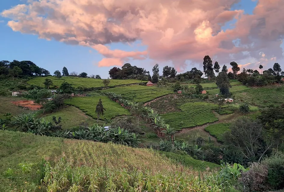
Dynamics of land-to-lake transfers in the Lake Victoria Basin
09/12/2024
In June 2024, a UK/Kenya research team shared research findings from a collaborative, four-year field and experimental programme within Kenya.
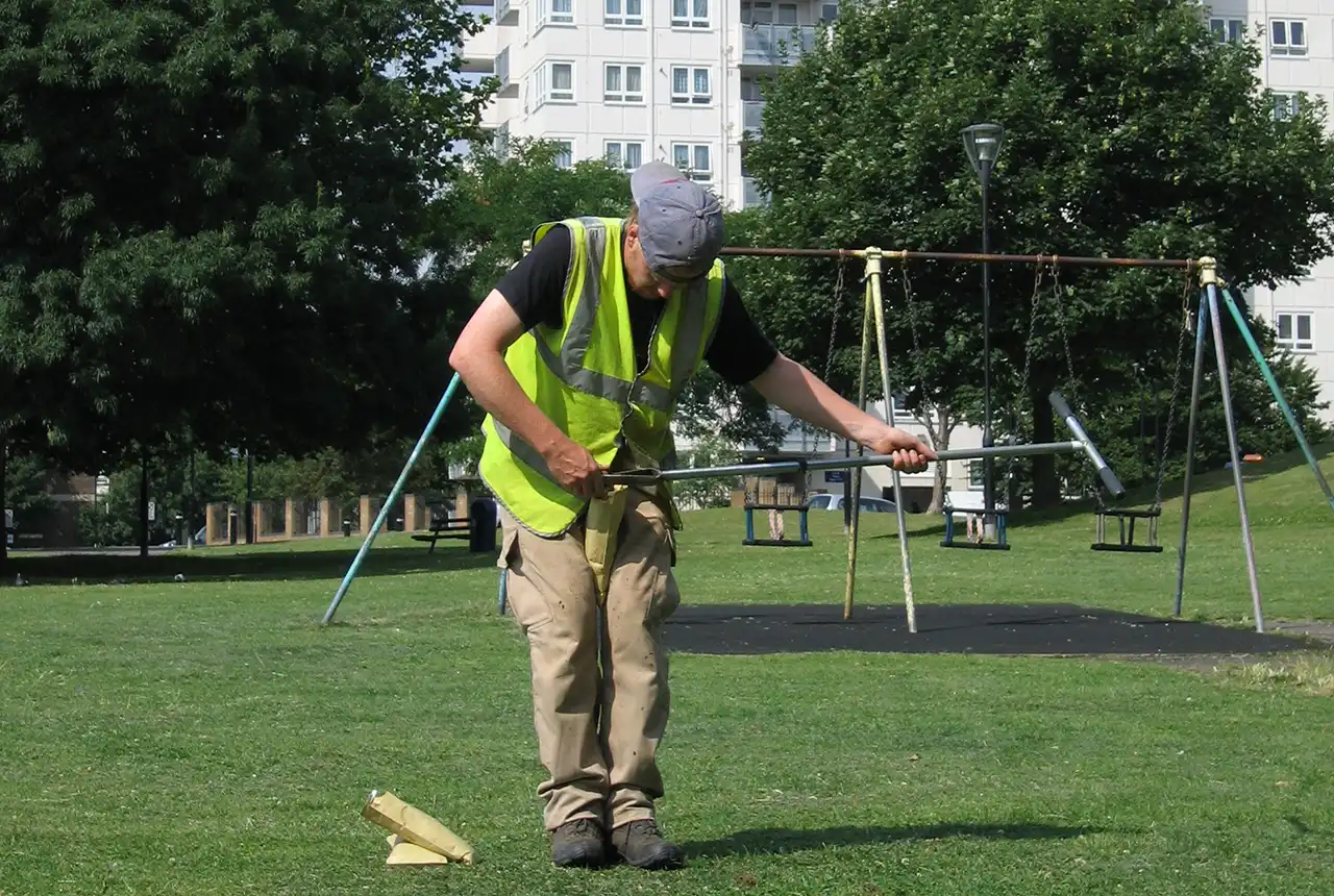
Forty years and counting: new topsoil data provides most extensive snapshot of environmental pollution effects
01/10/2024
Scientists have uncovered clear signs of the impact environmental pollution is having across the country’s soil.
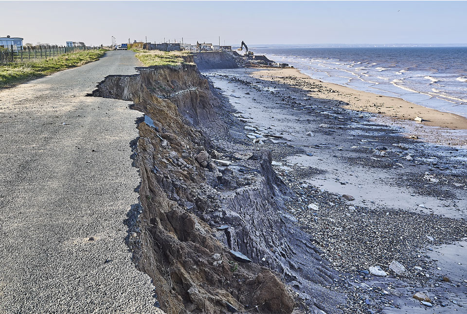
Spotlight on BGS coastal erosion data
18/07/2024
BGS GeoCoast data can support researchers and practitioners facing coastal erosion adaptation challenges along our coastline.
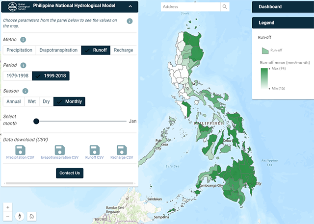
Philippine Hydrological Model
The first national-scale hydrological model of the Philippines.
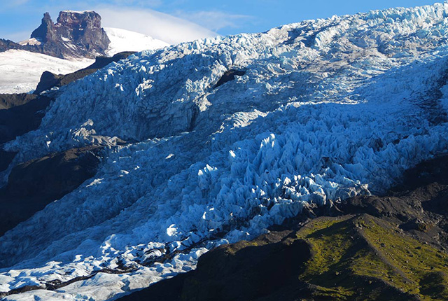
Glacial, periglacial and permafrost modelling
Glacier ice and permafrost have important implications for global water security and energy infrastructure
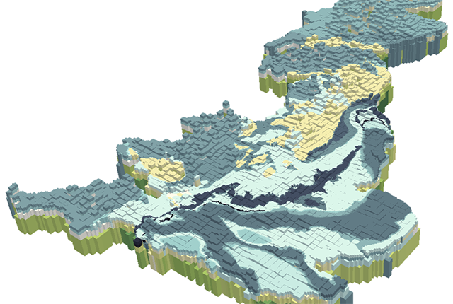
British Groundwater Model
A unique tool for simulating groundwater resources at the national scale.
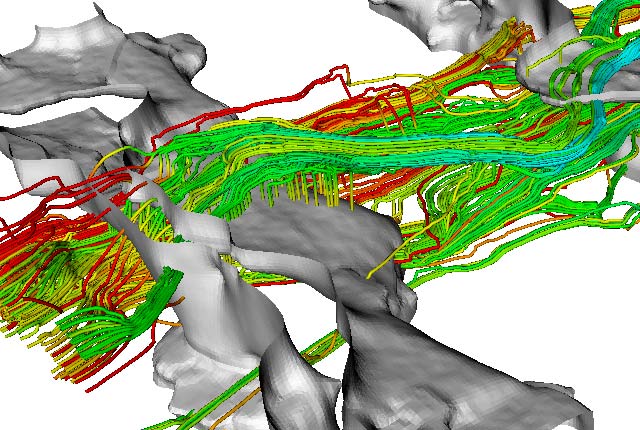
Environmental modelling
Advancing the understanding of environmental systems through innovative modelling techniques and interdisciplinary research.