UNESCO Global Geoparks
BGS Research
UNESCO’s Global Geoparks are areas with internationally important rocks and landscapes, all of which are managed responsibly for conservation, education and sustainable development. Whilst geology may be their foundation, UNESCO Global Geoparks build upon it by bringing together other aspects of heritage such as archaeology, history, culture and biodiversity. All of this is achieved in collaboration with local people to make UNESCO Global Geoparks better places to work, live and visit.
There are now over 225 UNESCO Global Geoparks in 50 countries around the world, all of which are members of the Global Geoparks Network (GGN). The GGN is a dynamic network where members work together to share examples of good practice and join together in common projects.
We contribute to the development of UNESCO Global Geoparks in the UK through the UK Committee for UNESCO Global Geoparks, which is responsible for coordinating Geoparks at a national level, and the submission of UK candidates for UNESCO Global Geoparks designation.
UK UNESCO Global Geoparks
The Black Country UNESCO Global Geopark is in the West Midlands of England and takes in parts of Dudley, Sandwell, Walsall and Wolverhampton. Home to over 1 million people, it is truly unique in being a completely urban Geopark, which brings with it a special connection with the area’s geological heritage.
The Black Country played a major role in the creation of the Industrial Revolution, with industrial minerals such as limestone, ironstone, fireclay and coal all providing the necessary ingredients for this to happen. Its rich mineral wealth led to the intense industrial activity from where the region gets its name: it was described as being ‘black by day and red by night’.
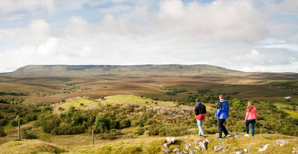
Straddling the border between Co. Fermanagh in Northern Ireland and Co. Cavan in the Republic of Ireland, the Cuilcagh Lakelands Geopark UNESCO Global Geopark was the first area in the UK recognised as a Geopark in 2001 and became the first transnational Geopark in the world in 2008. The geology of the Geopark covers a vast array of geological time, starting with the oldest Precambrian rocks and continuing to the present day with the active formation of cave and karst features.
By far the most dominant geological features are Carboniferous sedimentary rocks best seen at Cuilcagh Mountain, where a complete sequence of rocks covering eight million years (from 337 to 329 million years ago) is preserved and is one of the most important places internationally to witness the evolution of a sedimentary basin from this time.
Glacial landforms make up a significant part of the geodiversity of the Geopark. The vast tract of glacial ribbed moraines that extend across mid-Cavan are internationally important in terms of their unique size and with regard to glacial research.
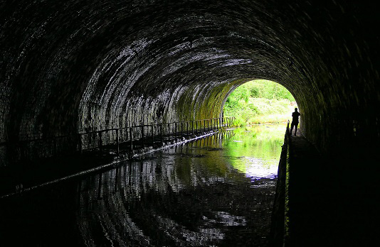
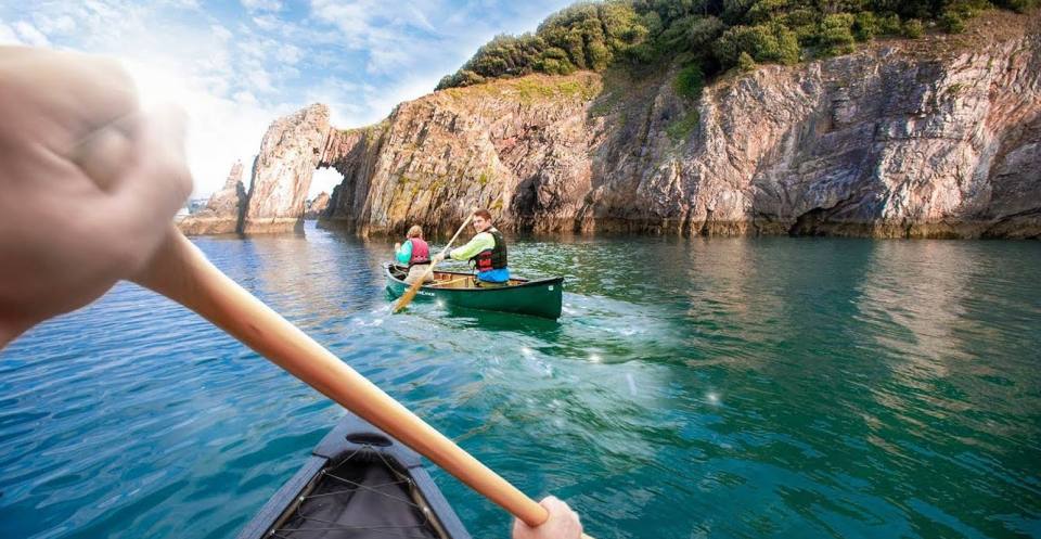
Situated within the stunning, rolling hills of south Devon, the English Riviera UNESCO Global Geopark can be found in Torbay and includes the resort towns of Torquay, Paignton and Brixham. Torbay’s geology has created a beautiful coastline, linking the rich diversity of the landscape with its wildlife, people and culture.
The Geopark’s historical contribution, in terms of the development of both geological and archaeological sciences, is outstanding, ranging from the Huttonian Theory to the naming of the Devonian Period by Sedgwick and Murchison, and even Pengelly’s cave exploration discoveries that revealed what is possibly the earliest anatomically modern human fossil yet discovered in north-west Europe.
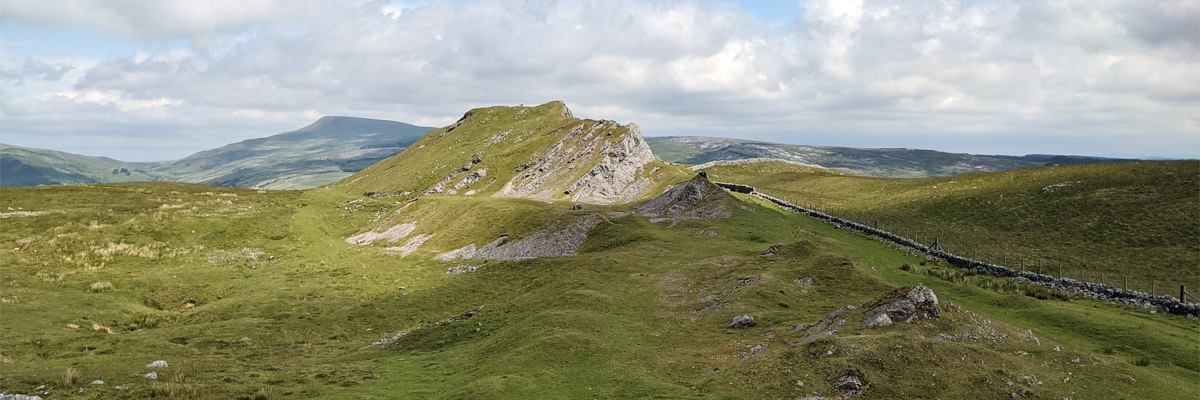
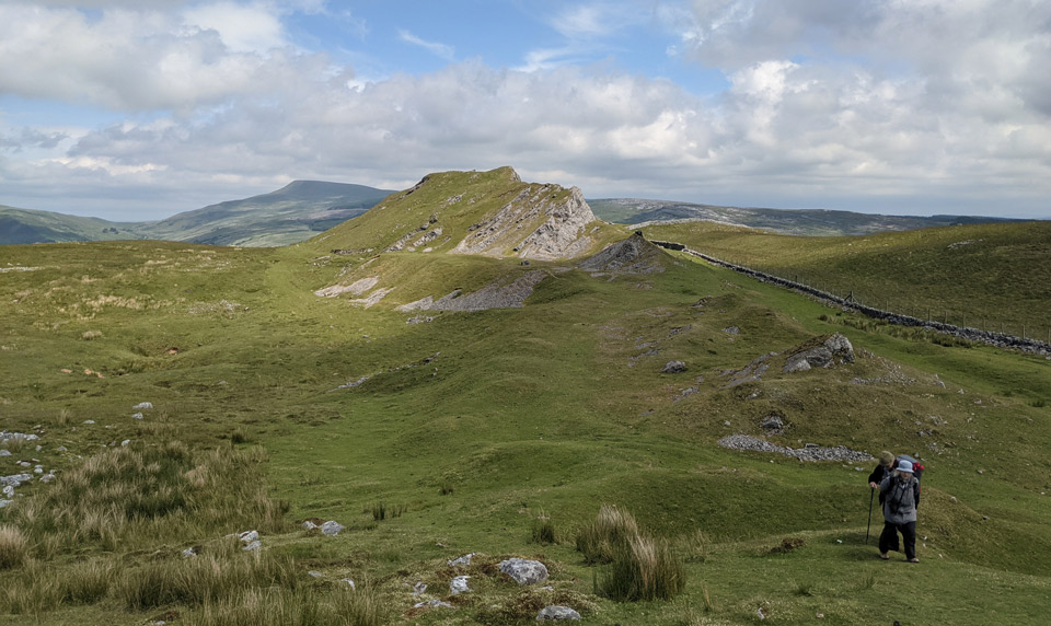
Fforest Fawr UNESCO Global Geopark (‘great forest’ in English) is a swathe of upland country that comprises the western half of the Brecon Beacons National Park in a landscape that sees the transition from rural mid-Wales to the industrial valleys of south Wales.
The rocks and landscapes of the Geopark record significant events in Earth’s history and help us to understand the geological evolution of Wales, the rest of the UK and Europe. Spanning a period of 480 million years, the Geopark plays host to rocks from the Ordovician to the Carboniferous periods and a stunning array of glaciated landscapes. Its importance in geological history is highlighted in the globally recognised terms Llandovery and Silurian, named respectively after a local town and the Celtic Silures tribe, who inhabited the area during Roman times.
The Geopark is also known for its industrial heritage from the past 200 years, a legacy of when the area was exploited for metal production and now an integral part of the dramatic landscape.
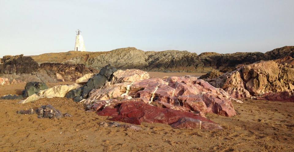
GeoMôn UNESCO Global Geopark gets its name from the largest of the Welsh islands, Ynys Môn, known in English as Anglesey, which is located off the north-west coast of Wales. The entire island is part of the Geopark with its spectacular geological history that spans four eras, 12 geological time periods and 1.8 billion years.
GeoMôn tells of the opening and closing of ancient oceans, the growth and eventual death of volcanoes, the blossoming of life in shallow tropical seas and the formation of huge ice sheets that grew and then eventually melted away in response to more recent changes in our climate.
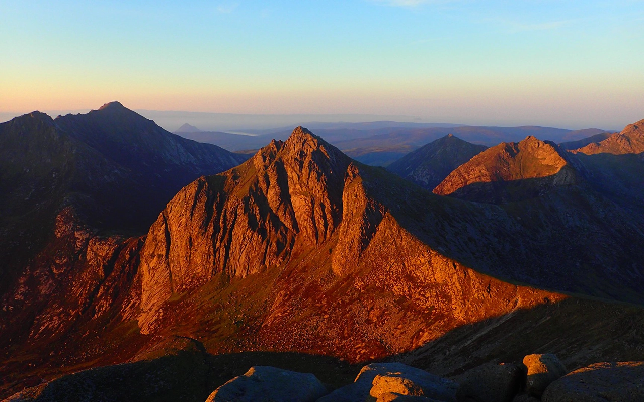
The Isle of Arran was officially announced as a UNESCO Global Geopark on Thursday 17 April 2025. Arran contains a variety of rock types and structures, vast archaeological and geological heritage, and an array of habitats that all make it a truly unique location. The island has a diverse range of plants and animals that benefit from the landscape and underlying geology, which means that Scotland’s ‘big five’ — golden eagles, red deer, red squirrels, otters and harbour seals — are well established.
Features of the island include folded rocks from ancient Caledonian mountains, red desert sandstone, footprints of extinct reptiles, and a great variety of dykes, sills and intrusions, formed when the Atlantic Ocean opened. It was at Arran that James Hutton, the ‘father of modern geology’, found the first example of an unconformity, now one of three Hutton’s unconformities.
Further information is available through the Arran Geopark website.
Mourne Gullion Strangford Geopark’s spectacular beauty has been forged by nature, torn apart by volcanic activity and sculpted by ice, providing a stunning backdrop to remarkable people and places. This dramatic and thriving landscape is where people live and work every day. A warm welcome awaits you in Mourne Gullion Strangford Geopark – with its mesmerizing blend of stunning landscapes, rich geological history, and vibrant cultural heritage.
For more information, please visit the Mourne Gullion Strangford Geopark website.
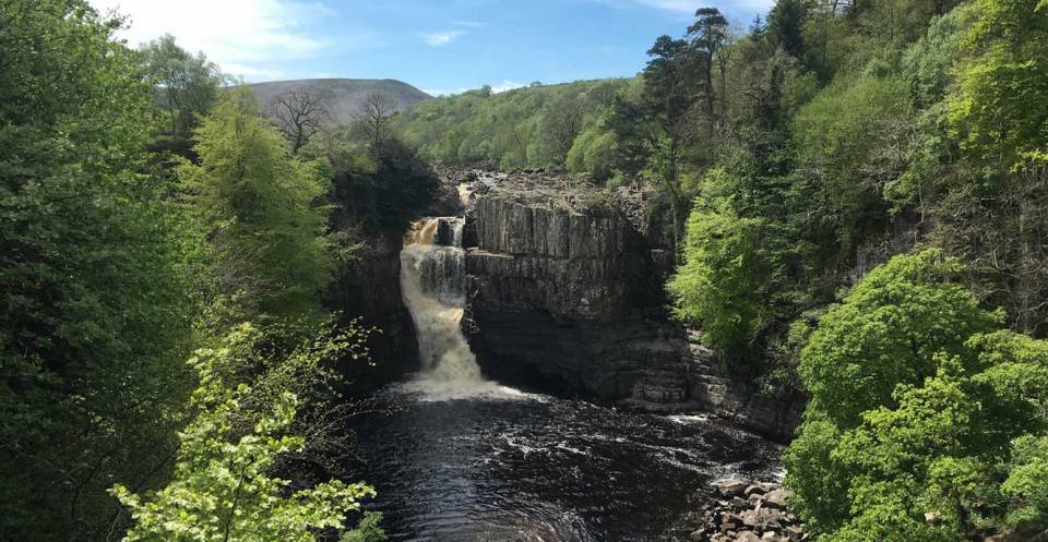
Located in the uplands of northern England, the North Pennines UNESCO Global Geopark stretches across the counties of Durham, Northumberland and Cumbria and shares its boundary with the North Pennines Area of Outstanding Natural Beauty (AONB).
The landscape reflects nearly 500 million years of geological heritage, with layers of Carboniferous sedimentary rocks forming terraced hillsides and the famous Whin Sill, which is an igneous intrusion from around 300 million years ago that forms distinctive scarps and dramatic waterfalls.
However, the Geopark is most famous for its mineral veins where, over the centuries, lead ore and other minerals have been mined, leaving behind a rich industrial and cultural heritage with ruins and spoil heaps dotting the spectacular and varied landscape.
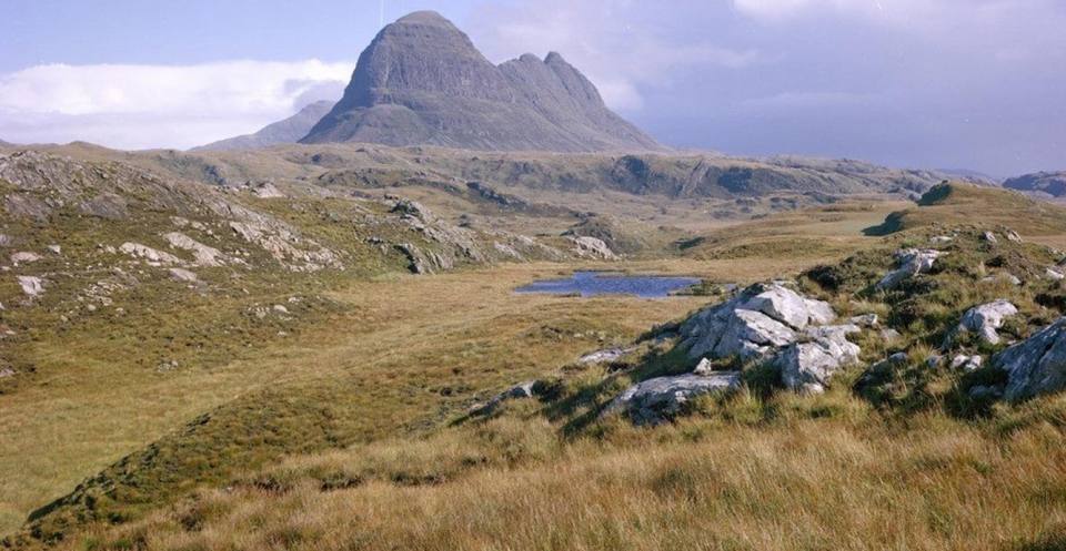
Seen by many as the cradle of modern geology, the North West Highlands UNESCO Global Geopark is located in the far north-west of Scotland and encompasses some of the finest mountains and coastal landscapes in the UK.
The Geopark was a key area in the history of geology, including the ‘Highlands Controversy’, which ended in the recognition of the Moine Thrust Zone and the first thrust belt ever to be scientifically documented. The area is home to the Lewisian Gneiss, the oldest rocks in Europe at 3 billion years old. It is also home to the earliest evidence of life in Europe: simple-celled algal life (stromatolites) occurring in the Torridonian Sandstone dated at 1.2 billion years old.
The Geopark hosts a vast geodiversity and covers two-thirds of the Earth’s history. Its landscapes, all of which are a direct result of the underlying geology, are famous the world over, leading to the phrase ‘The landscape is the geology; the geology is the landscape’.
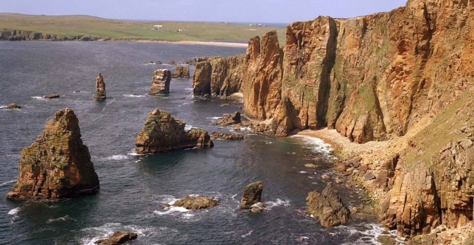
The most northerly of the UK’s UNESCO Global Geoparks, and taking in all of the islands that make up the Shetland archipelago, the UNESCO Global Geopark Shetland contains rocks from every geological period from the Precambrian to the Devonian.
Its rocks tell an amazing story of how the world has formed and changed, with oceans closing and opening, as well as mountains forming and eroding. Its northerly location also means that it is a haven for wildlife, especially birds, as well as having a strong Norse heritage, all of which are intricately linked to the landscape.
Other Geoparks
There are a number of Aspiring UNESCO Global Geoparks in the UK and these are at various stages in the application process. There are also a number of areas in the UK that have chosen not to pursue UNESCO Global Geopark status or that fail to meet the criteria to do so. These areas still use the term Geopark as they still have incredible geological heritage that they use for education, conservation and sustainable development. These include Abberley and Malvern Hills Geopark (England) and Lochaber Geopark (Scotland).
Contact
If you would like to discover more then please contact Kirstin Lemon.
You may also be interested in
National Geoscience
Creating multi-scale geological map data, 3D models and applied geological knowledge to meet stakeholder needs in the UK.
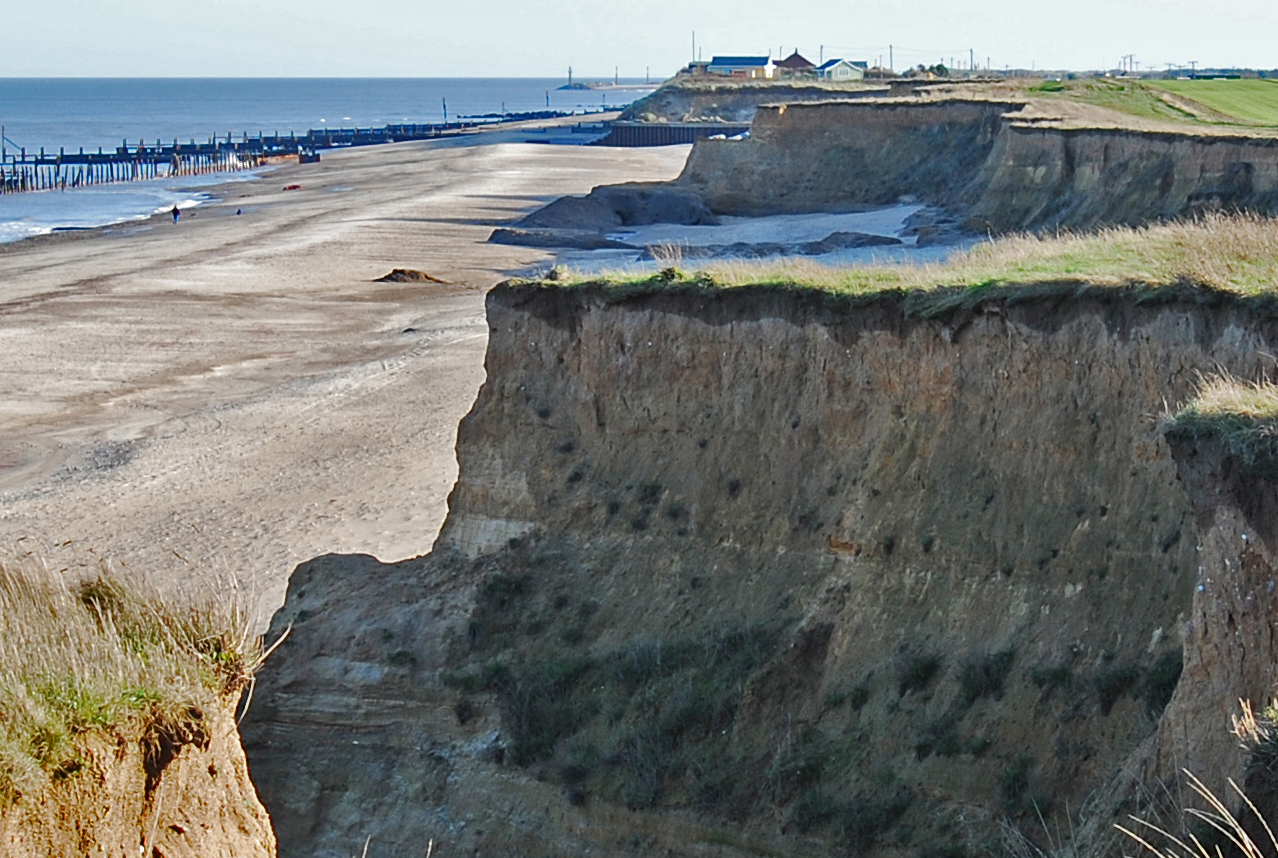
Coasts and estuaries geohazards
Providing independent and expert geoscientific tools and advice to assess different adaptation options to coastal flooding and erosion.