Geochemical predictive mapping in western Kenya
To mark World Soil Day, Olivier Humphrey highlights the soil-related activities of the BGS Inorganic Geochemistry Facility and its partners in western Kenya.
05/12/2021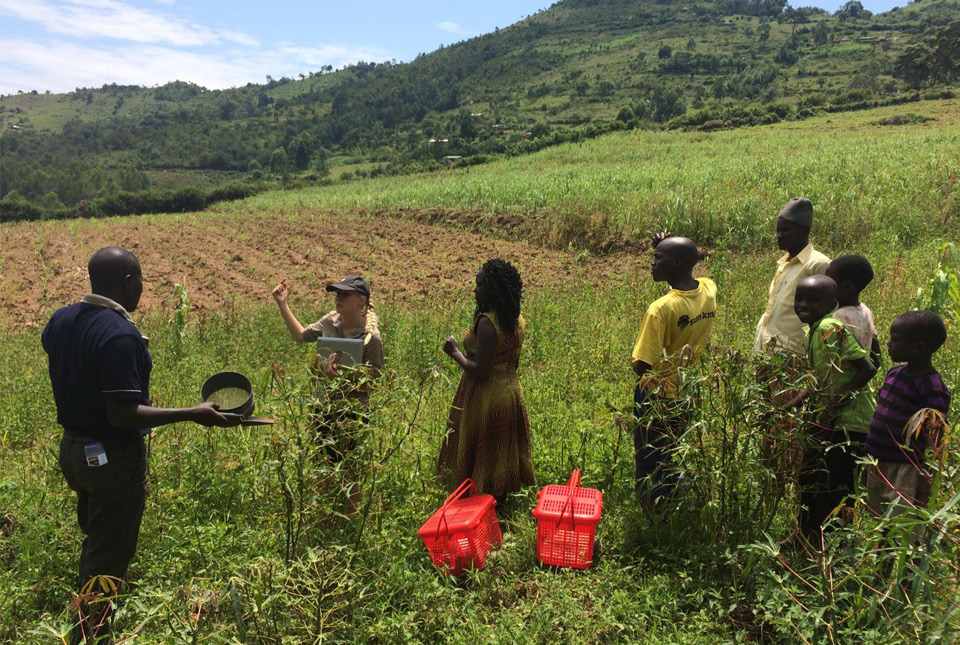

This BGS ArcGIS web application was created to develop a predictive soil geochemistry map of western Kenya. The interactive app provides baseline geochemistry data to the agri-community using BGS’s measured data combined with machine learning.
The original data, relating to land use, crops grown, drinking water source/usage and any local health problems, was generated from field collections between 2016 and 2019 during the BGS ODA-I programme, as part of a geochemistry and health project to investigate the spatial incidences of diseases within the Rift Valley (e.g. oesophageal cancer; micronutrient deficiencies). You can read more about the project and our time in western Kenya in our previous blogs on geochemistry and health in the Kenyan Rift Valley and inorganic geochemistry in Kenya.
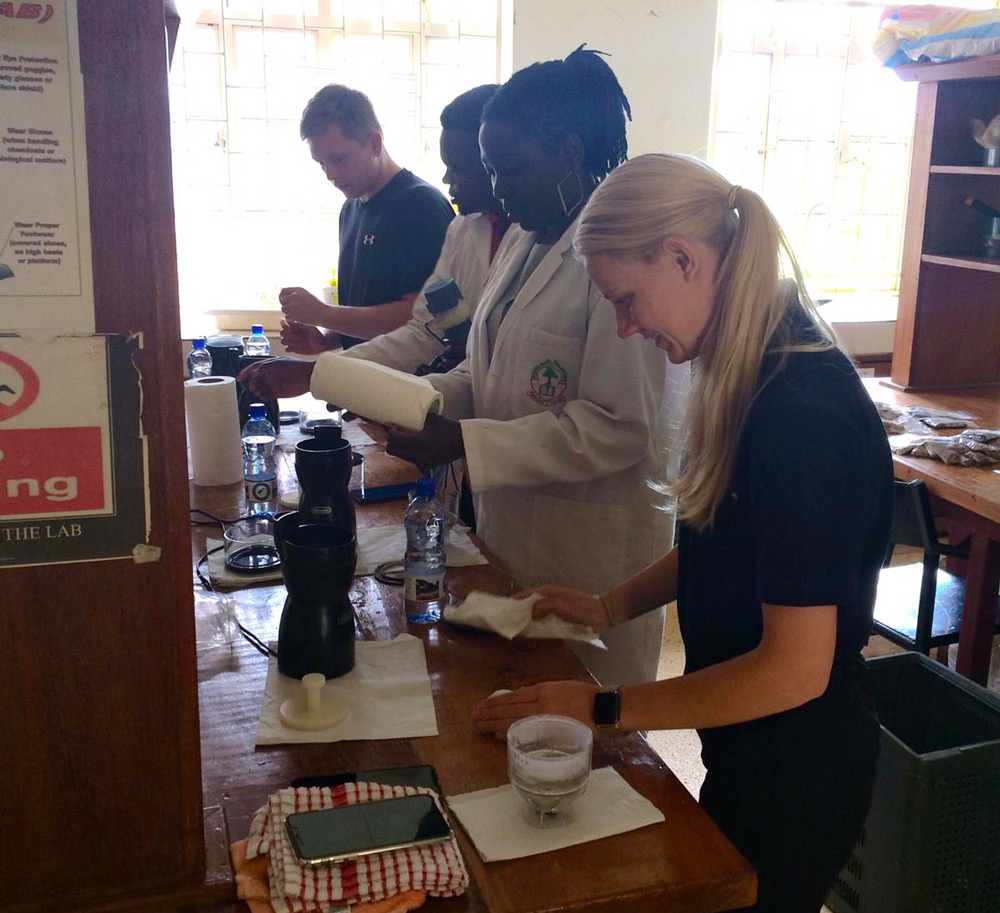
Processing samples at the University of Eldoret laboratories. BGS © UKRI.
On completing our fieldwork trips, we brought the collected samples back to the BGS headquarters at Keyworth, Nottingham, and analysed them at the Inorganic Geochemistry Laboratories. We created a dataset that compiled soil prediction maps for 56 chemical elements (mg/kg), pH and organic matter content (per cent) using machine learning (Random Forest) analysis. The predictive maps, displayed as raster files with a spatial resolution of 500 m, were based on the 452 soil samples collected from discrete sampling locations across western Kenya and relevant environmental covariate data, such as elevation and rainfall.
Once all of the predictive layers were created, they were entered into an ArcGIS web app, accessible ‘free’ online via a PC or mobile device. Stakeholders in Kenya from the academic and outreach sectors were consulted during development and tested the web tool, making useful suggestions for refinements to better communicate both the tool and the data itself directly to farmers. Future developments will enable us to continue to add more data and expand the area, subject to funding.
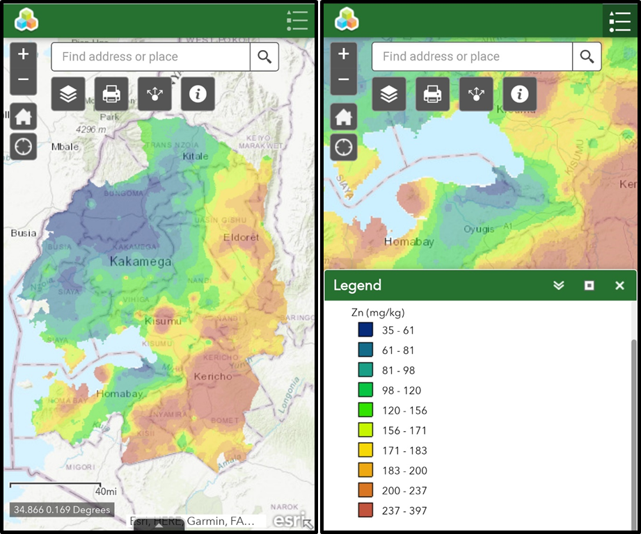
ArcGIS web app showing total zinc concentration (mg/kg) in soil. BGS © UKRI.
The ArcGIS map will have other research uses for BGS grant-funded projects, in particular a Royal Society International Collaboration grant to study dynamics for land-to-lake transfers within the Winam Gulf catchment of Lake Victoria resulting from soil degradation. This tool can also provide valuable information to agricultural extension services regarding areas where fertility may be at greater risk due to soil degradation and contribute to source apportionment models for transfers into the lake basin.
The publication of our web tool will enable BGS to seek wider stakeholder input to the tool to stimulate new developments, ideally with new funding. For example, combining this data with health incidence statistics could provide investigation assistance regarding the spatial influence of geochemistry on health conditions (e.g. oesophageal cancer and micronutrient deficiency) and exposure to geogenic potentially harmful metals with chronic health implications.
Acknowledgements
This research was supported by the BGS-NERC grant NE/R000069/1 ‘Geoscience for sustainable futures’ and BGS/Centre for Environmental Geochemistry programmes for financial support. It was delivered via the BGS Eastern Africa Official Development Assistance (ODA) Research Platform and the activities were coordinated by Michael Watts (BGS), Odipo Osano (University of Eldoret) and Diana Menya (Moi University).
We would like to thank the many people who assisted in the collection of samples, including the public health officers from each county administrative area and, in particular, the field and laboratory staff from the University of Eldoret (UoE), Moi University (Moi U) and BGS.
University of Eldoret
David Samoie, Doreen Meso, Charles Owano, Melvine Anyango and Job Isaboke.
Moi University
Esilaba Anabwani and Amimo Anabwani.
Queen’s University Belfast
Daniel Middleton.
BGS
Andrew Marriott, Amanda Gardner, Elliott Hamilton, Nicholas Porter and Sophia Dowell.
About the author
Dr Olivier Humphrey
Environmental chemist
Relative topics
Latest blogs

Building Europe’s geological future
20/07/2026
BGS scientists are contributing to a continent-wide initiative that is strengthening collaboration across borders to tackle shared subsurface challenges and unlock new opportunities.

Collecting beach pebbles: fun hobby but is it legal?
14/07/2026
The UK coastline will be inundated with keen holidaymakers this summer, many of whom will take a memento of their trip home in the shape of a pebble or two — but is it legal?

Strengthening capacity through partnership: a critical minerals perspective
28/04/2026
BGS has been working in partnership with the Geological Survey Department of Zambia (GSD) to build national capacity, improve data accessibility and support long-term, sustainable development.

PhD adventures in Copenhagen, Denmark: revealing past recovery processes of tropical forest systems through ancient environmental DNA
12/03/2026
PhD student Chris Bengt visited the University of Copenhagen to carry out very delicate extraction of aeDNA from lake-sediment cores, in the hopes of unlocking the secrets of past volcanic eruptions.

MARC Conference 2025: highlighting the importance of conferences to PhD students
16/02/2026
BGS and University of Nottingham PhD student Paulina Baranowska shares her experience presenting her research on nuclear forensics at her first international conference.

Hole-y c*@p! How bat excrement is sculpting Borneo’s hidden caves
23/12/2025
BGS researchers have delved into Borneo’s underworld to learn more about how guano deposited by bats and cave-dwelling birds is shaping the subsurface.

How the geology on our doorstep can help inform offshore infrastructure design
19/11/2025
BGS is part of a new collaboration using onshore field work to contextualise offshore data and update baseline geological models which can inform the sustainable use of marine resources.

Fieldwork on Volcán de Fuego
13/10/2025
Understanding how one of the world’s most active volcanoes builds up material, and how they collapse to feed hot flows
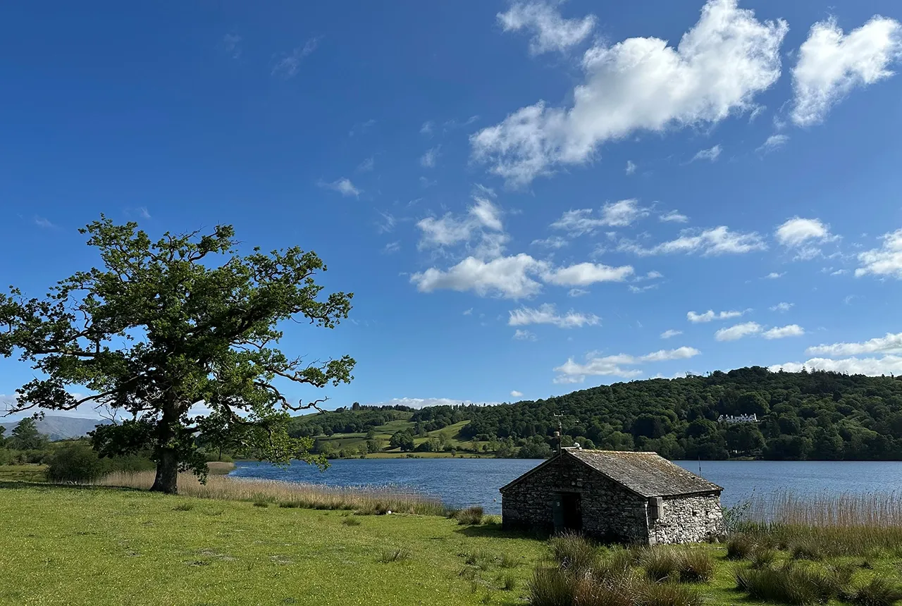
Esthwaite Water: applying novel approaches to understand lake-water nutrient pollution
19/09/2025
Andi Smith (BGS) and Savannah Worne (Loughborough University) embarked on fieldwork in the Lake District, applying a novel stable isotope method for tracing phosphorus sources.

Opening up the geosciences: making work experience more accessible
19/09/2025
BGS has been working with partners to make the geosciences more accessible to young people, including those from under-represented backgrounds.
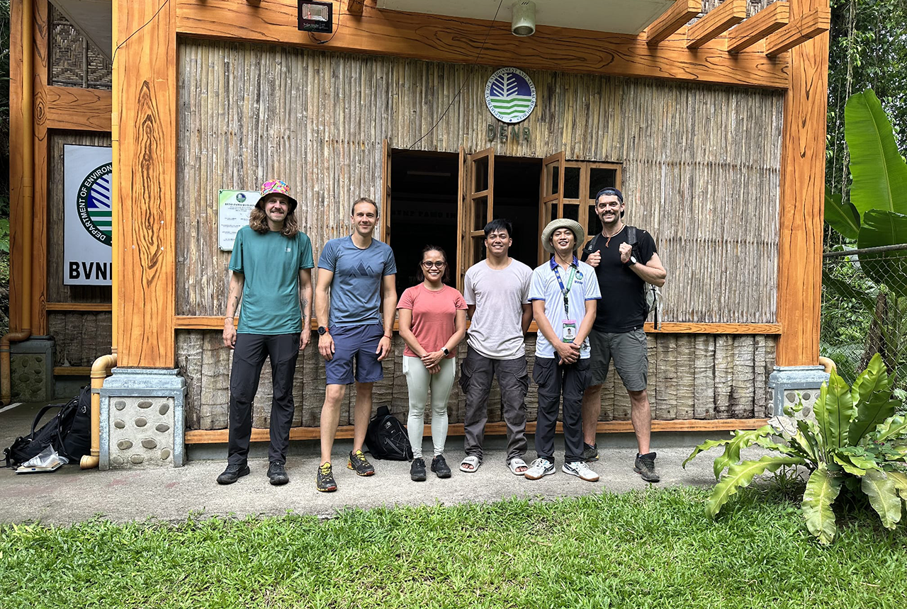
PhD adventures in the Philippines: coring around Lake Bulusan
05/09/2025
Chris Bengt recounts his two-week field trip to Bulusan Volcano Natural Park in the Philippines to collect lake sediment cores, fresh soil and water samples.
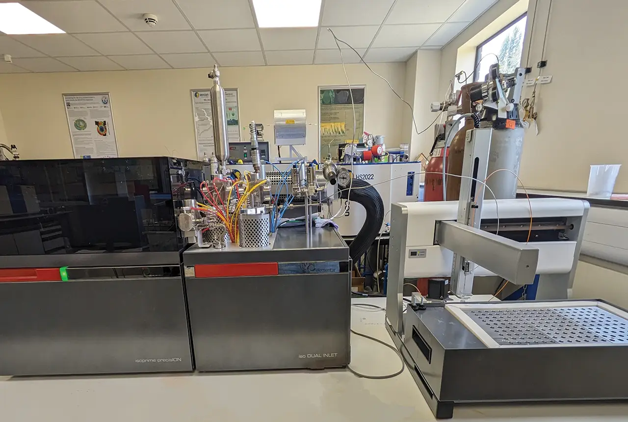
Gemini: a new stable isotope tool
21/08/2025
BGS’s Stable Isotope Facility has new mass spectrometer equipment for analysing carbon and oxygen isotopes from carbonates and water.