Deep drilling in Europe’s oldest and most species-rich lake provides new insights into evolution
The older and more stable an ecosystem is, the longer lived its species and the more stable the species communities are.
02/10/2020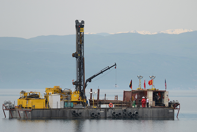

An international research team led by the Justus Liebig University Giessen and the University of Cologne, in collaboration with BGS, gained these new insights into evolution by drilling deep into the sediments of Lake Ohrid.
The 1.4-million-year-old lake on the border between Albania and North Macedonia is not only the oldest lake in Europe, but with more than 300 endemic species, i.e. species that only occur there, it is also the most species rich.
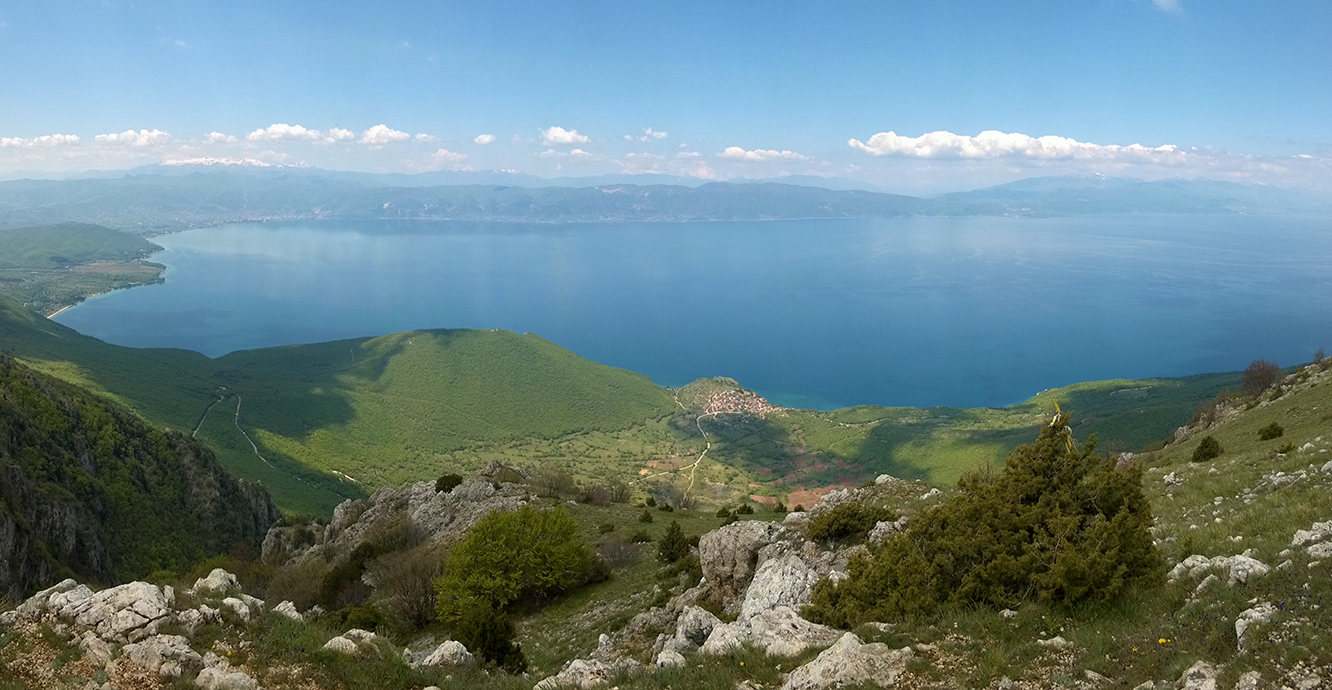
The 1.4 million year old Lake Ohrid on the border between Albania and Northern Macedonia (Photo credit: Thomas Wilke).
To study the evolutionary dynamics of Lake Ohrid since its formation, the scientists combined the environmental and climate data of a 568-meter-long sediment core with the fossil records of over 150 endemic diatom species.
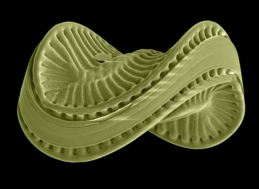
Colorized scanning electron microscope image of the endemic diatom species Scoliodiscus glaber from Lake Ohrid. Size of the silica shell 0.1 mm (Photo credit: Z. Levkov).
Dr Jack Lacey, a geochemist from BGS, used chemical data from the mud to understand past changes in the hydroclimate of Lake Ohrid.

The combination of our data and the fossil diatom record of Lake Ohrid provide us with a link between geological processes, environmental change, and the biological evolution of endemic species within the lake.
Using geochemical data from the layers of mud that built up over time at the bottom of Lake Ohrid, we have unravelled a 1.4-million-year history of lake development and climate change, that are interwoven and captured in the sediment record.
Dr Jack Lacey, BGS Geochemist.
The data show that shortly after the formation of the lake, new species emerged within a few thousand years. Many of them died out again very quickly in the relatively small and shallow lake.
The research team explains this by the fact that young lakes of small size offer many new ecological opportunities, but are also particularly sensitive to environmental changes such as fluctuations in temperature, lake level, and nutrient availability.
The geochemistry of lake muds is a recorder of past changes in rainfall and major shifts in the water level of Lake Ohrid.
After the lake became deeper and larger, as indicated by shifts in the geochemistry, the speciation and extinction processes slowed down dramatically.
The scientists attribute this to fewer new habitats emerging, the species richness approaching an ecological carrying capacity, and an increasing environmental and climate buffering of the lake.
The finding that, in the history of Lake Ohrid, a volatile assemblage of evolutionarily short-lived species developed into a stable community of long-lived species provides a new understanding of the evolutionary dynamics in ecosystems.
The study, which has now been published in the journal Science Advances, has importance for future biodiversity research.
Citation
Wilke, T, et al. 2020. Deep drilling reveals massive shifts in evolutionary dynamics after formation of ancient ecosystem. Science Advances, Vol. 6(40), eabb2943. DOI: https://doi.org/10.1126/sciadv.abb2943
About the author
Relative topics
Related news

New NERC-funded project empowers young people to engage with environmental science
23/07/2026
BGS is part of a new, collaborative project, funded through NERC’s ‘Opening up the environment’ programme, helping the environmental research community become more accessible.

Delving deep into mountains for future water security
16/07/2026
A BGS-led project is using new water-tracing investigation methods, geophysics and modelling to understand how water moves from mountains to the lowlands, helping to improve water security for billions of people.

Updated national 3D model will determine the depth to the solid bedrock beneath our feet
13/07/2026
The BGS Superficial Deposit Thickness Model now includes an elevation model of geological rockhead for the first time, providing important data for civil engineers, geoscientists and environmental scientists.

UK’s world-class research organisations launch new collective
10/07/2026
The launch of the National Research Organisations Group brings together more than 100 science leaders to provide an authorativive voice on science, research policy and long-term investment.

Cheshire Geoenergy Observatory releases key geological datasets for UK thermal energy storage scheme design
09/07/2026
A new report and data packs from BGS will provide a unique resource for scientists working on the geology and hydrogeology of the Sherwood Sandstone Formation, an important aquifer and reservoir rock.

New geological mapping underway to help manage flooding along the River Tweed
08/07/2026
Scientists are surveying the Tweed catchment for the first time in over 100 years to enhance understanding of localised groundwater and improve flood forecasting.

Geological research in North Sea helping to safeguard subsea cables
06/07/2026
Subsea power and telecommunications cables are critical to the UK’s energy infrastructure and global connectivity, yet they remain vulnerable to damage from ship anchors, fishing activity and natural hazards.

UK Critical Minerals Intelligence Centre makes recommendations for the next UK criticality assessment
01/07/2026
CMIC has outlined the enhancements made to the next assessment update to ensure it is better tailored to the structure of the UK economy.

From archive to discovery: historical mineral reports support gold exploration in Scotland
25/06/2026
Digitised geological records show potential to unlock untapped mineral resources in Ardlochan, Argyllshire.

UK and Philippines scientists investigate natural hydrogen generation processes at atomic scale
22/06/2026
BGS researchers were granted access to use the Diamond Light Source facility in order to study hydrogen in light brighter than the sun.

Shortage of end-of-life materials presents challenge to UK critical minerals security
17/06/2026
A new report by the UK Critical Minerals Intelligence Centre reveals insufficient end-of-life material stocks present a supply risk over the coming decade, but offer significant long-term potential to meet critical mineral demand through recycling.

UK geothermal catalogue receives update
16/06/2026
BGS releases the second digital version of the UK geothermal catalogue of subsurface temperature and rock thermal conductivity measurements and heat flow calculations.