Citizen science: become part of a real-time Global Landslide Detector
BGS and partners are trialling a new social media tool that detects worldwide landslides in real time.
29/08/2022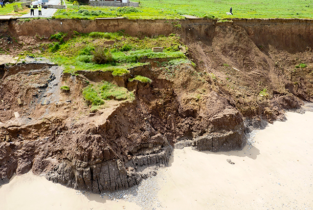

Social media is a valuable tool. Society is now sharing a constant stream of real-time information across a wide variety of digital platforms. Alongside all the pictures of pets, family members and delicious dinners, social media channels are also used when disaster strikes. In this respect, social media has the power to harness important data that can have a huge impact for the global good. Take, for instance, the ability to learn about natural disasters across the world, as they unfold in real time.
BGS has been working with earthquake and social media specialists at the European-Mediterranean Seismological Centre and computer scientists at the Qatar Computing Research Institute to build the Global Landslide Detector, a tool that uses machine learning to recognise landslides in photographs shared on social media.
When a landslide happens, the damage caused is usually unknown beyond the locality until news reporters can attend the scene or once satellites have been able to collect images, and their responding communities have processed the data. This is called ‘data latency’ and can take some time – at best a few hours; at worst, several days.
We realised we could help improve this situation by speeding up the timescale in which landslide data becomes available on a global scale.
Why is social media useful for landslides research?
Social media information is imperfect; there is an awful lot of content being produced very quickly and it is constantly being added to. While this can seem a little overwhelming, if you have a way of untangling valuable updates from the social noise, what you will end up with is data in large quantities, in real time, covering geographical areas much larger than any conventional ground sensors can detect. These ‘social sensors’ allow access to a rich source of human information such as text, videos, photographs, timestamps and locations. This can provide us with disaster information very quickly.
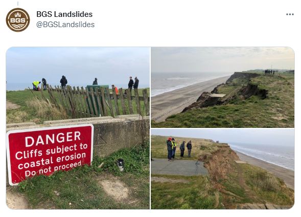
A typical tweet from the @BGSLandslides team. BGS © UKRI.
The Global Landslide Detector is a publicly available web service that extracts, in real time, photographs of landslides published on social media. This is something we hope will be welcomed by various sectors, including disaster risk reduction managers, first responders and landslide database researchers.
The detector currently monitors Twitter only, although there is scope for expansion in the future. It extracts tweets that contain a photograph in association with particular keywords. The keywords we’ve inputted are currently available in 31 different languages, which means that translation shouldn’t be a barrier to using the tool. Using machine learning, the tool then analyses the photographs automatically, to decide whether they contain a landslide or not. The data from this process is then organised by location and markers are placed on a map.
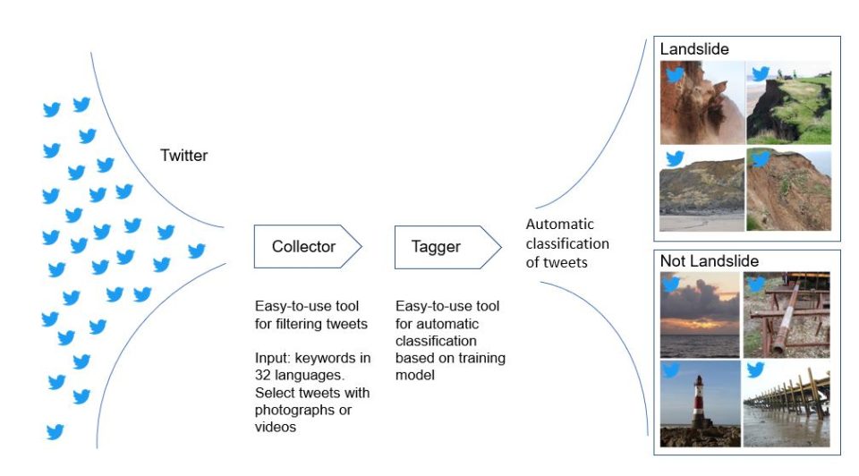
Diagram showing how the Global Landslide Detector extracts relevant information from Twitter and sorts photographs into landslides and not landslides. BGS © UKRI.
How you can help
Currently we are trialling the first version of the tool on the website. We are asking for feedback on several elements from the scientific landslide community, as well as anyone else with an active interest, including:
- refining the landslide keywords used to extract tweets
- expanding and updating keywords in other languages
- general layout
You can find an initial feedback form on the website, which may lead to further discussion, if needed.
Limitations
Before using the tool, it is important to understand some of its limitations.
- The Global Landslides Detector does not replace expert survey; data can come from any social media user
- Each photograph is analysed in isolation
- The tool does not discriminate between landslide ‘types’ but aims to recognise zones of depletion (where the material has come from) and accretion (where it has been deposited); this excludes scenarios where the landslide debris has been removed by coastal or fluvial erosion, or where a landslide has been remediated
- The tool aims to show contemporary, rather than historic, landslides
- There must be a clear representation of a landslide as the major focus of the image
- Where representation is borderline, consideration is given to whether the end user would be concerned by the image being labelled as a landslide, e.g. in a situation where another geomorphological feature such as a retaining wall or a sinkhole might be marked as a landslide
- The methodology is aimed to identify landslide features, but the task is not to discriminate scale, meaning that images labelled as landslides may be very small (less than 1 m and not strictly a landslide)
- Aerial photographs including multiple landslide events are not captured by the tool
- The tool is not intended to be used in isolation during a disaster scenario but could complement existing workflows and provide new data, taking into consideration the limitations described and data biases (e.g. mobile coverage; widespread use of social media; population density)
The Global Landslide Detector website is not under the control of BGS and BGS is not responsible for the website, policies or practices.
Further reading
Pennington, C V L, Bossu, R, Ofli, F, Imran, M, Qazi, U W, Roch, J, and Banks, V. 2022. A near-real-time global landslide incident reporting tool demonstrator using social media and artificial intelligence. International Journal of Disaster Risk Reduction, Vol. 77, 103089. DOI: https://doi.org/10.1016/j.ijdrr.2022.103089
Ofli, F, Imran, M, Qazi, U, Roch, J, Pennington, C V L, Banks, V, and Bossu, R. 2022. Landslide detection in real-time social media image streams. The Thirty-Fourth Annual Conference on Innovative Applications of Artificial Intelligence (IAAI-22), February 24-26, 2022, Vancouver, BC, Canada. Available at: https://arxiv.org/pdf/2110.04080.pdf

Catherine Pennington
Engineering geologist, landslide specialist
Latest blogs

Collecting beach pebbles: fun hobby but is it legal?
14/07/2026
The UK coastline will be inundated with keen holidaymakers this summer, many of whom will take a memento of their trip home in the shape of a pebble or two — but is it legal?

Strengthening capacity through partnership: a critical minerals perspective
28/04/2026
BGS has been working in partnership with the Geological Survey Department of Zambia (GSD) to build national capacity, improve data accessibility and support long-term, sustainable development.

PhD adventures in Copenhagen, Denmark: revealing past recovery processes of tropical forest systems through ancient environmental DNA
12/03/2026
PhD student Chris Bengt visited the University of Copenhagen to carry out very delicate extraction of aeDNA from lake-sediment cores, in the hopes of unlocking the secrets of past volcanic eruptions.

MARC Conference 2025: highlighting the importance of conferences to PhD students
16/02/2026
BGS and University of Nottingham PhD student Paulina Baranowska shares her experience presenting her research on nuclear forensics at her first international conference.

Hole-y c*@p! How bat excrement is sculpting Borneo’s hidden caves
23/12/2025
BGS researchers have delved into Borneo’s underworld to learn more about how guano deposited by bats and cave-dwelling birds is shaping the subsurface.

How the geology on our doorstep can help inform offshore infrastructure design
19/11/2025
BGS is part of a new collaboration using onshore field work to contextualise offshore data and update baseline geological models which can inform the sustainable use of marine resources.

Fieldwork on Volcán de Fuego
13/10/2025
Understanding how one of the world’s most active volcanoes builds up material, and how they collapse to feed hot flows
Esthwaite Water: applying novel approaches to understand lake-water nutrient pollution
19/09/2025
Andi Smith (BGS) and Savannah Worne (Loughborough University) embarked on fieldwork in the Lake District, applying a novel stable isotope method for tracing phosphorus sources.

Opening up the geosciences: making work experience more accessible
19/09/2025
BGS has been working with partners to make the geosciences more accessible to young people, including those from under-represented backgrounds.
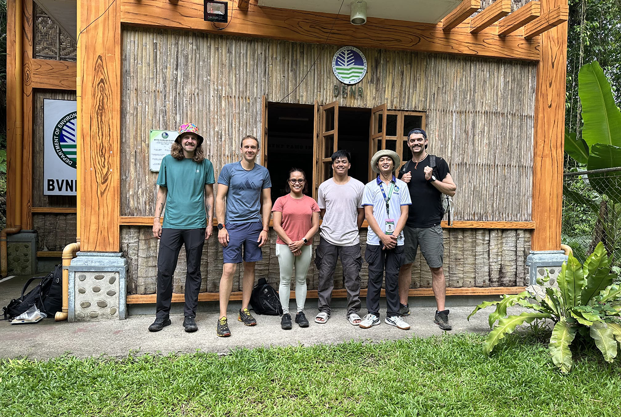
PhD adventures in the Philippines: coring around Lake Bulusan
05/09/2025
Chris Bengt recounts his two-week field trip to Bulusan Volcano Natural Park in the Philippines to collect lake sediment cores, fresh soil and water samples.
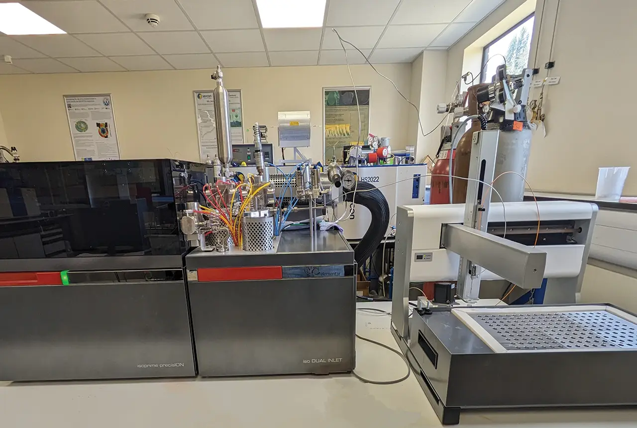
Gemini: a new stable isotope tool
21/08/2025
BGS’s Stable Isotope Facility has new mass spectrometer equipment for analysing carbon and oxygen isotopes from carbonates and water.
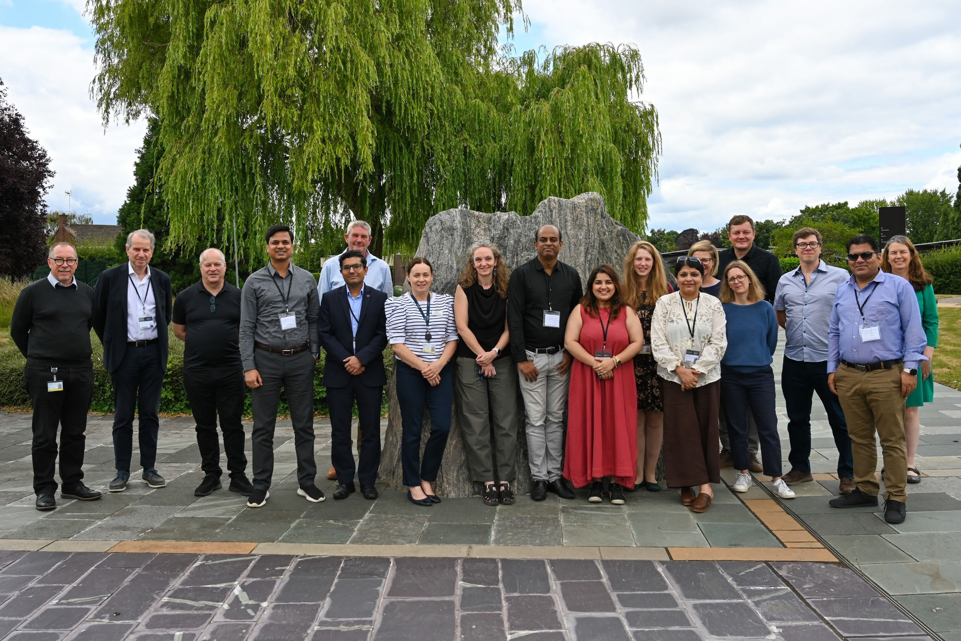
BGS hosts India for ‘deep dive’ on carbon capture and storage
30/07/2025
Some of India’s top scientists visited BGS to explore the UK’s carbon dioxide storage research potential.