BGS releases 10K maps through updated maps portal
BGS releases an updated maps portal, which allows users to view all publicly available maps, and includes 10 000 and 1:10 560 scale maps for the first time.
16/05/2023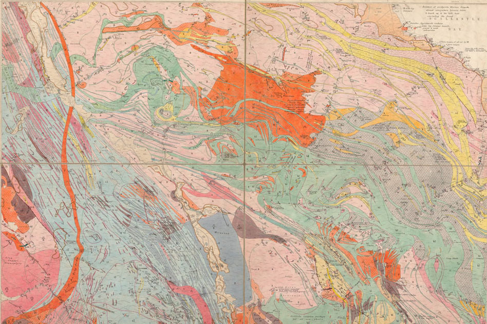

As part of our continuous effort to provide more open access to our data, BGS has launched the updated BGS Maps Portal. The renewed portal provides access to over 45 000 BGS maps and sections with the following themes:
- geological
- geophysical
- geochemical
- hydrogeological
The large-scale 10 000 and 1:10 560 BGS onshore geological maps collection is included in this portal for public viewing for the first time, along with the key 1:50 000 and 1:63 360 maps of England, Wales and Scotland.
Map portal features
The new portal will allow users to view all publicly available, maps held by BGS, with quick-view thumbnail browsing and an increased number of scanned images. Users can view the collections for free; those wishing to purchase their own copy of a map can buy high-resolution PDFs through the BGS shop.
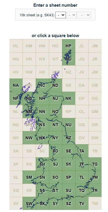
Image of National grid graphical interface on portal BGS © UKRI
A small number of maps do not have scans; for completeness, we have provided the full catalogue with all the maps’ details, omitting image links where scans do not exist.
We hope that, by providing this enhanced service, the maps portal will better meet our users’ diverse needs. However, it is important to note that users should visit BGS’s digital dataset BGS Geology, the GeoReports service or the onshore GeoIndex to access the latest digital vector mapping. The digital vector data in these services can differ significantly from the mostly historical maps presented in the maps portal so the most up-to-date vector data should be consulted for more professional user needs.
History of geological mapping at BGS
Since BGS’s inception in 1835, our maps have evolved in differing iterations of scale. Initially surveyed and produced at the 1:63 360 (one inch to one mile) scale, the decision was made in the 1850s to carry out geological surveys at the 1:10 560 scale (six inches to one mile). This standard large-scale map scale for recording field-survey information and producing maps continued for much of BGS’s existence and was based primarily on the Ordnance Survey County Sheet lines.
County series sheet 19, solid, 1:63 360, 1873. BGS © UKRI
The next major change came in the 1940s, when these ‘County Series’ maps began to be replaced by National Grid sheet line maps. Finally, in the late 1970s, the metric 1:10 000 scale was introduced and became the standard large-scale format for field mapping. A small number of remote areas were mapped and provided at the 1:25 000 scale.
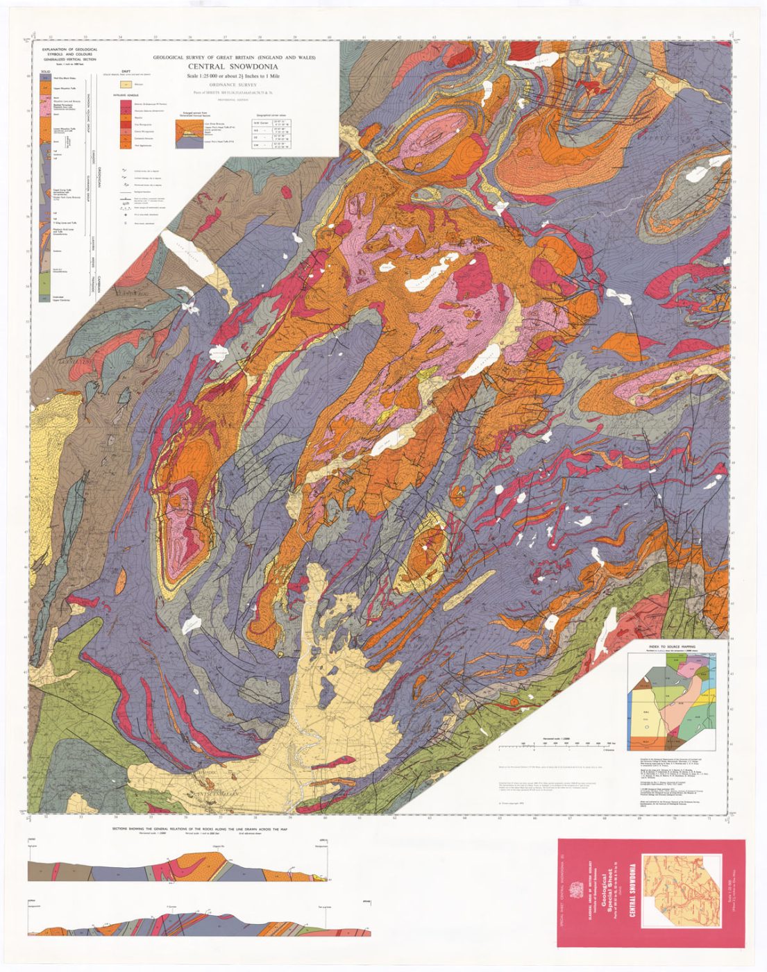
Central Snowdonia sheet 11, solid, 1:25 000, 1972. BGS © UKRI
The new 2023 to 2028 BGS Strategy ‘Understanding our Earth’ includes a renewed focus on national mapping, an aim which is supported by the renewal of the BGS Maps Portal.

One of the key science priorities identified in the new BGS Strategy focuses on the provision of geological maps and models and, in particular, ensuring that information about the underlying geology of our country is accessible. The new enhancements to the BGS Maps Portal, particularly the addition of the large-scale 1:10 000 maps and improved search features, very much align with this aim and are a significant step forward in maximising the value of our spatial data.
Dr David Schofield, BGS Director of National and International Geoscience.
Relative topics
Latest news

Delving deep into mountains for future water security
16/07/2026
A BGS-led project is using new water-tracing investigation methods, geophysics and modelling to understand how water moves from mountains to the lowlands, helping to improve water security for billions of people.

Updated national 3D model will determine the depth to the solid bedrock beneath our feet
13/07/2026
The BGS Superficial Deposit Thickness Model now includes an elevation model of geological rockhead for the first time, providing important data for civil engineers, geoscientists and environmental scientists.

UK’s world-class research organisations launch new collective
10/07/2026
The launch of the National Research Organisations Group brings together more than 100 science leaders to provide an authorativive voice on science, research policy and long-term investment.

Cheshire Geoenergy Observatory releases key geological datasets for UK thermal energy storage scheme design
09/07/2026
A new report and data packs from BGS will provide a unique resource for scientists working on the geology and hydrogeology of the Sherwood Sandstone Formation, an important aquifer and reservoir rock.

New geological mapping underway to help manage flooding along the River Tweed
08/07/2026
Scientists are surveying the Tweed catchment for the first time in over 100 years to enhance understanding of localised groundwater and improve flood forecasting.

Geological research in North Sea helping to safeguard subsea cables
06/07/2026
Subsea power and telecommunications cables are critical to the UK’s energy infrastructure and global connectivity, yet they remain vulnerable to damage from ship anchors, fishing activity and natural hazards.

UK Critical Minerals Intelligence Centre makes recommendations for the next UK criticality assessment
01/07/2026
CMIC has outlined the enhancements made to the next assessment update to ensure it is better tailored to the structure of the UK economy.

From archive to discovery: historical mineral reports support gold exploration in Scotland
25/06/2026
Digitised geological records show potential to unlock untapped mineral resources in Ardlochan, Argyllshire.

UK and Philippines scientists investigate natural hydrogen generation processes at atomic scale
22/06/2026
BGS researchers were granted access to use the Diamond Light Source facility in order to study hydrogen in light brighter than the sun.

Shortage of end-of-life materials presents challenge to UK critical minerals security
17/06/2026
A new report by the UK Critical Minerals Intelligence Centre reveals insufficient end-of-life material stocks present a supply risk over the coming decade, but offer significant long-term potential to meet critical mineral demand through recycling.

UK geothermal catalogue receives update
16/06/2026
BGS releases the second digital version of the UK geothermal catalogue of subsurface temperature and rock thermal conductivity measurements and heat flow calculations.

Scientists make new discovery in the history of the Giant’s Causeway
15/06/2026
New research is changing our scientific understanding of the formation of one of the UK’s most iconic landmarks and has revealed that Northern Ireland’s volcanic past occurred over a much shorter period than previously thought.