This landslide complex lies to the east of Charmouth in Dorset and parts of this site are sometimes also known as Fairy Dell and Cain’s Folly. The landslide is well known as one of England’s largest and most active landslide complexes, alongside the Black Ven landslide immediately to the west of it, and is a National Trust coastal site. It is BGS National Landslide Database ID 840/1.
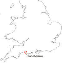

Stonebarrow Hill, Dorset location map. BGS © UKRI.
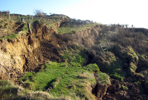
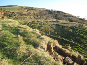
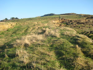
The cliffs are very high at the centre of the complex (140 m). A major landslide event occurred in 1942, a further movement in 1968 and, more recently, a significant re-activation consisting largely of mudslides took place in December 2000. This resulted in closure of the coast path along the main backscarp. Movement continues at this site.
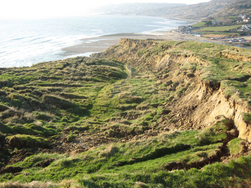
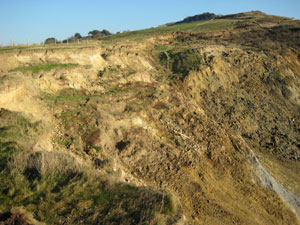
Evans Cliff landslide on the western flank of Stonebarrow Hill. BGS © UKRI.
Geology and landslide trigger
The landslide mechanism is dominated by multiple retrogressive rotational movements and mudflows. As at Black Ven, these act in the upper part of the slope (Gault Formation overlain by Upper Greensand Formation) with the mudslides draping over the ‘middle’ bench (Dyrham Formation) and the lowermost, unslipped sea-cliff bench of Lias Group (Belemnite Marl and Black Ven Marl members) mudstones and onto the beach. The upper part of the slope is formed in the Upper Greensand and Gault Formations overlying the Dyrham Formation.
The Stonebarrow Hill complex has been described in the literature (Brunsden and Jones, 1976; Lee and Clark, 2002).
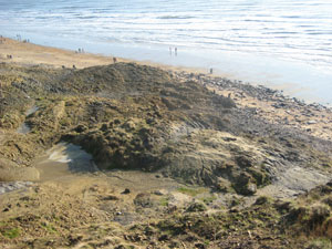
The main part of the landsliding at Stonebarrow Hill is occurring in the upper and middle sections of cliff. Major re-activation of this part of the landslide took place on 28 December 2000, during which large slumps generated mudflows and debris flows that cascaded over the lower cliff and deposited onto the beach. The remains of these were still visible after two years, but had almost completely disappeared by 2003. The landslide was caused by unusually high rainfall from mid-August to late December 2000, during which time 700 mm of rain fell at the Pinhay weather station near Lyme Regis.
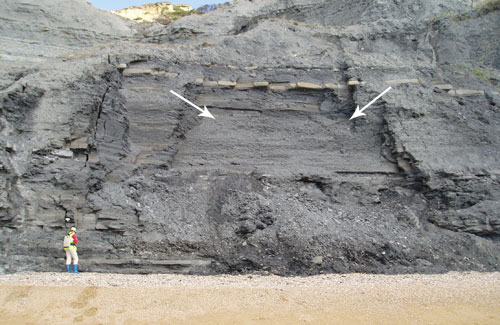
Falls from beneath a thin limestone bed in the lower cliff of the Black Ven Marl Formation. BGS © UKRI.
Survey
As part of a cliff monitoring programme at BGS, data was collected from the cliffs at Stonebarrow. The principal method of survey is long-range terrestrial laser scanning (terrestrial LiDAR).
Gallery from 2008
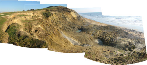
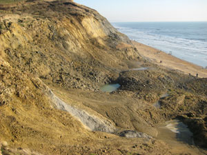
Panorama of landslide looking eastwards. 2008. BGS © UKRI.
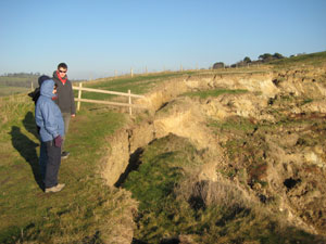
Backscarp. 2008. BGS © UKRI.
Stonebarrow Hill. BGS © UKRI.
BGS © UKRI.
BGS © UKRI.
BGS © UKRI.
BGS © UKRI.
BGS © UKRI.
You may also be interested in

Landslide case studies
The landslides team at the BGS has studied numerous landslides. This work informs our geological maps, memoirs and sheet explanations and provides data for our National Landslide Database, which underpins much of our research.

Understanding landslides
What is a landslide? Why do landslides happen? How to classify a landslide. Landslides in the UK and around the world.

How to classify a landslide
Landslides are classified by their type of movement. The four main types of movement are falls, topples, slides and flows.

Landslides in the UK and around the world
Landslides in the UK, around the world and under the sea.