A new open dataset to benefit onshore geoscience research
Data from deep onshore hydrocarbon wells is being released on an open access basis to help meet the UK’s net zero targets.
15/06/2023
The North Sea Transition Authority (NSTA) has authorised the release of all the well data for onshore hydrocarbon boreholes held by BGS in the National Geoscience Data Centre (NGDC). Unlike borehole data from the North Sea, which has been available free of charge for some time, the data relating to these onshore boreholes was previously only available via data release agents. It is now available free of charge to industry, academics and the public via the BGS Geoindex, providing a new, free resource that will add to the knowledge necessary to meet net zero objectives.
Why is the data significant?
Few boreholes have been drilled to these depths (over 1 km) onshore in the UK and are almost exclusively a consequence of oil, gas or coal exploration. The oil and gas wells deeply penetrate the crust under the UK mainland and are geographically widespread across the UK.
Unlike coal wells, the oil and gas drilling data is better structured and better conforms to global standards of deep geological and deep geophysical data collection.
Most of the direct knowledge and samples that BGS has access to about the deep geology of the UK are based upon this data.
Why is the data being released?
Data from these deep hydrocarbon wells forms the best dataset to understand the geology of the deep UK subsurface. Widening access to the dataset could enhance the knowledge needed to meet net zero objectives:
- assessing the suitability of UK rocks for extraction of geothermal heat
- storing surplus energy from renewables and waste materials such as carbon dioxide
- identifying potential new mineral resources.
The data has been provided to BGS under regulation PON 9B, which sets out the records and samples requirements for onshore surveys and wells licensed by the NSTA. The data was previously held for BGS internal science use only, so this release widens the community of scientists who can access this important dataset. It includes the data for all boreholes that have been released (four years post-drilling) and for which BGS holds original geophysical data.

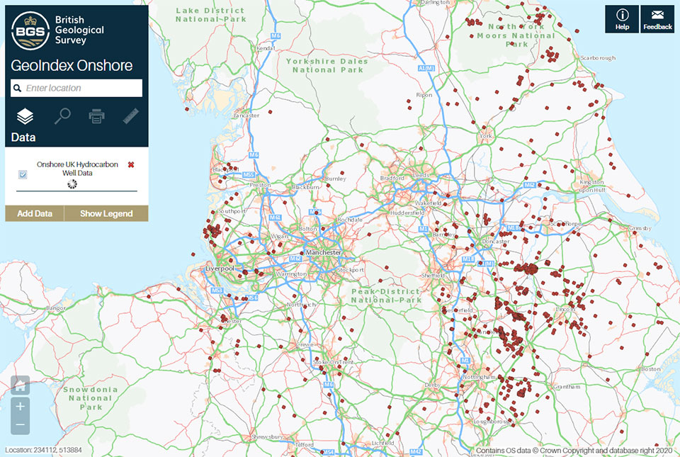
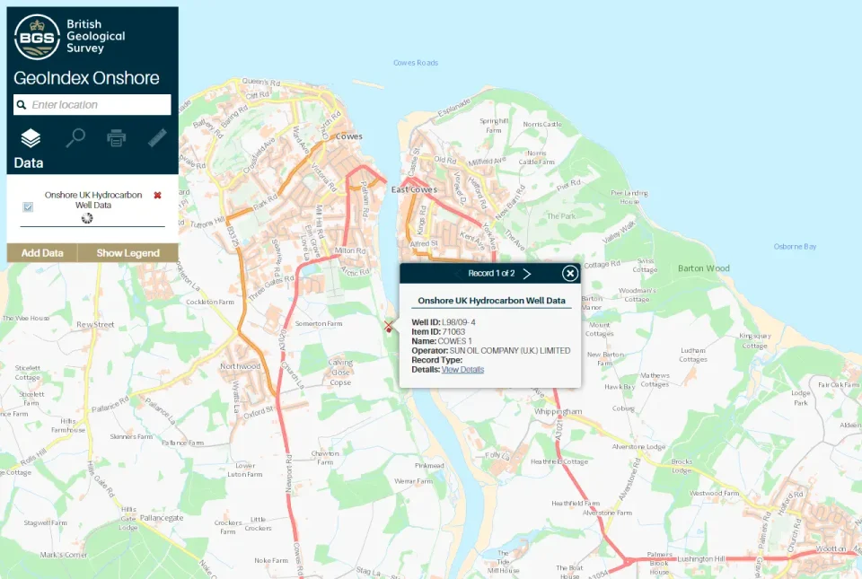
Example of onshore hydrocarbon well data on the BGS GeoIndex. Contains OS data © Crown Copyright and database right 2020
Data is being released using an Open Government Licence, which allows users to copy, publish, distribute and transmit the information, adapt the information and exploit the information commercially and non-commercially, provided that they acknowledge the source of the information.
The NSTA has collected data from more than 2200 onshore wells drilled in the search for oil and gas. Historically, half of that data were released through the British Geological Survey (BGS) with the rest provided by Data Release Agents on behalf of the NSTA. The new arrangement with the BGS means that all onshore hydrocarbon well data will be available from BGS. This free access to the unique onshore data will support the investment and innovation necessary to enable the ongoing energy transition.
Alan Poole, North Sea Transition Authority Geoscientist
BGS GeoIndex
The data is available via the BGS GeoIndex on a layer called ‘Onshore UK hydrocarbon well data’ and currently includes over 60 000 logs from 1200 wells and the number is still increasing. All related records in the BGS Borehole Index (which contains summary borehole metadata) have also been marked as open, releasing over 2000 records that were previously marked as confidential in the index.
About the authors

Andrew Kingdon
Head of BGS Digital Laboratories

Alison Steven
Data accession pipeline manager
Relative topics
Related news

Funding awarded to map the stocks and flows of technology metals in everyday electronic devices
12/02/2026
A new BGS project has been awarded Circular Electricals funding from Material Focus to investigate the use of technology metals in everyday electrical items.

New UK/Chile partnership prioritises sustainable practices around critical raw materials
09/02/2026
BGS and Chile’s Servicio Nacional de Geología y Minería have signed a bilateral scientific partnership to support research into critical raw materials and sustainable practices.

Extensive freshened water confirmed beneath the ocean floor off the coast of New England for the first time
09/02/2026
BGS is part of the international team that has discovered the first detailed evidence of long-suspected, hidden, freshwater aquifers.

Funding secured to help mitigate ground risk in UK construction sector
05/02/2026
The BGS Common Ground project has been awarded new funding to help unlock the value of ground investigation data.

Can sandstones under the North Sea unlock the UK’s carbon storage potential?
02/02/2026
For the UK to reach its ambitious target of storing 170 million tonnes of carbon dioxide per year by 2050, it will need to look beyond the current well-studied geographical areas.

Quaternary UK offshore data digitised for the first time
21/01/2026
The offshore wind industry will be boosted by the digitisation of a dataset showing the Quaternary geology at the seabed and the UK’s shallow subsurface.

Suite of ten new soil reference materials released
02/01/2026
BGS has a longstanding track record of producing high-quality reference materials and has released ten new soil reference materials.

Perth and Kinross tops the UK’s earthquake activity charts for 2025
29/12/2025
Seismologists at BGS have published data on the number of seismic events over the past 12 months with over 300 earthquakes recorded.

BGS awarded funding to support Malaysia’s climate resilience plan
17/12/2025
The project, funded by the Foreign, Commonwealth & Development Office, will focus on minimising economic and social impacts from rainfall-induced landslides.

New geological maps of the Yorkshire Wolds to better inform groundwater management and policy decisions
17/12/2025
The new mapping provides crucial data on localised geological issues that may assist in protecting water supplies.

‘Three norths’ set to leave England and not return for hundreds of years
12/12/2025
The historic alignment of true, magnetic, and grid north is set to leave England, three years after they combined in the country for the first time since records began.

BGS agrees to establish collaboration framework with Ukrainian government
11/12/2025
The partnership will focus on joint research and data exchange opportunities with Ukrainian colleagues.


