Key information
Scale:
1:50 000Coverage:
Great BritainAvailability:
LicensedFormat:
GIS line and polygon data. (ESRI, MapInfo, others available by request.)Price:
BGS Civils bundle (all eight layers) £0.56 per km2
BGS Civils individual layers £0.34 per km2
Subject to number of users, licence fee and data preparation fee.
Uses:
Local-level to Regional-level useGet Data
Free access
Our free data is available under the Open Government Licence. Please acknowledge reproduced BGS materials.
BGS Civils: strength sample dataPaid access
Supporting documents
BGS Civils is a suite of national maps of engineering properties based on geological data and the digital 1:50 000-scale geological map — BGS Geology 50K.
It comprises eight layers:
- bulking volume
- corrosivity (ferrous)
- discontinuities
- engineered fill
- excavatability
- foundation conditions
- strength
- sulfate/sulfide
The primary goal of the product is to provide the key engineering characteristics of the geology of Great Britain to professional users who need simple and rapid access to such information. You might be planning pipeline routes avoiding difficult ground conditions, calculating tender costs for trench excavation or you might need knowledge of ground properties in order to plan your daily activities.
The data is provided as GIS shapefiles that are available to licence individually or as a bundle to meet your own requirements.
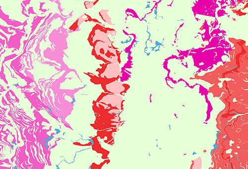

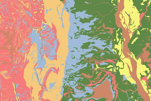
Sulfate/sulfide potential sample. BGS © UKRI.
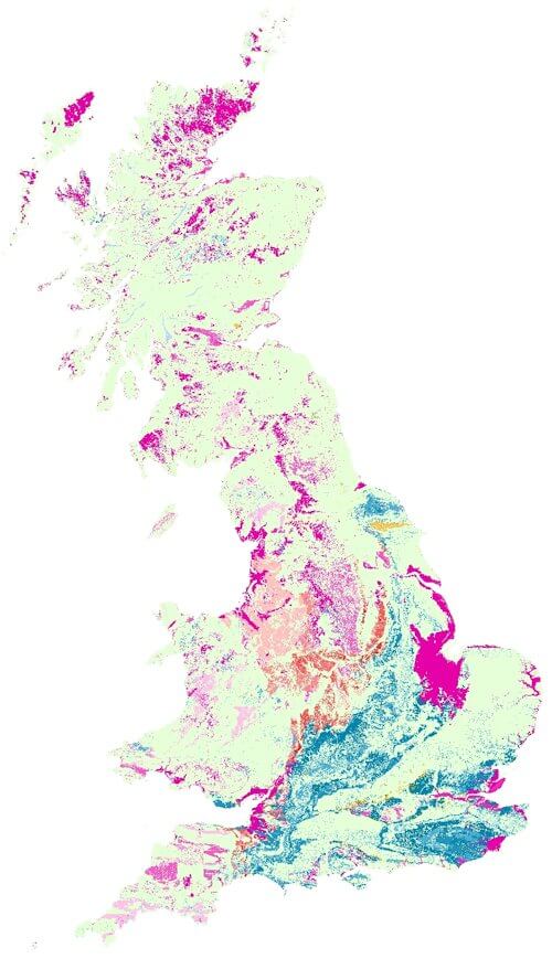
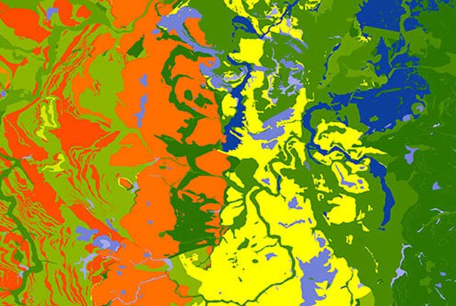
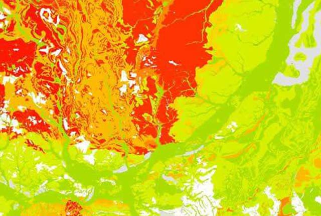
BGS Civils: sulfate/sulfide potential coverage. BGS © UKRI – Contains OS data © Crown copyright 2020.
This dataset
The BGS Civils: sulfates and sulfides dataset is a GIS layer that supports the management of underground assets and has been created in response to the growing awareness of the cost of maintenance of structures such as pipelines and building foundations.
In certain forms and under certain conditions, sulfates and sulfides (or sulphates and sulphides) in rocks and soils are of importance to the engineered environment as they can give rise to aggressive ground conditions. Sulfate ions react with some types of cement and concrete, weakening it (mostly in slightly acid to alkali conditions).
Sources of sulfate ions are primarily from gypsum (calcium sulfate), which is an evaporite deposit found in certain geological units, and from to the oxidation usually of very fine-grained iron sulfide (framboidal iron pyrite, or iron sulfide).
This dataset provides a guide to the potential sulfate/sulfide geohazard for geological units found at surface for Great Britain. It can be used as an indicator of primary sulfate and the potential presence or likely formation of sulfate species due to oxidation. It should be considered as a part of desk study for civil engineering purposes to inform the intrusive ground investigation and construction in the ground.
What is at risk and who might require this dataset?
The properties of earth materials are important in all engineering projects and the classification of the sulfate/sulfide component of a rock formation is important to avoid later weakening of buried concrete infrastructure. This dataset allows for more effective planning and execution of ground investigation work. It is envisaged that the sulfate/sulfide layer will be of interest to a wide range of organisations concerned with development, including:
- developers and engineering consultants
- energy providers
- engineering and industrial insurers, including associations such as the International Association of Engineering Insurers
- local authorities and councils
- petrochemical companies
- regulatory and coordinating bodies
- transport infrastructure providers
- water companies
- water regulators and coordinating organisations
Download BGS Civils sulphate/sulphide sample data
You may also be interested in

BGS Civils: bulking volume
BGS Civils is a suite of national maps of engineering properties based on geological data and the digital 1:50 000 scale geological map – BGS Geology 50k.
BGS Civils: corrosivity ferrous
The BGS corrosivity dataset is a GIS layer supporting the management of underground iron assets that has been created in response to the growing awareness of the cost of maintenance of structures such as pipelines and building foundations.
BGS Civils: discontinuities
This theme provides information on the discontinuities in bedrock and superficial deposits as part of a suite of GIS layers for different engineering parameters.
BGS Civils: engineered fill
This theme provides information on the suitability of a geological material to be used as engineered fill.
BGS Civils: excavatability
This theme provides information on the excavatability of geological deposits at surface.
BGS Civils: foundation conditions
This theme provides information on the suitability of a geological material for foundations as part of a suite of GIS layers for different engineering parameters.
BGS Civils: strength
This theme provides information on zones of rock strength and the local factors controlling it, as part of a suite of GIS layers for different engineering parameters.