What does the next generation of coastal environmental models look like?
A new tool is now available that has been designed to help coastal engineers and practitioners better manage the compound risk of coastal erosion and flooding.
15/04/2025 By BGS Press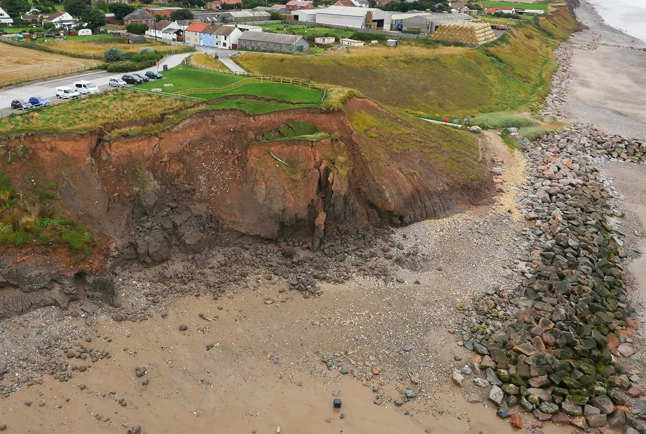

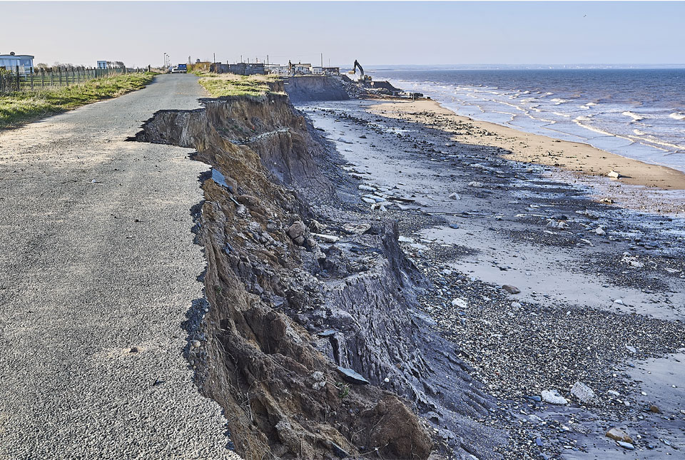
Improving our ability to predict how coastlines will change is an essential part of quantifying risks from coastal erosion and flooding. Coastal Modelling Environment, or CoastalME, is a free tool created by BGS in partnership with the Environmental Change Institute (ECI) at the University of Oxford and the University of Southampton.
CoastalME is being used in the UK and internationally to provide improved predictive capability for coastal adaptation. Modellers can use CoastalME to simulate the interaction of coastal landforms and human interventions for open coast systems. This enables users to model and visualise coastal landscape changes more effectively using commonly available spatial data.
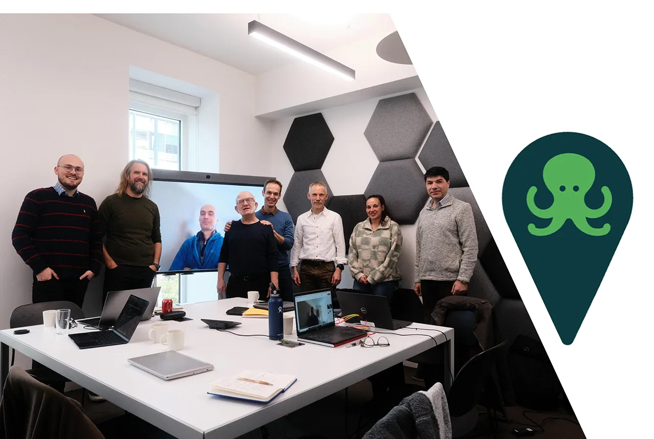
CoastalME developers meeting in London on 18 November 2024 for the pre-OSGeo project launch event, © Andres Payo Garcia 2024; CoastalME logo BGS © UKRI 2025.
The operational tool is being used to inform decision making at regional, international and global levels and was named as a case study as part of the Government’s Flood and Coastal Erosion Risk Management research and development programme. At the regional level, the tool is being used as part of the Resilient Coast (RC) project, funded by the Government’s flood and coastal resilience innovation programme.
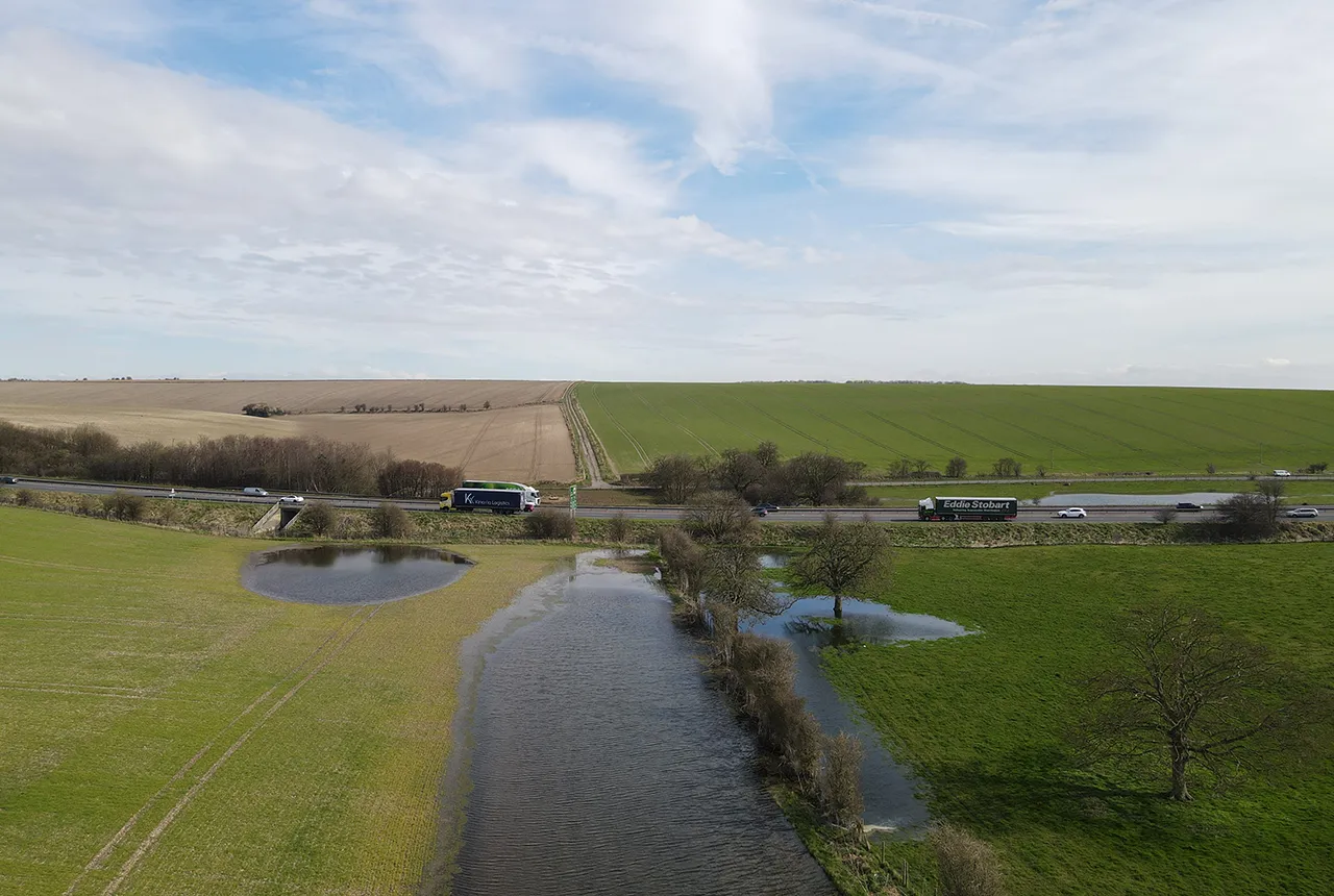
The RC project explores the concept of a sediment circular economy for coastal adaptation in East Anglia, in which the release and transit of sediment is mapped and value is assigned where benefits accrue. CoastalME is used to quantify the movement of sand, gravel and fine material along the coast and to determine its value as a nature-based resource. Early results suggest that allowing a 1 m landward recession of less than 10 m of the cliffs between Felixstowe and Caister would release around 1.8 million m3 of sand.
At an international level, CoastalME has been used in Spain to assess the risk of flooding and erosion for the whole of Andalusia’s coastline, which extends for 1200 km, measured at a scale of 1:25 000, and traverses five of eight provinces. This study represents the first attempt to map the spatial distribution of sediment thickness along this coastal zone by integrating various publicly available datasets. It demonstrated the flexible design of CoastalME by incorporating representations of geomorphological features such as ‘ramblas’ (a dry riverbed used as a road or thoroughfare) that are important sources of sediment during heavy rainfall events.

After years of developing CoastalME, we are pleased to see that it’s now been officially released and is freely available to support coastal engineers and decision makers to better assess the risk of compound flooding and erosion more accurately than ever before.
Dr Andres Payo Garcia, head of BGS Coasts and Estuaries.
Funding
This research was initially funded by the NERC iCOAST project as a proof of concept, NE/J005584/1 (2012 to 2016).
The workflow to create the sediment thickness model was developed between 2016 and 2022 thanks to funding from BLUEcoast, NE/N015649/1.
It is being operationalised (2022 to 2027) as part of the ongoing CHAMFER project NE/W004992/1 and is being extended to gravel-dominated coastal environments as part of the 2024 to 2028 UKGravelBarriers project, NE/Y503265/1.
Contact
For more information, please contact BGS press (bgspress@bgs.ac.uk) or call 07790 607 010.
Relative topics
Related news

PhD adventures in Copenhagen, Denmark: revealing past recovery processes of tropical forest systems through ancient environmental DNA
12/03/2026
PhD student Chris Bengt visited the University of Copenhagen to carry out very delicate extraction of aeDNA from lake-sediment cores, in the hopes of unlocking the secrets of past volcanic eruptions.
Modern pesticides found in UK rivers could pose risk to aquatic life
17/06/2025
New research shows that modern pesticides used in agriculture and veterinary medicines have been found for the first time in English rivers.
What is the impact of drought on temperate soils?
22/05/2025
A new BGS review pulls together key information on the impact of drought on temperate soils and the further research needed to fully understand it.
What does the next generation of coastal environmental models look like?
15/04/2025
A new tool is now available that has been designed to help coastal engineers and practitioners better manage the compound risk of coastal erosion and flooding.
Pioneering tool expanding to analyse agricultural pollution and support water-quality interventions
06/02/2025
An online tool that shows which roads are most likely to cause river pollution is being expanded to incorporate methods to assess pollution from agricultural areas.
Dynamics of land-to-lake transfers in the Lake Victoria Basin
09/12/2024
In June 2024, a UK/Kenya research team shared research findings from a collaborative, four-year field and experimental programme within Kenya.
Forty years and counting: new topsoil data provides most extensive snapshot of environmental pollution effects
01/10/2024
Scientists have uncovered clear signs of the impact environmental pollution is having across the country’s soil.
Spotlight on BGS coastal erosion data
18/07/2024
BGS GeoCoast data can support researchers and practitioners facing coastal erosion adaptation challenges along our coastline.
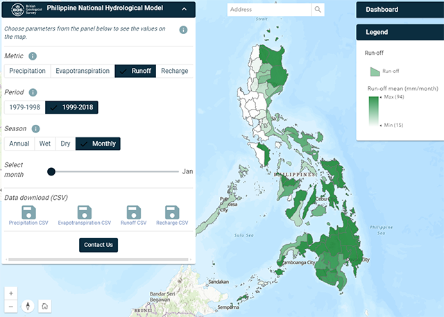
Philippine Hydrological Model
The first national-scale hydrological model of the Philippines.

Glacial, periglacial and permafrost modelling
Glacier ice and permafrost have important implications for global water security and energy infrastructure
British Groundwater Model
A unique tool for simulating groundwater resources at the national scale.
Environmental modelling
Advancing the understanding of environmental systems through innovative modelling techniques and interdisciplinary research.