River erosion: the forgotten hazard of flooding
Impacts from flood events can be widespread, long-lasting and extremely costly. The UK Government and environmental protection agencies continue to invest heavily in mitigation measures, as well as trying to predict which areas are most at risk.
03/08/2022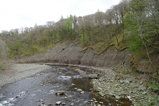

When considering natural hazards in a riverine or catchment setting, it is often high-magnitude flood events that grab the headlines. In comparison, associated catchment hazards such as river scour are often overlooked, but these events can be no less costly in their societal and economic impacts. Recent studies have shown that, in the UK, river erosion and associated impacts exacerbate flood damage by £336 million a year and are a considerable source of water pollutants, costing £238 million a year to remediate.River erosion further increases the costs of water treatment and maintenance of drainage networks by £132 million a year and accounts for 25 per cent of valid subsidence insurance claims (Li et al., 2021; Pritchard et al., 2013).
Infrastructure damage
Scour causes physical modification to riverbeds and banks via the removal of sediment or engineered materials. It occurs when the forces imposed by the flow of water on a sediment particle exceed the stabilising forces (Kirby et al., 2015). This is an environmental process occurring in response to the natural variability of river stream flows and sediment regimes but, unlike hazards associated with flood waters that will eventually recede, the changes that result from river erosion can be permanent.This makes river scour extremely damaging when it intersects assets such as farmland, infrastructure, residences, historic sites, etc.
Of particular concern is the significant damage river scour can cause to infrastructure adjacent to rivers, such as bridges, flood defences and electricity pylons. The Climate Change Committee’s recent, independent assessment of UK climate risk has highlighted that the risk to bridges and pipelines from future erosion requires further investigation.
Currently, river scour risk to UK railway bridges is estimated to cause the loss of 8.2 million passenger journeys each year, with an accompanying economic cost of up to £60 million (Lamb et al., 2019). In 2009, flood events in Cumbria caused a tragic fatality and the partial or total destruction of 20 road bridges, costing the local economy an estimated £2 million per week during the recovery period (Pizarro et al., 2020).
Events such as these serve as a stark and increasingly frequent reminder of the destructive effects of river scour. As a result, the ability to predict where river scour is likely to occur across the UK river network is being recognised as increasingly important, both under current conditions and future climate change scenarios. The UK Government Environment Act (2021) has a target to reduce the impact of physical modification on the water environment and, between 2009 and 2015, £68 million was spent towards reaching this goal (UK Government, 2021).
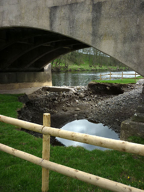
An example of river bank scour undermining a bridge in Cumbria. © Copyright Karl and Ali and licensed for reuse under the Creative Commons Licence.
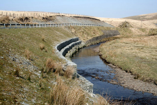
Protective measures installed to reinforce river bank against threat of erosion to road infrastructure in Scotland. © Copyright Roger Whittleston and licensed for reuse under the Creative Commons Licence.
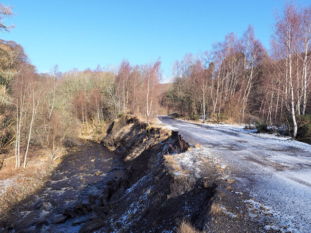
An example of road infrastructure threatened by river bank scour in County Durham. © Copyright Trevor Littlewood and licensed for reuse under the Creative Commons Licence.
Maintaining catchment health
Management and mitigation against river erosion is required at multiple scales and concerns a variety of stakeholders. Organisations involved in the maintenance of catchment health include:
- river basin and catchment management authorities
- charities such as the National Trust and various river trusts
- environmental protection agencies
- national park authorities
At a more granular level, the occurrence of river erosion is of interest to asset owners responsible for infrastructure, such as rail or road networks, local planning authorities and insurers, and lenders and property search companies when considering risks to assets, future developments and portfolios.
Efforts to model this costly geohazard have highlighted an important gap in available datasets. The joint efforts of the Environment Agency (EA), the Department for Environment, Food and Rural Affairs (Defra) and Natural Resource Wales (NRW) on the ‘Understanding how rivers channels change’ flagged: ‘There is currently no nationwide information showing where erosion or deposition is likely to occur’, whilst a UK Climate Resilience Programme (UKCRP)-funded project, ‘Erosion hazards in river catchments: making critical infrastructure more climate resilient’, found: ‘Creating resilient, sustainable infrastructure depends on understanding the potential future risks of changing erosion hazards and their impact. Yet at present, no predictive modelling framework exists for erosion hazard.’
The role of geological data
The geological properties of bedrock and superficial deposits that make up riverbeds and banks are fundamental controls on the susceptibility of any given river reach to scouring. As such, geological data is a key input into any predictive models attempting to resolve this issue and is an invaluable resource for infrastructure risk and catchment health assessments at both catchment and reach scales.
Existing modelling efforts by the UK’s environmental protection agencies and the wider scientific community utilise various BGS data holdings. For example, the UKCRP project derives sediment compositions from the BGS soils texture maps, whilst Defra, EA and NRW are considering the use of BGS superficial deposits data as indication of the location of erodible deposits. Both have limitations: the latter project fails to consider erodible or soluble bedrock deposits and the former acknowledges that it lacks ‘sufficient information on the spatial variation in these [sediment] compositions’. This emphasises the need for consistent information on the erodibility of riverbed and bank material at national and granular levels.
Stay tuned for our upcoming blog to find out how BGS’s updated GeoScour data product can provide geological river scour assessments from catchment down to individual reach scale with national coverage.
Join the BGS GeoScour dataset webinar: 8 September 2022
BGS Product Development invites you to the launch of our newly updated dataset, GeoScour. Our 30-minute webinar will give an overview of river scour and its associated river erosion hazards, including surface geology susceptibility and bedrock geology susceptibility, and will be followed by an introduction to the Open and Premium GeoScour data packages.
Defra, Welsh Government, Natural Resources Wales, and Environment Agency. Delivering benefits through evidence: understanding river channel sensitivity to geomorphological changes. (Bristol, UK: Environment Agency. ) ISBN: 978-1-84911-480-6. Available at https://assets.publishing.service.gov.uk/media/606ddd86e90e074e53c33dbf/Understanding_how_river_channels_change_-_method_report.pdf
Kirby, A, Roca, M, Kitchen, A, Escarameia, M, and Chesterton, O. 2015. Manual on Scour at Bridges and Other Hydraulic Structures. (London, UK: CIRIA.) ISBN: 0860177475.
Lamb, R, Garside, P, Pant, R, and Hall, J W. 2019. A probabilistic model of the economic risk to Britain’s railway network from bridge scour during floods. Risk Analysis, Vol. 39(11), 2457–2478. DOI: https://doi.org/10.1111/risa.13370
Li, X, Cooper, J R, and Plater, A J. 2021. Quantifying erosion hazards and economic damage to critical infrastructure in river catchments: impact of a warming climate. Climate Risk Management, Vol. 32, 100287. DOI: https://doi.org/10.1016/j.crm.2021.100287
Pizarro, A, Manfreda, S, and Tubaldi, E. 2020. The science behind scour at bridge foundations: a review. Water, Vol. 12(12), 374. DOI: https://doi.org/10.3390/w12020374
Pritchard, O, Hallett, S H, and Farewell, T S. 2013. Soil corrosivity in the UK – impacts on critical infrastructure. Working Paper Series, Infrastructure Transition Research Consortium, Cranfield University. Available at https://www.itrc.org.uk/wp-content/PDFs/Soil-corrosivity-impacts-UK-infrastructure-report.pdf
UK Climate Risk. 2021. Findings from the third UK Climate Change Risk Assessment (CCRA3) Evidence Report 2021. Available at https://www.ukclimaterisk.org/wp-content/uploads/2021/06/CCRA3-Briefing-Transport.pdf
UK Government. 2021. At a glance: summary of targets in our 25-year environment plan. Available at https://www.gov.uk/government/publications/25-year-environment-plan/25-year-environment-plan-our-targets-at-a-glance
About the author

Rob Shaw
Geospatial data analyst
Relative topics
Latest news

Shortage of end-of-life materials presents challenge to UK critical minerals security
17/06/2026
A new report by the UK Critical Minerals Intelligence Centre reveals insufficient end-of-life material stocks present a supply risk over the coming decade, but offer significant long-term potential to meet critical mineral demand through recycling.

UK geothermal catalogue receives update
16/06/2026
BGS releases the second digital version of the UK geothermal catalogue of subsurface temperature and rock thermal conductivity measurements and heat flow calculations.

Scientists make new discovery in the history of the Giant’s Causeway
15/06/2026
New research is changing our scientific understanding of the formation of one of the UK’s most iconic landmarks and has revealed that Northern Ireland’s volcanic past occurred over a much shorter period than previously thought.

Latest research emphasises climate-related subsidence risk to millions of British homes
11/06/2026
New data from BGS highlights the projected future impact of warmer, drier summers and underlines the need for mitigation measures in susceptible regions.

Ukraine and the UK strengthen their commitment to geological cooperation
10/06/2026
A new Memorandum of Understanding reaffirms the UK’s support of Ukraine’s ambitions to develop its critical mineral resources, paving the way for collaboration through capacity-building programmes.
Newly released core could hold clues on potential mineral prospectivity in Perthshire
05/06/2026
A comprehensive collection of geological samples from the vicinity of a former mine in Scotland is now available to scientists for further research.
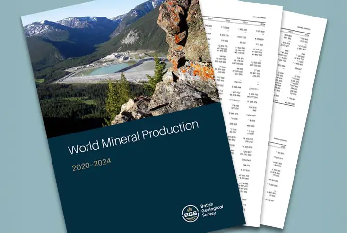
Latest data on world mineral production now available
25/05/2026
BGS has released the updated statistics on the global production of over 70 commodities between 2020 and 2024.

International science consortium to survey the health, economic value and social importance of Lake Victoria
22/05/2026
The project will replicate the 1927 survey to assess changes in the lake’s health, economic value and social importance.

New geological maps of Berwick-upon-Tweed to help future-proof natural water supply
20/05/2026
Scientists have mapped the geology under the town to better understand the groundwater system to inform decisions around abstraction.

BGS contributes to UN sand and sustainability report
19/05/2026
The new report highlights the impact of poor governance and unsustainable sand mining practices, calling on policymakers to take action.

BGS engineering geologist elected to CCOP
29/04/2026
Marcus Dobbs has been elected as vice-chair of the advisory group for the Coordinating Committee for Geoscience Programmes in East and Southeast Asia.
UK Minerals Yearbook 2025 now available
21/04/2026
The annual publication provides essential information about the production, consumption and trade of UK minerals up to 2025.