Latest
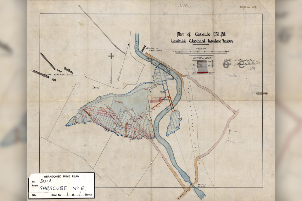
Release of over 500 Scottish abandoned-mine plans
24/06/2025
The historical plans cover non-coal mines that were abandoned pre-1980 and are available through BGS's plans viewer.
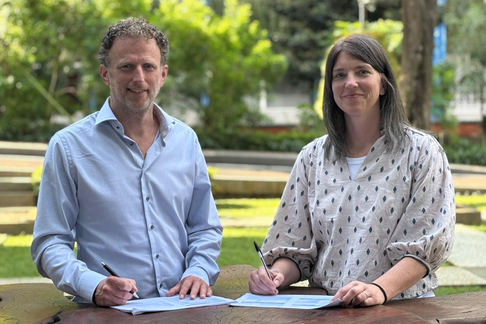
New collaboration aims to improve availability of real-time hazard impact data
19/06/2025
BGS has signed a memorandum of understanding with FloodTags to collaborate on the use of large language models to improve real-time monitoring of geological hazards and their impacts.
AI and Earth observation: BGS visits the European Space Agency
02/07/2025
The newest artificial intelligence for earth science: how ESA and NASA are using AI to understand our planet.
Explore more news
Browse all news and events by category
BGS Virtual Strategy Launch – Understanding our Earth
Event on 23/05/2023
Join us online to learn more about our new BGS strategy 2023 to 2028 - Understanding our Earth
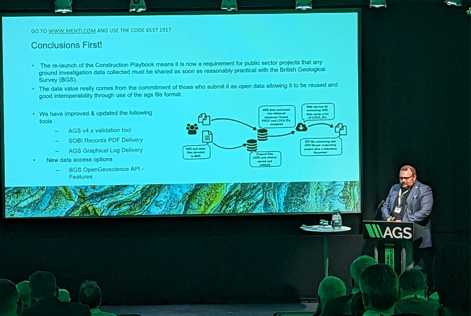
AGS file utilities tool: production release
16/05/2023
BGS’s online tool for validating AGS files against the official AGS data format rules and its own NGDC data submission requirements goes live.
BGS releases 10K maps through updated maps portal
16/05/2023
BGS releases an updated maps portal, which allows users to view all publicly available maps, and includes 10 000 and 1:10 560 scale maps for the first time.
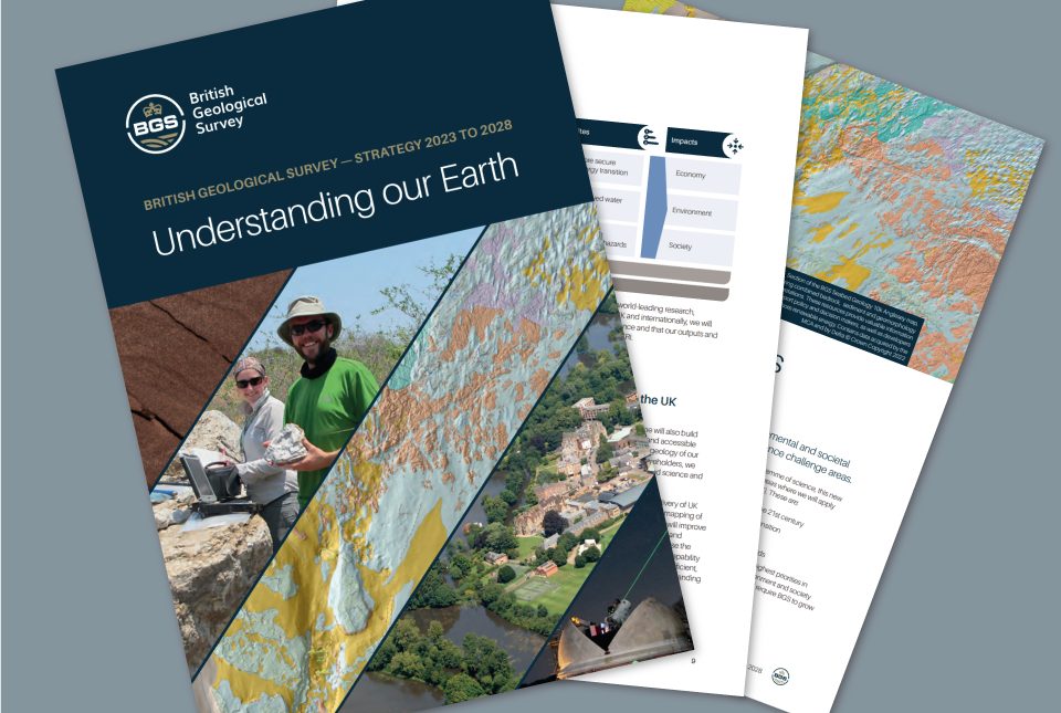
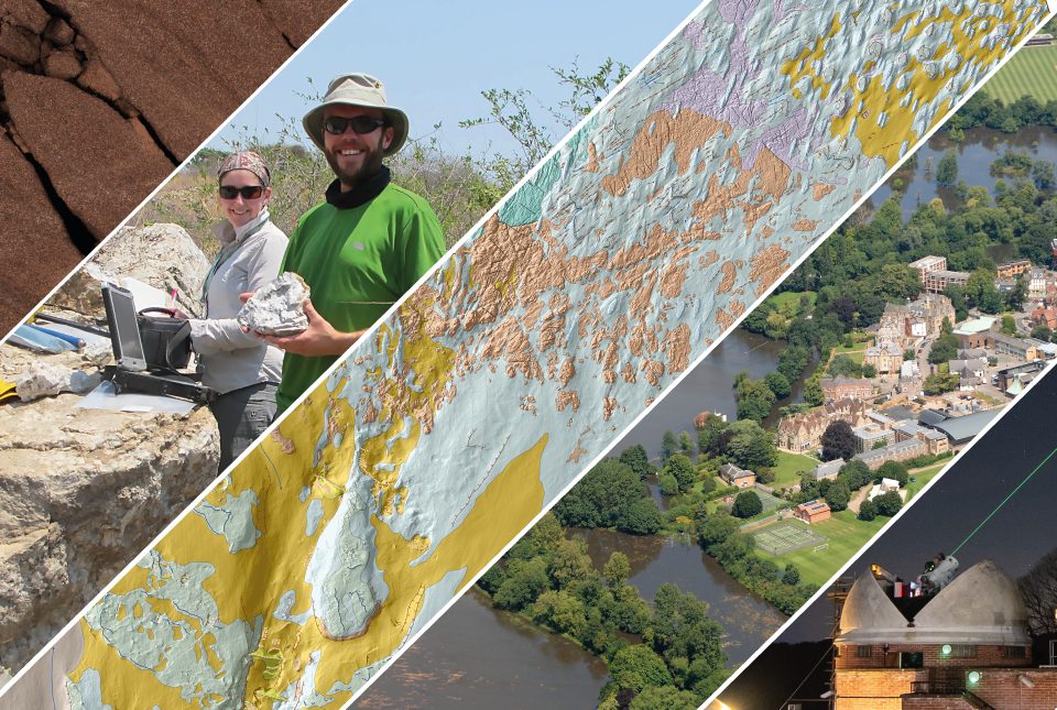
BGS maps out priorities with five-year strategy
11/05/2023
BGS publishes its new strategy for 2023 to 2028, 'Understanding our Earth'.
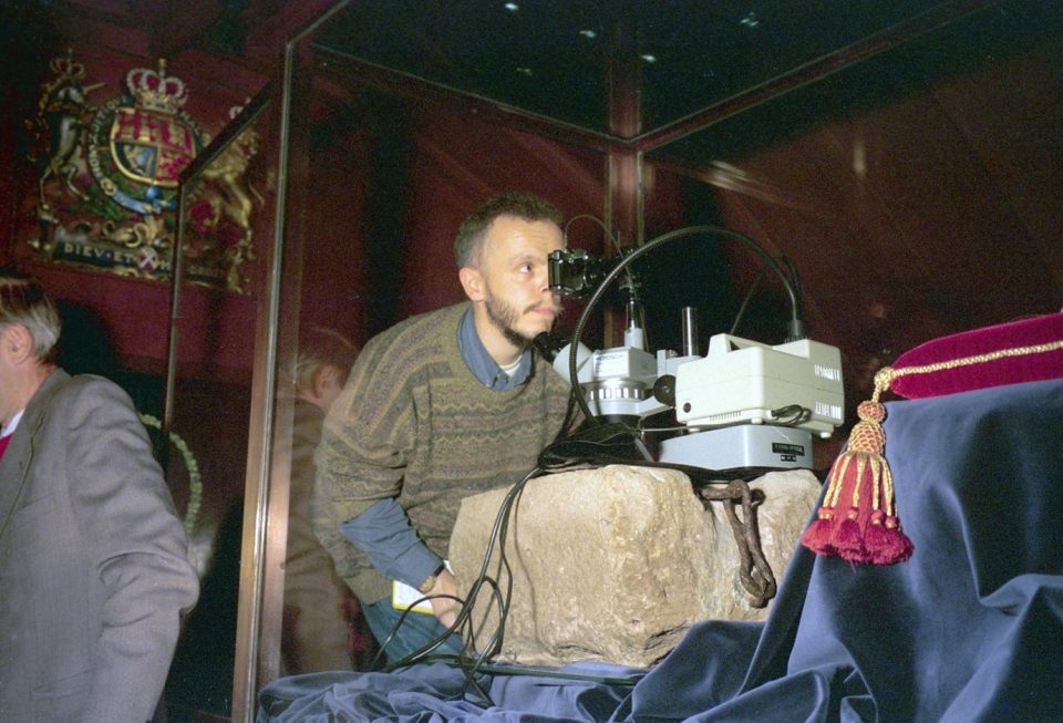
The Stone of Destiny
03/05/2023
The origins of the Stone of Scone: where it came from, why BGS has crumbs of it in its collections and the little-known fact that it is upside down.
Improvements to borehole delivery
25/04/2023
BGS releases improvements to its borehole layer on the GeoIndex, which makes access faster and improves quality.

Island groundwater management in the Philippines: part one — Boracay
19/04/2023
BGS’s Andy Barkwith and Andy McKenzie travelled to the Philippines to undertake collaborative research and outreach with Filipino partners for a national hydrological modelling project. In this first blog, they discuss the first week of work on small islands.
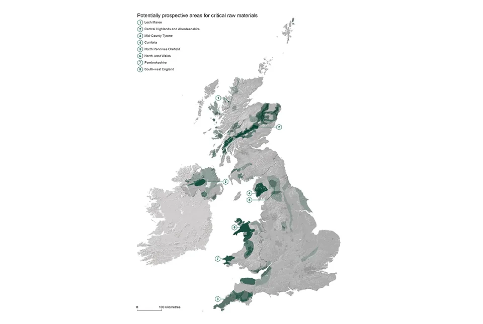
Report identifies areas of the UK prospective for critical raw materials
17/04/2023
Areas from the Highlands to south-west England have the right geology to be prospective for several critical raw materials such as lithium and graphite, according to a new report.