New seabed geology maps to enable long term conservation around Ascension Island
BGS deliver the first marine geology and habitat maps for one of the world’s largest marine protected areas.
01/04/2025 By BGS Press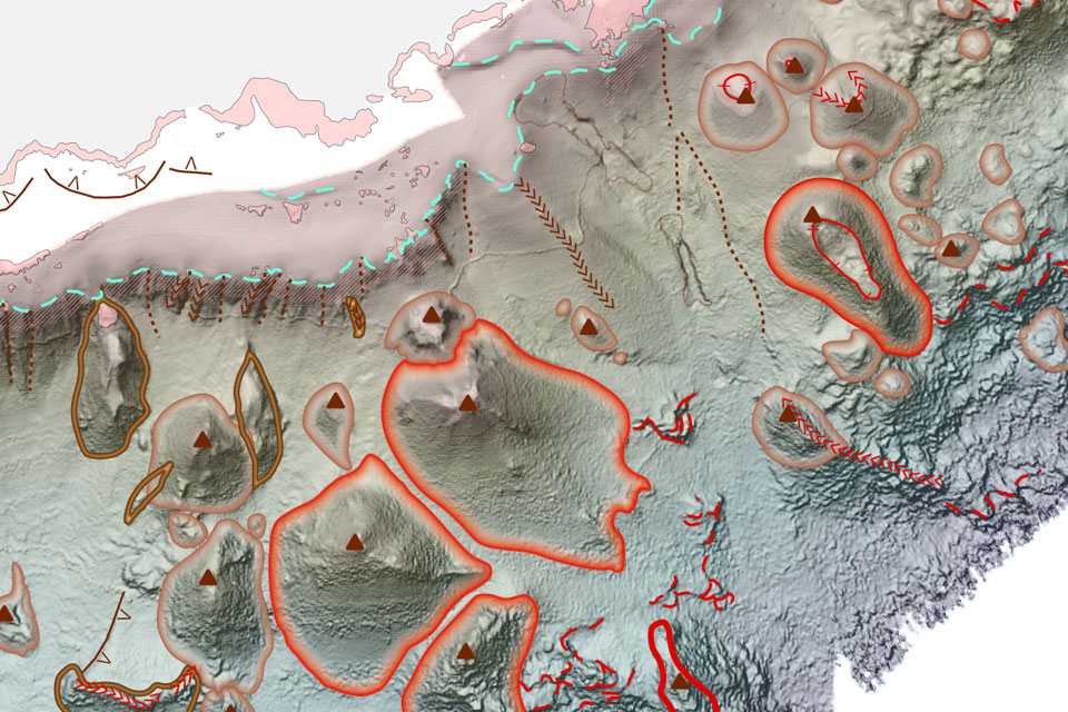

The Ascension Island Marine Protected Area (MPA) is one of the largest areas of protected ocean in the world and safeguards a unique ecosystem in the South Atlantic Ocean. It supports many species that are found nowhere else on earth, a mixture of deep sea and open ocean habitats that remain largely untouched and unexplored, whilst the island itself is home to thousands of nesting turtles and seabirds.
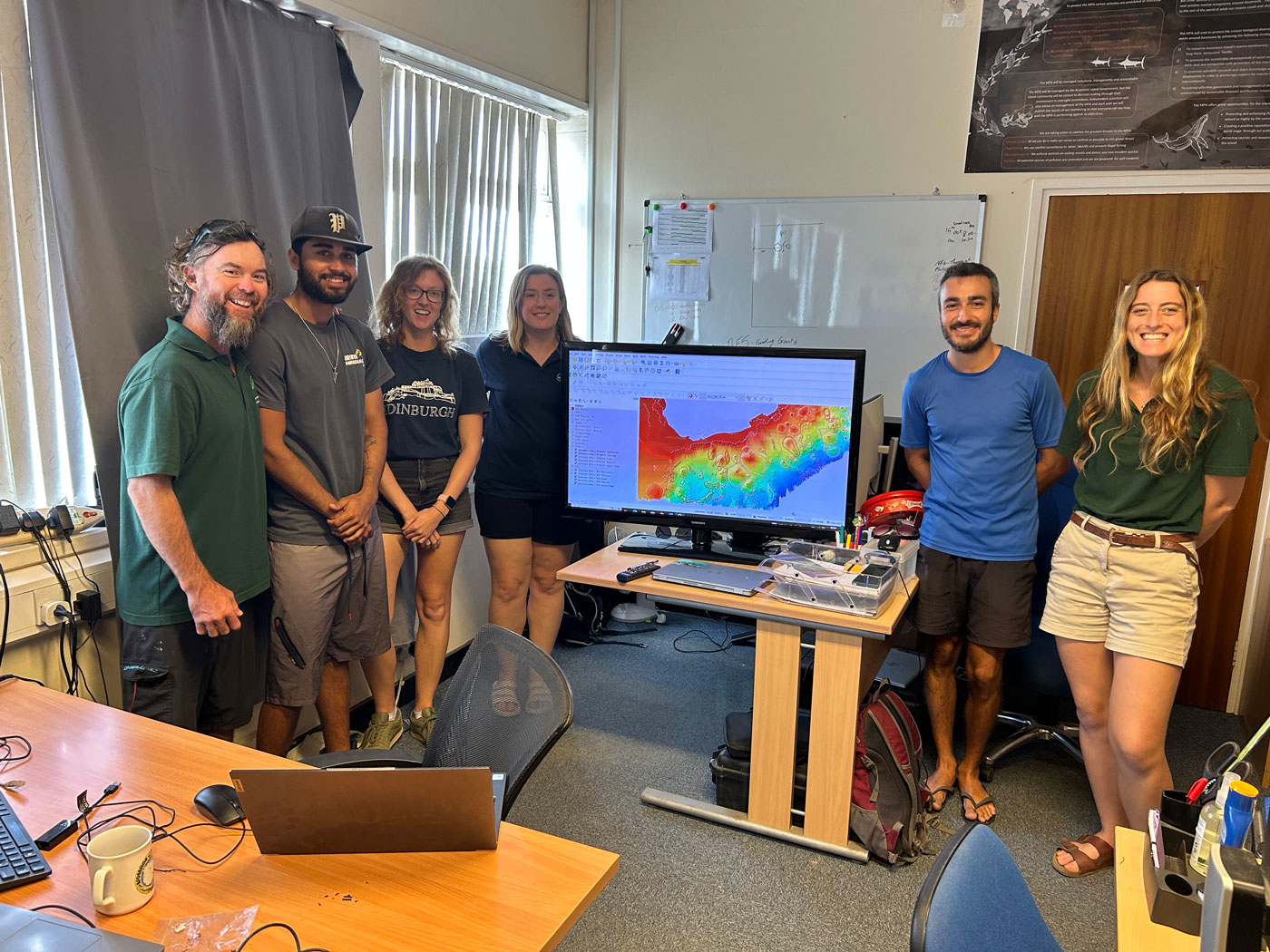
BGS Marine Geoscientist, Catriona MacDonald delivering a lesson in geomorphology to the Ascension Island Government Conservation Team. Source: BGS © UKRI
The British Geological Survey (BGS) recently completed a programme of high-resolution bathymetry surveys and drop-camera sampling within the nearshore areas of the Island. The survey team even managed to collect data where no other survey had ever been undertaken, which in addition to supporting conservation efforts, will also enable safer navigation in future.
The project was funded by the UK Government and utilised both BGS and Royal Navy bathymetry (depth), backscatter (seabed composition), ground-truth sampling (underwater video footage) and many other derived data layers to create the suite of bespoke geological outputs.
The maps, which include seabed geology (substrate and geomorphology) and habitat, are the first to be created for the Island and determine the character, distribution and extent of the nearshore habitats of the MPA.
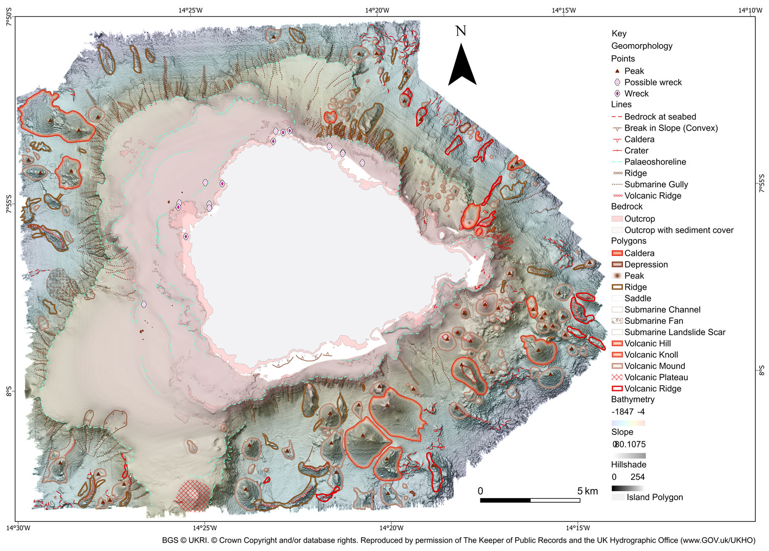
BGS 1:50 000 Geomorphology map of the seabed around Ascension Island. BGS © UKRI. © Crown Copyright and/or database rights. Reproduced by permission of The Keeper of Public Records and the UK Hydrographic Office (www.GOV.uk/UKHO)
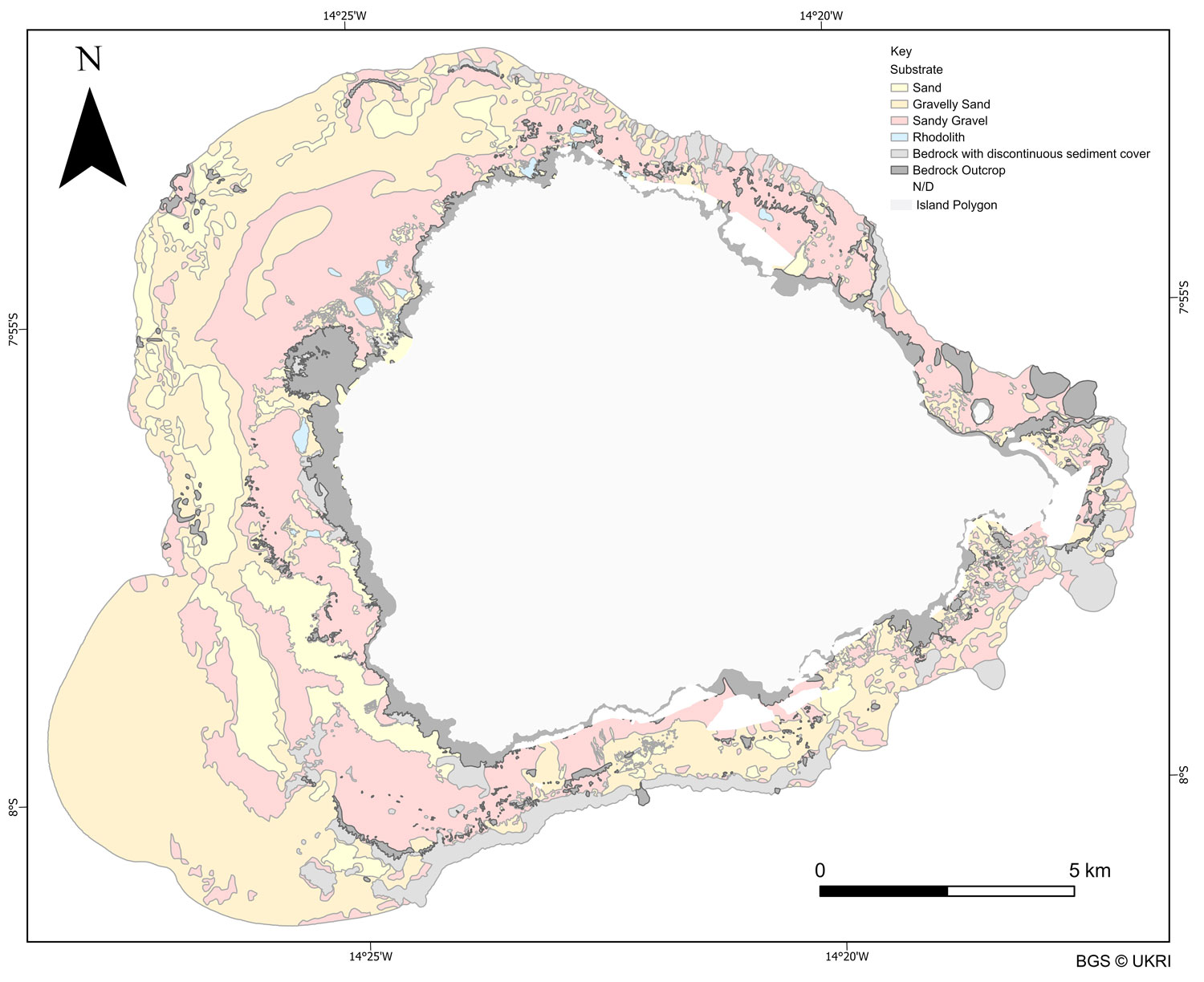
BGS substrate map around Ascension Island, which one of the essential input layers to derive habitat management zones. BGS © UKRI
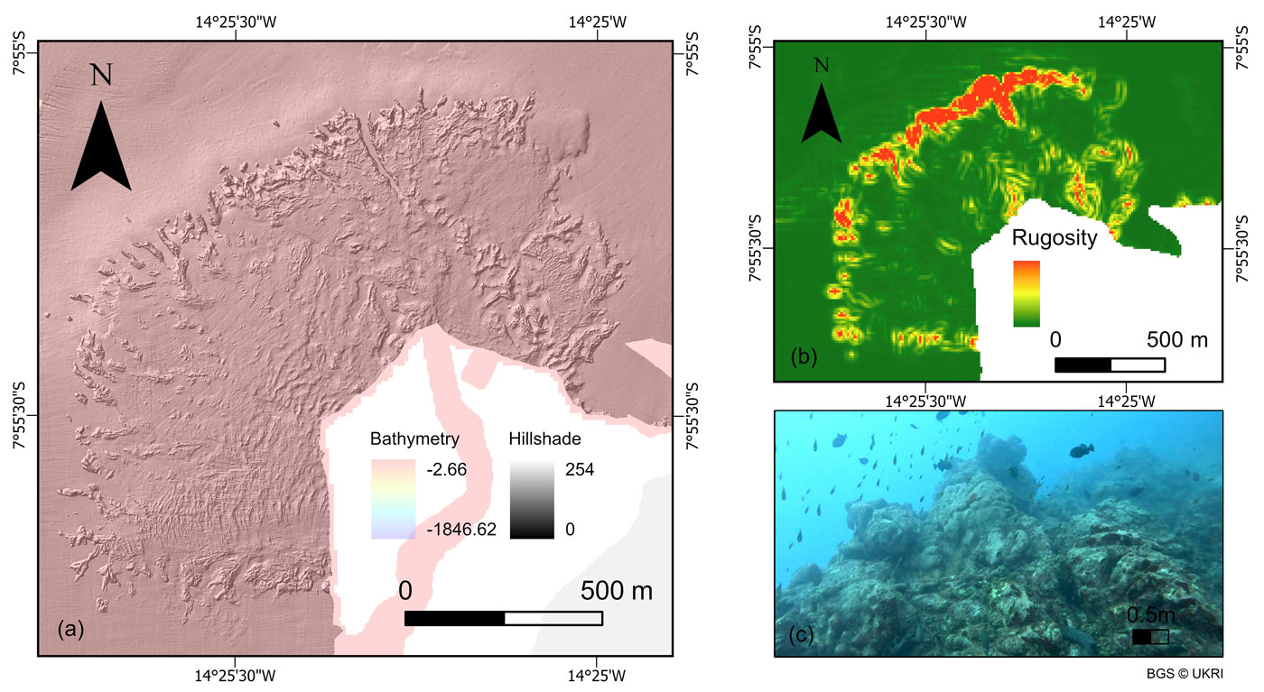
Example bathymetry data and a derived layer (slope) and ground truth footage used to create seabed maps. BGS © UKRI
The geomorphological map revealed a collection of previously unmapped volcanic, erosion-depositional and coastal features including seamounts, submerged lava flows, ridges, submarine landslides and channels. Whilst the substrate map focused on the nearshore areas, composed of sandy sediments and rocky outcrops which are fundamental habitats for the marine communities. Both maps have enhanced the understanding of seabed processes and geological processes occurring around Ascension Island and enabled the creation of seabed habitat maps which provide unprecedented insight into the diverse ecosystems present in the surrounding waters.
As part of the project, the BGS Marine team provided training to the Ascension Island Government (AIG) in how to effectively use GIS software to view, edit, query and manipulate the data. The intention is for AIG to modify these maps as new data and knowledge becomes available and the management requirements of the protected area changes. Although the region is rich in biodiversity it is one of the habitats most at risk from anthropogenic development and climate change. The maps and data will be a vital resource for the AIG Conservation team as they continue to manage and safeguard the region.

“Collecting data in such a remote and exposed location was a challenge, but an absolute privilege and pleasure. BGS had to adapt existing technology to work with the available survey platform within the limits of Ascension’s wonderfully varied and unpredictable operating environment.”
Rhys Cooper, BGS Project Manager and Senior Surveyor
“The collection of new high-resolution datasets around Ascension Island allowed us to map the seafloor geology in unprecedented detail, uncovering critical geological features and habitats that support a rich diversity of marine life, and marks a significant milestone in our understanding of Ascension Island’s marine environment.”
Catriona Macdonald, BGS Marine Geoscientist
“AIG are excited to have access to such high-quality bathymetry and habitat maps. They will be transformative in our nearshore research and monitoring and allow for much more evidence based conservation management.”
Tiffany Simpson, Director of Conservation and Fisheries, Ascension Island Government
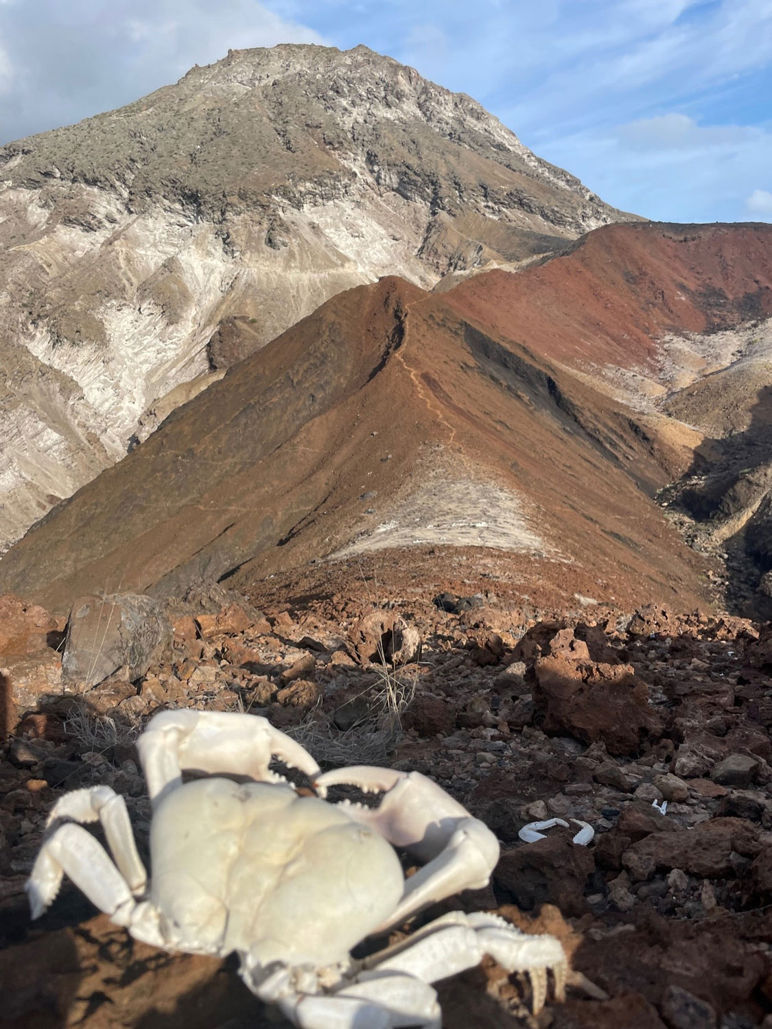
Land crabs (Johngarthia lagostoma) on the approach to White Hill, Ascension Island. BGS © UKRI
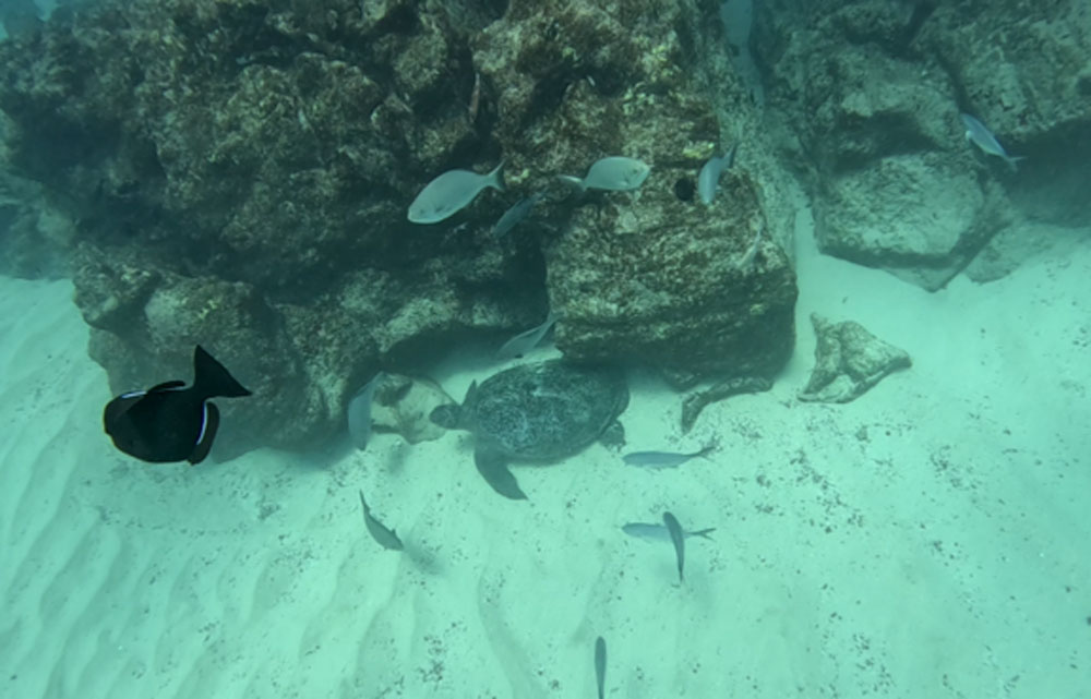
Marine life filmed as part of the video transect work around the coast of Ascension Island. BGS © UKRI
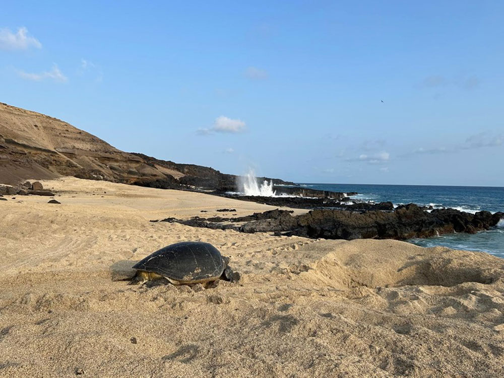
A green turtle (Chelonia mydas) returning to the sea after nesting on North East Beach, Ascension Island. BGS © UKRI
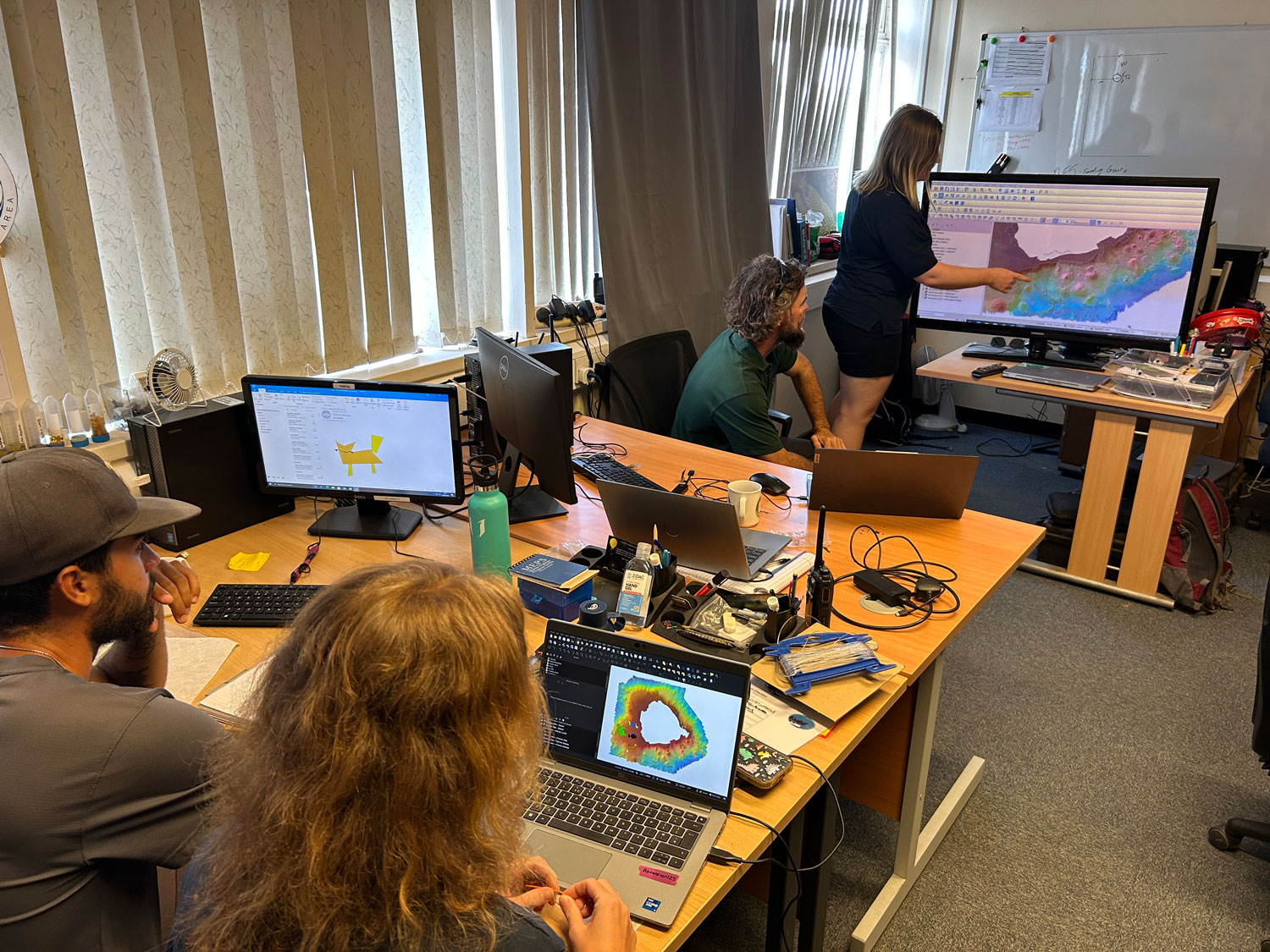
In depth training in QGIS and how to interpret the maps with the Ascension Island Government Conservation Team. BGS © UKRI
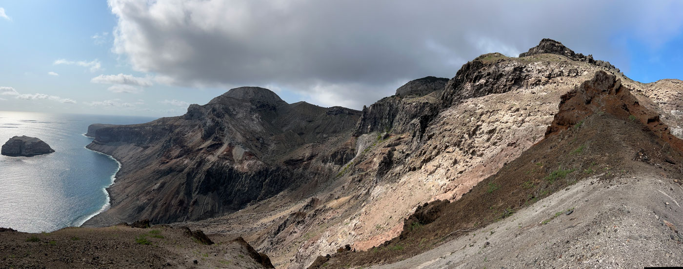
View down to Spire Beach from one of the world-famous letterbox walks. BGS © UKRI
The final maps were delivered by BGS to the Ascension Island Government’s Department of Conservation in February 2025 and will be used by the team to manage the marine environment for future generations.
Further information
Ascension Island Marine Protected Area Website
BGS completes first mapping expedition to Ascension Island
In photos: Marine surveying a remote volcanic island
Report of survey : Ascension Island multibeam & video transects
This project is funded by the UK Government through Darwin Plus.

Relative topics
Related news

Isotopes and science: my student placement at BGS
08/04/2026
Industrial placements at BGS for undergraduate students give real-life experience of working in laboratories and learning different analytical techniques.

Updated geological assessment of the Southern North Sea set to underpin future offshore infrastructure development
25/03/2026
The first regional assessment for 30 years will support offshore marine and subsurface planning for the UK’s low-carbon energy infrastructure, including the 2030 target of 45 to 50 GW generated through offshore wind.

New research could help provide a more reliable water supply for millions in rural Africa
24/03/2026
A new BGS-led study has revealed crucial insights into the longstanding challenges affecting the reliability and performance of rural water supply infrastructure in sub-Saharan Africa.

Call for new members and Chair to join the NERC facilities steering committees
25/02/2026
New members are needed to join the committees over the next four years.

Your views wanted: developing a geothermal energy subsurface data portfolio
24/02/2026
BGS is aiming to support the growth of the sector by providing the best-available, location-specific geothermal and ground source heat information as an accessible product or service.

Map of BGS BritPits showing the distribution of worked mineral commodities across the country
18/02/2026
BGS’s data scientists have generated a summary map of the most commonly extracted mineral commodities by local authority area, demonstrating the diverse nature of British mineral resources.

Funding awarded to map the stocks and flows of technology metals in everyday electronic devices
12/02/2026
A new BGS project has been awarded Circular Electricals funding from Material Focus to investigate the use of technology metals in everyday electrical items.

New UK/Chile partnership prioritises sustainable practices around critical raw materials
09/02/2026
BGS and Chile’s Servicio Nacional de Geología y Minería have signed a bilateral scientific partnership to support research into critical raw materials and sustainable practices.

Extensive freshened water confirmed beneath the ocean floor off the coast of New England for the first time
09/02/2026
BGS is part of the international team that has discovered the first detailed evidence of long-suspected, hidden, freshwater aquifers.

Funding secured to help mitigate ground risk in UK construction sector
05/02/2026
The BGS Common Ground project has been awarded new funding to help unlock the value of ground investigation data.

Can sandstones under the North Sea unlock the UK’s carbon storage potential?
02/02/2026
For the UK to reach its ambitious target of storing 170 million tonnes of carbon dioxide per year by 2050, it will need to look beyond the current well-studied geographical areas.

Quaternary UK offshore data digitised for the first time
21/01/2026
The offshore wind industry will be boosted by the digitisation of a dataset showing the Quaternary geology at the seabed and the UK’s shallow subsurface.