New method developed to identify wetland inhabitants
BGS-led research has helped develop a method to identify ancient human and animal wetland inhabitants.
01/11/2023 By BGS Press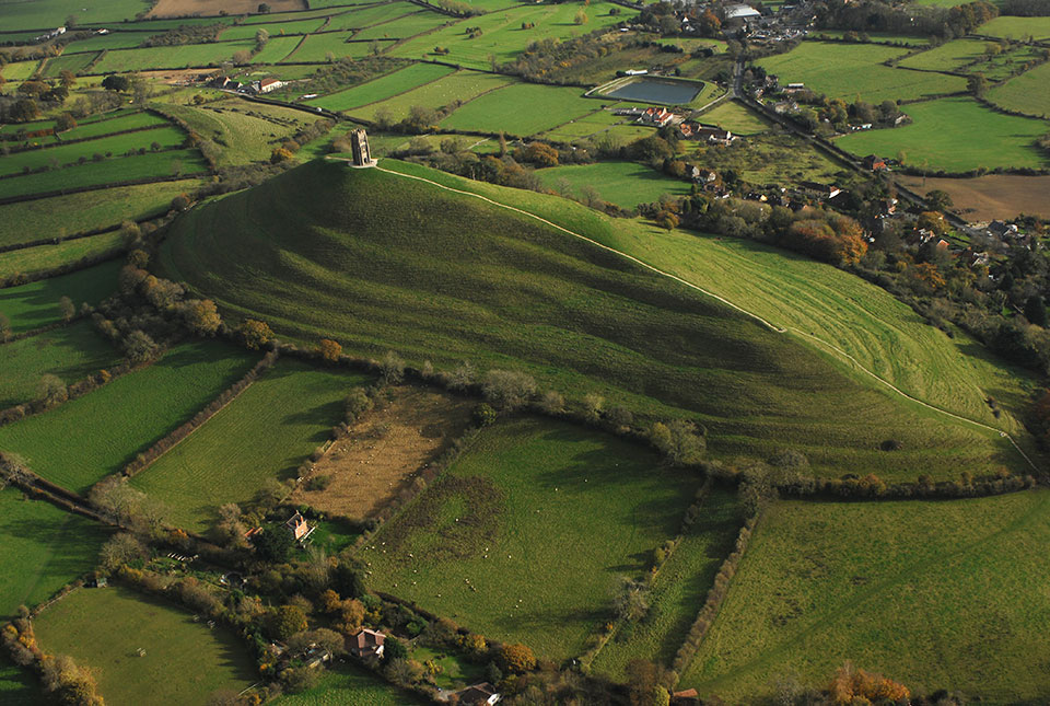

A team of isotope scientists from BGS, along with Cardiff University, has led research that has developed a new analytical method to identify archaeological remains of humans and animals that once inhabited wetlands. The method provides an additional tool for archaeologists to explore human and animal mobility in the past.
Identifying human and animal movement has long been an important pursuit in archaeology. Isotope analysis provides direct data for this and is helpful in identifying non-local individuals and patterns of migration.

Our aim was to test the hypothesis that certain underlying rock types will produce low sulphur (sulfur; S) isotope values, which are transferred through the food chain and could therefore provide a means of identifying humans and animals raised in wetlands in the past.
Angela Lamb, BGS Isotope Geochemist.
The new research explored the potential of previously undiagnostic low, often negative, S-isotope values to identify wetland dwellers. This was carried out by testing the hypothesis that impervious clays, which often support wetlands, will produce low S-isotope values due to both the underlying substrate and redox conditions.
Collecting samples
To characterise the modern S-isotope biogeography of typical wetland environments, the researchers collected and analysed 58 modern plant samples taken from areas overlying Jurassic rocks in southern England. The sampling targeted archaeologically important areas of the Somerset Levels and the Cambridgeshire Fens. S-isotope ratios were also extracted from the bone collagen of 65 faunal fossil samples from archaeological sites in both regions and analysed to compare with modern data and test if this relationship held for archaeological samples. To understand if the plant signals were transferred up the food chain to the fauna, S-isotopes in modern bone collagen, extracted from nine farm animals raised in these areas, were also analysed.
An additional tool for archaeologists
Of the samples tested, 60 per cent gave a value below zero, with the modern plant datasets giving more negative values for the eastern regions of Cambridgeshire relative to Oxfordshire and Somerset. The plants showed a correlation between S-isotope composition and altitude, which supports the idea that low-lying wetlands supply the most negative values into the environment.
These results support the interpretation that relatively low or negative S-isotope values are indicative of vegetation and wildlife growing and grazing on wetland regions underlain by Jurassic clays. Data from this study formed part of a new BGS isotope domain map (see Figure 1).
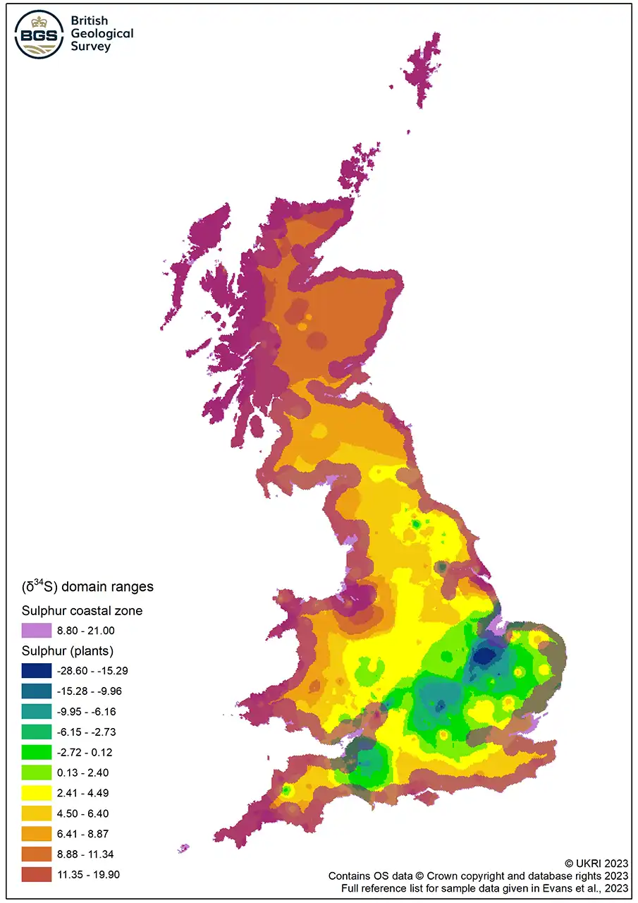
Figure 1 Map of S-isotope domain ranges for plants. BGS © UKRI.
Further work is needed to resolve regional differences in the altitude below which low S-isotope values occur and to understand S-isotope variability in higher altitude locations on the Jurassic clay, but this is a step forward in our understanding and therefore the application of low S- isotope ratios.
Angela Lamb
As a result, ancient humans and animals from wetlands, or that acquired their food from wetlands, may be identified using primary analytical methods. This provides an additional tool for archaeologists to explore animal management and human and animal mobility in the past.
More information
Read the research: Wet Feet: developing sulfur isotope provenance methods to identify wetland inhabitants
Evans, J A, Chenery, C A, Mee, K, and Marchant A P. 2023. Biosphere Isotope Domains GB (V2) [interactive website]. Available at https://www.bgs.ac.uk/datasets/biosphere-isotope-domains-gb/
Relative topics
Related news

New NERC-funded project empowers young people to engage with environmental science
23/07/2026
BGS is part of a new, collaborative project, funded through NERC’s ‘Opening up the environment’ programme, helping the environmental research community become more accessible.

Geo-Explorers – after-school kids’ clubs
Event from 07/09/2026 to 07/12/2026
An after school club for junior geology enthusiasts

Building Europe’s geological future
20/07/2026
BGS scientists are contributing to a continent-wide initiative that is strengthening collaboration across borders to tackle shared subsurface challenges and unlock new opportunities.

Delving deep into mountains for future water security
16/07/2026
A BGS-led project is using new water-tracing investigation methods, geophysics and modelling to understand how water moves from mountains to the lowlands, helping to improve water security for billions of people.

Collecting beach pebbles: fun hobby but is it legal?
14/07/2026
The UK coastline will be inundated with keen holidaymakers this summer, many of whom will take a memento of their trip home in the shape of a pebble or two — but is it legal?

Updated national 3D model will determine the depth to the solid bedrock beneath our feet
13/07/2026
The BGS Superficial Deposit Thickness Model now includes an elevation model of geological rockhead for the first time, providing important data for civil engineers, geoscientists and environmental scientists.

UK’s world-class research organisations launch new collective
10/07/2026
The launch of the National Research Organisations Group brings together more than 100 science leaders to provide an authorativive voice on science, research policy and long-term investment.

Cheshire Geoenergy Observatory releases key geological datasets for UK thermal energy storage scheme design
09/07/2026
A new report and data packs from BGS will provide a unique resource for scientists working on the geology and hydrogeology of the Sherwood Sandstone Formation, an important aquifer and reservoir rock.

New geological mapping underway to help manage flooding along the River Tweed
08/07/2026
Scientists are surveying the Tweed catchment for the first time in over 100 years to enhance understanding of localised groundwater and improve flood forecasting.

Geological research in North Sea helping to safeguard subsea cables
06/07/2026
Subsea power and telecommunications cables are critical to the UK’s energy infrastructure and global connectivity, yet they remain vulnerable to damage from ship anchors, fishing activity and natural hazards.

UK Critical Minerals Intelligence Centre makes recommendations for the next UK criticality assessment
01/07/2026
CMIC has outlined the enhancements made to the next assessment update to ensure it is better tailored to the structure of the UK economy.

From archive to discovery: historical mineral reports support gold exploration in Scotland
25/06/2026
Digitised geological records show potential to unlock untapped mineral resources in Ardlochan, Argyllshire.