A new open dataset to benefit onshore geoscience research
Data from deep onshore hydrocarbon wells is being released on an open access basis to help meet the UK’s net zero targets.
15/06/2023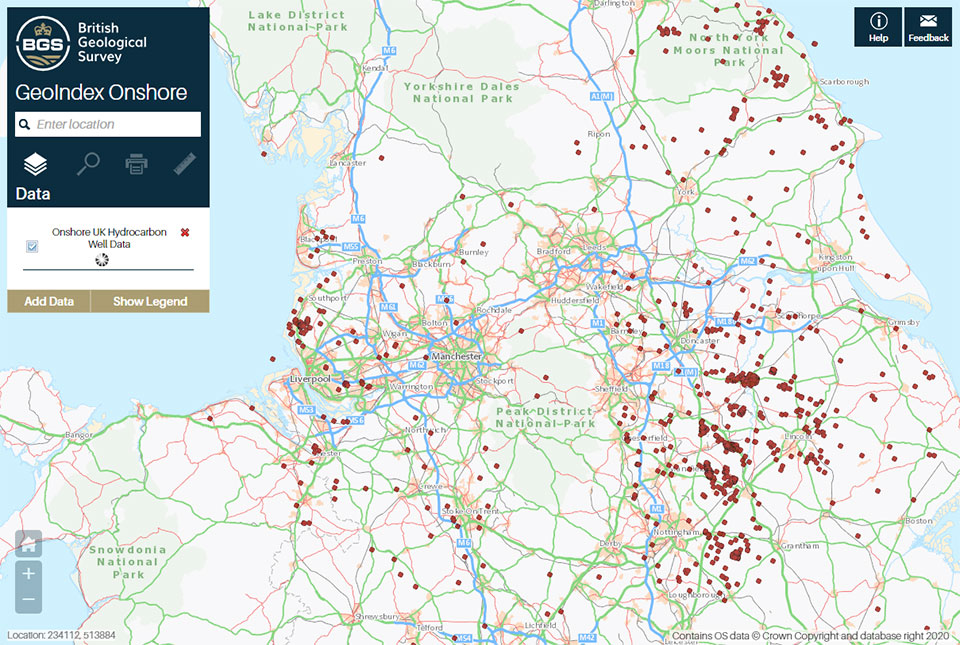

The North Sea Transition Authority (NSTA) has authorised the release of all the well data for onshore hydrocarbon boreholes held by BGS in the National Geoscience Data Centre (NGDC). Unlike borehole data from the North Sea, which has been available free of charge for some time, the data relating to these onshore boreholes was previously only available via data release agents. It is now available free of charge to industry, academics and the public via the BGS Geoindex, providing a new, free resource that will add to the knowledge necessary to meet net zero objectives.
Why is the data significant?
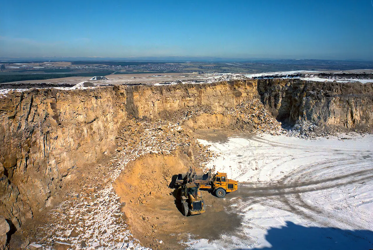
Few boreholes have been drilled to these depths (over 1 km) onshore in the UK and are almost exclusively a consequence of oil, gas or coal exploration. The oil and gas wells deeply penetrate the crust under the UK mainland and are geographically widespread across the UK.
Unlike coal wells, the oil and gas drilling data is better structured and better conforms to global standards of deep geological and deep geophysical data collection.
Most of the direct knowledge and samples that BGS has access to about the deep geology of the UK are based upon this data.
Why is the data being released?
Data from these deep hydrocarbon wells forms the best dataset to understand the geology of the deep UK subsurface. Widening access to the dataset could enhance the knowledge needed to meet net zero objectives:
- assessing the suitability of UK rocks for extraction of geothermal heat
- storing surplus energy from renewables and waste materials such as carbon dioxide
- identifying potential new mineral resources.
The data has been provided to BGS under regulation PON 9B, which sets out the records and samples requirements for onshore surveys and wells licensed by the NSTA. The data was previously held for BGS internal science use only, so this release widens the community of scientists who can access this important dataset. It includes the data for all boreholes that have been released (four years post-drilling) and for which BGS holds original geophysical data.
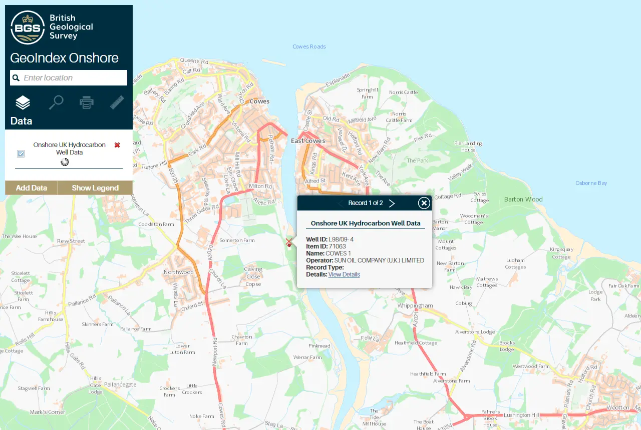
Example of onshore hydrocarbon well data on the BGS GeoIndex. Contains OS data © Crown Copyright and database right 2020
Data is being released using an Open Government Licence, which allows users to copy, publish, distribute and transmit the information, adapt the information and exploit the information commercially and non-commercially, provided that they acknowledge the source of the information.

The NSTA has collected data from more than 2200 onshore wells drilled in the search for oil and gas. Historically, half of that data were released through the British Geological Survey (BGS) with the rest provided by Data Release Agents on behalf of the NSTA. The new arrangement with the BGS means that all onshore hydrocarbon well data will be available from BGS. This free access to the unique onshore data will support the investment and innovation necessary to enable the ongoing energy transition.
Alan Poole, North Sea Transition Authority Geoscientist
BGS GeoIndex
The data is available via the BGS GeoIndex on a layer called ‘Onshore UK hydrocarbon well data’ and currently includes over 60 000 logs from 1200 wells and the number is still increasing. All related records in the BGS Borehole Index (which contains summary borehole metadata) have also been marked as open, releasing over 2000 records that were previously marked as confidential in the index.
About the authors

Andrew Kingdon
Head of BGS Digital Laboratories

Alison Steven
Data accession pipeline manager
Relative topics
Related news
Latest data on world mineral production now available
25/05/2026
BGS has released the updated statistics on the global production of over 70 commodities between 2020 and 2024.

International science consortium to survey the health, economic value and social importance of Lake Victoria
22/05/2026
The project will replicate the 1927 survey to assess changes in the lake’s health, economic value and social importance.

New geological maps of Berwick-upon-Tweed to help future-proof natural water supply
20/05/2026
Scientists have mapped the geology under the town to better understand the groundwater system to inform decisions around abstraction.

BGS contributes to UN sand and sustainability report
19/05/2026
The new report highlights the impact of poor governance and unsustainable sand mining practices, calling on policymakers to take action.
BGS engineering geologist elected to CCOP
29/04/2026
Marcus Dobbs has been elected as vice-chair of the advisory group for the Coordinating Committee for Geoscience Programmes in East and Southeast Asia.
UK Minerals Yearbook 2025 now available
21/04/2026
The annual publication provides essential information about the production, consumption and trade of UK minerals up to 2025.

UK scientists unite for seabed mapping survey of the UK’s south-west coastline
15/04/2026
BGS geologists join research voyage, gathering crucial geological data to support offshore energy and infrastructure projects.

Isotopes and science: my student placement at BGS
08/04/2026
Industrial placements at BGS for undergraduate students give real-life experience of working in laboratories and learning different analytical techniques.

Updated geological assessment of the Southern North Sea set to underpin future offshore infrastructure development
25/03/2026
The first regional assessment for 30 years will support offshore marine and subsurface planning for the UK’s low-carbon energy infrastructure, including the 2030 target of 45 to 50 GW generated through offshore wind.

New research could help provide a more reliable water supply for millions in rural Africa
24/03/2026
A new BGS-led study has revealed crucial insights into the longstanding challenges affecting the reliability and performance of rural water supply infrastructure in sub-Saharan Africa.

Call for new members and Chair to join the NERC facilities steering committees
25/02/2026
New members are needed to join the committees over the next four years.

Your views wanted: developing a geothermal energy subsurface data portfolio
24/02/2026
BGS is aiming to support the growth of the sector by providing the best-available, location-specific geothermal and ground source heat information as an accessible product or service.