10 years on: the 2011 Great East Japan Earthquake and Tsunami
In remembrance, Prof David Tappin discusses the importance of tsunami anniversaries
11/03/2021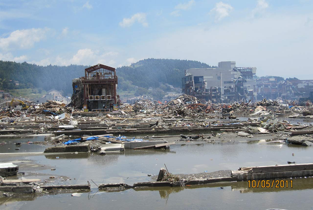

It is a time for remembrance; on the 11th March 2011 at 2.46 in the afternoon, a 9.1 magnitude earthquake off the east coast of Honshu Island, Japan caused a tsunami up to 40 metres high that flooded local coastlines, causing over 18,500 fatalities and over 280 billion dollars’ worth of damage. This was the most recent devastating tsunami, and its magnitude was a major surprise. Seven years previously, in 2004, in the Indian Ocean, another surprise earthquake generated tsunami resulted in over 220,000 deaths. Afterward, there was still some uncertainty over where these events would strike, and Japan demonstrated that the hazard was global but, also, that their mechanisms (earthquake or submarine landslide) might not be as clear cut as first observations might suggest.
Over the past 20 years there have been a number of devastating tsunamis, which suggests that we are living in the ‘Age of Tsunamis’. Perhaps the first of these important recent events was in 1998, in Papua New Guinea, where 2,200 people died in tsunami up to 15 metres high. Here the earthquake magnitude 7.1 was too small to explain the tsunami height, and for the first time, a submarine sediment failure, termed a slump was proved to explain the tsunami. At that time submarine landslides were not considered effective at causing hazardous tsunamis; and the landslide was identified by new technology available to map the seabed, with the surveys mainly funded by Japan. Six years after the Papua New Guinea tsunami, in December 2004 over 220,000 people died in the devastating tsunami that struck the eastern Indian Ocean. Then in March 2011 the Japan tsunami struck. Here, although the earthquake generated most of the tsunami along the low-lying Sendai Plain, the very high, up to 40 metre elevations, father north along the ‘Sanriku’ coast have been proposed as being from a secondary, submarine landslide. This is still not completely certain, but without the Papua New Guinea tsunami of 1998, it would have been an impossible idea.
May 2011 – overview of tsunami damage in Minamisanriku, North Honshu Island. Source: © David Tappin / BGS
The tsunami events of 1998, 2004 and 2011 were catastrophic, with many hundreds of thousands of fatalities, but they all resulted in improved understandings of tsunami mechanisms and tsunami hazard which led to improved mitigation; there are now tsunami warning systems in all the world’s major oceans, whereas in 2004, only the Pacific was covered. The recent earthquake event in New Zealand testifies to the importance of these global warning systems; here there was no dangerous tsunami, but if there had been many lives would have saved.
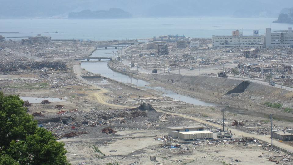
Tsunami 2011 damage on the Sendai Plain. Source: © David Tappin / BGS
Our knowledge base today, to plan and respond to tsunamis is far beyond anything considered possible 20 years ago. The result is that all the major ocean basins have warning systems. Devastating tsunami events are, fortunately, quite rare, but not impossible. In this context rather than letting time subdue our memories of these devastating events, anniversaries are important, both in remembering and honouring those who died and suffered in them, but also in reminding us that they will happen again in the future, and when they do we will be aware and prepared. Today’s anniversary of the Japan 2011 tsunami is critically important in this respect.
References:
Tappin, D.R., Evans, H.M., Jordan, C.J., Richmond, B., Sugawara, D., Goto, K., 2012. Coastal changes in the Sendai area from the impact of the 2011 Tōhoku-oki tsunami: Interpretations of time series satellite images, helicopter-borne video footage and field observations. Sedimentary Geology 282, 151-174.
Tappin, D.R., Grilli, S.T., Harris, J.C., Geller, R.J., Masterlark, T., Kirby, J.T., Shi, F., Ma, G., Thingbaijam, K.K.S., Mai, P.M., 2014. Did a submarine landslide contribute to the 2011 Tohoku tsunami? Marine Geology 357, 344-361
David Tappin is a BGS scientist, and Visiting Professor at University College, London, who has researched tsunamis for over 20 years, including those in Papua New Guinea, the Indian Ocean and Indonesia. After the Japan 2011 tsunami struck, he participated in a number of post-tsunami field surveys in Japan and published on the possibility that the tsunami was in part caused by a submarine landslide. Most recently he has researched the Indonesian tsunamis of 2018 in Palu, Sulawesi and the Sunda Strait.
Prof David Tappin
Principal researcher
Relative topics
Latest news

Call for new members and Chair to join the NERC facilities steering committees
25/02/2026
New members are needed to join the committees over the next four years.

Your views wanted – developing a ‘Geothermal energy subsurface data portfolio’
24/02/2026
BGS is aiming to support the growth of the sector by providing the best-available, location-specific geothermal and ground source heat information as an accessible product or service.

Map of BGS BritPits showing the distribution of worked mineral commodities across the country
18/02/2026
BGS’s data scientists have generated a summary map of the most commonly extracted mineral commodities by local authority area, demonstrating the diverse nature of British mineral resources.

Funding awarded to map the stocks and flows of technology metals in everyday electronic devices
12/02/2026
A new BGS project has been awarded Circular Electricals funding from Material Focus to investigate the use of technology metals in everyday electrical items.

New UK/Chile partnership prioritises sustainable practices around critical raw materials
09/02/2026
BGS and Chile’s Servicio Nacional de Geología y Minería have signed a bilateral scientific partnership to support research into critical raw materials and sustainable practices.

Extensive freshened water confirmed beneath the ocean floor off the coast of New England for the first time
09/02/2026
BGS is part of the international team that has discovered the first detailed evidence of long-suspected, hidden, freshwater aquifers.

Funding secured to help mitigate ground risk in UK construction sector
05/02/2026
The BGS Common Ground project has been awarded new funding to help unlock the value of ground investigation data.

Can sandstones under the North Sea unlock the UK’s carbon storage potential?
02/02/2026
For the UK to reach its ambitious target of storing 170 million tonnes of carbon dioxide per year by 2050, it will need to look beyond the current well-studied geographical areas.

Quaternary UK offshore data digitised for the first time
21/01/2026
The offshore wind industry will be boosted by the digitisation of a dataset showing the Quaternary geology at the seabed and the UK’s shallow subsurface.

Suite of ten new soil reference materials released
02/01/2026
BGS has a longstanding track record of producing high-quality reference materials and has released ten new soil reference materials.
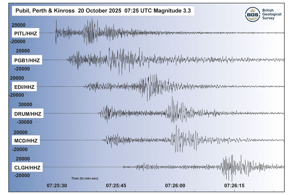
Perth and Kinross tops the UK’s earthquake activity charts for 2025
29/12/2025
Seismologists at BGS have published data on the number of seismic events over the past 12 months with over 300 earthquakes recorded.

BGS awarded funding to support Malaysia’s climate resilience plan
17/12/2025
The project, funded by the Foreign, Commonwealth & Development Office, will focus on minimising economic and social impacts from rainfall-induced landslides.