At BGS, we have combined our groundwater modelling capabilities with state-of-the-art weather forecasts to deliver probabilistic forecasts of groundwater levels across the UK’s principal aquifers over daily to annual timescales. These forecasts are underpinned by a national network of BGS AquiMod groundwater models that continues to be developed and expanded through applied research and commercial projects in collaboration with our stakeholders. These forecasts feed into a number of services that build national resilience to groundwater extremes.
Hydrological Outlook
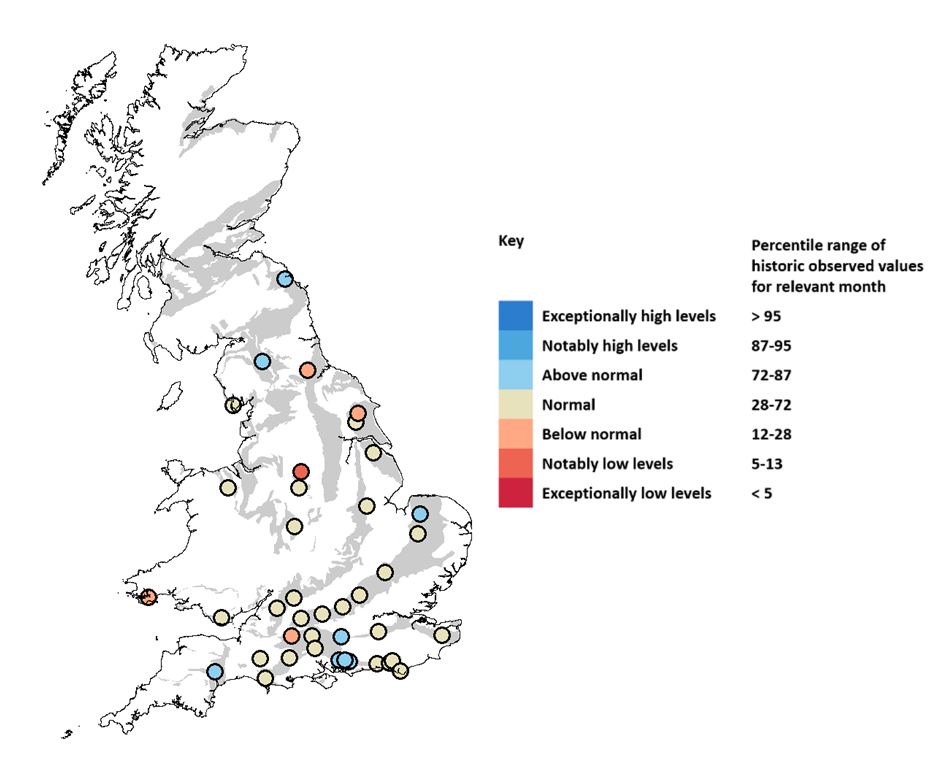

Example three-month groundwater level forecast for September to November 2021. BGS © UKRI.
The Hydrological Outlook UK reports the likely groundwater levels and river flows one month and three months ahead. At the BGS, we produce groundwater level forecasts for 48 different locations across the UK’s principal aquifers, the results from which are incorporated in the Hydrological Outlook UK website on a monthly basis. The sites are currently mainly located on the major aquifers of England, with a lower density of sites in Scotland, Wales and Northern Ireland. The models are driven using seasonal weather forecasts produced by the UK Met Office. We produce the Hydrological Outlook in partnership with:
- UK Centre for Ecology and Hydrology
- Environment Agency
- UK Met Office
- Scottish Environment Protection Agency
- Natural Resources Wales
- Department for Infrastructure, Northern Ireland
Groundwater Flood Forecasting Service
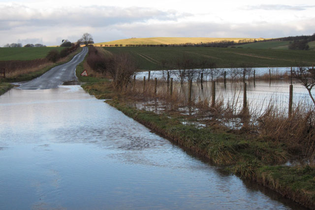
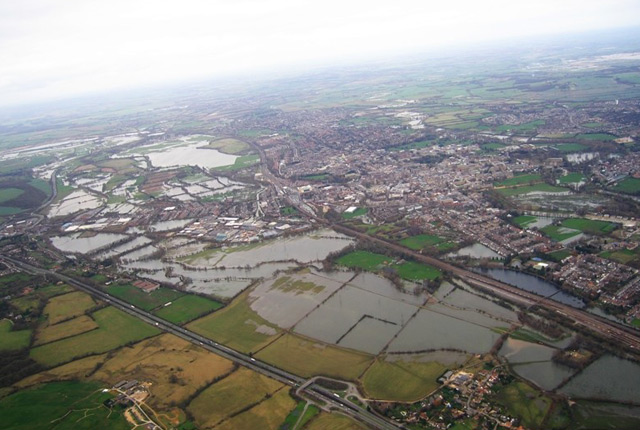
Groundwater flooding in Wiltshire during the exceptionally wet winter of 2013/14. BGS © UKRI.
We deliver a daily groundwater flood forecasting service to the Flood Forecasting Centre (FFC) for over 50 locations in England (principally, the Chalk Group and Jurassic limestones). The forecasts are updated on a daily basis using a combination of Numerical Weather Prediction and climatological forecasts to deliver probabilistic estimates of groundwater flood risk up to 30 days into the future. The forecasts feed into the FFC’s hydrometeorological service which supports the Category 1 and 2 emergency response community, the Environment Agency and Natural Resources Wales flood warnings and Met Office weather warning services for England and Wales.
Water situation forward look
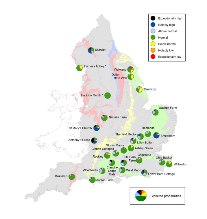
Example 12-month groundwater level forecast produced for the Environment Agency October 2021 water situation report.
We also produce up to 24-month probabilistic and scenario-based forecasts of groundwater levels for 30 indicator boreholes in England to assess the long-range trajectories of groundwater resource conditions under different climate scenarios. These forecasts are produced on a monthly basis and are published as part of the Environment Agency monthly water situation report.
Contact
If you want to discover more then please contact Jonathan Mackay.
Relative topics
You may also be interested in
Groundwater research
Addressing issues related to the sustainability of water resources and quality, and the effects of environmental change on the water cycle, natural hazards, and human health.
Groundwater extremes, climate change and resilience
We are researching groundwater extremes, the impacts of environmental and climate change on groundwater in the UK and internationally, and what this means for building a more resilient future for our water resources.