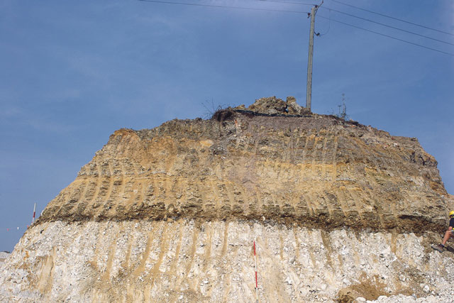
In the UK, geological maps traditionally have been attributed with lithostratigraphical map units. These maps are sometimes only of limited use for planning and engineering projects without significant supplementary information.
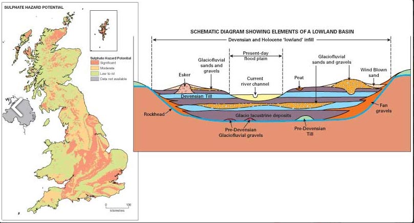

Example inset map and schematic diagram used to populate the marginalia
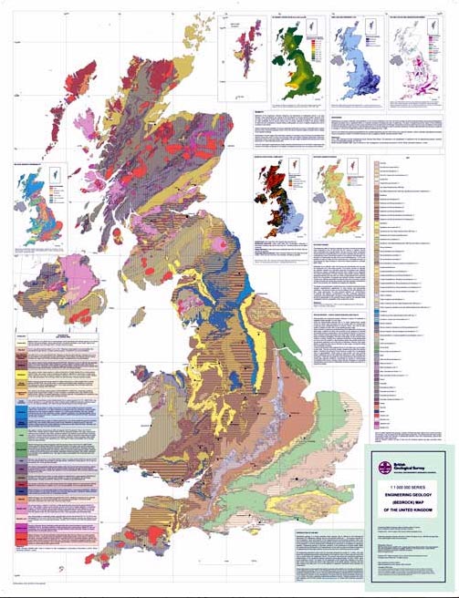
The Engineering Geology Bedrock Map of the UK
1:1 million-scale engineering geology maps of the UK
BGS has now produced two 1:1 million-scale engineering geological maps of the UK, one for bedrock and one for superficial deposits. These new maps are attributed with ‘engineering geological units’ in place of the traditional lithostratigraphical units.
In addition to the two map sheets, an extended key has also been produced. It includes a description of each engineering geological lithology and information on engineering considerations including foundations, excavatability, engineered fill and general ground investigation conditions.
The purpose of these maps is to present an overview of the engineering geology of the UK. They are not intended as a replacement for detailed site-specific desk studies or ground investigations. The maps may prove of particular use to those who are embarking on the study of engineering geology or who are in the early stages of their professional careers in civil or environmental engineering.
They also serve to raise the awareness of the impact that geology has on planning and development, and act as a reminder of the importance of engineering geology in reducing the risks associated with human interaction in the built and natural environment.
Further, more detailed information on geology, physical properties and geological hazards are available at:
- Boreholes (GeoRecords Plus+)
- BGS Civils (1:50 000 national maps of engineering properties)
- National Geotechnical Properties Database
- GeoReports
- BGS GeoSure
- Ground information for sustainable development (3D Geology)
- Shallow geohazards and risks
- Urban geoscience
Publications
BGS. 2011. Engineering Geology (Bedrock) Map of the United Kingdom. (Nottingham, UK: British Geological Survey.)
BGS. 2011. Engineering Geology (Superficial) Map of the United Kingdom. (Nottingham, UK: British Geological Survey.)
BGS. 2011. Extended key for the engineering geology maps of the United Kingdom. (Nottingham, UK: British Geological Survey.)
Culshaw, M G, Dobbs, M R, Reeves, H J, Northmore, K J, and Entwisle, D C. 2010. A tribute to Professor William Dearman: New small-scale engineering geological maps of the UK. 187–198 in Geologically Active: Proceedings of the 11th IAEG Congress. Williams, A L, Pinches, G M, Chin, C Y, McMorran, T J, and Massey, C I (editors). Auckland, New Zealand, 5–10 September 2010. (CRC Press.)
Dobbs, M R, Culshaw, M G, Northmore, K J, Reeves, H J, and Entwisle D C. 2012. Methodology for creating national engineering geological maps of the UK. Quarterly Journal of Engineering Geology and Hydrogeology, Vol. 45, 335–347. DOI: https://doi.org/10.1144/1470-9236/12-003
Dobbs, M, Reeves, H J, Northmore, K J, and Entwisle, D C. 2010. Engineering geology maps of the UK. Earthwise, Vol. 26, 50–51.
Relative topics
Engineering geology studies
Engineering geological studies of bedrock formations
Mapping the engineering geological characteristics, mineralogy, industrial applications, geological hazard potential, physical properties and behaviour of geological formations.
Gault Formation
The Gault Formation was deposited in the Cretaceous and crops out from East Anglia to west Dorset, and from north-east Kent to Sussex.
Lambeth Group
The Lambeth Group was deposited in the Palaeogene and underlies much of the city of London.
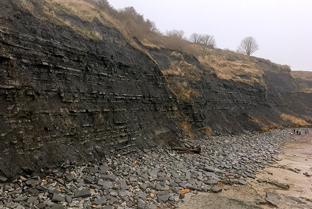
Lias Group
The Lias Group was deposited in the Late Triassic to early Jurassic and crops out in a band across England from Dorset to Yorkshire.
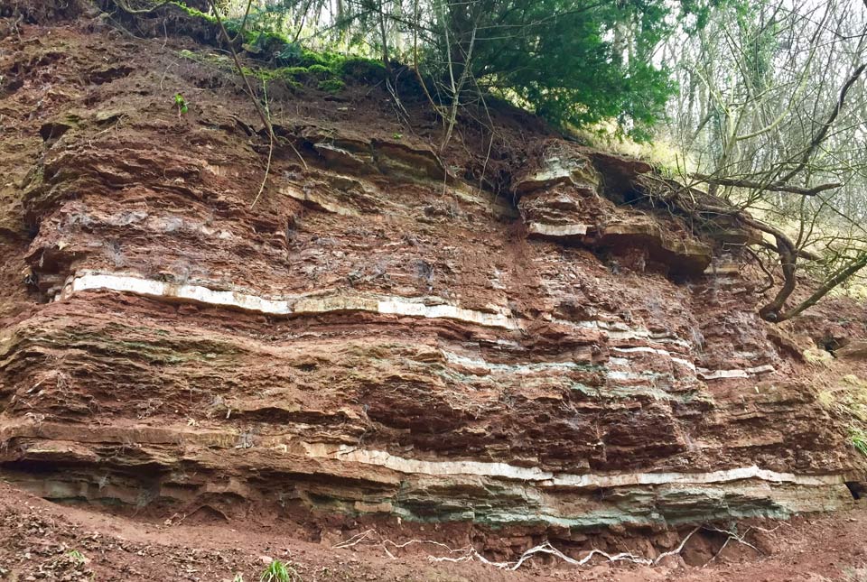
Mercia Mudstone Group
The Mercia Mudstone Group was deposited in the Triassic and underlies much of central and southern England.

Sherwood Sandstone Group
The Sherwood Sandstone Group was deposited in the Late Permian to Early Triassic and is present in many of the sedimentary basins in the UK.