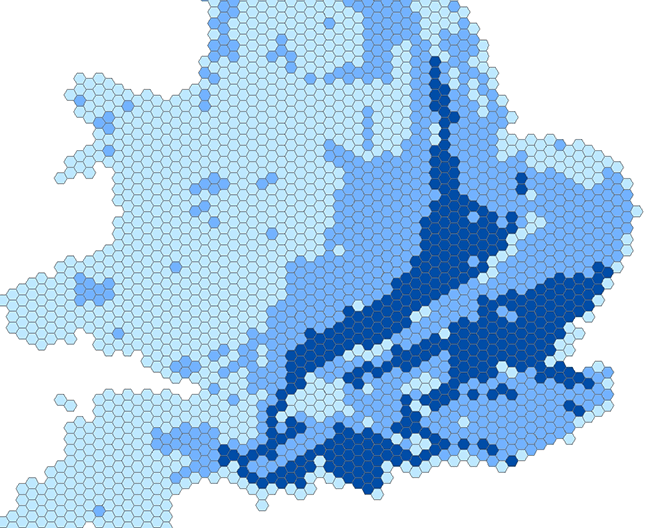

BGS GeoSure (5 km hex grid) coverage. BGS © UKRI – Contains OS data © Crown copyright 2020.
BGS GeoSure 5 km hex grid
- 5 km hex grid (approx. 1:5 000 000)
- Great Britain
- Open
The BGS GeoSure 5 km hex grid datasets provide a generalised overview of the susceptibility to six naturally occurring geohazards in Great Britain. The hexagon grid provides a national-scale summary of the GeoSure data product.
Supporting documents:
Key information
- Scale:
- 5 km hex grid (approx. 1:5 000 000)
- Coverage:
- Great Britain
- Availability:
- Open
- Price:
Free for commercial, research and public use under the Open Government Licence. Please acknowledge the material
- Format:
- GIS polygon data (ESRI).
- Uses:
- National-level use
- Themes:
- Engineering geology, Hazards
The BGS GeoSure 5 km hex grid datasets provide a generalised overview of the susceptibility to six naturally occurring geohazards in Great Britain. The hexagon grid provides a national-scale summary of the GeoSure data product. The detailed GeoSure dataset is also available to licence and provides further detail at a scale of 1:50 000.
The 5 km hex grid data has been generalised into a vector map of interlocking hexagon cells (a side length of 5 km), with an area approximately 65 km2. There are three classes included within the data: low, moderate and significant.
The six layers of data provided are as follows:
- BGS GeoSure: collapsible deposits
- BGS GeoSure: compressible ground
- BGS GeoSure: landslides
- BGS GeoSure: running sand
- BGS GeoSure: shrink–swell
- BGS GeoSure: soluble rocks
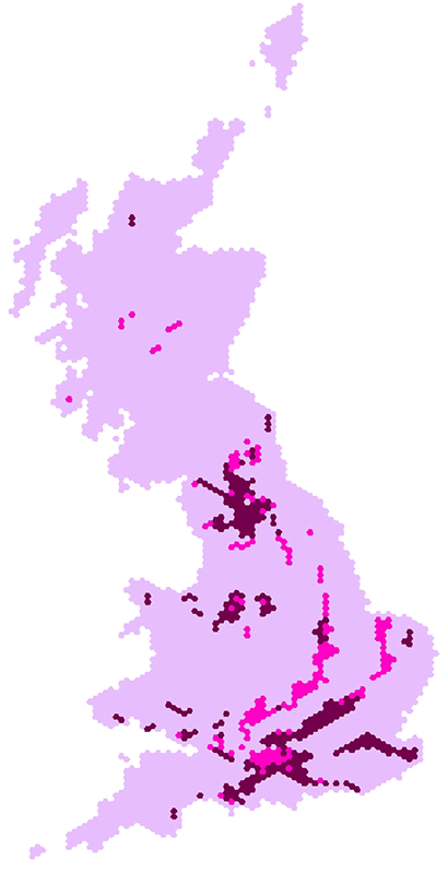
BGS GeoSure 5 km hex grid coverage (soluble rocks layer). BGS © UKRI – Contains OS data © Crown copyright 2020.
You may also be interested in

BGS GeoSure
The BGS GeoSure datasets identify areas of potential hazard and, therefore, potential natural ground movement, in Great Britain.