Geology sans frontières
Geology doesn’t stop at international borders, so BGS is working with neighbouring geological surveys and research institutes to solve common problems with the geology they share.
24/04/2025 By BGS Press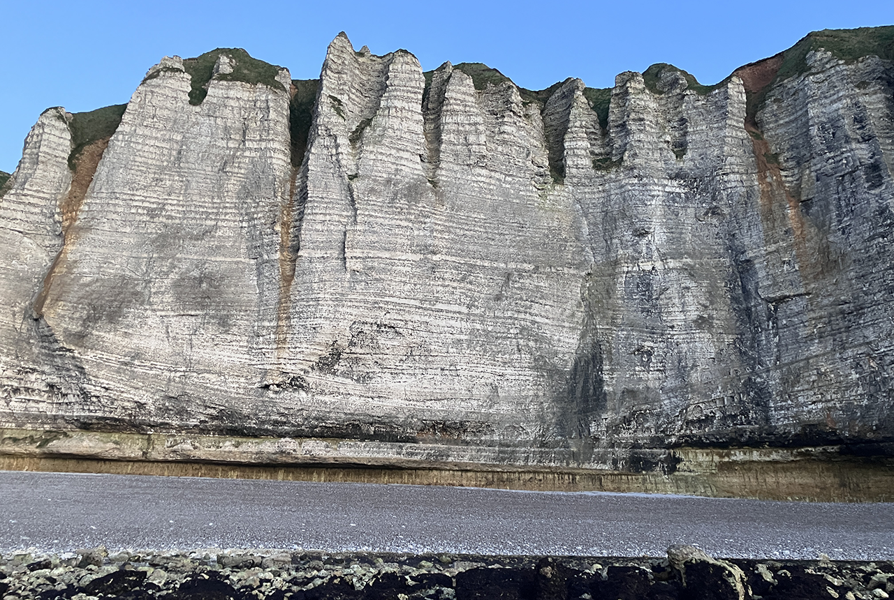

Chalk: a shared geology
The Upper Cretaceous-aged Chalk Group (commonly known as ‘the Chalk’) is perhaps Europe’s most iconic geological unit. Besides forming the famous white cliffs, the Chalk:
- is a major aquifer, supplying millions of people with drinking water and sustaining rare ecological habitats
- is important for energy as it hosts oil and gas reservoirs in the North Sea, provides the foundation for offshore wind farms and hosts numerous shallow geothermal-energy schemes
- has the potential act as storage for hydrogen and CO2
- is a raw material for cement
- hosts many major civil engineering and infrastructure schemes across northern Europe including, in the UK alone, the recently approved Lower Thames Crossing, HS2, the Channel Tunnel and the new ‘super sewer’, the Thames Tideway Tunnel in London
Yet the Chalk is also one of the most misunderstood geological units. It is a common misconception that it is a uniform rock unit with very little structure or faulting. In reality, it has significant variations in physical properties and is often faulted.
Recent geological mapping in the Chilterns and Yorkshire Wolds, undertaken by BGS in collaboration with the Environment Agency and water companies, has shown how geological discontinuities in the Chalk affect groundwater flow. These discontinuities facilitate the development of dissolutional conduits and rapid flow pathways, creating a very heterogenous aquifer. This heterogeneity generates major challenges for the water industry, civil engineers and planners.
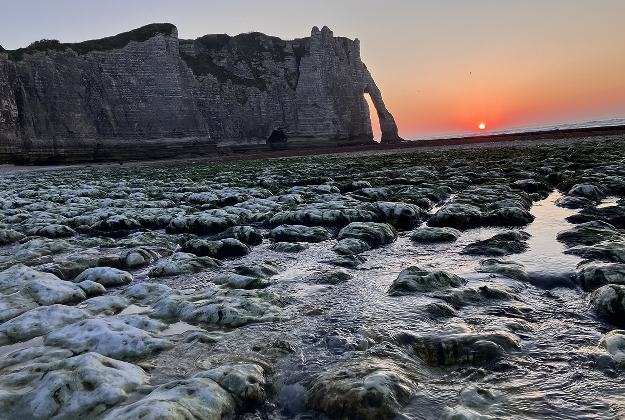
The sun setting behind the famous chalk arches at Étretat, France, with a significant karstic spring in the foreground. BGS © UKRI 2025.
As an aquifer, the Chalk is under pressure, both in terms of water quality and resource. The demand for water, especially in more populated areas of southeast England is increasing, but there is also a need to protect rare chalk stream habitats and maintain river flows. Climate change, drought and contaminants such as nitrate exacerbate the problem. Addressing these issues require a greater geological understanding of the aquifer and how groundwater flows it.
These challenges aren’t just restricted to the UK: France has similar problems in the extensive chalk outcrops across the north of the country, as do the Netherlands, Denmark and Belgium.
Current research
A good understanding of the Chalk Group is needed to better predict groundwater flow and engineering ground conditions. This requires good quality geological maps and 3D models fit for the 21st century, using all the available information including field data, geophysical borehole logs, geophysical surveys and biostratigraphical data. In the UK, geological maps used to show the Chalk Group with just three subdivisions; we now divide the chalk into nine individual mappable formations, reflecting their differing engineering and hydrogeological properties. These more detailed maps are able to show much more geological structure, and are more relavent to engineers and hydrogeologists.
Recent groundwater modelling in BGS work has focused on building the national scale British Groundwater Model, simulating groundwater flooding, and projecting the impact of climate change on chalk streams and public water supplies. Other geological surveys are also modelling groundwater, for example, to investigate the impacts of nitrate and other contaminants on the chalk aquifer.
Likewise, more detailed understanding of the Chalk Group has helped civil engineers better predict ground conditions on major infrastructure projects. For example, BGS maps and models help identify zones of weak faulted ground that might be an issue for tunnelling or road cuttings. Similarly, BGS helped characterise flint content in the Chalk in the Thames Estuary to help design cutting heads for the Lower Thames Crossing tunnel-boring machines. Lessons learned from major projects in the UK can be equally applied in northern France and vice versa.
Common problems: common solutions
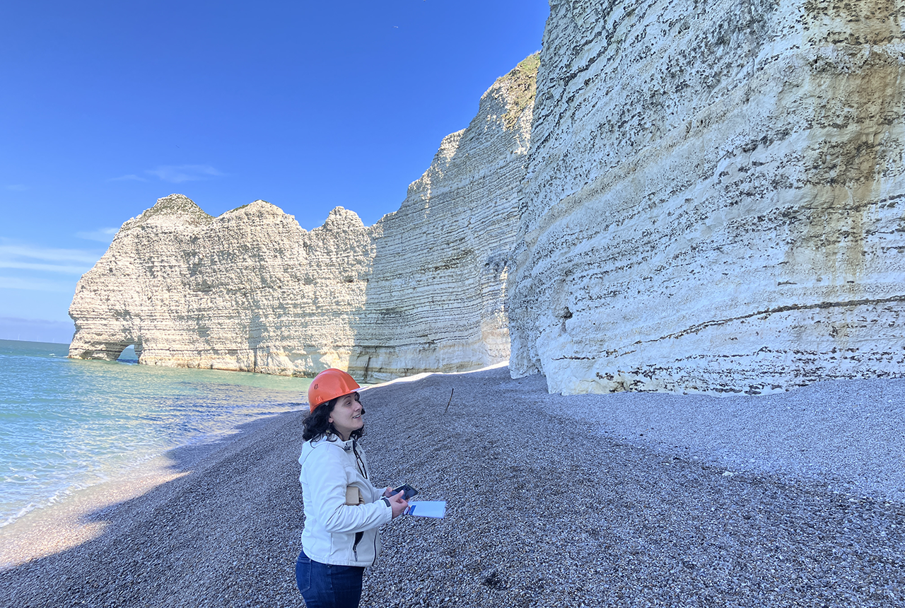
Dr Carole Nehme , University of Rouen examining the chalk cliffs at Étretat. BGS © UKRI 2025.
A key remit of geological surveys and research institutions is to work to find solutions to geological problems. BGS has teamed up with other northern European geological surveys and research institutes to discuss common interests in the Upper Cretaceous Chalk. Twenty-eight participants from 13 different research institutions and geological surveys, including geologists, hydrogeologists, biostratigraphers and engineering geologists, gathered for the inaugural EuroChalk workshop in the town of Étretat on the French coast. Étretat hosts spectacular chalk cliffs and rock arches made famous by the painter Claude Monet. These amazing outcrops admirably demonstrate how variations in the Chalk influence the local hydrogeology and cliff stability.
Outcomes
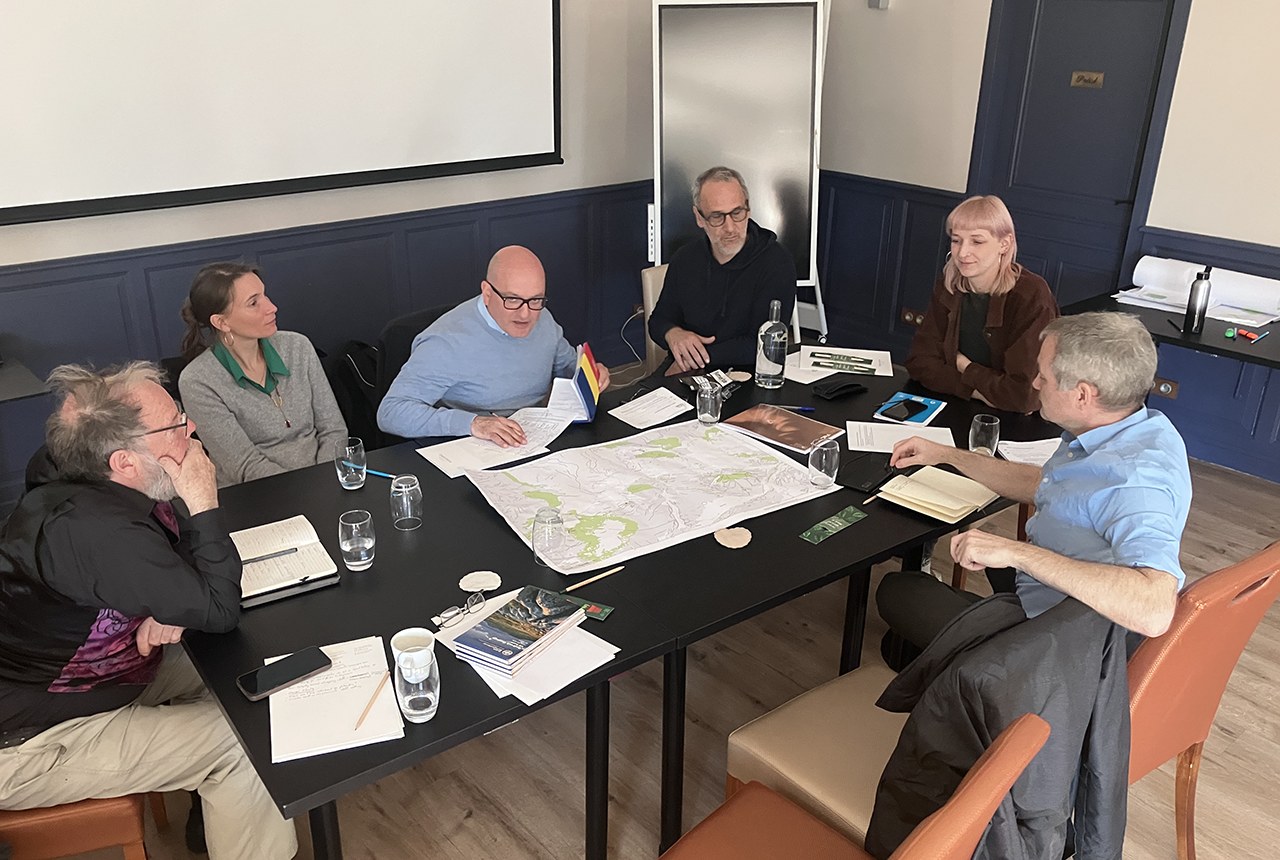
Participants at the workshop, including BGS, Imperial College London, BRGM, Institut Français du Pétrole (IFP) and University of Portsmouth. BGS © UKRI 2025.
Exactly how does the Chalk vary across northern Europe? Many productive discussions were had during the workshop and several common themes were identified. Key to understanding the variability of the chalk is the application of a unified Chalk Group stratigraphy, so variations and changes in rock properties across the Anglo–Paris basin can be better understood and predicted.
Another area of common interest is the development of karst features in the chalk such as sinkholes, dissolution pipes, caves and dissolutional conduits. These are important not only from a hydrogeological perspective, but also as an engineering hazard. The French geological survey, BRGM, has been leading the way here, undertaking numerous tracer tests and identifying sinkholes across Normandy. A similar approach is being taken by BGS, learning from the French.
A third area of interest is incorporating lithological variability and karst into groundwater models. At present, many groundwater models treat the Chalk as a single porous medium, often modelled as just one or two layers. This ignores much of the complexity within the group. Much discussion was had on how to best approach modelling groundwater in the Chalk at a range of scales.
Next steps
This first meeting generated a huge amount of interest and enthusiasm. The next steps are to translate this into concrete actions. Essential to this is identifying potential funding sources for common projects, such as stratigraphical correlations across the Anglo–Paris basin. A special issue on Chalk Group stratigraphy in a relevant journal is another possibility.
Another workshop is being planned for 2026, either in Maastricht or in south-east England.
Thanks
Thanks to Ophélie Faÿ (University of Mons) and Eric Lasseur (BRGM) for organising the event.
About the author
Dr Andrew Farrant is a geologist and karst geomorphologist based at the BGS. He is the Regional Geologist for Southeast England and has extensive experience mapping the Chalk across southern and eastern England.
Relative topics
Related news

Ukraine and the UK strengthen their commitment to geological cooperation
10/06/2026
A new Memorandum of Understanding reaffirms the UK’s support of Ukraine’s ambitions to develop its critical mineral resources, paving the way for collaboration through capacity-building programmes.

International science consortium to survey the health, economic value and social importance of Lake Victoria
22/05/2026
The project will replicate the 1927 survey to assess changes in the lake’s health, economic value and social importance.

New geological maps of Berwick-upon-Tweed to help future-proof natural water supply
20/05/2026
Scientists have mapped the geology under the town to better understand the groundwater system to inform decisions around abstraction.

BGS contributes to UN sand and sustainability report
19/05/2026
The new report highlights the impact of poor governance and unsustainable sand mining practices, calling on policymakers to take action.
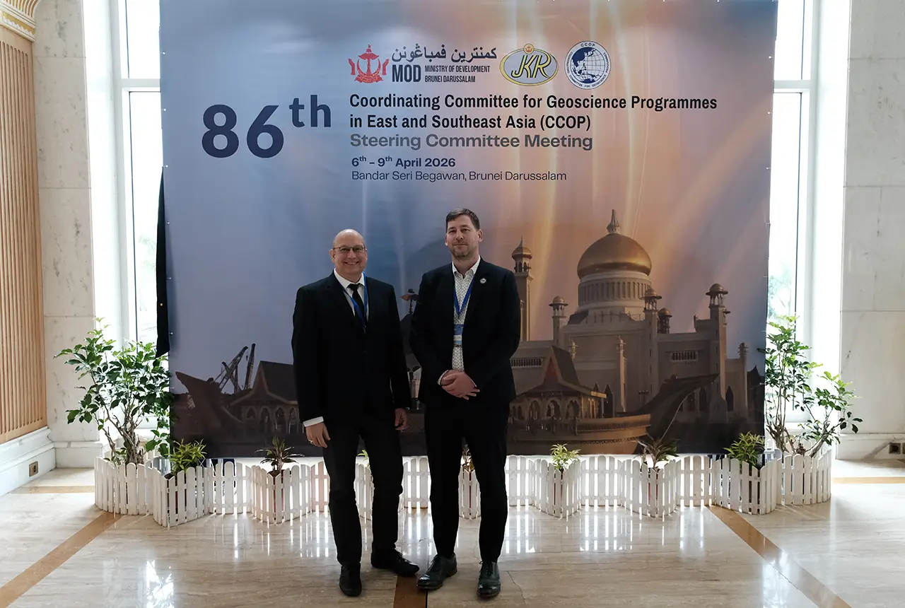
BGS engineering geologist elected to CCOP
29/04/2026
Marcus Dobbs has been elected as vice-chair of the advisory group for the Coordinating Committee for Geoscience Programmes in East and Southeast Asia.

Strengthening capacity through partnership: a critical minerals perspective
28/04/2026
BGS has been working in partnership with the Geological Survey Department of Zambia (GSD) to build national capacity, improve data accessibility and support long-term, sustainable development.

Updated geological assessment of the Southern North Sea set to underpin future offshore infrastructure development
25/03/2026
The first regional assessment for 30 years will support offshore marine and subsurface planning for the UK’s low-carbon energy infrastructure, including the 2030 target of 45 to 50 GW generated through offshore wind.

New research could help provide a more reliable water supply for millions in rural Africa
24/03/2026
A new BGS-led study has revealed crucial insights into the longstanding challenges affecting the reliability and performance of rural water supply infrastructure in sub-Saharan Africa.

Map of BGS BritPits showing the distribution of worked mineral commodities across the country
18/02/2026
BGS’s data scientists have generated a summary map of the most commonly extracted mineral commodities by local authority area, demonstrating the diverse nature of British mineral resources.

New UK/Chile partnership prioritises sustainable practices around critical raw materials
09/02/2026
BGS and Chile’s Servicio Nacional de Geología y Minería have signed a bilateral scientific partnership to support research into critical raw materials and sustainable practices.

Extensive freshened water confirmed beneath the ocean floor off the coast of New England for the first time
09/02/2026
BGS is part of the international team that has discovered the first detailed evidence of long-suspected, hidden, freshwater aquifers.

Can sandstones under the North Sea unlock the UK’s carbon storage potential?
02/02/2026
For the UK to reach its ambitious target of storing 170 million tonnes of carbon dioxide per year by 2050, it will need to look beyond the current well-studied geographical areas.