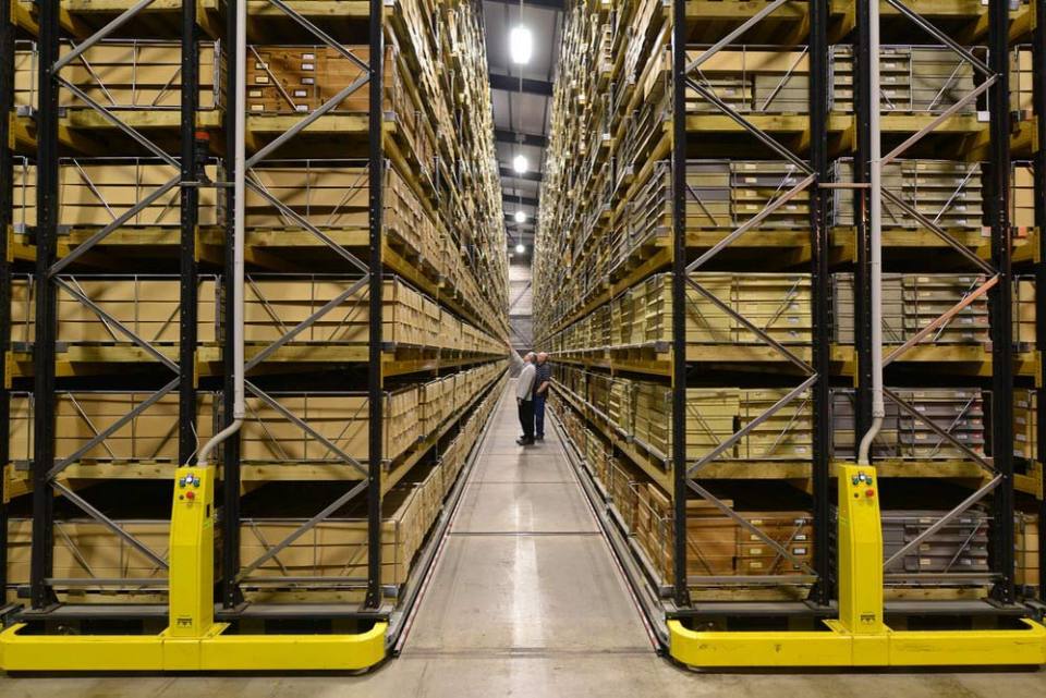
We offer a variety of services and products for the general public, available online and in our on-site shop at our headquarters in Keyworth, including:
- reports
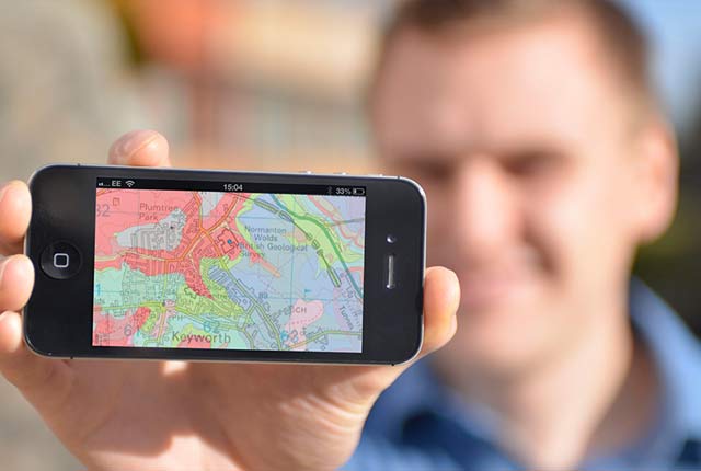
- geological maps in digital and printed versions
- books
- posters and guides
- mobile applications


BGS offers a variety of services and products for the general public, including reports, maps, books and mobile applications. ©iStock.com/Dmytro Varavin.
Services for homeowners
We have a range of information available to help your home-buying process, such as geological assessments, ground stability (subsidence) reports and radon risk reports. We can also provide natural ground-stability condition reports, including information about collapsible ground, compressible ground, dissolution, landslide, running sand and swelling clay.
Through GeoReports you can have cost-effective access to unique sources of published and unpublished geological data, combined with expert advice from BGS scientists. If you are interested in ground conditions for drilling, investigation or house purchase or if you are concerned about any other specific hazard, then GeoReports can help you.
Radon protection reports
Radon is a natural radioactive gas that enters buildings from the ground and can cause lung cancer. If you are buying, building or extending a home, then you need to know about radon, and there are several reports available for you, including:
- radon protective measures for new builds and extensions: reports, occurrence and risks
- radon in workplaces
Homes with addresses including postcodes
If the home has a full postal address including a postcode then you can obtain a Radon Risk Report (£3+VAT) online from UKradon
This report will tell you if the home is in a radon affected area, which you need to know if buying or living in it, and if you need to install radon protective measures, if you are planning to extend it.
Homes with addresses not including postcodes
If you are building a new home then you are unlikely to have a full postal address for it.
You can obtain a report from GeoReports service, located using grid references or site plans, which will tell you whether you need to install radon protective measures when building the home.
More information
For further information about radon affected areas and radon protective measures see Radon data: radon potential dataset.
BGS GeoSure
The BGS GeoSure datasets identify areas of potential natural ground movement and therefore potential hazard in Great Britain. This data has been produced by our geologists and geotechnical specialists and is presented as six GIS data layers related to the geohazard.
BGS Shop
We have an online shop.
Need more information?
Find out more about our research
Our data and services
The BGS offers a range of services and information for businesses, home-owners, policymakers and the general public.
OpenGeoscience
Accessing maps and downloading data, scans, photos and other information via BGS’s free OpenGeoscience service.
Related news

New NERC-funded project empowers young people to engage with environmental science
23/07/2026
BGS is part of a new, collaborative project, funded through NERC’s ‘Opening up the environment’ programme, helping the environmental research community become more accessible.

Geo-Explorers – after-school kids’ clubs
Event from 07/09/2026 to 07/12/2026
An after school club for junior geology enthusiasts

Building Europe’s geological future
20/07/2026
BGS scientists are contributing to a continent-wide initiative that is strengthening collaboration across borders to tackle shared subsurface challenges and unlock new opportunities.

Delving deep into mountains for future water security
16/07/2026
A BGS-led project is using new water-tracing investigation methods, geophysics and modelling to understand how water moves from mountains to the lowlands, helping to improve water security for billions of people.

Collecting beach pebbles: fun hobby but is it legal?
14/07/2026
The UK coastline will be inundated with keen holidaymakers this summer, many of whom will take a memento of their trip home in the shape of a pebble or two — but is it legal?

Updated national 3D model will determine the depth to the solid bedrock beneath our feet
13/07/2026
The BGS Superficial Deposit Thickness Model now includes an elevation model of geological rockhead for the first time, providing important data for civil engineers, geoscientists and environmental scientists.

UK’s world-class research organisations launch new collective
10/07/2026
The launch of the National Research Organisations Group brings together more than 100 science leaders to provide an authorativive voice on science, research policy and long-term investment.

Cheshire Geoenergy Observatory releases key geological datasets for UK thermal energy storage scheme design
09/07/2026
A new report and data packs from BGS will provide a unique resource for scientists working on the geology and hydrogeology of the Sherwood Sandstone Formation, an important aquifer and reservoir rock.

New geological mapping underway to help manage flooding along the River Tweed
08/07/2026
Scientists are surveying the Tweed catchment for the first time in over 100 years to enhance understanding of localised groundwater and improve flood forecasting.

Geological research in North Sea helping to safeguard subsea cables
06/07/2026
Subsea power and telecommunications cables are critical to the UK’s energy infrastructure and global connectivity, yet they remain vulnerable to damage from ship anchors, fishing activity and natural hazards.

UK Critical Minerals Intelligence Centre makes recommendations for the next UK criticality assessment
01/07/2026
CMIC has outlined the enhancements made to the next assessment update to ensure it is better tailored to the structure of the UK economy.

From archive to discovery: historical mineral reports support gold exploration in Scotland
25/06/2026
Digitised geological records show potential to unlock untapped mineral resources in Ardlochan, Argyllshire.