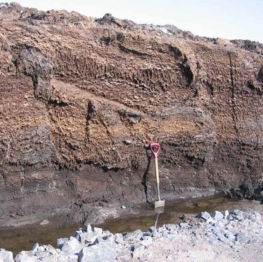

Peat compressible ground BGS © UKRI
BGS GeoSure: compressible ground
- 1:50 000
- Great Britain
- Premium
The potential for compressible ground to be a hazard has been assessed using 1:50 000-scale digital maps of superficial and bedrock deposits.
Supporting documents:
Key information
- Scale:
- 1:50 000
- Coverage:
- Great Britain
- Availability:
- Premium
- Price:
£0.23 per km2. Subject to number of users, licence fee and data preparation fee.
- Format:
- GIS polygon data (ESRI, MapInfo, others available by request)
- Uses:
- Local-level use
- Themes:
- Engineering geology, Hazards
Some types of ground may contain layers of very soft materials like clay or peat. These may compress if loaded by overlying structures or if the groundwater level changes, potentially resulting in depression of the ground and disturbance of foundations.
Ground is compressible if an applied load, such as a house, causes the fluid in the pore space between its solid components to be squeezed out, causing it to decrease rapidly in thickness (compress). Peat, alluvium and laminated clays are common types of deposits associated with various degrees of compressibility. The deformation of the ground is usually a one-way process that occurs during or soon after construction.
If the ground is extremely compressible, the building may sink below the surface of the surrounding ground or relative to adjacent structures that apply lesser or greater loads to the ground. If the compressible ground is not uniform, different parts of the building will sink at different rates or by different amounts (differential settlement).
A property affected by compressible ground may experience the following problems:
- structural damage to foundations and to the fabric of the building
- service connections to water, gas and electricity supplies may become strained or break
- cracks in the walls, floors or ceilings of a building
- tilting of walls or buildings
- cracks at the junction of a building and associated structures
The potential for compressible ground to be a hazard has been assessed using 1:50 000-scale digital maps of superficial and bedrock deposits. These have been combined with information from the BGS superficial thickness dataset and scientific and engineering reports. The detailed digital data illustrated in the map is available as attributed vector polygons, as raster grids and in spreadsheet format.
You may also be interested in


BGS GeoSure
The BGS GeoSure datasets identify areas of potential hazard and, therefore, potential natural ground movement, in Great Britain.
Compressible ground: property hazard information
If compressible ground appears to be a problem on or near your property, inform your insurance company, mortgage lender or landlord.