Relative topics
17 results for "offshore"

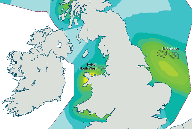
Updated geological assessment of the Southern North Sea set to underpin future offshore infrastructure development
The first regional assessment for 30 years will support offshore marine and subsurface planning for the UK’s low-carbon energy infrastructure, including the 2030 target of 45 to 50 GW generated through offshore wind.

Quaternary UK offshore data digitised for the first time
The offshore wind industry will be boosted by the digitisation of a dataset showing the Quaternary geology at the seabed and the UK’s shallow subsurface.

Extended seabed geology map of the Bristol Channel published
BGS has released significantly extended high-resolution maps that will support offshore green-energy initiatives in the area.

IODP³-NSF Expedition 501: successful offshore operations launches onshore phase
Scientists have managed to take water and sediment samples from beneath the ocean on the New England Shelf for the first time, with the intention of understanding this offshore aquifer system.
New hazard maps set to help safeguard UK offshore energy industry
Essential geological model detailing seismic hazard published as the pursuit of new renewable energy infrastructure intensifies.
National Hydrocarbons Data Archive files now accessible through the National Data Repository
Offshore well and survey information held within BGS’s archive have now been transferred to the North Sea Transition Authority’s National Data Repository to enable greater access.
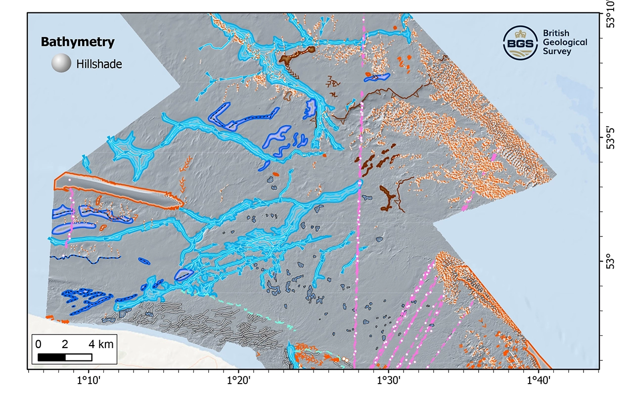
New research reveals the secrets of the seabed off the East Anglian coast
New geological map will help in the hunt for new renewable energy opportunities whilst protecting delicate marine ecosystems.
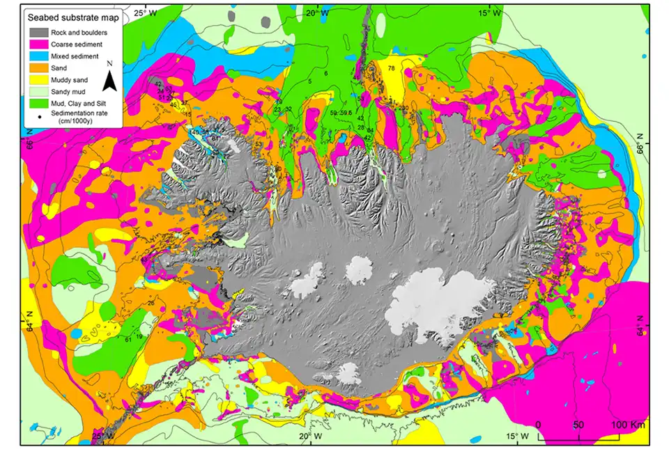
BGS awarded research grant to support potential offshore wind development in Iceland
BGS has been awarded the NERC-Arctic grant for a collaboration project with Iceland GeoSurvey.