The primary test study for monitoring contaminated land remediation using 4D ALERT technology was the Contaminated Land: Assessment of Remediation by Electrical Tomography (CLARET) project. This was undertaken from November 2007 to January 2009 and was funded by a grant from the Technology Strategy Board (project TP/5/CON/6/I/H0048B) and contributions from a consortium partnership comprising:
- VHE Construction PLC
- BGS
- Interkonsult Ltd
- South Kesteven District Council
Aims and objectives
Traditional intrusive sampling can only test statistically small volumes of ground, therefore assessing the effectiveness of remediation techniques with certainty can be difficult and time-consuming. Time-lapse geoelectrical imaging can act as a surrogate monitoring technology for tracking and visualising changes in contaminant concentrations, whether through natural processes or active remediation. When combined with intrusive sampling calibration, it has the potential to produce easily visualised, volumetric, time-dependent (4D) maps of contaminant distributions.
Remediation monitoring
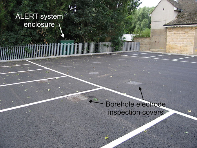

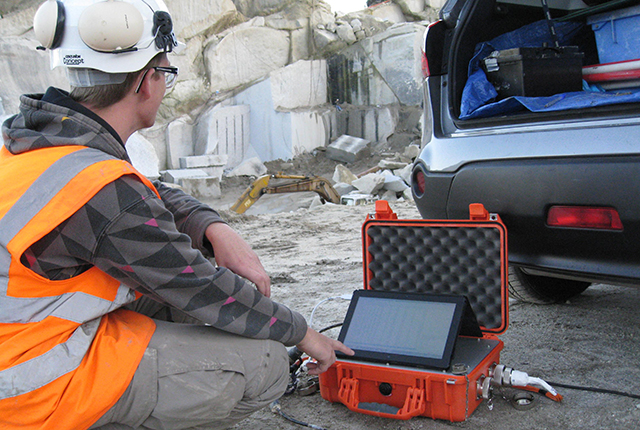
ALERT system and borehole electrode network.
The project test site was a municipal car park on the site of a former gasworks in Stamford, Lincolnshire. The site had been polluted by a range of polyaromatic hydrocarbons and dissolved-phase contaminants and was designated statutory contaminated land under Part IIA of the Environmental Protection Act due to the risk of polluting an underlying minor aquifer.
An ALERT system with a wireless communications link was installed on site, with 224 electrodes in 14 vertical boreholes drilled to depths of 8 m below ground level. The arrays were arranged along two boundaries of the site, bordering a river and privately owned land. The aim of the installation was to monitor changes in groundwater quality following the completion of a remediation programme.
Monitoring took place for a period of just over one year, during which time no geoelectrical evidence of remnant pollution migration was detected. The average resistivity of the minor aquifer exhibited a steady increase in resistivity for the first six months, after which it remained approximately constant.
In the absence of seasonal changes due to temperature or infiltration, it was concluded that the increase in resistivity was likely to be due to an improvement in the quality of groundwater, i.e. a decrease in dissolved contaminants.
Tracer test (natural attenuation) visualisation and monitoring
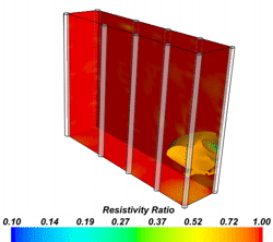
Dilution and dispersal of a saline tracer.
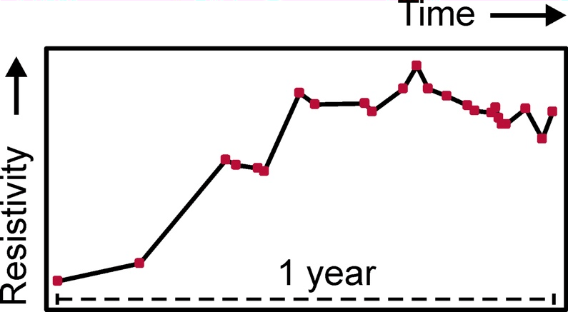
Change of minor aquifer resistivity following remediation.
A tracer test was undertaken to investigate the groundwater flow direction and speed and to demonstrate the ability of ALERT to directly visualise natural attenuation processes (and by inference, other remediation processes).
A saline tracer was introduced into the minor aquifer and its dilution and dispersal were mapped at high spatial and temporal resolutions (25 cm and 4 hours respectively). The tracer test confirmed that no new pollution pathways were created during the installation of the borehole electrode arrays, while the directly observed dispersal of the tracer enabled the calculation of the groundwater seepage velocity, which was found to be in excellent agreement with estimated values.
The monitoring concepts used to study the natural attenuation at this site are easily transferable to monitor other contamination remediation practices.
Contact
If you want to discover more please contact Paul Wilkinson or Jonathan Chambers, or you can download our Contaminated Land ALERT flyer.
You may also be interested in

Waste management ALERT project
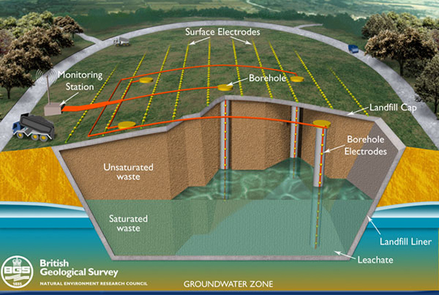
Thw Waste Management ALERT project aims to develop a non-invasive, 4D, electrical imaging system for automated time-lapse monitoring of landfill sites.
Applications
Applications range from mineral exploration and waste management, to monitoring active processes within the subsurface, such as the movement of pollutants, or the flow of groundwater in unstable slopes affecting infrastructure.