Scientists produce first record of environmental data off coast of Hawai’i
An international team of researchers, including BGS geoscientists, have succeeded in acquiring a continuous record of environmental data using fossilised coral from Hawai’i.
01/03/2024 By BGS Press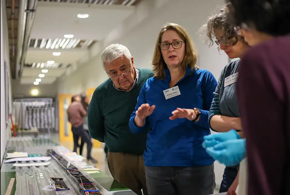

The two-month long International Ocean Discovery Programme (IODP) Expedition 389: Hawai’ian drowned reefs, managed by a team from BGS, aimed to get a better understanding of sea-level changes by recovering samples of fossilised coral reefs. A total of 29 scientists from across the world participated in the expedition, with 10 scientists on board the MMA Valour, which set sail from Honolulu, Hawai’i, on 31 August 2023.
A total of 426 m of core was recovered from below the seabed at water depths from 130 to 1240 m. The core has now been opened, analysed and sampled by the scientific team, following almost a month of intensive work at the University of Bremen during February 2024.
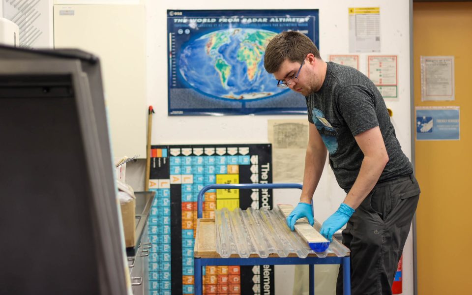
Andrew McIntyre (University of Leicester) loading a core into the high-resolution core imager. Marley Parker @ ECORD/IODP.
The next phase of the research will involve scientists using cutting-edge methods in their laboratories to extract information about sea level and climate change from these tremendously important, high-resolution archives. The ability to look back at Earth’s history will provide valuable insights into the mechanisms that cause climate change, including abrupt events, and the impact of these changes on reef growth and health.

We are extremely proud to have coordinated this expedition with our UK and international partners, and to have successfully recovered high-resolution records of sea level and environmental changes over the last few hundred thousand years. Our team is now supporting the international science party to initially analyse the cores and create foundational datasets to support research on this important topic for many years to come.
David McInroy, BGS Marine Geoscientist.
About the expedition
The expedition is conducted by the European Consortium for Ocean Research Drilling (ECORD) as part of the International Ocean Discovery Program (IODP). IODP is a publicly funded, international marine research programme, supported by 21 countries, which explores Earth’s history and dynamics recorded in seabed sediments and rocks, and monitors sub-seabed environments. Through multiple platforms — a feature unique to IODP — scientists sample the deep biosphere and sub-seabed ocean to study environmental change, processes and effects, and solid-Earth cycles and dynamics.
More information
Relative topics
Related news

Updated geological assessment of the Southern North Sea set to underpin future offshore infrastructure development
25/03/2026
The first regional assessment for 30 years will support offshore marine and subsurface planning for the UK’s low-carbon energy infrastructure, including the 2030 target of 45 to 50 GW generated through offshore wind.

New research could help provide a more reliable water supply for millions in rural Africa
24/03/2026
A new BGS-led study has revealed crucial insights into the longstanding challenges affecting the reliability and performance of rural water supply infrastructure in sub-Saharan Africa.

UK Critical Minerals Intelligence Centre 2026 showcase
Event on 31/03/2026
Join us for a special live webinar with the team from the Critical Minerals Intelligence Centre showcasing the latest research from 2026 on copper, the future of digital, and what’s next for the criticality assessment.

PhD adventures in Copenhagen, Denmark: revealing past recovery processes of tropical forest systems through ancient environmental DNA
12/03/2026
PhD student Chris Bengt visited the University of Copenhagen to carry out very delicate extraction of aeDNA from lake-sediment cores, in the hopes of unlocking the secrets of past volcanic eruptions.

Call for new members and Chair to join the NERC facilities steering committees
25/02/2026
New members are needed to join the committees over the next four years.

Your views wanted: developing a geothermal energy subsurface data portfolio
24/02/2026
BGS is aiming to support the growth of the sector by providing the best-available, location-specific geothermal and ground source heat information as an accessible product or service.

Map of BGS BritPits showing the distribution of worked mineral commodities across the country
18/02/2026
BGS’s data scientists have generated a summary map of the most commonly extracted mineral commodities by local authority area, demonstrating the diverse nature of British mineral resources.

MARC Conference 2025: highlighting the importance of conferences to PhD students
16/02/2026
BGS and University of Nottingham PhD student Paulina Baranowska shares her experience presenting her research on nuclear forensics at her first international conference.

Funding awarded to map the stocks and flows of technology metals in everyday electronic devices
12/02/2026
A new BGS project has been awarded Circular Electricals funding from Material Focus to investigate the use of technology metals in everyday electrical items.

New UK/Chile partnership prioritises sustainable practices around critical raw materials
09/02/2026
BGS and Chile’s Servicio Nacional de Geología y Minería have signed a bilateral scientific partnership to support research into critical raw materials and sustainable practices.

Extensive freshened water confirmed beneath the ocean floor off the coast of New England for the first time
09/02/2026
BGS is part of the international team that has discovered the first detailed evidence of long-suspected, hidden, freshwater aquifers.

Funding secured to help mitigate ground risk in UK construction sector
05/02/2026
The BGS Common Ground project has been awarded new funding to help unlock the value of ground investigation data.