Property subsidence assessment: helping to mitigate shrink–swell hazard risk
The BGS Property Subsidence Assessment dataset provides insurers and homeowners with tools to better understand shrink–swell and the risk it poses to homes and businesses.
25/01/2023

Shrink–swell in clay soils is a major geohazard in the UK and costs the economy over £400 million a year. This is predicted to rise to over £600 million by 2050, due to climate change-driven weather extremes (Harrison et al., 2012). Research predicts a 50 per cent increase in shrink–swell subsidence events across Europe by 2040 (Swiss Re, 2011).
Many towns, cities and major infrastructure corridors in the UK are founded on clay-rich soils, especially in the south-east, including most of London. Volume change of clay minerals within these soils is the primary cause of shrink–swell and is controlled by mineralogy, temperature and rainfall. As such, some areas of the UK are more susceptible than others, depending on their underlying geology and regional climate (Jones and Jefferson, 2012; Jones et al., 2020).
Between January and June 2022, the UK experienced the driest weather in over 40 years, culminating with the hottest days on record in July when temperatures exceeded 40°C for the first time. These unprecedented hot, dry conditions will have resulted in levels of clay shrinkage never previously experienced in the UK and significant rainfall will be necessary to promote their recovery.
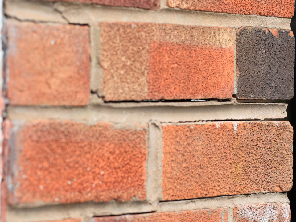
Subsidence damage to UK properties. © nsj-images via Getty Images Signature.
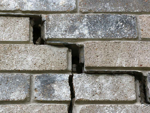
Subsidence damage to UK properties. © Trigem777 via Getty Images.
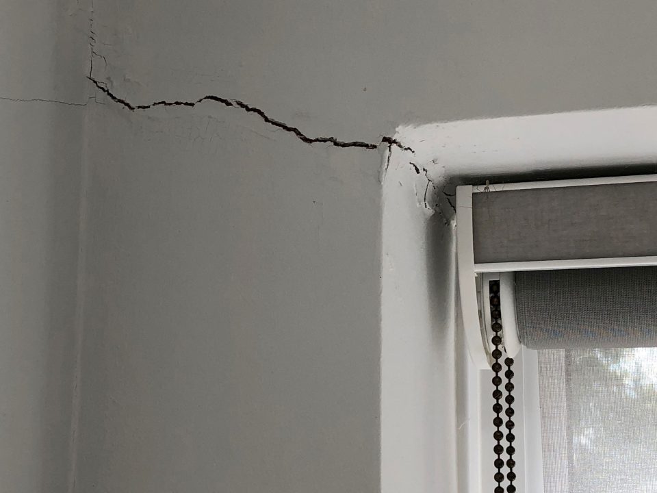
Subsidence damage to UK properties. Deborah Rayner, BGS © UKRI.
The BGS Property Subsidence Assessment dataset
The identification of shrink–swell-related subsidence-prone buildings, alongside the inclusion of potential additional factors that could exacerbate this phenomenon, can better inform insurers and homeowners and form the basis to make decisions concerning prevention and remediation.
The BGS Property Subsidence Assessment (PSA) dataset provides insurers and homeowners access to a better understanding of the shrink–swell hazard at both the individual property and postcode level for England and Wales. It builds upon the BGS GeoSure shrink–swell data, which highlights the susceptibility of the local geology to shrink and swell, by mapping the hazard to the individual building polygon and considering the following additional susceptibility or influencing factors.
Building type and number of storeys
Building type and height influence the potential extent of structural damage, should movement occur. Damage to a structure is possible when as little three per cent volume expansion takes place, especially when these movements are unevenly distributed beneath a foundation or property.
Building age
Due to changes in foundation design and building regulations, the age of a property gives an indication of the potential foundation depth likely to be associated with the building and how that could be affected by shrink–swell.
Drainage
Building practice changed from the use of clay to plastic pipes in 1950. Clay pipes have a higher propensity to crack as a result of shrink–swell and resulting ground movement and therefore exacerbate possible movement in the vicinity of any cracks and leaks.
Tree proximity
Many subsidence insurance claims are linked to tree damage. Damage may occur as tree roots take up water from the soil, causing the ground to dry out and shrink, resulting in uneven settlement. This occurs predominately during the spring and summer months. Areas with many older houses and old-style shallow foundations can be seriously affected.
Using the dataset
PSA users receive GIS building polygons with an overall susceptibility to subsidence score between 1 and 100, with one being lowest susceptibility. Scores are also grouped into five classes, ranging from ’non-plastic’, indicating the absence of plastic clays (therefore the lowest susceptibility), to ‘very high’. Each building polygon is also scored from 1 to 10 for each of the individual subsidence factors, so users can identify the potential main causes of subsidence.
Postcode data is available as a table showing the generalised PSA score for all the buildings within each postcode.
More information
Please visit the BGS PSA data product web page for more details and the data user guide. Keep an eye out for our upcoming blog on the full suite of BGS shrink–swell subsidence data products for an overview of all the subsidence solutions BGS has to offer and how these can be best used together.
References
Harrison, A M, Plim, J F M, Harrison, M, Jones, L D, and Culshaw, M G. 2012. The relationship between shrink–swell occurrence and climate in south-east England. Proceedings of the Geologists’ Association, Vol. 123(4), 556–575. DOI: https://doi.org/10.1016/j.pgeola.2012.05.002
Jones, L D, and Jefferson, I. 20212. Expansive soils. 413–441 in ICE manual of geotechnical engineering. Volume 1, geotechnical engineering principles, problematic soils and site investigation. Burland, J, Chapman, T, Skinner, H and Brown, M (editors). (London, UK: ICE Publishing.)
Jones, L, Banks, V, and Jefferson, I. 2020. Swelling and shrinking soils. Engineering Geology Special Publications, Vol. 29, 223–242. (London, UK: Geological Society.) DOI: https://doi.org/10.1144/EGSP29.8
Swiss Re. 2011. The hidden risks of climate change: an increase in property damage from soil subsidence in Europe. (Zurich, Switzerland: Swiss Reinsurance Company Ltd.)
Relative topics
About the author

Luke Bateson
Acting head of shallow geohazards and Earth observation; head of geodesy and remote sensing (Keyworth)