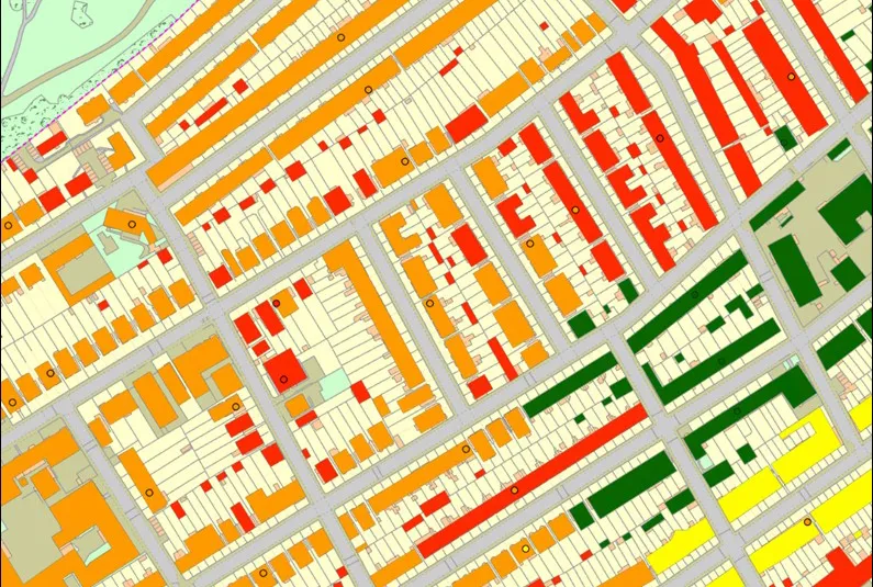

BGS property subsidence assessment — buildings sample. BGS © UKRI. Contains Ordnance Survey data © Crown Copyright and database rights 2024. Ordnance Survey Licence No. AC0000824781
Property subsidence assessment
- PSA buildings: 1:50 000; PSA postcodes
- Great Britain
- via BGS Data Resellers
The BGS property subsidence assessment dataset uses a combination of geology, tree location and property (including age, drainage, building type and number of storeys) information to provide property- and postcode-specific information on susceptibility to shrink-swell subsidence across Great Britain.
Supporting documents
Key information
- Scale:
- PSA buildings: 1:50 000; PSA postcodes
- Coverage:
- Great Britain
- Availability:
- via BGS Data Resellers
- Price:
Contact BGS Data resellers
- Format:
- PSA Buildings: GIS polygon data (ESRI, others available by request) PSA Postcode: GIS point data (ESRI, others available by request) Database csv tables
- Uses:
- Local-level use
- Themes:
- Built environment, Hazards
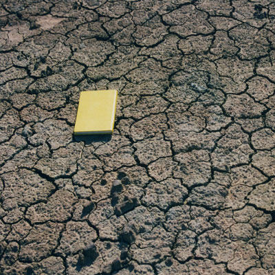
Subsidence hazards as a result of shrink–swell clay soils, inadequate foundation structures and tree presence/proximity, may lead to financial loss for anyone involved in the ownership or management of property, including developers, householders or local government. These costs could include increased insurance premiums, depressed house prices and, in some cases, require engineering works to stabilise land or property.
BGS property subsidence assessment — buildings sample. BGS © UKRI. Contains Ordnance Survey data © Crown Copyright and database rights 2024. Ordnance Survey Licence No. AC0000824781
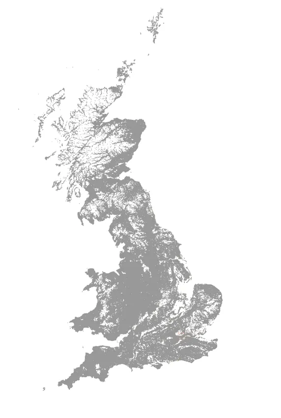
BGS property subsidence assessment — full extent map. BGS © UKRI.
The product enhances geological information obtained from the GeoSure insurance product and GeoSure, and includes a risk element for the housing stock at postcode and building level.
The BGS property subsidence assessment dataset identifies the risk of subsidence at property and postcode resolutions. There are two levels of data:
- BGS property subsidence assessment buildings: building-level vector GIS data with X,Y coordinates, built on OS Open Map Local, providing individual risk scores for:
- geology
- tree distance and density
- age of building (and likely foundation depth)
- potential drainage failure associated with the building
- number of storeys
- building type
- a combined hazard score
- BGS property subsidence assessment postcodes: postcode-level data, delivered as point vector GIS data and .csv table, providing a combined hazard score for each postcode.
You may also be interested in

BGS GeoSure
The BGS GeoSure datasets identify areas of potential hazard and, therefore, potential natural ground movement, in Great Britain.
GeoSure insurance and lenders product
This product provides an index-level assessment of the potential for financial insurance loss due to natural ground movement.
BGS GeoSure: shrink–swell
Many soils contain clay minerals that absorb water when wet (making them swell), and lose water as they dry (making them shrink). Many of us see this in our gardens when the ground becomes cracked during the summer, yet becomes ‘heavy’ in the winter.