

GeoSure insurance & lenders product. BGS © UKRI.
BGS GeoSure insurance and lenders product
- 1:50 000
- Great Britain
- via BGS Data Resellers
The BGS GeoSure insurance and lenders product gives an index-level assessment of the potential for a geological deposit to create financial insurance loss due to natural ground movement.
Key information
- Scale:
- 1:50 000
- Coverage:
- Great Britain
- Availability:
- via BGS Data Resellers
- Price:
Contact BGS Data Resellers
- Format:
- Database tables and GIS polygon data (ESRI, MapInfo, others available by request)
- Uses:
- Local-level use
- Themes:
- Built environment, Hazards
The BGS GeoSure insurance and lenders product incorporates the combined effects of the six BGS GeoSure hazards on (low-rise) buildings and links these to a postcode database (the derived postcode database). This database contains a normalised hazard rating for each of the six BGS GeoSure themes hazards (i.e. each BGS GeoSure theme has been balanced against each other) and a combined unified hazard rating for each postcode in Great Britain.
A series of geographical information system (GIS) maps show the most significant hazard areas. The ground movement, or subsidence, hazards included are:
- landslides
- shrink-swell clays
- soluble rocks
- running sands
- compressible deposits
- collapsible deposits
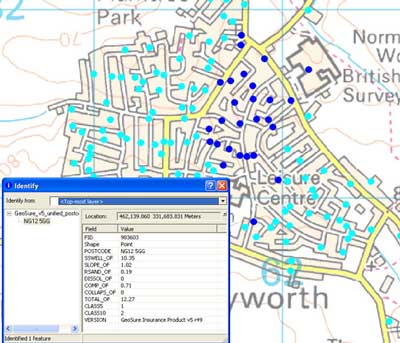
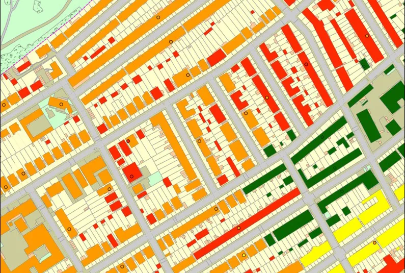
BGS GeoSure insurance and lenders product sample. BGS © UKRI. Contains Ordnance Survey data © Crown Copyright and database rights 2011. BGS OS licence no. AC0000824781.

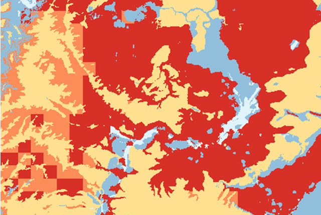
BGS GeoSure insurance and lenders product coverage. BGS © UKRI – Contains OS data © Crown copyright and database right 2020.
You may also be interested in

BGS GeoSure
The BGS GeoSure datasets identify areas of potential hazard and, therefore, potential natural ground movement, in Great Britain.
GeoClimate UKCP18 Premium
This product has now been superseded by the GeoClimate Shrink-swell dataset.
Property subsidence assessment
The BGS property subsidence assessment dataset uses a combination of best available geology, tree location and property information to provide property- and postcode-specific information on ground movement across England and Wales.