Observing magnetic fields: 100 years of data
Marking the centenary of the Lerwick Geophysical Observatory.
02/08/2022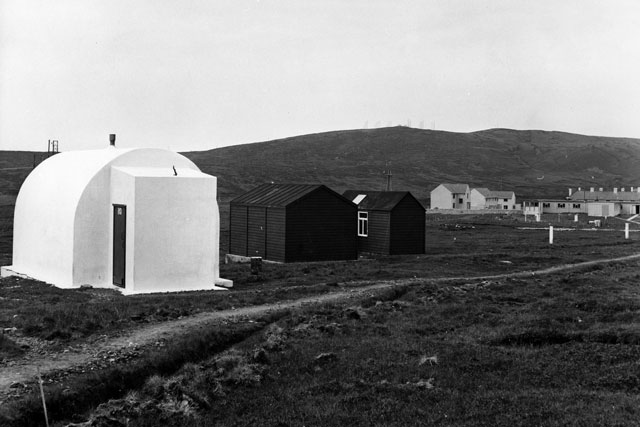

In scientific fields, a lot changes over the course of 100 years. From our understanding of how the world works to the tools that we use to measure data, very little stays the same. For that reason, it is important to celebrate things that have remained constant through that time and supported scientific learning and exploration for generations. One such thing is the Lerwick Geophysical Observatory, which recently celebrated its centenary — albeit one year late due to COVID-19 delays.
The Lerwick Geophysical Observatory in Shetland is a facility operated by the Met Office and some of the data collected there is processed and analysed by BGS. The observatory plays an important role in weather forecasting, the detection of the local magnetic field and seismic monitoring.
The high geomagnetic latitude of Shetland makes the Lerwick observatory an excellent site for measuring the Earth’s natural magnetic field variations and making aurora observations. In fact, the observatory was established when the Norwegian government lobbied the British to establish a meteorological observatory in the Shetland Islands after explorer Roald Amundsen expressed a desire to compare notes on the aurora borealis.
The geomagnetic observatory at Lerwick, Shetland, pictured in 1965. BGS © UKRI.
Magnetic data has been recorded continuously since 1921, first in analogue form traced onto paper then, from the 1980s, as digital data. Today, modern magnetometers automatically transfer data every minute to the BGS office in Edinburgh for processing. BGS archives maintain a complete record of the natural magnetic field variations since 1921.
Guanren Wang from BGS’s geomagnetism team attended the observatory’s centenary celebration on 7 June 2022, where he gave a presentation about the history and current work of the observatory to an audience of local guests.
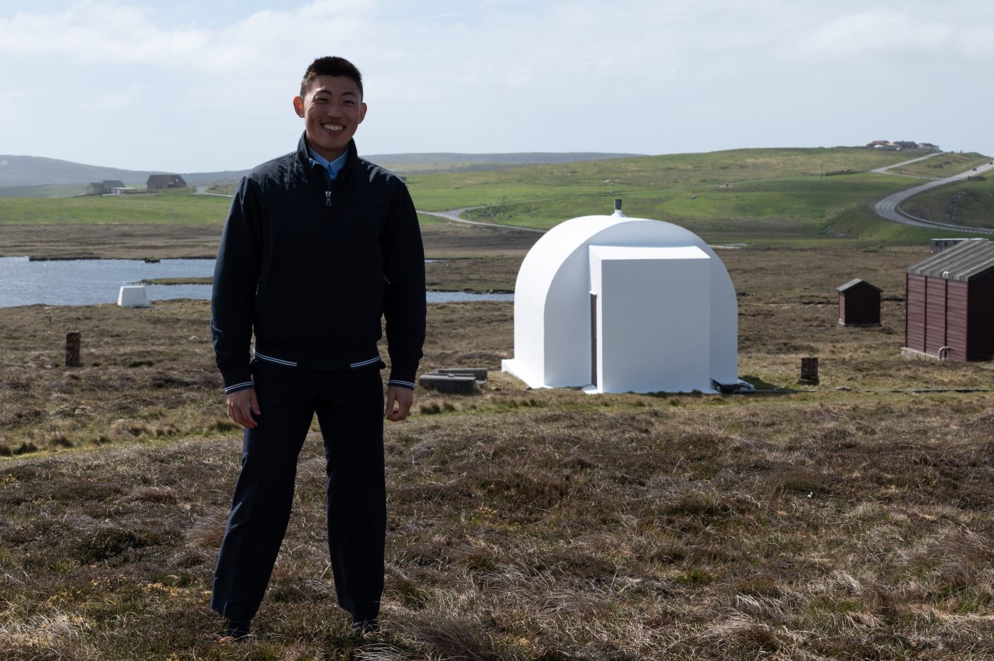
BGS geomagnetic scientist Guanren Wang in front of the magnetometer hut, which is part of BGS’s equipment at Lerwick Met Observatory, taken on its 101st anniversary celebration. The white hut is a variometer hut designed in 1921. Its thick concrete walls are coated entirely in white paint to avoid heating in the sun; this is done so the internal room temperature is kept stable because magnetometer measurements are sensitive to changing temperatures. The whole hut is deliberately constructed from non-magnetic materials and is free of iron and steel. BGS © UKRI.
Up-to-date magnetic field data is essential for a range of high-precision modern navigation techniques, which would have been unimaginable 100 years ago when the observatory was first established. This leads to the question — where will magnetic data take us in the next 100 years?
About the author

Eilidh Henderson
Head of engagement
Relative topics
Latest blogs

Collecting beach pebbles: fun hobby but is it legal?
14/07/2026
The UK coastline will be inundated with keen holidaymakers this summer, many of whom will take a memento of their trip home in the shape of a pebble or two — but is it legal?

Strengthening capacity through partnership: a critical minerals perspective
28/04/2026
BGS has been working in partnership with the Geological Survey Department of Zambia (GSD) to build national capacity, improve data accessibility and support long-term, sustainable development.

PhD adventures in Copenhagen, Denmark: revealing past recovery processes of tropical forest systems through ancient environmental DNA
12/03/2026
PhD student Chris Bengt visited the University of Copenhagen to carry out very delicate extraction of aeDNA from lake-sediment cores, in the hopes of unlocking the secrets of past volcanic eruptions.

MARC Conference 2025: highlighting the importance of conferences to PhD students
16/02/2026
BGS and University of Nottingham PhD student Paulina Baranowska shares her experience presenting her research on nuclear forensics at her first international conference.

Hole-y c*@p! How bat excrement is sculpting Borneo’s hidden caves
23/12/2025
BGS researchers have delved into Borneo’s underworld to learn more about how guano deposited by bats and cave-dwelling birds is shaping the subsurface.

How the geology on our doorstep can help inform offshore infrastructure design
19/11/2025
BGS is part of a new collaboration using onshore field work to contextualise offshore data and update baseline geological models which can inform the sustainable use of marine resources.

Fieldwork on Volcán de Fuego
13/10/2025
Understanding how one of the world’s most active volcanoes builds up material, and how they collapse to feed hot flows
Esthwaite Water: applying novel approaches to understand lake-water nutrient pollution
19/09/2025
Andi Smith (BGS) and Savannah Worne (Loughborough University) embarked on fieldwork in the Lake District, applying a novel stable isotope method for tracing phosphorus sources.

Opening up the geosciences: making work experience more accessible
19/09/2025
BGS has been working with partners to make the geosciences more accessible to young people, including those from under-represented backgrounds.
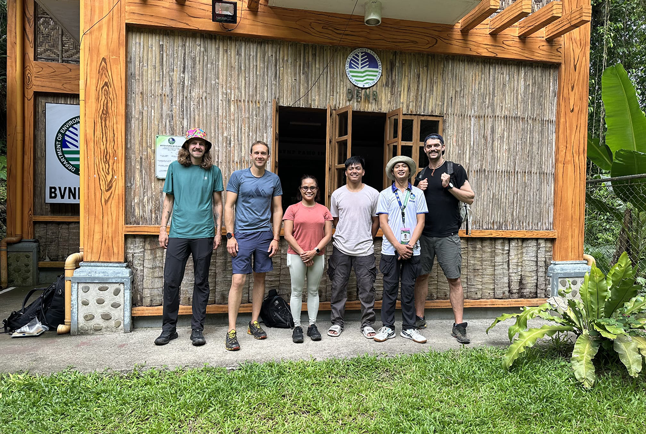
PhD adventures in the Philippines: coring around Lake Bulusan
05/09/2025
Chris Bengt recounts his two-week field trip to Bulusan Volcano Natural Park in the Philippines to collect lake sediment cores, fresh soil and water samples.
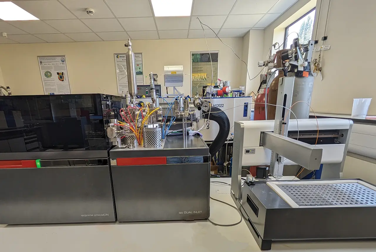
Gemini: a new stable isotope tool
21/08/2025
BGS’s Stable Isotope Facility has new mass spectrometer equipment for analysing carbon and oxygen isotopes from carbonates and water.
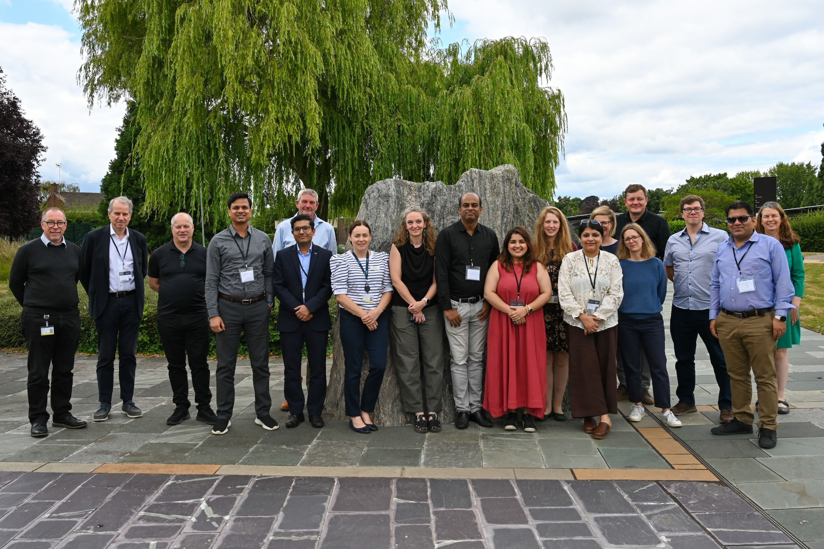
BGS hosts India for ‘deep dive’ on carbon capture and storage
30/07/2025
Some of India’s top scientists visited BGS to explore the UK’s carbon dioxide storage research potential.