Insights into the ‘missing link’ of how copper ore deposits form
Porphyry deposits provide around 75 per cent of the world’s copper, which is in increasing demand as a major raw material in power infrastructure and green technologies.
26/03/2021 By BGS Press

A new study, published in Communications Earth & Environment and led by BUFI PhD student Lawrence Carter, has provided important new insights into a ‘missing link’ of how porphyry copper deposits (PCDs) form. It proposes how naturally occurring, copper-rich fluids are transported from their magmatic source deep underground towards the Earth’s surface. Lawrence is a doctoral student at Camborne School of Mines and is working in collaboration with researchers at BGS as part of the BGS University Funding Initiative (BUFI) programme.
Where do PCDs form?
PCDs originally develop several kilometres below the Earth’s surface, above even deeper large magma chambers. Not only are PCDs rare but many of the large, near-surface examples have already been found. Any new model for how and where they form can be of great interest towards greener exploration and extraction in the future.
Understanding the scale of the systems that lead to the formation of PCDs represents one of the biggest challenges to our overall understanding of how these systems work. For example, the depth at which the metals concentrate is many kilometres above the magmas from which the metals and fluids are sourced. This can be several kilometres below the surface. This huge range in depth over which metals are naturally extracted and concentrated makes it almost impossible to view how the system is connected, including the pathways that the fluids and metals take. Only the exposed upper levels of mined PCDs can typically be observed; by the time deeper zones of the magmatic system are exposed, any evidence for ore deposit formation has been lost due to the rocks being exhumed and eroded.
A unique geological record in the Nevada desert
The consequent paucity in observational evidence to connect the different crustal levels means previous workers have inferred a wide variety of conceptual and numerical models to describe the transport of fluid and metals from deep magmas through the crust. In this new study, however, researchers examined a unique geological record in the Yerington district of Nevada, USA.
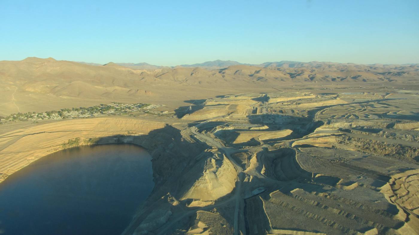
Aerial view of the Yerington porphyry copper mine, Nevada, USA. © Lawrence Carter.
When the magmatic rocks here formed around 167 million years ago, they underwent geological processes that extracted and concentrated huge quantities of metals from the magma chambers, forming a number of ore deposits. These would normally remain buried or be eroded away but, much later, tectonic forces tilted the ground to provide a naturally exposed cross-section. This means that a continuum of rocks, spanning from volcanics erupted at the Earth’s surface down to once-molten magma chambers that were about 8 km beneath the surface, can literally be walked across.

‘This study highlights that there is still the need for researchers doing first-order geological characterisation. By going out to specifically look for the physical evidence for how metals are transported and concentrated under volcanoes, this research has shone an important new light on fundamental Earth processes.
‘This is a fantastic contribution from a BUFI research student and we are looking forward to the next stages of Lawrence’s research.’
Dr Simon Tapster, BGS Geochronologist.
Identifying PCD fluid pathways
By looking for the pathways fluids took through the system, the team were able to identify a ‘wormy’ interconnected network of quartz within finely crystalline dykes found in rocks that were once beneath the PCDs. This crystalline network represents copper-bearing fluids that passed through the dykes’ once-permeable, magmatic crystal mush of feldspar and quartz. These observations provide novel physical evidence for the dykes acting as conduits for vast quantities of PCD-forming fluids from deep portions of the underlying source magmas. This breakthrough could lead to the development of more reliable PCD exploration models and has significance for other ore deposit types and volcanic processes.
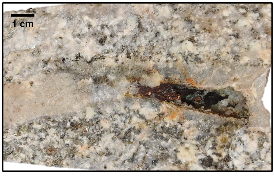
The preserved copper-bearing fluid pathway through an approximately 6 km-deep body of granite, on its way to form an ore deposit. © Lawrence Carter.
Funding and project partners
Lawrence’s PhD research is supported by the NERC GW4+ DTP, BUFI and the Society of Economic Geologists Foundation. It was also conducted in collaboration with University of Surrey researchers. Lawrence’s research continues with BGS, using high-precision U-Pb geochronology at the Geochronology and Tracers Laboratory to reconstruct timescales over which the PCD-sourcing magma chambers grew.
BGS participation in the ongoing research work is funded by the NERC Highlight topic consortium From arc magmas to ores (FAMOS).
Reference
Carter, L C, Williamson, B J, Tapster, S R, Costa, C, Grime, G W, and Rollinson, G K. 2021. Crystal mush dykes as conduits for mineralising fluids in the Yerington porphyry copper district, Nevada. Communications Earth & Environment, Vol. 2, 59. DOI: https://doi.org/10.1038/s43247-021-00128-4