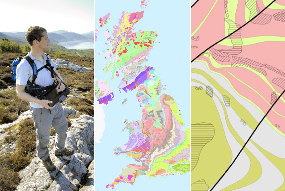
BGS launches new Geology Viewer
A new app providing easy access to the subsurface of Britain has been released by BGS.
30/06/2022 By BGS Press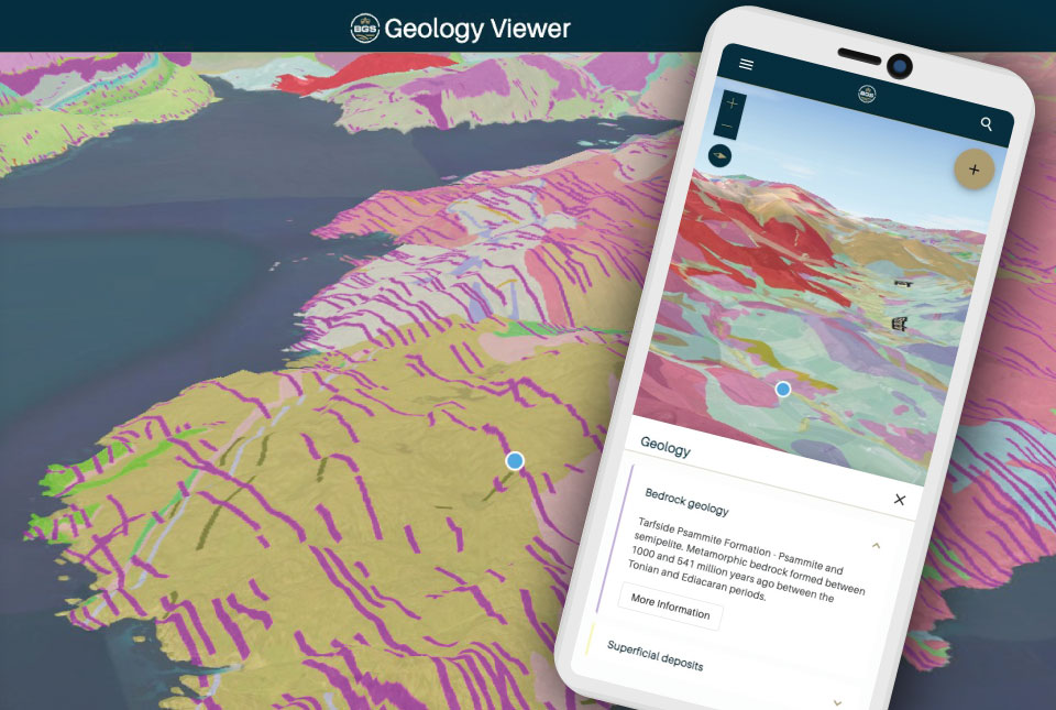

The BGS Geology Viewer has been designed to provide geology enthusiasts and the general public with bedrock and superficial geology maps of Great Britain. Anyone with a browser-enabled device — including mobiles, tablets and laptops — can use the free application.
The GPS-enabled viewer allows users to zoom to their location and tap the 3D map for information on each geology layer and how it was formed. The dynamic map legend updates to display only the visible rock formations and users can access further information with links to additional records in the BGS Lexicon. The viewer is also customisable, with a range of different base maps to choose from.
The application has been designed as a streamlined successor to some of BGS’s existing viewers. The mobile-first design is intended to make the new viewer available to a much wider range of users across different devices.
It will not be found in the Apple or Google App stores; instead, users can access the viewer through the BGS website.
Mobile users can also choose to add the app to their home screen and launch it like a native app. Initially launched in beta, further development is planned over the coming years to provide exciting new functionality to meet the evolving needs of our data users.
Following the launch, two older BGS applications, iGeology and the Geology of Britain Viewer, will be retired on 1 August.
For professional users who need to access BGS data as part of their business requirements, BGS GeoIndex is also available, containing borehole records and a comprehensive BGS data catalogue.
For further information, including frequently asked questions, troubleshooting and where to send feedback, please visit the BGS Geology Viewer application page.
Relative topics
Related news
Zambia’s first critical minerals guide supports the country’s potential in global clean energy transition
18/07/2025
A new guide to Zambia’s critical minerals highlights the country’s current and potential critical mineral resources, including cobalt and lithium.

Funding awarded to UK/Canadian critical mineral research projects
08/07/2025
BGS is part of a groundbreaking science partnership aiming to improve critical minerals mining and supply chains.
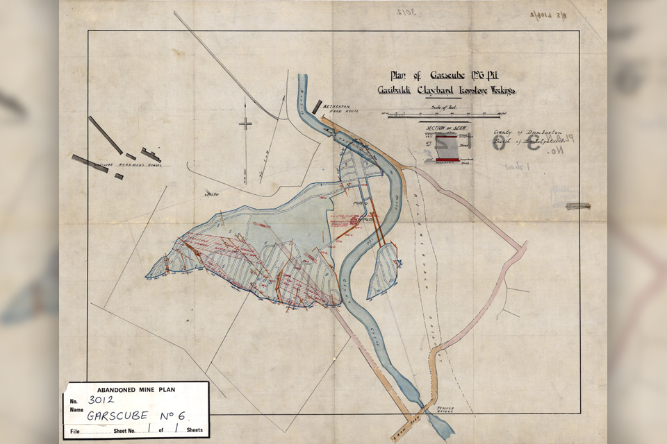
Release of over 500 Scottish abandoned-mine plans
24/06/2025
The historical plans cover non-coal mines that were abandoned pre-1980 and are available through BGS’s plans viewer.
New collaboration aims to improve availability of real-time hazard impact data
19/06/2025
BGS has signed a memorandum of understanding with FloodTags to collaborate on the use of large language models to improve real-time monitoring of geological hazards and their impacts.

Modern pesticides found in UK rivers could pose risk to aquatic life
17/06/2025
New research shows that modern pesticides used in agriculture and veterinary medicines have been found for the first time in English rivers.

Goldilocks zones: ‘geological super regions’ set to drive annual £40 billion investment in jobs and economic growth
10/06/2025
Eight UK regions identified as ‘just right’ in terms of geological conditions to drive the country’s net zero energy ambitions.
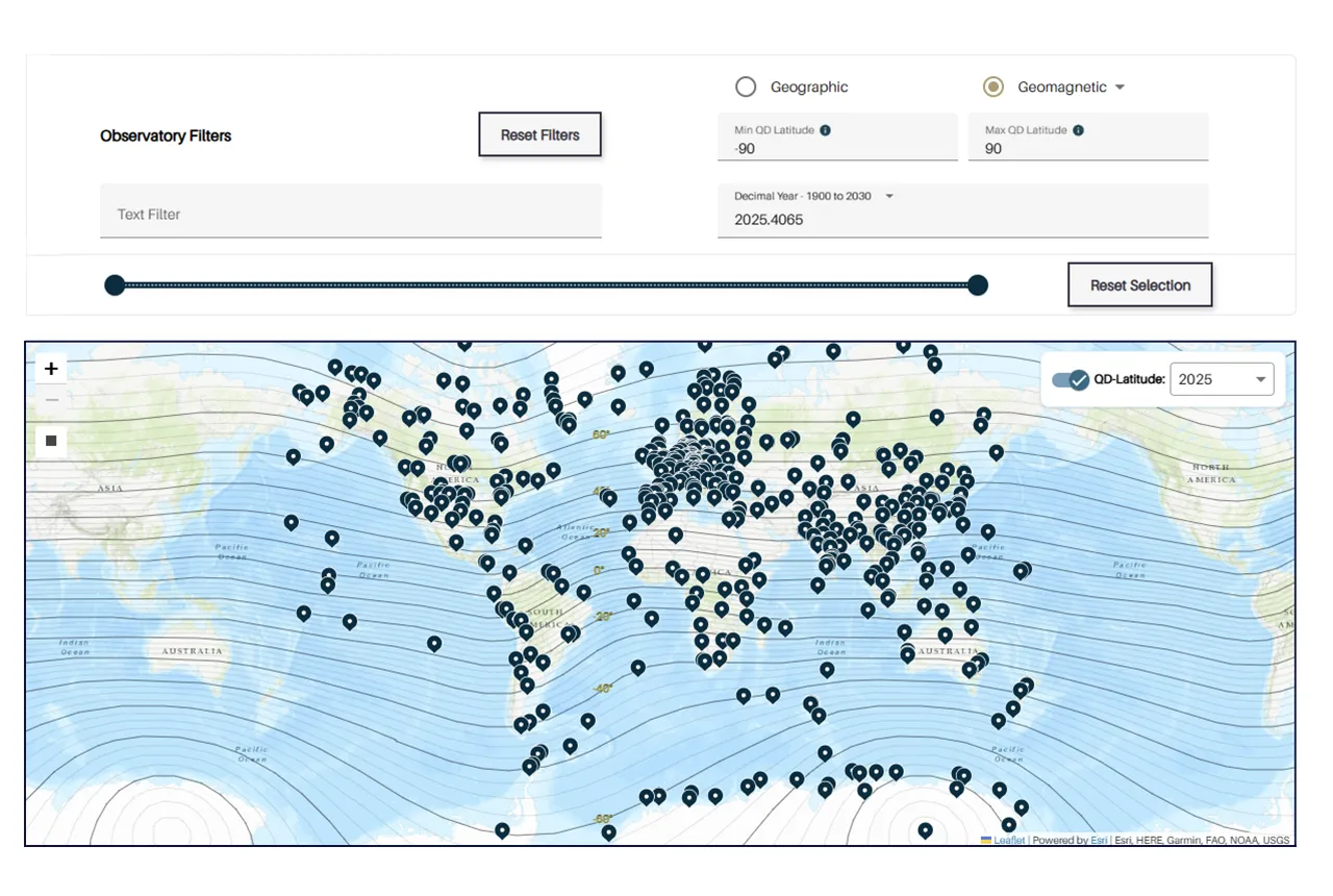
Upgraded web portal improves access to geomagnetism data
02/06/2025
BGS’s geomagnetism portal, which holds data for over 570 observatories across the world, has received a significant update.
BGS digital geology maps: we want your feedback
29/05/2025
BGS is asking for user feedback on its digital geological map datasets to improve data content and delivery.
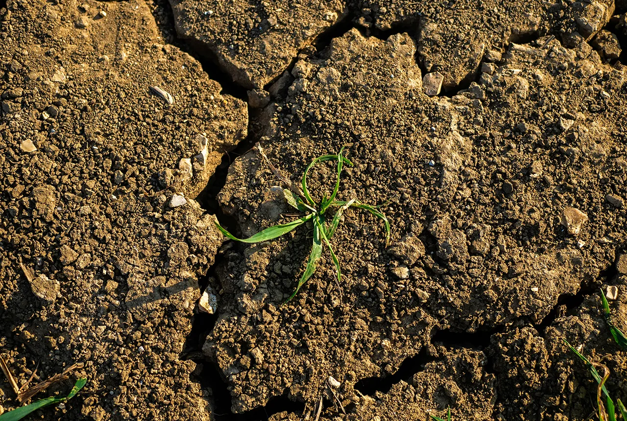
What is the impact of drought on temperate soils?
22/05/2025
A new BGS review pulls together key information on the impact of drought on temperate soils and the further research needed to fully understand it.
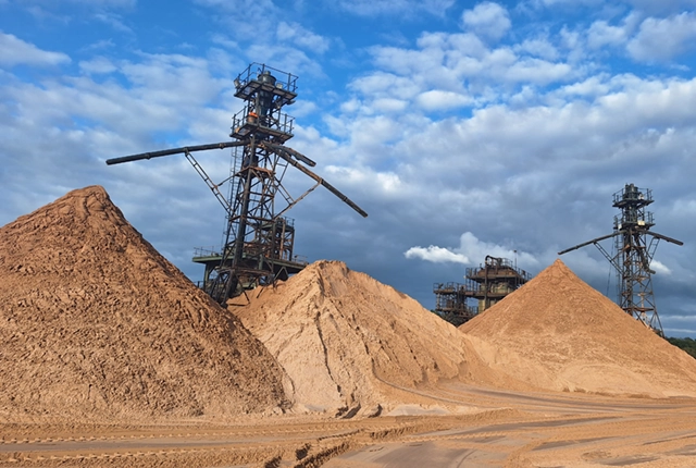
UK Minerals Yearbook 2024 released
21/05/2025
The annual publication provides essential information about the production, consumption and trade of UK minerals up to 2024.
BGS scientists join international expedition off the coast of New England
20/05/2025
Latest IODP research project investigates freshened water under the ocean floor.

New interactive map viewer reveals growing capacity and rare earth element content of UK wind farms
16/05/2025
BGS’s new tool highlights the development of wind energy installations over time, along with their magnet and rare earth content.