Antarctic mountain named in honour of BGS scientist
BGS’s Ian Millar has been honoured for his geological research in Antarctica by having a mountain on the continent named after him.
06/11/2023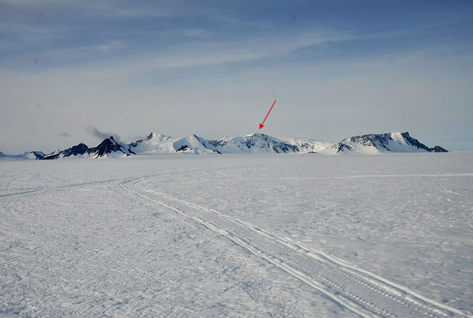

Each year, the Antarctic Place-names Committee recommends new names for geographical features, to honour scientists and support staff who have worked in the region. This year, they have announced that a 2000 m mountain on the southern Antarctic Peninsula will be named Mount Millar after Dr Ian Millar of the British Geological Survey (BGS).
Ian, who works at BGS’s headquarters in Keyworth, Nottinghamshire, worked for the British Antarctic Survey (BAS) for more than 21 years before he became an isotope geochemist at BGS in 2005. During his time at BAS, he took part in several field seasons and cruises in and around the Antarctic Peninsula and Transantarctic Mountains, spending more than a year in total working on the southern continent.
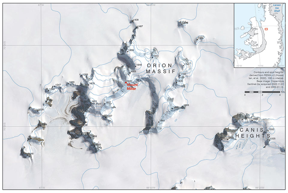
Mount Millar on the map. © UK Antarctic Place-names Committee and British Antarctic Survey.
In 1991, Ian spent ten weeks camping and travelling by skidoo with a field guide in a remote area of the southern part of the Antarctic Peninsula, collecting rock samples in order to determine the ages of the rocks, working close to the location of Mount Millar. His work there contributed to determining the geological history of the peninsula through detailed geochronology.

I have been incredibly lucky to undertake some amazing fieldwork during my career, both in Antarctica with BAS and, more recently, in much warmer regions like North Africa and south-east Asia since joining BGS.
Dr Ian Millar, BGS Isotope Geochemist.
Mount Millar can be found on the Antarctic Place-names Committee’s website.
About BAS
The British Antarctic Survey (BAS) is the United Kingdom’s national polar research institute. It has a dual purpose: to conduct polar science, enabling better understanding of global issues, and to provide an active presence in the Antarctic on behalf of the UK. BAS is a component of the Natural Environment Research Council (NERC), which is part of UK Research and Innovation (UKRI).
About the author
Relative topics
Related news

Delving deep into mountains for future water security
16/07/2026
A BGS-led project is using new water-tracing investigation methods, geophysics and modelling to understand how water moves from mountains to the lowlands, helping to improve water security for billions of people.

Collecting beach pebbles: fun hobby but is it legal?
14/07/2026
The UK coastline will be inundated with keen holidaymakers this summer, many of whom will take a memento of their trip home in the shape of a pebble or two — but is it legal?

Updated national 3D model will determine the depth to the solid bedrock beneath our feet
13/07/2026
The BGS Superficial Deposit Thickness Model now includes an elevation model of geological rockhead for the first time, providing important data for civil engineers, geoscientists and environmental scientists.

UK’s world-class research organisations launch new collective
10/07/2026
The launch of the National Research Organisations Group brings together more than 100 science leaders to provide an authorativive voice on science, research policy and long-term investment.

Cheshire Geoenergy Observatory releases key geological datasets for UK thermal energy storage scheme design
09/07/2026
A new report and data packs from BGS will provide a unique resource for scientists working on the geology and hydrogeology of the Sherwood Sandstone Formation, an important aquifer and reservoir rock.

New geological mapping underway to help manage flooding along the River Tweed
08/07/2026
Scientists are surveying the Tweed catchment for the first time in over 100 years to enhance understanding of localised groundwater and improve flood forecasting.

Geological research in North Sea helping to safeguard subsea cables
06/07/2026
Subsea power and telecommunications cables are critical to the UK’s energy infrastructure and global connectivity, yet they remain vulnerable to damage from ship anchors, fishing activity and natural hazards.

UK Critical Minerals Intelligence Centre makes recommendations for the next UK criticality assessment
01/07/2026
CMIC has outlined the enhancements made to the next assessment update to ensure it is better tailored to the structure of the UK economy.

From archive to discovery: historical mineral reports support gold exploration in Scotland
25/06/2026
Digitised geological records show potential to unlock untapped mineral resources in Ardlochan, Argyllshire.

UK and Philippines scientists investigate natural hydrogen generation processes at atomic scale
22/06/2026
BGS researchers were granted access to use the Diamond Light Source facility in order to study hydrogen in light brighter than the sun.

Shortage of end-of-life materials presents challenge to UK critical minerals security
17/06/2026
A new report by the UK Critical Minerals Intelligence Centre reveals insufficient end-of-life material stocks present a supply risk over the coming decade, but offer significant long-term potential to meet critical mineral demand through recycling.

UK geothermal catalogue receives update
16/06/2026
BGS releases the second digital version of the UK geothermal catalogue of subsurface temperature and rock thermal conductivity measurements and heat flow calculations.