On 30 September 2010, the BGS Landslide Response Team made a visit to a landslide located to the west of Blubberhouses in North Yorkshire along the A59 road, to investigate the failures. Information was collected for the BGS National Landslide Database and geological maps.
Although the landslides did not encroach on the road surface, the A59 was closed between Blubberhouses and Raven’s Peak while remediation work took place.
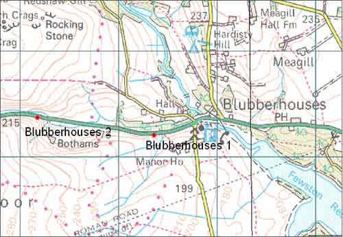

Approximate locations of the Blubberhouses landslides. Topography © Crown Copyright. All rights reserved. BGS 10007897/210.
Blubberhouses location map. BGS © UKRI.
News reports
The landslides at Blubberhouses were reported in the local and national news:
- Landslip causes A59 road closure in North Yorkshire BBC News, 28 September 2010
- Road still closed after landslide Craven Herald, 28 September 2010
Geology
The underlying bedrock geology of the area is part of the Carboniferous (Namurian) Millstone Grit Group and comprises fine- to very coarse-grained, feldspathic sandstones interbedded with grey siltstones and mudstones, with subordinate marine shaly mudstone, claystone, coals and seatearths. Although no superficial deposits are mapped at this site it is likely that the landslide involved colluvium and weathered bedrock.
The landslides
The Blubberhouses 1 landslide has the characteristics of a flow. A spring 20 m up the slope is likely to have contributed to the instability at this site. The fence by the side of the road prevented the flow from moving on to the A59 road.
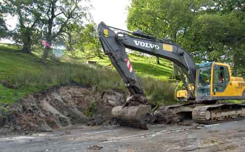
Remediation work taking place at the landslide site at map location 1, west of Blubberhouses. BGS © UKRI.
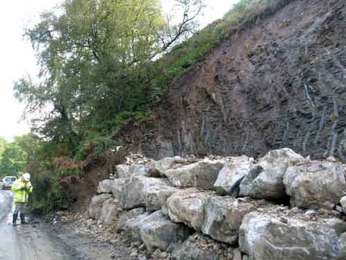
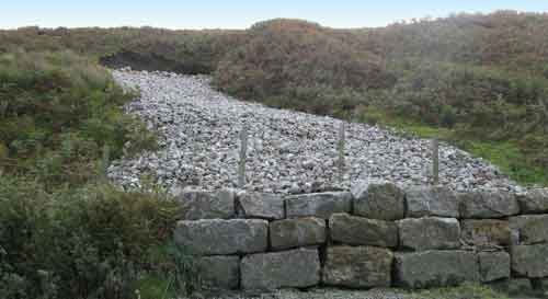
The completed remediation work at the landslide site at map location 2, west of Blubberhouses. BGS © UKRI.
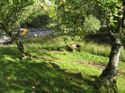
Blubberhouses 1. Looking downslope, the flow is highlighted by tall grass, which is common on saturated ground conditions. BGS © UKRI.
Blubberhouses 2. Looking upslope, water is flowing out of the saturated ground. BGS © UKRI.
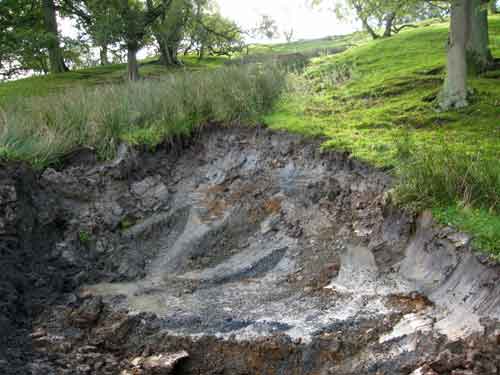
The Blubberhouses 2 landslide was an earth slide. The failed material had been removed when the visit took place but the area that had failed was clearly visible. Workers at the site suggested that trees uprooted upslope caused the superficial deposits and bracken that overlaid the bedrock to become unstable and slide downslope.
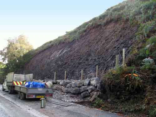
Blubberhouses 2. All the slide material has been removed and stone blocks placed at the base to stop any further sliding. BGS © UKRI.
Blubberhouses 2. Thin layer of superficial deposits and bracken overlying the bedrock. BGS © UKRI.
Previous landslide activity
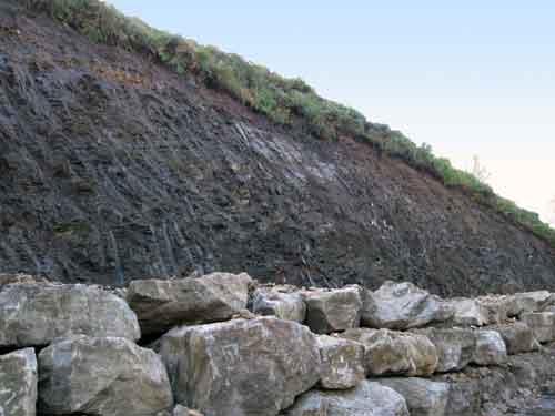
This stretch of the A59 has been prone to landslides in the past; a car was reported to have been covered by earth and rubble by a landslide in 2007. The Landslide Response Team recorded two remediated landslides west of the two recent slides, which are likely to have been the site of this previous incident.
Possible site of 2007 slide. BGS © UKRI.
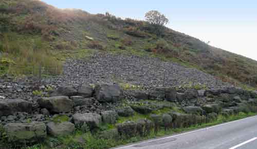
Another remediated landslide along the A59. BGS © UKRI.
Landslide information being recorded using SIGMA·mobile. BGS © UKRI.
All the information about the landslide was collected by the Landslide Response Team, using BGS•SIGMAmobile technology.
You may also be interested in

Landslide case studies
The landslides team at the BGS has studied numerous landslides. This work informs our geological maps, memoirs and sheet explanations and provides data for our National Landslide Database, which underpins much of our research.

Understanding landslides
What is a landslide? Why do landslides happen? How to classify a landslide. Landslides in the UK and around the world.

How to classify a landslide
Landslides are classified by their type of movement. The four main types of movement are falls, topples, slides and flows.

Landslides in the UK and around the world
Landslides in the UK, around the world and under the sea.