By 1854 the Geological Survey in England and Wales had been progressing since 1835 and for slightly longer in Ireland. It was at this time that Sir Henry de la Beche considered the extension of the survey to Scotland and he asked A C Ramsay to ‘break the ground’ in Scotland.
It was also at this time that consideration of the base mapping scale was hotly debated. In England and Wales, mapping proceeded on base maps on a scale of one inch to the mile, while in Ireland mapping was done in greater detail at the scale of six inches to the mile. Ramsay was intent on following the Irish method.
Beginnings
In August 1854, de la Beche, the local director for England and Wales, Jukes (director of the Irish Survey) and Ramsay met in Glengarriff at Bantry Bay in Ireland. It was here, after discussion, that the nature of the Geological Survey of Scotland was decided. The survey was to proceed at the scale of six inches to the mile.
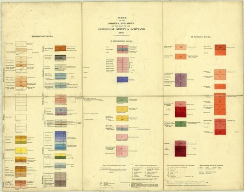

Standard colours for Scotland in 1897
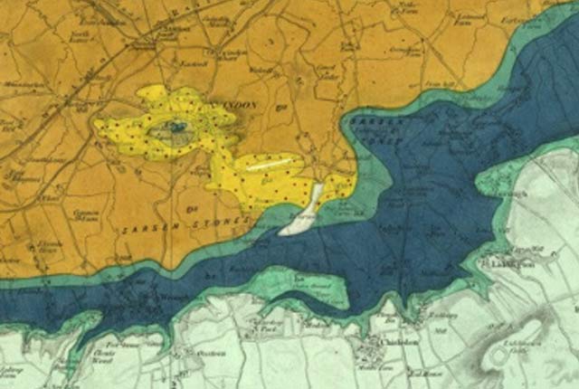
Later in 1854, in the autumn, Ramsay began work in the Dunbar area, mapping the Carboniferous and the Old Red Sandstone. The following year, two other young geologists, H H Howell and Archibald Geikie, were sent up to continue the mapping. They mapped large tracts of the Lothians and Borders, culminating in the publication of the hand-coloured, one-inch-to-the-mile geological sheet 32 of Edinburgh. In about 1861, it was decided to map the superficial deposits, which in Scotland are mostly glacial drift, clays, sands and gravels laid down by the retreat of glaciers, and to show them on the one-inch-to-the-mile published sheets. This entailed remapping previous areas as well as new areas.
New identity
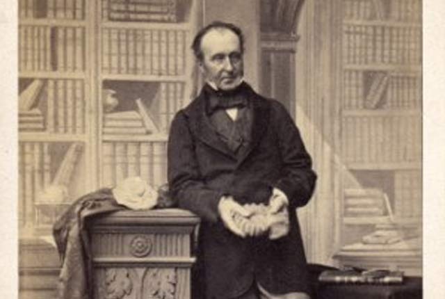
A new separate identity was created for the Geological Survey of Scotland in 1869. Roderick Impey Murchison, the then director general, set up a headquarters office in Edinburgh and Archibald Geikie was made the director.
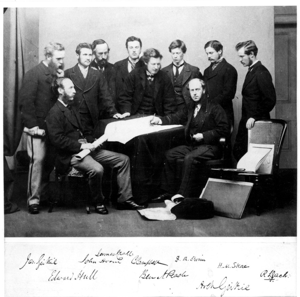
Group photograph of staff of Geological Survey. Left to right: J Geikie, J Horne, J Croll, G Campbell, B N Peach, D R Irvin, H M Skae, R L Jack. Seated: E Hull and A Geikie. BGS © UKRI.
For the first 20 years of its existence, mapping was focused on the southern and central parts of Scotland. Maps and memoirs of the coalfield areas were published as well as adjacent non-coalfield areas. ‘Clean copies’ of the six-inch field slips were made at the same scale for public consultation in the survey’s offices.
As the survey of the Central Belt and the adjacent areas matured, in 1875, attention turned towards the Highlands. Work initially started in the Old Red Sandstone on the southern margins of the Highlands but soon extended into the Moray Firth and Grampians area.
In 1882, Archibald Geikie became the director general of the whole Geological Survey and wanted to speed up and complete the primary survey of the UK. After a brief experiment changing to one-inch to one mile primary surveying, which proved to be very inadequate to convey the complex geology, the mapping team was increased. Despite this increase, the nature of the terrain, weather and complex geology resulted in slow progress.
Attention turns towards the Highlands
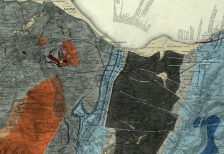
Extract from sheet 32, Edinburgh. BGS © UKRI.
For many years, since around 1860, a major geological controversy had existed between Murchison and Prof Nicols of Aberdeen over the nature of the succession for the North-west Highlands. Charles Lapworth had also considered the problem. Geikie thought detailed mapping of the area would resolve the issue, so he pulled together a very experienced mapping team of Ben Peach and John Horne and later Clough, Hinxman, Cadell and Gunn. By 1884, they had resolved the issue and, together with Lapworth, they agreed that the upper rocks had been pushed over the lower rocks in a very low angle thrust fault.
Economic activity
From the early days of the survey in Scotland there had been work related to economic activity, especially the coal and oil shale resources. Indeed, the whole oil-shale industry really developed when Geikie, after his detailed mapping, showed James ‘Paraffin’ Young, who discovered how to distill paraffin from oil shale, the main outcrops of the oil shales in Scotland.
For much of the time there was a focus on mapping the coalfield areas and making the detailed ‘clean copies’ available for consultation. In the 1890s, Grant Wilson started to collect information with a view to revising the mapping of the coalfield areas as a result of increase demand for these resources.
Southern Uplands
Subsequent to the first and very rapid survey of the Southern Uplands, Charles Lapworth had developed the view that fossil graptolites provided the key to deciphering the stratigraphy of the folded and faulted Palaeozoic rocks.
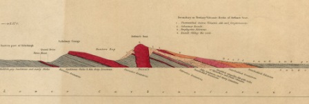
Extract from a horizontal section of Arthur’s Seat, Edinburgh. BGS © UKRI.
Peach and Horne were called in to revise the mapping. So, between 1888 and 1898 they resurveyed the area, working in the winter months while summers were spent in the Highlands. Their two great memoirs were subsequently published: the Southern Uplands in 1888 and the North-west Highlands in 1907.
Timeline
| Date | Event |
|---|---|
| 1 April 1845 | The Geological Survey of Great Britain and Ireland comes into existence by Act of Parliament. Henry de la Beche is the first director. |
| 1854–1867 | Geologists are based in London and visit Scotland for field work, with a small temporary store for maps and specimens at the Industrial Museum of Scotland. |
| August 1854 | The nature of the Geological Survey of Scotland is decided between de La Beche, Jukes and Ramsay. Mapping is to proceed at a scale of six inches to one mile. |
| Autumn 1854 | Ramsay begins mappingthe Old Red Sandstone and Carboniferous around Dunbar. |
| 1855 | H H Howell and Archibald Geikie map Berwickshire, Lothians and Fife. |
| 1855 | Roderick Impey Murchison succeeds de la Beche as director general. |
| 1858 | Palaeontologist J W Salter, from London, visits East Lothian to study the fossils and help with the correlation of the Carboniferous strata. |
| 1859 | The first one-inch geological map is published: Sheet 32, Edinburgh. |
| 1861 | The first sheet memoir is published for Edinburgh district and includes a list of Silurian and Carboniferous fossils compiled by J W Salter. |
| 1861 | Geikie shows James ‘Paraffin’ Young the outcrop of the oil-shales in Scotland. This is the basis of the new oil-shale industry. |
| 1861 | The decision is made to start mapping the superficial deposits — sands, gravels and clays deposited by former glaciers. |
| 1861 | Howells is replaced by James Geikie and John Young. |
| 1862 | Ben Peach joins the survey. |
| 1867 | The Geological Survey of Scotland gets a new identity and its offices open in Edinburgh. Archibald Geikie is director, Edward Hull is deputy. |
| 1867–1869 | The Geological Survey of Scotland is housed in Argyle Square at the Museum of Science and Art (formerly the Industrial Museum of Scotland). |
| 1867–1870 | New recruits:
|
| 1869 | James Geikie becomes assistant director. |
| 1869–1879 | The Geological Survey of Scotland is housed at No. 1 India buildings, Victoria Street. |
| 1871 | R Etheridge, Jr is the first palaeontologist to be appointed to the survey in Scotland. Previously, Scottish palaeontological work was undertaken in London. |
| 1875 | Mapping attention turns to the Highlands. |
| 1875 | New recruits:
|
| 1879–1905 | Ben Peach now undertakes all the palaeontological work in Scotland. |
| 1879–1906 | The Geological Survey of Scotland is now located on the other side of George IV Bridge in the Sherriff Court Buildings. |
| 1882 | A Geikie becomes director general. |
| 1882–1899 | J H H Howells is the director in Scotland. |
| 1884 | G Barrow, C T Clough, E H Cunningham-Craig, J R Dakyns, W Gunn and H Miller are transferred from England to speed up the mapping of Scotland. |
| 1860–1884 | The ‘Highland Controversy’, about the nature of the succession in the North-west Highlands. |
| 1884 | Highland Controversy is resolved following detailed mapping by Peach and Horne in conjunction with Charles Lapworth. |
| 1888–1898 | A re-survey of the Southern Uplands is undertaken by Peach and Horne. |
| 1891 | Geological photography is started by the survey. R Lunn, who started in the survey in 1874 as a boy porter, undertakes the photography using plate cameras and glass negatives. |
| 1890s | A Harker begins mapping volcanic rocks of south Skye, and H B Woodward from the English survey is sent to map the Jurassic rocks of Skye and Raasay. |
| 1899 | The Silurian Rocks of Scotland — the famous memoir covering the Southern Uplands — is published. |
| 1901 | A Geikie retires as director general and J J H Teall takes over, under the title ‘director’. |
| 1901–1911 | John Horne is assistant to the director (head of the Scottish Survey). |
| 1902 | Detailed revision of the coalfield begins. |
| 1905 | Ben Peach retires after 43 years’ service. |
| 1906 | The Geological Survey moves to 33 George Square, Edinburgh, the former home of Sir Noel Paton, a famous Scottish artist. |
| 1906 | The first edition of the oil-shale memoir is published. |
| 1908 | The North-west Highlands of Scotland — the famous and historic memoir elucidating the geology of the area — is published. |
| 1909 | The last hand-coloured sheets, 36 Kilmartin [Solid] and Kilmartin [Drift], are published. |
| 1910 | Colour-printed one-inch maps are published from this date. The revised map of Edinburgh (32), the geological map of Arran (special sheet), Haddington (33) and Glenelg (71) are published. |
Bibliography
- Bailey, E B. 1952. Geological Survey of Great Britain. (London: Murby.)
- Flett, J S. 1937. The first hundred years of the Geological Survey of Great Britain. (London: HMSO.)
- McIntosh, R P. 2012. Geological Survey of Great Britain and Ireland – a contemporary account of the Survey, 1897 (3.17 MB pdf). Extract and illustrated from 1897 Geological Survey of Great Britain. Summary of Progress (unpublished).
- McKenna, G (editor). [Unpublished manuscript]. Instructions for the Local Directors of the Geological Survey of Great Britain and Ireland (330 KB pdf) by Henry de la Beche 22 May 1845. Selected documents from the BGS Archives No. 1
- Wilson, Harry. 1985. Down to Earth: one hundred and fifty years of the British Geological Survey. (Edinburgh: Scottish Academic press.)
- Wilson, R B. 1977. A History of the Geological Survey in Scotland (4.3 MB pdf). (Edinburgh: Institute of Geological Sciences.)
You may also be interested in

BGS maps portal
High-resolution viewing of images of almost all the small- and medium-scale geological maps produced by the BGS since mapping started in 1832.
Geological survey historical notes
Brief historical notes and links to key documents on the early 1:63 360 map series for England and Wales, Scotland and Ireland.
Geological Survey history — England and Wales
A short history of the Geological Survey of England and Wales.
Geological Survey history — Ireland
A history of geological mapping in Ireland