While urban areas only account for around three per cent of the Earth’s land surface, they are home to 55 per cent of the world’s population, generate about 80 percent of global gross domestic product (GDP) and produce over 70 per cent of global carbon emissions.
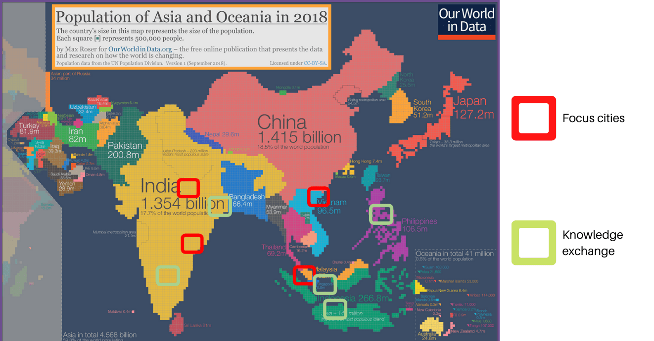

Geographic distribution of the BGS ODA Resilience of Asian Cities research. Source: Our World in Data.
In coming decades, 90 per cent of urban expansion will occur in developing countries. Rapidly urbanising cities are exposed to natural hazards, pressure on resources and significant uncertainty regarding their resilience to environmental change.
Our Official Development Assistance (ODA) programme aims to improve city resilience by integrating geology into urban subsurface planning and urban-catchment science in India and south-east Asia. We have worked closely with city planners, geoscientists and communities across three countries — Malaysia, Vietnam and India — with a focus on:
- building understanding of urban geoscience by strengthening capacity for managing, interpreting and disseminating geological data using state-of-the-art geological models
- developing networks between geoscientists, city planners and other interested parties, both within cities and across the region
- addressing city-specific issues such as the role of groundwater, subsidence, building material life cycles or engineering hazards
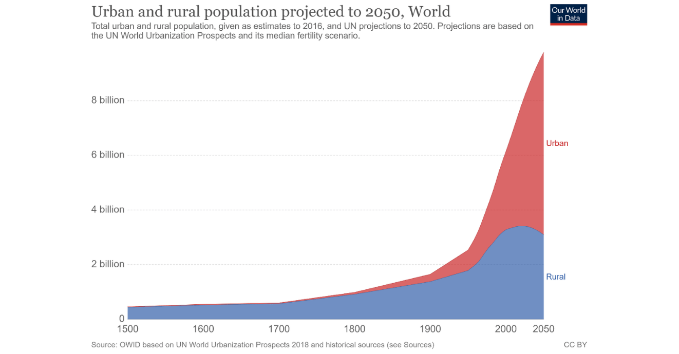
Urban and rural population projected to 2050. Source: Our World in Data.
The project has been developed in partnership with institutions in Asia, and is structured around addressing the United Nations’ Sustainable Development Goals (SDGs), particularly:
- sustainable cities and communities (SDG11)
- industry, innovation and infrastructure (SDG9)
- responsible consumption and production (SDG12)
- clean water and sanitation (SDG6)
Further projects
- 3D models for better understanding of urban geoscience
- 3D Kuala Lumpur
- Hanoi urban geology database
- geology, groundwater and lakes, Bangalore
- subsidence, Hanoi
- Red River Delta projects
BGS, in partnership with Vietnam Institute of Geosciences and Mineral Resources (VIGMR) and with community engagement, has created a workshop that aims to increase preparation for hydrometeorological hazards and will allow researchers to maximise the social impacts of national and international research programmes.
Our research
Underground space: Kuala Lumpur
Kuala Lumpur’s geology is complex; with karstic limestone, granites and interbedded sediments that make construction complex and give rise to geohazards, including sinkholes and landslides.
Geoscience: Amaravati
The BGS has been studying the geology underneath some of India’s large cities, including Amaravati — a city so new it hasn’t been built yet.
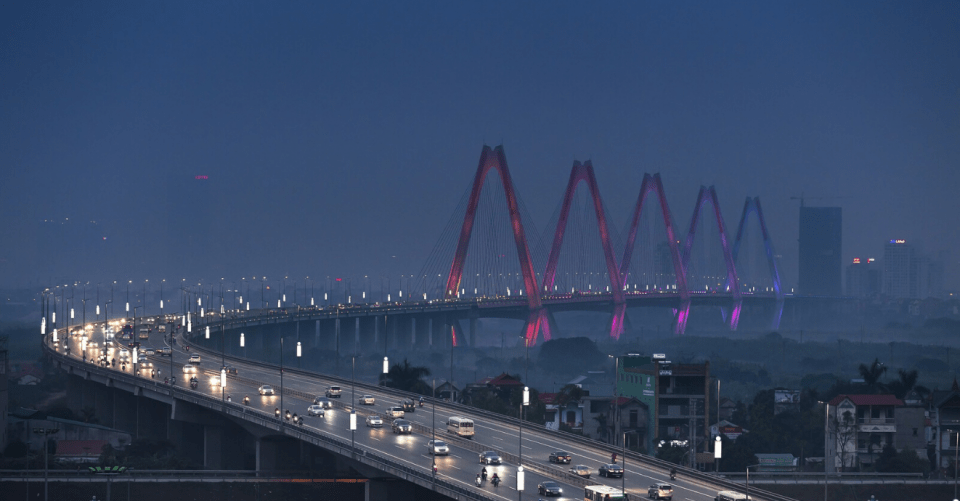
Urban resource flows: Hanoi
Hanoi is a rapidly growing city built on the alluvial plain of the Red River. As the city expands and develops, managing resources and protecting the environment are a constant challenge.
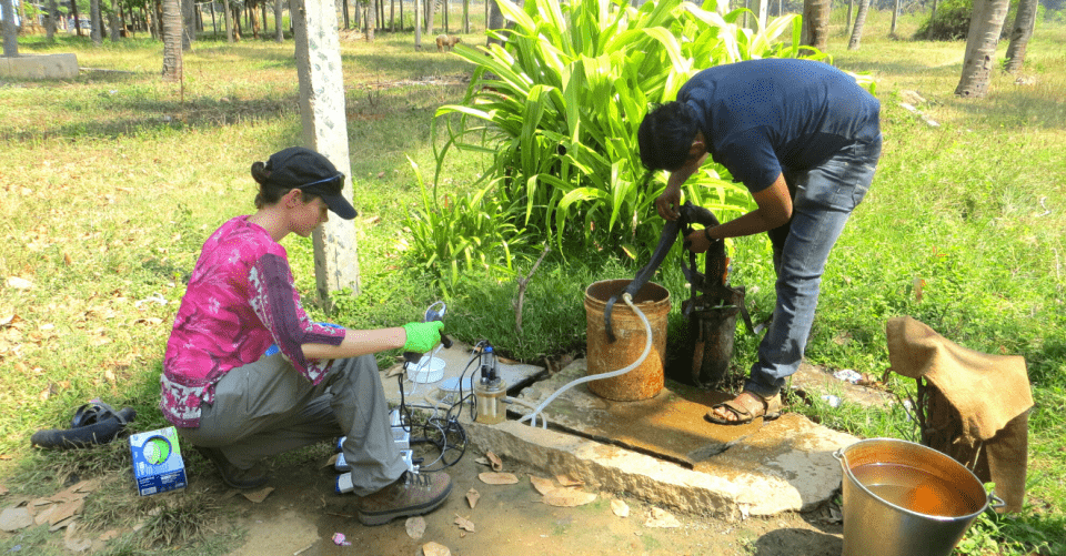
Geology and groundwater: Varanasi
Varanasi faces many environmental challenges. The city must modernise infrastructure while maintaining its rich cultural and spiritual heritage on the banks of the Ganges.
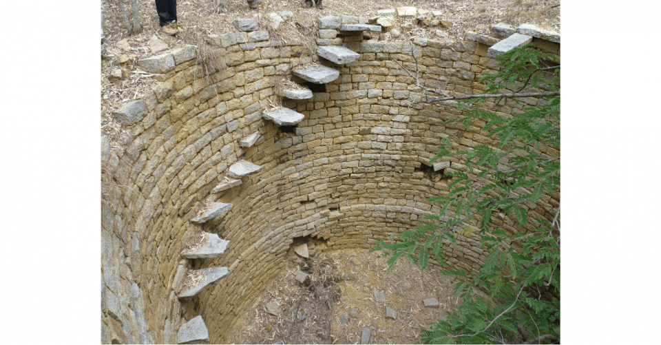
Geology, groundwater and lakes: Bangalore
The BGS and partners are developing an understanding of the interaction between public water supply systems, sewage systems, traditional water tanks and groundwater.


You may also be interested in
International geoscience
BGS is active across the globe delivering institutional strengthening programmes and applied research projects across a wide variety of sectors.
Partnerships for Development
The main aim of our Partnerships for Development work was to support our partner countries in developing sustainable extractives sectors.