BGS led the Forum of European Geological Surveys (FOREGS, now EuroGeoSurveys) Geochemistry Working Group between 1994 and 1996, completing an inventory of geochemical data across Europe ahead of plans to carry out a standardised, Europe-wide geochemical survey.
Between 1996 and 1999, as its contribution to the IUGS Global Geochemical Baselines Programme, FOREGS collected various environmental materials through its component surveys to create geochemical baseline maps for Europe. For the drainage samples and soil, this was done at a scale that averages to approximately one sample per 4700 km2. A two-part geochemical atlas of Europe has been published (Salminen et al., 2005; De Vos et al., 2006).
Sample site selection was based on the Global Reference Network (GRN) grid cells developed for the purpose of global geochemical baseline Mapping (Darnley et al., 1995), each cell being 160×160 km. The sampling procedure is described in detail in Salminen et al. (1998). The target was to collect from five randomly chosen sites within each cell.
BGS collected a total of 60 stream sediment, stream water, top- (0–25 cm) and sub- (25 cm layer within 50–200 cm depth range) soil, 51 floodplain sediment and 28 humus samples for FOREGS in the UK between August and October 1998.

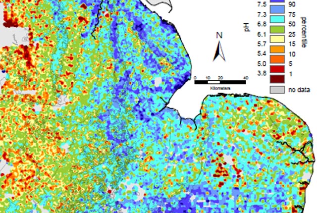
Geochemical Atlas of Europe. Source: weppi.gtk.fi/.
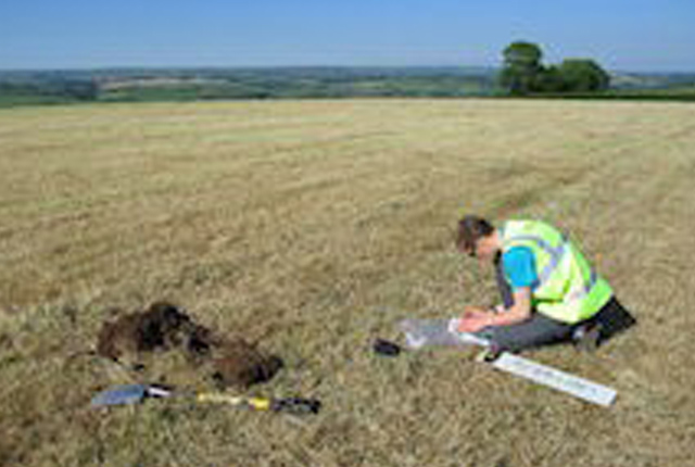
Soil sample and floodplain sediment sites
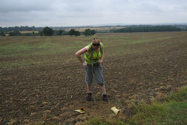
- Residual soil (<2 mm), upper horizon (topsoil) 0–25 cm without the top organic layer
- Residual soil (<2 mm), lower (C) horizon (subsoil); a 25 cm layer within a depth range of 50–200 cm
- Humus where present
Suitable sampling sites were selected in an area where 3–5 pits could be dug to observe and sample the soil profile.
Each sample was a composite of 3–5 samples, the minimum distance between any two subsamples being 5 m.
Floodplain sediment samples were collected at a depth of 0–25 cm. One sample was taken from each of the larger drainage basins (>500 km2) in which the drainage sample sites were located.
Soil and floodplain samples in the UK were collected with a stainless-steel trowel and stored in Kraft paper bags.
Living surface vegetation, fresh litter, big roots and rock fragments (stones) were removed. Samples were dried at a temperature not higher than 40ºC, disaggregated in a porcelain bowl, sieved through a 2 mm nylon screen and subsequently pulverised to <0.063 mm in an agate disc mill.
Top and sub soil, and floodplain sediment samples were analysed at various laboratories across Europe by XRFS-WD, ICP-MS (following mixed acid extraction), ICP-AES (following aqua regia extraction), Hg analyser and a granulometric method for total organic carbon (TOC).
Drainage sample sites
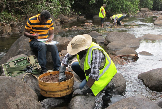
At drainage sites, stream sediment and water were collected. Active stream sediment was collected from small, second order drainage basins (catchment areas <100 km2).
Each sample was a composite of material taken from 5–10 points over a stretch of 250–500 m along the stream.
The sediment is wet sieved, firstly through a 2 mm nylon screen, then a 150 µm nylon sieve, and the resulting fine sediment collected in a wooden gold pan.
The fine stream sediment was collected in a KraftTM paper bag. A minimum of 500 g of sediment (dry weight) was collected at each site.
The stream sediments were analysed at a number of laboratories across Europe by a variety of chemical techniques: XRFS-WD, ICP-MS (following mixed acid extraction), ICP-AES (following aqua regia extraction), Hg analyser and a granulometric method for total organic carbon (TOC).
Geochemical results and maps are freely available from FOREGS Geochemical Atlas of Europe hosted by the Finnish Geological Survey (GTK).
Data files take the form of a collection of zipped MS Excel files from which individual country subsets can be extracted using the country code field.
Excess sample powders were transferred in 2009 to the National Geoscience Data Centre (NGDC), British Geological Survey, Keyworth, Nottingham, UK and form a sample archive.
A selection of further publications from the FOREGS project are available below:
Thematic interpretation of stream water chemistry
Batista, M.J., Martins, L., Salminen, R., Bidovec, M., Pirc, S., De Vivo, B., De Vos, W., Mrnkova, J., Gilucis, A., Gregorauskiene, V., Halamic, J., Heitzmann, P., Lima, A., Jordan, G., Klaver, G., Klein, P., Lis, J., Locutura, J., Marsina, K., Mazreku, A., O’Connor, P.J., Olsson, S.Å., Ottesen, R.T., Petersell, V., Plant, J.A., Reeder, S., Salpeteur, I., Sandström, H., Siewers, U., Steenfelt, A. & Tarvainen, T., 2005. Geochemical Atlas of Europe – FOREGS Geochemical Baseline Mapping: The Portuguese experience. Associação portuguesa de geólogos, Geonovas nº 19, 43-53.
Distribution of elements in stream water
Distribution of elements in stream sediment
Comparison of elements in all sample media, general comments and conclusions
Distribution of elements in humus
Distribution of elements in floodplain sediment
Fordyce, Fiona; Plant, Jane; Klaver, Gerard; Locutura, Juan; Salminen, Reijo; Vrana, Kamil. 1997 Geochemical Mapping in Europe. In: Xie, Xuejin, (ed.) Geochemistry : Proceedings of the 30th International Geological Congress. Utrecht, Netherlands, Taylor and Francis, 111-125. (Proceedings of the 30th International Geological Congress, 19).
The Forum of European Geological Surveys Geochemistry Task Group 1994-1996 inventory
J. A. Plant, S. Reeder, R. Salminen, D. B. Smith, T. Tarvainen, B. De Vivo and M. G. Petterson. 2003. The distribution of uranium over Europe: geological and environmental significance. Applied Earth Science (Trans. Inst. Min. Metall. B) Vol. 112 B1. DOI 10.1179/037174503225003152
The geological and tectonic framework of Europe
Introduction to the chemistry and geochemistry of the elements
You may also be interested in:
International geochemistry
BGS has a long history of collaborative international geochemical projects involving regional baseline mapping and health and environment studies.
G-BASE: environmental geochemistry
In addition to expertise in geochemical mapping, BGS geochemists are involved in numerous activities and research that relate to the collection of geochemical samples, the use of geochemical baseline data and the interpretation of those as part of a wide range of geoscientific and environmental studies.
G-BASE: regional geochemistry
Systematic geochemical sampling and analysis of rural stream sediment, stream water and soil samples was carried out across the UK by the BGS and GSNI.