In addition to expertise in geochemical mapping, BGS geochemists are involved in numerous activities and research that relate to the collection of geochemical samples, the use of geochemical baseline data and the interpretation of those as part of a wide range of geoscientific and environmental studies. The following are examples of research activities in relation to the G-BASE and TellusNI projects.
Examples of research activities in relation to G-BASE and TellusNI
- TellusNI geochemical survey of Northern Ireland
- TellusSW environmental survey of south-west England
- Tamar catchment geochemical survey
- Clyde Basin Super-project Glasgow
- FOREGS and GEMAS European geochemical mapping projects
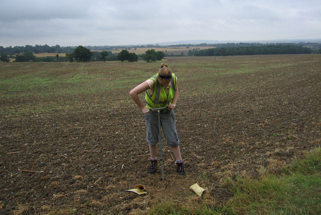
OPAL Open Air Laboratories – connecting people, science and nature
Key publications
- Public participation in soil surveys: lessons from a pilot study in England
- Soil quality assessment under emerging regulatory requirements
- From chemical risk assessment to environmental quality management: the challenge for soil protection
- Using public participation to sample trace metals in lake surface sediments: the OPAL metals survey
Eocene sand horizons and iron contamination mapping – Thames Basin streams
Soil chemistry for environmental assessments
Maps of Great Britain, showing the distributions of potentially harmful elements including As, Cd, Cr, Cu, Ni, Pb, Sn and Zn to aid land quality risk assessment under land contamination guidance. Includes technical guidance sheets.
Normal background concentrations (NBCs) of contaminants in English and Welsh soils was commissioned by Defra to establish normal background concentrations of contaminants in English and Welsh soils as part of the UK land contamination regulations. Includes reports and technical guidance.
Review of Natural Contamination Project commissioned by the Department of the Environment (DOE)
A review of the significance of contamination from natural sources and mining areas to planning and development in Great Britain: natural radioactivity and radon; methane, carbon dioxide and oil seeps; potentially harmful elements (including arsenic, cadmium, copper, lead and zinc).
The work begun under this project has progressed into the following studies:
- soil chemistry for environmental assessments dataset
- radon potential mapping:
- Assessment of naturally occurring radionuclides in England and Wales
- Indoor radon measurements in south-west England explained by topsoil and stream sediment geochemistry, airborne gamma-ray spectroscopy and geology
Brownfield Ground Risk Calculator
Sediment and soil quality for catchment and land management
- Diffuse pollution impacts: the environmental and economic impacts of diffuse pollution in the UK
- Uranium anomalies identified using G-BASE data — natural or anthropogenic? A uranium isotope pilot study
- Assessing threats to shallow groundwater quality from soil pollutants in Glasgow, UK: development of a new screening tool
- Mapping metallic contamination of soils in the Lower Foyle catchment
- Mining impact on stream sediment quality in County Antrim, Northern Ireland
- Using geological and geochemical information to estimate the potential distribution of trace elements in Scottish groundwater
- Stream sediment background concentrations in mineralised catchments in Northern Ireland: assessment of ‘pressures’ on water bodies in fulfilment of Water Framework Directive objectives
- Arsenic and selenium
- An appraisal of soil geochemistry for two growth areas in the south of England
- Controls on the phosphorus content of fine stream-bed sediments in agricultural headwater catchments at the landscape scale
- Arsenic retention and release in ombrotrophic peatlands
- Distribution of iodine in soils of Northern Ireland, UK
- Regional lead isotope study of a polluted river catchment: River Wear, Northern England, UK
- The effect of humic acids on the sequential extraction of metals in soils and sediments using ICP-AES and chemometric analysis
- Catchment-scale impact of diffuse and point-source contamination associated with abandoned mines
The G-BASE and TellusNI baseline geochemical datasets have been used extensively in medical geology investigations, in relation to animal and human health.
We have significant expertise in urban land quality assessment. See urban geochemistry.
- Molybdenum in British drinking water
- Clyde tributaries:
Hydrochemical databases for water quality assessment
- A critical re-evaluation of the prediction of alkalinity and base cation chemistry from BGS sediment composition data
- Can sediment data be used to predict alkalinity and base cation chemistry of surface waters?
- Evaluation and interpretation of regional and site-specific hydrochemical databases for water quality assessment
- How does temporal variation affect the value of stream water as a medium for regional geochemical survey?
- A model of potential carbon dioxide efflux from surface water across England and Wales using headwater stream survey data and landscape predictors
- Arsenic retention and release in ombrotrophic peatlands
- Geochemical mapping of stream water for environmental studies and mineral exploration in the UK
- Methods for the integration, modelling and presentation of high-resolution regional hydrochemical baseline survey data
Carbon and peat dynamics
- Carbon sequestration in the soils of Northern Ireland: potential based on mineralogical controls
- The importance of inorganic carbon in soil carbon databases and stock estimates: a case study from England
- Methods for estimating types of soil organic carbon and their application to surveys of UK urban areas
Particle size estimation and aggregate stability
- Problems with determining the particle size distribution of chalk soil and some of their implications
- Estimating particle-size fractions of soil dominated by silicate minerals from geochemistry
- Relationships between particle size distribution and VNIR reflectance spectra are weaker for soils formed from bedrock compared to transported parent materials
- Estimating specific surface area of fine stream bed sediments from geochemistry
- An improved method for measurement of soil aggregate stability using laser granulometry applied at regional scale
Soil geochemical baseline data and Quaternary till deposits
- Investigating glacial sediment provenance in Northern Ireland using principal component analysis of Tellus soil geochemical data
- The application of regional-scale geochemical data in defining the extent of aeolian sediments: the Late Pleistocene loess and coversand deposits of East Anglia, UK
- Reconstructing flowpaths of the Middle Pleistocene British ice sheet in central-eastern England: the application of regional soil geochemical data
Soil parent material model
Cryptogeology
Using geochemistry as an aid to geological mapping.
- Cryptogology: G-BASE data as an aid to geological mapping
- Arsenic and presumed resistate trace element geochemistry of the Lincolnshire (UK) sedimentary ironstones, revealed by a regional geochemical survey using soil, water and stream sediment sampling
- Preliminary report on the regional geochemistry of Strathmore (including comparisons with Ayrshire)
- Anomalous enrichment of molybdenum and associated metals in Lower Jurassic (Lias Group) black shales of central England, as revealed by systematic geochemical surveys
- Regional geochemical comparisons from the Lower Palaeozoic, Southern Uplands–Down–Longford terrane in Northern Ireland and Scotland
- The interpretation and application of regional geochemistry: lessons from the paratectonic Caledonides
- Regional geochemical variation across the Iapetus Suture Zone: tectonic implications
- Geochemistry characterises provenance in southern Scotland
- Regional geochemical patterns in SE Scotland: source lithology, inheritance and glacial overprinting
- Sustainable soil
- Commercial agricultural analyses for soil monitoring (CAASM)
- Assessing the use of farmer’s data to monitor soil properties
- The Mersey estuary: sediment geochemistry
- Mercury contamination in surface sediments and sediment cores of the Mersey estuary, UK
- Geochemistry and related studies of Clyde estuary sediments. The Geosciences in Europe’s Urban Sustainability: Lessons from Glasgow and Beyond (CUSP)
- Rise and fall of mercury (Hg) pollution in sediment cores of the Thames Estuary, London, UK
- Trends in heavy metals, polychlorinated biphenyls and toxicity from sediment cores of the inner River Thames estuary, London, UK
You may also be interested in

Applied geochemistry
Since the 1960s, the BGS has amassed considerable geochemical data holdings and developed significant expertise in applied geochemistry.